- National Register of Historic Places listings in Beaufort County, North Carolina
-

This list includes properties and districts listed on the National Register of Historic Places in Beaufort County, North Carolina. Click the "Map of all coordinates" link to the right to view a Google map of all properties and districts with latitude and longitude coordinates in the table below.[1]
-
- This National Park Service list is complete through NPS recent listings posted November 10, 2011.[2]
[3] Landmark name [4] Image Date listed Location City or town Summary 1 Bank of Washington, West End Branch February 18, 1971 216 W. Main St.
35°32′36″N 77°03′24″W / 35.543333°N 77.056667°WWashington 2 Bath Historic District February 26, 1970 Bounded by Bath Creek, NC 92, and King St.
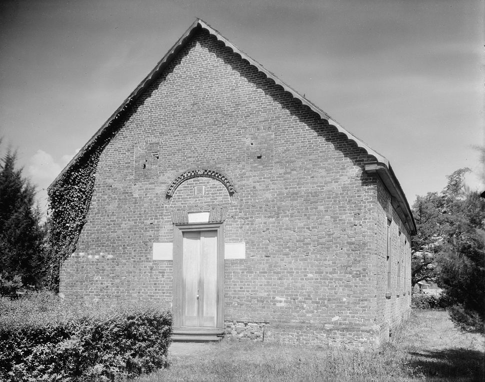
35°28′33″N 76°48′50″W / 35.475833°N 76.813889°WBath 3 Bath School January 30, 2008 King & Carteret Sts.
35°28′35″N 76°48′42″W / 35.476444°N 76.811567°WBath 4 Beaufort County Courthouse March 31, 1971 Corner of W. 2nd and Market Sts.
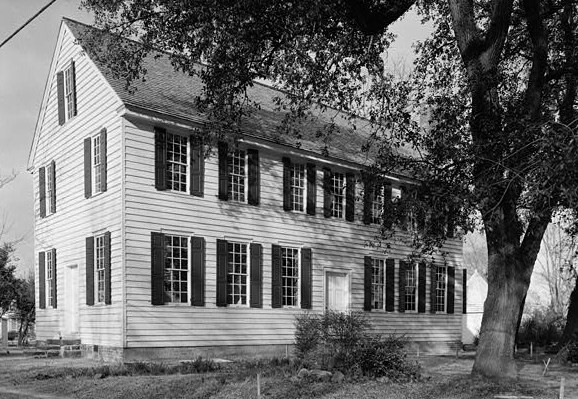
35°32′35″N 77°03′16″W / 35.543133°N 77.054578°WWashington 5 Belfont Plantation House December 12, 1976 N of Latham on SR 1411
35°37′06″N 77°08′14″W / 35.618333°N 77.137222°WLatham 6 Belhaven City Hall January 27, 1981 Main St.
35°32′21″N 76°36′40″W / 35.539167°N 76.611111°WBelhaven 7 Bonner House February 26, 1970 Front St.
35°28′20″N 76°48′49″W / 35.472222°N 76.813611°WBath 8 Bowers-Tripp House April 1, 1999 1040 N. Market St.
35°33′05″N 77°02′56″W / 35.551389°N 77.048889°WWashington 9 North Market Street Historic District October 25, 2011 Roughly bounded by 15th, Nicholson & 6th Sts. & Summit Ave.
35°33′06″N 77°02′56″W / 35.551667°N 77.048889°WWashington 10 Palmer-Marsh House 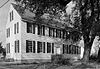
February 26, 1970 Main St., S of NC 92
35°28′36″N 76°48′51″W / 35.476667°N 76.814167°WBath 11 Pantego Academy October 25, 1984 Academy St.
35°35′26″N 76°39′47″W / 35.590556°N 76.663056°WPantego 12 Rosedale April 29, 1982 NW of Washington off SR 1407
35°35′48″N 77°05′26″W / 35.596575°N 77.090589°WWashington 13 St. Thomas Episcopal Church 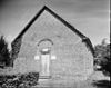
November 20, 1970 Craven St.
35°28′26″N 76°48′50″W / 35.473889°N 76.813889°WBath 14 Trinity Cemetery August 19, 2011 NC 33, .07 miles west of junction with NC 1157
35°30′57″N 77°07′09″W / 35.515833°N 77.119167°WChocowinity vicinity 15 Ware Creek School December 6, 1996 East side of NC 1103, .3 miles southeast of junction with NC 1112
35°25′12″N 76°56′19″W / 35.42°N 76.938611°WBlounts Creek 16 Washington Historic District February 9, 1979 Roughly bounded by Jacks Creek, Pamlico River, Hackney, 3rd, Market, 5th, Harvey, and 2nd Sts.
35°32′37″N 77°03′17″W / 35.543611°N 77.054722°WWashington 17 Zion Episcopal Church August 16, 2000 US 264, 0.2 miles east of junction with NC 1601
35°31′23″N 76°56′05″W / 35.523056°N 76.934722°WWashington See also
- National Register of Historic Places listings in North Carolina
- List of National Historic Landmarks in North Carolina
References
- ^ The latitude and longitude information provided in this table was derived originally from the National Register Information System, which has been found to be fairly accurate for about 99% of listings. For about 1% of NRIS original coordinates, experience has shown that one or both coordinates are typos or otherwise extremely far off; some corrections may have been made. A more subtle problem causes many locations to be off by up to 150 yards, depending on location in the country: most NRIS coordinates were derived from tracing out latitude and longitudes off of USGS topographical quadrant maps created under the North American Datum of 1927, which differs from the current, highly accurate WGS84 GPS system used by Google maps. Chicago is about right, but NRIS longitudes in Washington are higher by about 4.5 seconds, and are lower by about 2.0 seconds in Maine. Latitudes differ by about 1.0 second in Florida. Some locations in this table may have been corrected to current GPS standards.
- ^ "National Register of Historic Places: Weekly List Actions". National Park Service, United States Department of the Interior. Retrieved on November 10, 2011.
- ^ Numbers represent an ordering by significant words. Various colorings, defined here, differentiate National Historic Landmark sites and National Register of Historic Places Districts from other NRHP buildings, structures, sites or objects.
- ^ "National Register Information System". National Register of Historic Places. National Park Service. . http://nrhp.focus.nps.gov/natreg/docs/All_Data.html.
U.S. National Register of Historic Places Topics Lists by states Alabama • Alaska • Arizona • Arkansas • California • Colorado • Connecticut • Delaware • Florida • Georgia • Hawaii • Idaho • Illinois • Indiana • Iowa • Kansas • Kentucky • Louisiana • Maine • Maryland • Massachusetts • Michigan • Minnesota • Mississippi • Missouri • Montana • Nebraska • Nevada • New Hampshire • New Jersey • New Mexico • New York • North Carolina • North Dakota • Ohio • Oklahoma • Oregon • Pennsylvania • Rhode Island • South Carolina • South Dakota • Tennessee • Texas • Utah • Vermont • Virginia • Washington • West Virginia • Wisconsin • WyomingLists by territories Lists by associated states Other Municipalities and communities of Beaufort County, North Carolina City 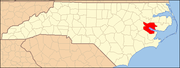
Towns Aurora | Bath | Belhaven | Chocowinity | Pantego | Washington Park
CDP Unincorporated
communitiesBayview | Royal
Categories:- Beaufort County, North Carolina
- National Register of Historic Places in North Carolina
- Buildings and structures in Beaufort County, North Carolina
-

Wikimedia Foundation. 2010.