- Chocowinity, North Carolina
-
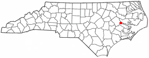
Chocowinity, North Carolina — Town — Location of Chocowinity, North Carolina
Coordinates: 35°30′57″N 77°6′2″W / 35.51583°N 77.10056°WCoordinates: 35°30′57″N 77°6′2″W / 35.51583°N 77.10056°W Country United States State North Carolina County Beaufort Area – Total 3.0 sq mi (2.6 km2) – Land 3.0 sq mi (2.6 km2) – Water 0.0 sq mi (0.0 km2) Elevation 39 ft (12 m) Population (2008) – Total 720 – Density 733.5/sq mi (283.2/km2) Time zone Eastern (EST) (UTC-5) – Summer (DST) EDT (UTC-4) ZIP code 27817 Area code(s) 252 FIPS code 37-12580[1] GNIS feature ID 1019670[2] Chocowinity (meaning "Otter" or "Little Otters") is a town in Beaufort County, North Carolina, United States. The population was 720 at the 2008 census. The town is a part of the Greenville Metropolitan Area located in North Carolina's Coastal Plains region.
Contents
History
In the early 20th century, Chocowinity became the railroad hub of the regional system known as the Norfolk Southern Railway in 1910. The town is sometimes called Marsden as a result of a railroad communications problem. Around 1917, the railway started calling the pivotal location "Marsden", which was easier to spell on a telegraph than "Chocowinity". The source of the new name was apparently taken in honor of one of its financial backers, Marsden J. Perry of New York, who eventually served as president of the railroad.
The regional Norfolk Southern (one of the predecessors of the modern system which adopted the same name) had lines between Norfolk, Virginia and Charlotte and served many locations in southestern Virginia (including branches to Virginia Beach and Suffolk) and most of eastern and central North Carolina, including Elizabeth City, New Bern, Morehead City, Goldsboro, Raleigh, Durham, Fayetteville, North Carolina and Asheville. The regional carrier was acquired by the Southern Railway, and lent its historic name to the merger with the Norfolk and Western in the early 1980s to form the current large Norfolk Southern Railway System. The railroad resumed using "Chocowinity" to designate the location in 1970, after railway telegraphs were replaced with voice communications via 2-way radios. [1]
Geography
Chocowinity is located at 35°30′57″N 77°6′2″W / 35.51583°N 77.10056°W (35.515788, -77.100528).[3]
According to the United States Census Bureau, the town has a total area of 1.0 square mile (2.6 km2), all of it land.
Demographics
As of the census[1] of 2000, there were 733 people, 302 households, and 202 families residing in the town. The population density was 733.5 people per square mile (283.0/km²). There were 330 housing units at an average density of 330.2 per square mile (127.4/km²). The racial makeup of the town was 60.44% White, 38.74% African American, 0.14% Native American, 0.27% from other races, and 0.41% from two or more races. Hispanic or Latino of any race were 3.41% of the population.
There were 302 households out of which 25.8% had children under the age of 18 living with them, 50.0% were married couples living together, 13.6% had a female householder with no husband present, and 32.8% were non-families. 28.8% of all households were made up of individuals and 11.3% had someone living alone who was 65 years of age or older. The average household size was 2.41 and the average family size was 2.94.
In the town the population was spread out with 23.5% under the age of 18, 10.0% from 18 to 24, 25.2% from 25 to 44, 25.2% from 45 to 64, and 16.1% who were 65 years of age or older. The median age was 39 years. For every 100 females there were 89.4 males. For every 100 females age 18 and over, there were 85.1 males.
The median income for a household in the town was $29,712, and the median income for a family was $31,875. Males had a median income of $23,750 versus $18,516 for females. The per capita income for the town was $11,747. About 14.6% of families and 21.3% of the population were below the poverty line, including 34.2% of those under age 18 and 23.9% of those age 65 or over.
Chocowinity has three public schools, one elementary (Grades K-4), one middle (Grades 5-8), and one high school (Grades 9-12). They are: Chocowinity Primary School, Chocowinity Middle School (formerly Chocowinity High School), Southside High School.
References
- ^ a b "American FactFinder". United States Census Bureau. http://factfinder.census.gov. Retrieved 2008-01-31.
- ^ "US Board on Geographic Names". United States Geological Survey. 2007-10-25. http://geonames.usgs.gov. Retrieved 2008-01-31.
- ^ "US Gazetteer files: 2010, 2000, and 1990". United States Census Bureau. 2011-02-12. http://www.census.gov/geo/www/gazetteer/gazette.html. Retrieved 2011-04-23.
External links
Municipalities and communities of Beaufort County, North Carolina City 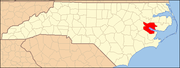
Towns Aurora | Bath | Belhaven | Chocowinity | Pantego | Washington Park
CDP Unincorporated
communitiesBayview | Royal
Categories:- Towns in North Carolina
- Populated places in Beaufort County, North Carolina

Wikimedia Foundation. 2010.