- National Register of Historic Places listings in Randolph County, North Carolina
-

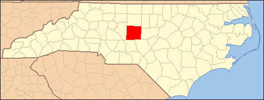
This list includes properties and districts listed on the National Register of Historic Places in Randolph County, North Carolina. Click the "Map of all coordinates" link to the right to view a Google map of all properties and districts with latitude and longitude coordinates in the table below.[1]
-
- This National Park Service list is complete through NPS recent listings posted November 10, 2011.[2]
[3] Landmark name[4] Image Date listed Location City or Town Summary 1 Central School November 12, 1993 414 Watkins St.
35°42′38″N 79°48′14″W / 35.71056°N 79.80389°WAsheboro 2 Coleridge Historic District November 13, 1976 NC 22
35°38′23″N 79°37′0″W / 35.63972°N 79.616667°WColeridge 3 Deep River-Columbia Manufacturing Company November 15, 1978 Main St.
35°43′48″N 79°39′16″W / 35.73°N 79.65444°WRamseur 4 Franklinville Historic District December 20, 1984 Roughly bounded by Deep River, Sunrise Ave., Clark St., and Greensboro Rd.
35°44′45″N 79°41′51″W / 35.74583°N 79.6975°WFranklinville 5 Moses Hammond House June 12, 1989 118 Trindale Rd.
35°54′51″N 79°58′31″W / 35.91417°N 79.97528°WArchdale 6 Harper House July 22, 1979 SW of Archdale
35°51′36″N 80°0′56″W / 35.86°N 80.01556°WArchdale 7 Wilson Kindley Farm and Kindley Mine June 11, 1992 NC 1408, E side, 1 miles N of US 64
35°44′47″N 79°58′15″W / 35.74639°N 79.97083°WAsheboro 8 Lewis-Thornburg Farm February 24, 2005 NC 1107, approx 1.5 miles S of jct. with NC 1170
35°36′59″N 79°56′41″W / 35.61639°N 79.94472°WAsheboro 9 Liberty Historic District November 22, 2000 Roughly along W of Norfolk & Southern RR bet. Butler Ave. and W. Patterson Ave., inc. the 100 blk. of W. Swannanoa St.
35°51′23″N 79°34′22″W / 35.85639°N 79.57278°WLiberty 10 Marley House December 18, 1990 N side of US 64 .1 miles W of jct. with SR 2475
35°44′39″N 79°33′3″W / 35.74417°N 79.55083°WStaley 11 Mount Shepherd Pottery Site February 1, 1980 Address Restricted Asheboro 12 Pisgah Community Covered Bridge 
January 20, 1972 SE of Pisgah on SR 1109 off SR 1112
35°32′31.56″N 79°53′37.97″W / 35.5421°N 79.8938806°WPisgah 13 Randleman Graded School April 20, 2005 130 W. Academy St.
35°49′6″N 79°48′22″W / 35.81833°N 79.80611°WRandleman 14 Randolph County Courthouse May 10, 1979 Worth St.
35°42′22″N 79°48′48″W / 35.70611°N 79.81333°WAsheboro 15 Skeen's Mill Covered Bridge January 20, 1972 1.7 miles W of Flint Hill on SR 1406 off SR 1408
35°45′56.67″N 79°59′34.11″W / 35.7657417°N 79.9928083°WFlint Hill Destroyed[5] 16 Sunset Theater April 20, 2011 232, 234, 236 Sunset Ave.
35°42′22″N 79°49′0″W / 35.70611°N 79.816667°WAsheboro 17 Thayer Farm Site (31RD10) August 28, 1986 Address Restricted Asheboro See also
- National Register of Historic Places listings in North Carolina
- List of National Historic Landmarks in North Carolina
References
- ^ The latitude and longitude information provided in this table was derived originally from the National Register Information System, which has been found to be fairly accurate for about 99% of listings. For about 1% of NRIS original coordinates, experience has shown that one or both coordinates are typos or otherwise extremely far off; some corrections may have been made. A more subtle problem causes many locations to be off by up to 150 yards, depending on location in the country: most NRIS coordinates were derived from tracing out latitude and longitudes off of USGS topographical quadrant maps created under North American Datum of 1927, which differs from the current, highly accurate GPS system used by Google maps. Chicago is about right, but NRIS longitudes in Washington are higher by about 4.5 seconds, and are lower by about 2.0 seconds in Maine. Latitudes differ by about 1.0 second in Florida. Some locations in this table may have been corrected to current GPS standards.
- ^ "National Register of Historic Places: Weekly List Actions". National Park Service, United States Department of the Interior. Retrieved on November 10, 2011.
- ^ Numbers represent an ordering by significant words. Various colorings, defined here, differentiate National Historic Landmark sites and National Register of Historic Places Districts from other NRHP buildings, structures, sites or objects.
- ^ "National Register Information System". National Register of Historic Places. National Park Service. 2008-04-24. http://nrhp.focus.nps.gov/natreg/docs/All_Data.html.
- ^ "North Carolina Listings in the National Register of Historic Places by County". North Carolina State Historic Preservation Office. 22 October 2008. http://www.hpo.ncdcr.gov/nrlist.htm. Retrieved 6 July 2009.
U.S. National Register of Historic Places Topics Lists by states Alabama • Alaska • Arizona • Arkansas • California • Colorado • Connecticut • Delaware • Florida • Georgia • Hawaii • Idaho • Illinois • Indiana • Iowa • Kansas • Kentucky • Louisiana • Maine • Maryland • Massachusetts • Michigan • Minnesota • Mississippi • Missouri • Montana • Nebraska • Nevada • New Hampshire • New Jersey • New Mexico • New York • North Carolina • North Dakota • Ohio • Oklahoma • Oregon • Pennsylvania • Rhode Island • South Carolina • South Dakota • Tennessee • Texas • Utah • Vermont • Virginia • Washington • West Virginia • Wisconsin • WyomingLists by territories Lists by associated states Other Municipalities and communities of Randolph County, North Carolina Cities Archdale‡ | Asheboro | High Point‡ | Randleman | Thomasville‡

Towns Unincorporated
communitiesBennett | Cedar Grove | Coleridge | Erect | Farmer | Level Cross | Pisgah | Sophia | Ulah | Whynot
Footnotes ‡This populated place also has portions in an adjacent county or counties
Categories:- Randolph County, North Carolina
- National Register of Historic Places in North Carolina
- Buildings and structures in Randolph County, North Carolina
-

Wikimedia Foundation. 2010.