- National Register of Historic Places listings in Chatham County, North Carolina
-

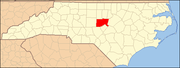
This list includes properties and districts listed on the National Register of Historic Places in Chatham County, North Carolina. Click the "Map of all coordinates" link to the right to view a Google map of all properties and districts with latitude and longitude coordinates in the table below.[1]
-
- This National Park Service list is complete through NPS recent listings posted November 10, 2011.[2]
[3] Landmark name[4] Image Date listed Location City or Town Summary 1 Alston-DeGraffenried House November 18, 1974 W of Pittsboro off U.S. 64; also the northern side of U.S. Route 64, 0.4 miles west of its junction with NC 1564
35°43′51″N 79°14′38″W / 35.73083°N 79.24389°WPittsboro Second set of boundaries represents a boundary increase of October 21, 1993, the Alston-DeGraffenried Plantation 2 Aspen Hall July 29, 1982 W of Pittsboro on US 64
35°44′2″N 79°16′24″W / 35.73389°N 79.27333°WPittsboro 3 Baldwin's Mill January 2, 1986 SR 1520
35°49′35″N 79°14′4″W / 35.82639°N 79.23444°WPittsboro 4 Bowen-Jordan Farm July 5, 1985 SR 1100
35°40′51″N 79°30′30″W / 35.68083°N 79.50833°WSiler City 5 Cadmus N. Bray House December 30, 1999 229 W. Second St.
35°43′25″N 79°27′42″W / 35.72361°N 79.46167°WSiler City 6 Sheriff Stephen Wiley Brewer Farmstead August 21, 2003 365 Thompson St.
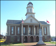
35°43′27″N 79°10′15″W / 35.72417°N 79.17083°WPittsboro 7 Chatham County Courthouse 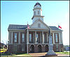
May 10, 1979 NC 15-501 and Highway 64
35°43′12″N 79°10′39″W / 35.72°N 79.1775°WPittsboro 8 Luther Clegg House October 5, 1982 S of Pittsboro on SR 1012
35°41′54″N 79°9′49″W / 35.69833°N 79.16361°WPittsboro 9 Deep River Camelback Truss Bridge June 9, 1995 Adjacent to NC 2153 over Deep R.
35°34′13″N 79°14′28″W / 35.57028°N 79.24111°WCumnock-Gulf 10 DeGraffenreidt-Johnson House July 5, 1985 SR 1346
35°46′37″N 79°18′15″W / 35.77694°N 79.30417°WSilk Hope 11 East Raleigh Street Historic District May 11, 2000 300-400 blks. of E. Second St., and 300-600 blks of E. Raleigh St.
35°43′30″N 79°27′32″W / 35.725°N 79.45889°WSiler City 12 Ebenezer Methodist Church July 5, 1985 SR 1008
35°43′37″N 79°0′23″W / 35.72694°N 79.00639°WBells 13 Lewis Freeman House October 5, 1982 205 W. Salisbury St.
35°43′17″N 79°10′49″W / 35.72139°N 79.18028°WPittsboro 14 Goldston Commercial Historic District November 25, 1987 Roughly S. Bellevue and S. Main Sts. between W. Goldbar & C olonial Sts.
35°35′33″N 79°19′41″W / 35.5925°N 79.32806°WGoldston 15 Goodwin Farm Complex July 5, 1985 SR 1900
35°43′11″N 78°57′37″W / 35.71972°N 78.96028°WBells 16 Gregson-Hadley House July 5, 1985 322 E. Raleigh St.
35°43′27″N 79°27′34″W / 35.72417°N 79.45944°WSiler City 17 Hadley House and Grist Mill November 25, 1980 NW of Pittsboro on SR 2165
35°42′32″N 79°18′2″W / 35.70889°N 79.30056°WPittsboro 18 Hall-London House October 5, 1982 206 Hillsboro St.
35°43′19″N 79°10′37″W / 35.72194°N 79.17694°WPittsboro 19 Haughton-McIver House July 5, 1985 SR 1007
35°33′26″N 79°17′5″W / 35.55722°N 79.28472°WGulf 20 High Point Bending and Chair Company, Former November 12, 1999 108 W. 3rd St.
35°43′33″N 79°28′1″W / 35.72583°N 79.46694°WSiler City 21 Hotel Hadley July 5, 1985 103 N. Chatham St.
35°43′24″N 79°27′49″W / 35.72333°N 79.46361°WSiler City 22 Marion Jasper Jordan Farm February 25, 1988 R. Jordan Rd./SR 2145
35°33′27″N 79°16′13″W / 35.5575°N 79.27028°WGulf 23 Kelvin October 5, 1982 503 W. Salisbury St.
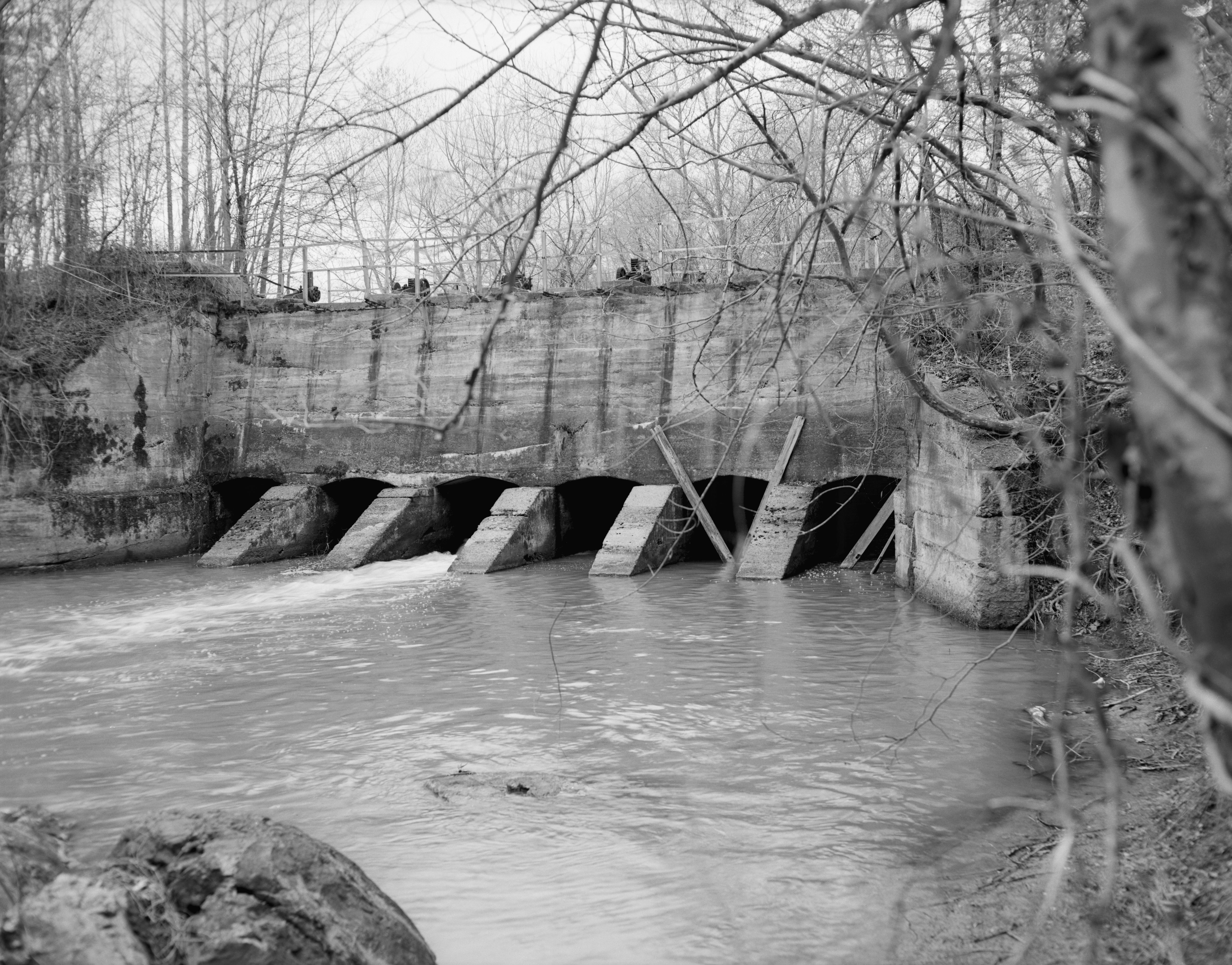
35°43′16″N 79°11′3″W / 35.72111°N 79.18417°WPittsboro Destroyed[5] 24 Lockville Dam, Canal and Powerhouse 
November 20, 1984 W of Moncure at Deep River and U.S. 1
35°37′10″N 79°5′45″W / 35.61944°N 79.09583°WMoncure 25 London Cottage October 5, 1982 N of Pittsboro on SR 1516
35°43′36″N 79°11′13″W / 35.72667°N 79.18694°WPittsboro 26 Henry Adolphus London House September 3, 1998 440 W. Salisbury St.
35°43′21″N 79°11′7″W / 35.7225°N 79.18528°WPittsboro 27 John A. Mason House October 23, 1974 SW of Durham off NC 751
35°49′31″N 78°59′38″W / 35.82528°N 78.99389°WFarrington 28 McClenahan House October 5, 1982 Address Restricted Pittsboro 29 Robert Joseph Moore House September 3, 1998 NC 1713, jct. with NC 1711
35°46′43″N 79°8′0″W / 35.77861°N 79.133333°WBynum 30 Moore-Manning House October 5, 1982 400 Hillsboro St.
35°43′31″N 79°10′37″W / 35.72528°N 79.17694°WPittsboro 31 Mount Vernon Springs Historic District December 3, 1987 SR 1134 & SR 1135
35°39′32″N 79°26′38″W / 35.65889°N 79.44389°WBonlee 32 New Hope Rural Historical Archeological District February 25, 1985 Address Restricted Wilsonville 33 Newkirk State (Site 3lCH366) November 14, 1983 Address Restricted Moncure 34 North Third Avenue Historic District July 20, 2000 Roughly bounded by N. Second Ave., E. Fourth St., N. Third Ave., and E. Third St.
35°43′34″N 79°27′47″W / 35.72611°N 79.46306°WSiler City 35 O'Kelly's Chapel July 5, 1985 NC 751
35°51′56″N 78°56′41″W / 35.86556°N 78.94472°WFarrington 36 Paschal-Womble House April 26, 1984 421 Main St.
35°35′40″N 79°19′44″W / 35.59444°N 79.32889°WGoldston 37 Pittsboro Historic District May 5, 2000 Roughly bounded by Chatham St., Small St., Rectory St., and Launis St.
35°43′21″N 79°10′36″W / 35.7225°N 79.17667°WPittsboro 38 Pittsboro Masonic Lodge January 31, 1978 East and Masonic Sts.
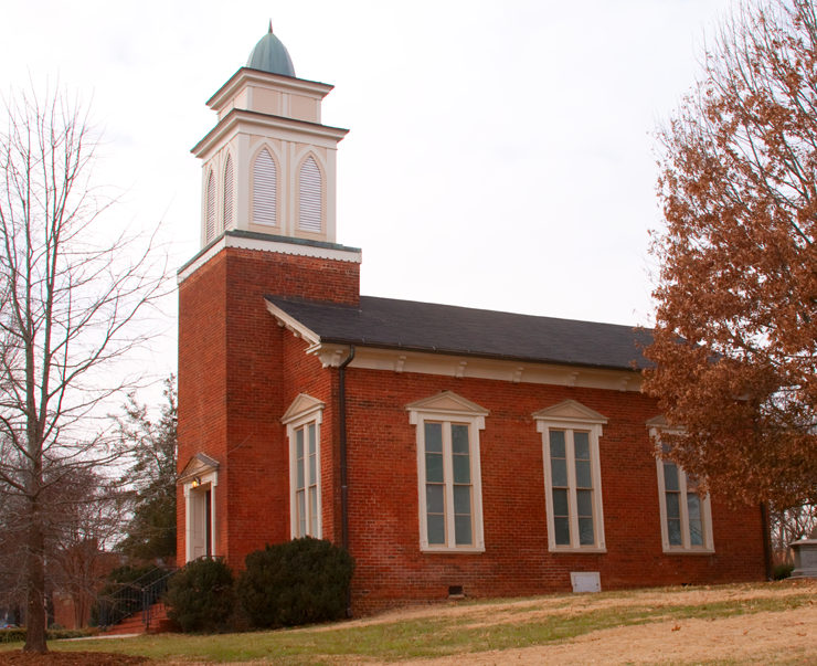
35°43′13″N 79°10′32″W / 35.72028°N 79.17556°WPittsboro 39 Pittsboro Presbyterian Church 
January 30, 1978 N. East St.
35°43′13″N 79°10′34″W / 35.72028°N 79.17611°WPittsboro 40 Reid House October 5, 1982 200 W. Salisbury St.
35°43′18″N 79°10′47″W / 35.72167°N 79.17972°WPittsboro 41 William Alston Rives House July 5, 1985 End of SR 2183 off SR 2187
35°37′24″N 79°18′22″W / 35.62333°N 79.30611°WGoldston 42 Siler City City Hall October 30, 1998 311 N. Second Ave.
35°43′31″N 79°27′52″W / 35.72528°N 79.46444°WSiler City 43 Siler City Commercial Historic District July 27, 2000 Roughly bounded by Second Ave., Birch Ave., Third St. and Beaver St.
35°43′23″N 79°27′50″W / 35.72306°N 79.46389°WSiler City 44 Siler City High School July 15, 1998 119 S. Third Ave.
35°43′23″N 79°27′36″W / 35.72306°N 79.46°WSiler City 45 Snipes-Fox House September 3, 1998 306 S. Dogwood Ave.
35°43′8″N 79°28′0″W / 35.71889°N 79.466667°WSiler City 46 Patrick St. Lawrence House October 5, 1982 Address Restricted Pittsboro 47 Joseph B. Stone House June 1, 1982 SR 1008
35°46′47″N 79°0′25″W / 35.77972°N 79.00694°WFarrington 48 William Teague House July 5, 1985 SR 1004
35°46′24″N 79°26′41″W / 35.77333°N 79.44472°WSiler City 49 A. P. Terry House October 5, 1982 601 Womack St.
35°43′5″N 79°11′14″W / 35.71806°N 79.18722°WPittsboro 50 James A. Thomas Farm July 5, 1985 SR 1941
35°42′21″N 79°4′43″W / 35.70583°N 79.07861°WPittsboro 51 Dr. E. H. Ward Farm July 5, 1985 SR 1700
35°46′44″N 79°5′47″W / 35.77889°N 79.09639°WBynum 19th century homestead of a traveling physician, Dr. Edward Hiram Ward (August 1829 – June 1896) was the son of Hiram Ward (1794–1842) and Sara Hackney (1806–1848) and lived in Chatham County, North Carolina. Private residence, outdoor wedding and event location venue - Ward's Hollow. 52 Whitehead-Fogleman Farm July 5, 1985 SR 1352 & SR 1351 jct.
35°50′1″N 79°27′20″W / 35.83361°N 79.45556°WCrutchfield Crossroads 53 Burdett Woody House August 6, 2008 2232 White Smith Rd.
35°48′24.92″N 79°18′49.62″W / 35.8069222°N 79.3137833°WSiler City See also
- National Register of Historic Places listings in North Carolina
- List of National Historic Landmarks in North Carolina
References
- ^ The latitude and longitude information provided in this table was derived originally from the National Register Information System, which has been found to be fairly accurate for about 99% of listings. For about 1% of NRIS original coordinates, experience has shown that one or both coordinates are typos or otherwise extremely far off; some corrections may have been made. A more subtle problem causes many locations to be off by up to 150 yards, depending on location in the country: most NRIS coordinates were derived from tracing out latitude and longitudes off of USGS topographical quadrant maps created under the North American Datum of 1927, which differs from the current, highly accurate WGS84 GPS system used by Google maps. Chicago is about right, but NRIS longitudes in Washington are higher by about 4.5 seconds, and are lower by about 2.0 seconds in Maine. Latitudes differ by about 1.0 second in Florida. Some locations in this table may have been corrected to current GPS standards.
- ^ "National Register of Historic Places: Weekly List Actions". National Park Service, United States Department of the Interior. Retrieved on November 10, 2011.
- ^ Numbers represent an ordering by significant words. Various colorings, defined here, differentiate National Historic Landmark sites and National Register of Historic Places Districts from other NRHP buildings, structures, sites or objects.
- ^ "National Register Information System". National Register of Historic Places. National Park Service. 2008-04-24. http://nrhp.focus.nps.gov/natreg/docs/All_Data.html.
- ^ "North Carolina Listings in the National Register of Historic Places by County". North Carolina State Historic Preservation Office. 22 October 2008. http://www.hpo.ncdcr.gov/nrlist.htm. Retrieved 14 July 2009.
U.S. National Register of Historic Places Topics Lists by states Alabama • Alaska • Arizona • Arkansas • California • Colorado • Connecticut • Delaware • Florida • Georgia • Hawaii • Idaho • Illinois • Indiana • Iowa • Kansas • Kentucky • Louisiana • Maine • Maryland • Massachusetts • Michigan • Minnesota • Mississippi • Missouri • Montana • Nebraska • Nevada • New Hampshire • New Jersey • New Mexico • New York • North Carolina • North Dakota • Ohio • Oklahoma • Oregon • Pennsylvania • Rhode Island • South Carolina • South Dakota • Tennessee • Texas • Utah • Vermont • Virginia • Washington • West Virginia • Wisconsin • WyomingLists by territories Lists by associated states Other Municipalities and communities of Chatham County, North Carolina Towns Cary‡ | Goldston | Pittsboro | Siler City
CDP Unincorporated
communitiesBear Creek | Bells | Bennett | Bonlee | Brickhaven | Bynum | Carbonton | Corinth | Crutchfield Crossroads | Farrington | Gulf | Harpers Crossroads | Haywood | Lockville | Moncure | Seaforth | Silk Hope | Wilsonville
Footnotes ‡This populated place also has portions in an adjacent county or counties
Categories:- Chatham County, North Carolina
- National Register of Historic Places in North Carolina
- Buildings and structures in Chatham County, North Carolina
-

Wikimedia Foundation. 2010.