- National Register of Historic Places listings in Vance County, North Carolina
-

This list includes properties and districts listed on the National Register of Historic Places in Vance County, North Carolina. Click the "Map of all coordinates" link to the right to view a Google map of all properties and districts with latitude and longitude coordinates in the table below.[1]
-
- This National Park Service list is complete through NPS recent listings posted November 10, 2011.[2]
[3] Landmark name[4] Image Date listed Location City or Town Summary 1 Ashburn Hall August 16, 1977 W of Kittrell on SR 1101
36°12′18.97″N 78°30′9.13″W / 36.2052694°N 78.5025361°WKittrell 2 Ashland March 14, 1973 N of Henderson on Satterwhite Point Rd.
36°25′55.32″N 78°22′8.66″W / 36.4320333°N 78.3690722°WHenderson 3 Belvidere November 12, 1992 NC 1329, NE end
36°28′14″N 78°23′5″W / 36.47056°N 78.38472°WWilliamsboro 4 Burnside Plantation House 
April 16, 1971 On SR 1335
36°26′2.22″N 78°27′44.78″W / 36.43395°N 78.4624389°WWilliamsboro 5 Thomas Capehart House May 6, 1977 W of Kittrell on SR 1105
36°13′46.81″N 78°27′59.86″W / 36.2296694°N 78.4666278°WKittrell 6 Josiah Crudup House September 25, 1979 S of Kittrell on US 1
36°11′16.63″N 78°26′59.09″W / 36.1879528°N 78.4497472°WKittrell 7 Henderson Central Business Historic District August 24, 1987 Garnett St. from Church to Young Sts.
36°19′34″N 78°24′19″W / 36.32611°N 78.40528°WHenderson 8 Henderson Fire Station and Municipal Building 
August 10, 1978 Garnett and Young Sts.
36°19′40″N 78°24′8″W / 36.32778°N 78.40222°WHenderson 9 LaGrange April 27, 1982 S of Townsville off SR 1308
36°24′14″N 78°24′45″W / 36.40389°N 78.4125°WHarris Crossroads 10 Library and Laboratory Building-Henderson Institute November 29, 1995 Rock Spring St.
36°20′18″N 78°24′9″W / 36.33833°N 78.4025°WHenderson 11 Machpelah March 27, 2007 12079 NC 39, approx. 0.5 mi (1 km). S of Townsville
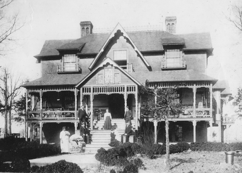
36°29′10.96″N 78°25′58.01″W / 36.4863778°N 78.4327806°WTownsville 12 Mistletoe Villa 
August 10, 1978 Young Ave.
36°19′14″N 78°24′33″W / 36.32056°N 78.40917°WHenderson 13 Maria Parham Hospital September 2, 1994 406 S. Chestnut St.
36°19′37″N 78°24′30″W / 36.32694°N 78.40833°WHenderson 14 Pleasant Hill/Hawkins House March 19, 1979 W of Middleburg on SR 1371
36°24′2″N 78°20′34″W / 36.40056°N 78.34278°WMiddleburg 15 Pool Rock Plantation November 29, 1978 NE of Williamsboro on SR 1380
36°27′15″N 78°25′4″W / 36.45417°N 78.41778°WWilliamsboro 16 St. James Episcopal Church and Rectory December 14, 1978 Jct. of SR 1551 and SR 1555
36°13′21.69″N 78°26′24.92″W / 36.2226917°N 78.4402556°WKittrell 17 St. John's Episcopal Church April 16, 1971 SR 1329
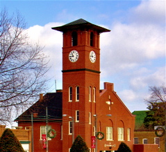
36°25′46.25″N 78°26′2.88″W / 36.4295139°N 78.4341333°WWilliamsboro 18 Daniel Stone Plank House July 12, 1984 Address Restricted Henderson 19 Vance County Courthouse May 10, 1979 Young St.
36°19′43″N 78°24′9″W / 36.32861°N 78.4025°WHenderson 20 West End School February 2, 2005 1000 S. Chestnut St.
36°19′24″N 78°24′48″W / 36.32333°N 78.41333°WHenderson 21 Zollicoffer's Law Office June 13, 1978 215 N. Garnett St.
36°19′41″N 78°24′6″W / 36.32806°N 78.40167°WHenderson See also
- National Register of Historic Places listings in North Carolina
- List of National Historic Landmarks in North Carolina
References
- ^ The latitude and longitude information provided in this table was derived originally from the National Register Information System, which has been found to be fairly accurate for about 99% of listings. For about 1% of NRIS original coordinates, experience has shown that one or both coordinates are typos or otherwise extremely far off; some corrections may have been made. A more subtle problem causes many locations to be off by up to 150 yards, depending on location in the country: most NRIS coordinates were derived from tracing out latitude and longitudes off of USGS topographical quadrant maps created under the North American Datum of 1927, which differs from the current, highly accurate WGS84 GPS system used by Google maps. Chicago is about right, but NRIS longitudes in Washington are higher by about 4.5 seconds, and are lower by about 2.0 seconds in Maine. Latitudes differ by about 1.0 second in Florida. Some locations in this table may have been corrected to current GPS standards.
- ^ "National Register of Historic Places: Weekly List Actions". National Park Service, United States Department of the Interior. Retrieved on November 10, 2011.
- ^ Numbers represent an ordering by significant words. Various colorings, defined here, differentiate National Historic Landmark sites and National Register of Historic Places Districts from other NRHP buildings, structures, sites or objects.
- ^ "National Register Information System". National Register of Historic Places. National Park Service. 2008-04-24. http://nrhp.focus.nps.gov/natreg/docs/All_Data.html.
U.S. National Register of Historic Places Topics Lists by states Alabama • Alaska • Arizona • Arkansas • California • Colorado • Connecticut • Delaware • Florida • Georgia • Hawaii • Idaho • Illinois • Indiana • Iowa • Kansas • Kentucky • Louisiana • Maine • Maryland • Massachusetts • Michigan • Minnesota • Mississippi • Missouri • Montana • Nebraska • Nevada • New Hampshire • New Jersey • New Mexico • New York • North Carolina • North Dakota • Ohio • Oklahoma • Oregon • Pennsylvania • Rhode Island • South Carolina • South Dakota • Tennessee • Texas • Utah • Vermont • Virginia • Washington • West Virginia • Wisconsin • WyomingLists by territories Lists by associated states Other Municipalities and communities of Vance County, North Carolina City 
Towns CDP Unincorporated
communityCategories:- Vance County, North Carolina
- National Register of Historic Places in North Carolina
- Buildings and structures in Vance County, North Carolina
-

Wikimedia Foundation. 2010.