- National Register of Historic Places listings in Harnett County, North Carolina
-

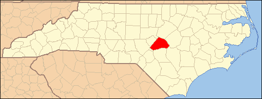
This list includes properties and districts listed on the National Register of Historic Places in Harnett County, North Carolina. Click the "Map of all coordinates" link to the right to view a Google map of all properties and districts with latitude and longitude coordinates in the table below.[1]
-
- This National Park Service list is complete through NPS recent listings posted November 10, 2011.[2]
[3] Landmark name[4] Image Date listed Location City or Town Summary 1 Averasboro Battlefield Historic District May 10, 2001 Roughly bounded by Cape Fear R., NC 1780, the Black R., NC 1801
35°15′16″N 78°39′52″W / 35.25444°N 78.66444°WErwin 2 James Archibald Campbell House November 17, 1977 U.S. 421
35°24′28″N 78°45′0″W / 35.40778°N 78.75°WBuies Creek 3 Dunn Commercial Historic District September 9, 2009 Roughly Bounded by Harnett St., Cumberland St., Clinton Ave. & Fayetteville Ave.
35°18′30.37″N 78°36′34.24″W / 35.3084361°N 78.6095111°WDunn 4 Harrington-Dewar House January 23, 2009 994 Fred Burns Rd.
35°33′13.25″N 78°54′37.61″W / 35.5536806°N 78.9104472°WHolly Springs 5 Kenneth L. Howard House August 19, 1982 400 S. Layton Ave.
35°18′26″N 78°36′58″W / 35.30722°N 78.61611°WDunn 6 Ivy Burne September 5, 1991 NC 217, E side 0.4 miles S of jct. with NC 2027
35°15′57″N 78°44′3″W / 35.26583°N 78.73417°WLinden 7 Johnson Farm April 15, 2010 2095 Kipling Rd. (south side SR 1403, .2 miles east of SR 1425)
35°29′16.94″N 78°51′9.42″W / 35.4880389°N 78.8526167°WKipling 8 Lebanon January 29, 1973 4.5 miles SW of Dunn on NC 82
35°15′35″N 78°40′17″W / 35.25972°N 78.67139°WDunn 9 Gen. William C. Lee House November 25, 1983 209 W. Divine St.
35°18′26″N 78°36′51″W / 35.30722°N 78.61417°WDunn 10 Long Valley Farm June 6, 1994 Address Restricted Spring Lake 11 John A. McKay House and Manufacturing Company April 10, 1986 100 E. Divine St.
35°18′20″N 78°36′46″W / 35.30556°N 78.61278°WDunn 12 Dr. Wayman C. Melvin House January 9, 2008 6386 NC 217
35°16′1.32″N 78°44′25.99″W / 35.2670333°N 78.7405528°WLinden 13 Summer Villa and the McKay-Salmon House April 25, 1985 SR 1291
35°24′18″N 78°51′54″W / 35.405°N 78.865°WLillington 14 Summerville Presbyterian Church and Cemetery April 25, 1985 Off SR 1291
35°24′10″N 78°51′19″W / 35.40278°N 78.85528°WLillington 15 Thorbiskope January 23, 1986 Off SR 2049 at SR 2050
35°13′58″N 78°53′51″W / 35.23278°N 78.8975°WBunnlevel 16 Williams Grove School May 26, 1995 E. Depot St. N side, between Hickory and Willow Sts.
35°30′27″N 78°44′6″W / 35.5075°N 78.735°WAngier See also
- National Register of Historic Places listings in North Carolina
- List of National Historic Landmarks in North Carolina
References
- ^ The latitude and longitude information provided in this table was derived originally from the National Register Information System, which has been found to be fairly accurate for about 99% of listings. For about 1% of NRIS original coordinates, experience has shown that one or both coordinates are typos or otherwise extremely far off; some corrections may have been made. A more subtle problem causes many locations to be off by up to 150 yards, depending on location in the country: most NRIS coordinates were derived from tracing out latitude and longitudes off of USGS topographical quadrant maps created under the North American Datum of 1927, which differs from the current, highly accurate WGS84 GPS system used by Google maps. Chicago is about right, but NRIS longitudes in Washington are higher by about 4.5 seconds, and are lower by about 2.0 seconds in Maine. Latitudes differ by about 1.0 second in Florida. Some locations in this table may have been corrected to current GPS standards.
- ^ "National Register of Historic Places: Weekly List Actions". National Park Service, United States Department of the Interior. Retrieved on November 10, 2011.
- ^ Numbers represent an ordering by significant words. Various colorings, defined here, differentiate National Historic Landmark sites and National Register of Historic Places Districts from other NRHP buildings, structures, sites or objects.
- ^ "National Register Information System". National Register of Historic Places. National Park Service. 2008-04-24. http://nrhp.focus.nps.gov/natreg/docs/All_Data.html.
U.S. National Register of Historic Places Topics Lists by states Alabama • Alaska • Arizona • Arkansas • California • Colorado • Connecticut • Delaware • Florida • Georgia • Hawaii • Idaho • Illinois • Indiana • Iowa • Kansas • Kentucky • Louisiana • Maine • Maryland • Massachusetts • Michigan • Minnesota • Mississippi • Missouri • Montana • Nebraska • Nevada • New Hampshire • New Jersey • New Mexico • New York • North Carolina • North Dakota • Ohio • Oklahoma • Oregon • Pennsylvania • Rhode Island • South Carolina • South Dakota • Tennessee • Texas • Utah • Vermont • Virginia • Washington • West Virginia • Wisconsin • WyomingLists by territories Lists by associated states Other Municipalities and communities of Harnett County, North Carolina City 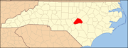
Towns Angier | Broadway‡ | Coats | Erwin | Lillington
Townships Anderson Creek | Averasboro | Barbecue | Black River | Buckhorn | Duke | Grove | Hectors Creek | Johnsonville | Lillington | Neills Creek | Stewarts Creek | Upper Little River
CDP Unincorporated
communitiesAnderson Creek | Barbecue | Barclaysville | Bunnlevel | Cape Fear | Chalybeate Springs | Cokesbury | Duncan | Fonville | Johnsonville | Harnett | Kipling | Luart | Mamers | Olivia | Overhills | Pineview | Rawls | Ryes | Seminole | Shawtown | Spout Springs | Turlington
Footnotes ‡This populated place also has portions in an adjacent county or counties
Categories:- Harnett County, North Carolina
- National Register of Historic Places in North Carolina
- Buildings and structures in Harnett County, North Carolina
-
Wikimedia Foundation. 2010.