- Coats, North Carolina
-
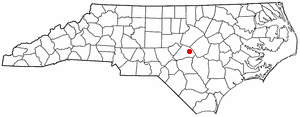
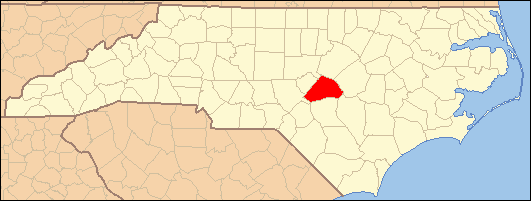
Coats, North Carolina — Town — Location of Coats, North Carolina
Coordinates: 35°24′23″N 78°40′11″W / 35.40639°N 78.66972°WCoordinates: 35°24′23″N 78°40′11″W / 35.40639°N 78.66972°W Country United States State North Carolina County Harnett Government – Mayor Walter Weeks Area – Total 1.4 sq mi (3.6 km2) – Land 1.4 sq mi (3.6 km2) – Water 0.0 sq mi (0.0 km2) Elevation 308 ft (94 m) Population (2000) – Total 1,845 – Density 1,341.5/sq mi (518.0/km2) Time zone Eastern (EST) (UTC-5) – Summer (DST) EDT (UTC-4) ZIP code 27521 Area code(s) 910 FIPS code 37-13360[1] GNIS feature ID 1019711[2] Website www.coatsnc.com Coats is a town in Harnett County, North Carolina, United States. The population was 1,845 at the 2000 census.
Contents
Geography
Coats is located at 35°24′23″N 78°40′11″W / 35.40639°N 78.66972°W (35.406372, -78.669588)[3].
According to the United States Census Bureau, the town has a total area of 1.4 square miles (3.6 km2), all of it land.
Demographics
As of the census[1] of 2000, there were 1,845 people, 755 households, and 471 families residing in the town. The population density was 1,341.5 people per square mile (516.2/km²). There were 844 housing units at an average density of 613.7 per square mile (236.1/km²). The racial makeup of the town was 80.22% White, 12.63% African American, 0.27% Native American, 0.65% Asian, 0.05% Pacific Islander, 5.04% from other races, and 1.14% from two or more races. Hispanic or Latino of any race were 11.87% of the population.
There were 755 households out of which 28.2% had children under the age of 18 living with them, 46.8% were married couples living together, 11.0% had a female householder with no husband present, and 37.6% were non-families. 29.7% of all households were made up of individuals and 11.1% had someone living alone who was 65 years of age or older. The average household size was 2.44 and the average family size was 2.99.
In the town the population was spread out with 23.1% under the age of 18, 13.4% from 18 to 24, 32.7% from 25 to 44, 18.2% from 45 to 64, and 12.6% who were 65 years of age or older. The median age was 32 years. For every 100 females there were 95.2 males. For every 100 females age 18 and over, there were 96.4 males.
The median income for a household in the town was $26,023, and the median income for a family was $43,274. Males had a median income of $25,296 versus $23,203 for females. The per capita income for the town was $16,468. About 12.1% of families and 21.1% of the population were below the poverty line, including 19.3% of those under age 18 and 25.6% of those age 65 or over.
References
- ^ a b "American FactFinder". United States Census Bureau. http://factfinder.census.gov. Retrieved 2008-01-31.
- ^ "US Board on Geographic Names". United States Geological Survey. 2007-10-25. http://geonames.usgs.gov. Retrieved 2008-01-31.
- ^ "US Gazetteer files: 2010, 2000, and 1990". United States Census Bureau. 2011-02-12. http://www.census.gov/geo/www/gazetteer/gazette.html. Retrieved 2011-04-23.
External links
Municipalities and communities of Harnett County, North Carolina City 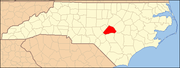
Towns Angier | Broadway‡ | Coats | Erwin | Lillington
Townships Anderson Creek | Averasboro | Barbecue | Black River | Buckhorn | Duke | Grove | Hectors Creek | Johnsonville | Lillington | Neills Creek | Stewarts Creek | Upper Little River
CDP Unincorporated
communitiesAnderson Creek | Barbecue | Barclaysville | Bunnlevel | Cape Fear | Chalybeate Springs | Cokesbury | Duncan | Fonville | Johnsonville | Harnett | Kipling | Luart | Mamers | Olivia | Overhills | Pineview | Rawls | Ryes | Seminole | Shawtown | Spout Springs | Turlington
Footnotes ‡This populated place also has portions in an adjacent county or counties
Categories:- Populated places in Harnett County, North Carolina
- Towns in North Carolina
Wikimedia Foundation. 2010.