- National Register of Historic Places listings in Lincoln County, North Carolina
-

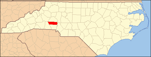
This list includes properties and districts listed on the National Register of Historic Places in Lincoln County, North Carolina. Click the "Map of all coordinates" link to the right to view a Google map of all properties and districts with latitude and longitude coordinates in the table below.[1]
-
- This National Park Service list is complete through NPS recent listings posted November 10, 2011.[2]
[3] Landmark name[4] Image Date listed Location City or Town Summary 1 Caldwell-Cobb-Love House February 6, 1986 218 E. Congress St.
35°28′8″N 81°15′13″W / 35.46889°N 81.25361°WLincolnton 2 Emanuel United Church of Christ December 14, 1994 329 E. Main St.
35°28′22″N 81°15′11″W / 35.47278°N 81.25306°WLincolnton 3 Emmanuel Lutheran Church December 14, 1994 216 S. Aspen St.
35°28′11″N 81°15′26″W / 35.46972°N 81.25722°WLincolnton 4 First Baptist Church December 21, 1994 403 E. Main St.
35°28′24″N 81°15′9″W / 35.47333°N 81.2525°WLincolnton 5 First Presbyterian Church December 14, 1994 114 W. Main St.
35°28′16″N 81°15′31″W / 35.47111°N 81.25861°WLincolnton 6 First United Methodist Church December 14, 1994 201 E. Main St.
35°28′19″N 81°15′20″W / 35.47194°N 81.25556°WLincolnton 7 William A. Graham Jr. Farm May 6, 1977 S of Denver on SR 1360
35°28′43″N 81°4′5″W / 35.47861°N 81.06806°WKidville 8 Ingleside 
April 13, 1972 S of jct. of NC 73 and SR 1383
35°27′49″N 81°2′39″W / 35.46361°N 81.04417°WIron Station 9 Laboratory Historic District December 10, 2003 Jct. of Laboratory Rd. and S. Fork Rd.
35°26′21″N 81°15′24″W / 35.43917°N 81.25667°WLaboratory 10 Lincoln County Courthouse May 10, 1979 Courthouse Sq.
35°28′41″N 81°15′26″W / 35.47806°N 81.25722°WLincolnton 11 Lincolnton Commercial Historic District December 16, 2005 Roughly bounded by Pine St., Poplar St., Church St. and W. Court Square
35°28′20″N 81°15′22″W / 35.47222°N 81.25611°WLincolnton 12 Lincolnton Recreation Department Youth Center December 30, 2009 119 E. Pine St.
35°28′22.16″N 81°15′26.52″W / 35.4728222°N 81.2573667°WLincolnton 13 Loretz House March 16, 1972 NW of Lincolnton off SR 1204
35°30′48″N 81°15′53″W / 35.51333°N 81.26472°WLincolnton 14 Magnolia Grove March 16, 1972 Jct. of SR 1309 and 1313
35°25′3″N 81°10′26″W / 35.4175°N 81.17389°WIron Station Boundaries increased on June 27, 1997 15 Methodist Church Cemetery December 14, 1994 Jct. of S. Aspen and W. Congress Sts., W corner
35°28′4″N 81°15′23″W / 35.46778°N 81.25639°WLincolnton 16 Mount Welcome September 13, 1991 Jct. of NC 1511 and NC 1412
35°25′45″N 81°3′13″W / 35.42917°N 81.05361°WMariposa 17 Old White Church Cemetery December 14, 1994 Jct. of S. Aspen and Church Sts., E corner
35°28′11″N 81°15′21″W / 35.46972°N 81.25583°WLincolnton 18 Pleasant Retreat Academy May 29, 1975 129 E. Pine St.
35°28′20″N 81°15′22″W / 35.47222°N 81.25611°WLincolnton 19 Reinhardt-Craig House, Kiln and Pottery Shop January 9, 2008 3171 Cat Square Rd.
35°33′47″N 81°25′46″W / 35.56306°N 81.42944°WVale 20 Rock Springs Camp Meeting Ground September 22, 1972 SR 1373 off NC 16
35°32′25″N 81°1′40″W / 35.54028°N 81.02778°WLincolnton 21 Salem Union Church and Cemetery October 4, 1995 Jct. of NC 1005 (Startown Rd.) and NC 1274 (Maiden-Salem Rd.), SE corner
35°32′51″N 81°15′54″W / 35.5475°N 81.265°WMaiden 22 Andrew Seagle Farm February 24, 1975 N of Reepsville off SR 1205
35°31′10″N 81°20′46″W / 35.51944°N 81.34611°WReepsville 23 Shadow Lawn March 24, 1972 301 W. Main St.
35°28′13.39″N 81°15′35.57″W / 35.4703861°N 81.2598806°WLincolnton 24 South Aspen Street Historic District January 15, 2003 500-1000 blks. S. Aspen St., 114-130 E. Rhodes St., and 624-636 W. Park Dr.
35°27′53″N 81°15′16″W / 35.46472°N 81.25444°WLincolnton 25 St. Luke's Church and Cemetery January 14, 1992 303-321 N. Cedar St., 322 E. McBee St.
35°28′27″N 81°15′13″W / 35.47417°N 81.25361°WLincolnton 26 Tucker's Grove Camp Meeting Ground October 18, 1972 N of Machpelah off SR 1360
35°28′3″N 81°5′0″W / 35.4675°N 81.083333°WMachpelah 27 Vesuvius Furnace August 13, 1974 On SR 1382, N of NC 73
35°29′31″N 81°5′0″W / 35.49194°N 81.083333°WCatawba Springs 28 West Main Street Historic District January 15, 2003 200-300 W. Main St. and 114 N. High St.
35°28′13″N 81°15′37″W / 35.47028°N 81.26028°WLincolnton 29 Woodside March 7, 1973 W of jct. of U.S. 182 and 27
35°27′15″N 81°16′42″W / 35.45417°N 81.27833°WLincolnton See also
- National Register of Historic Places listings in North Carolina
- List of National Historic Landmarks in North Carolina
References
- ^ The latitude and longitude information provided in this table was derived originally from the National Register Information System, which has been found to be fairly accurate for about 99% of listings. For about 1% of NRIS original coordinates, experience has shown that one or both coordinates are typos or otherwise extremely far off; some corrections may have been made. A more subtle problem causes many locations to be off by up to 150 yards, depending on location in the country: most NRIS coordinates were derived from tracing out latitude and longitudes off of USGS topographical quadrant maps created under the North American Datum of 1927, which differs from the current, highly accurate WGS84 GPS system used by Google maps. Chicago is about right, but NRIS longitudes in Washington are higher by about 4.5 seconds, and are lower by about 2.0 seconds in Maine. Latitudes differ by about 1.0 second in Florida. Some locations in this table may have been corrected to current GPS standards.
- ^ "National Register of Historic Places: Weekly List Actions". National Park Service, United States Department of the Interior. Retrieved on November 10, 2011.
- ^ Numbers represent an ordering by significant words. Various colorings, defined here, differentiate National Historic Landmark sites and National Register of Historic Places Districts from other NRHP buildings, structures, sites or objects.
- ^ "National Register Information System". National Register of Historic Places. National Park Service. 2008-04-24. http://nrhp.focus.nps.gov/natreg/docs/All_Data.html.
U.S. National Register of Historic Places Topics Lists by states Alabama • Alaska • Arizona • Arkansas • California • Colorado • Connecticut • Delaware • Florida • Georgia • Hawaii • Idaho • Illinois • Indiana • Iowa • Kansas • Kentucky • Louisiana • Maine • Maryland • Massachusetts • Michigan • Minnesota • Mississippi • Missouri • Montana • Nebraska • Nevada • New Hampshire • New Jersey • New Mexico • New York • North Carolina • North Dakota • Ohio • Oklahoma • Oregon • Pennsylvania • Rhode Island • South Carolina • South Dakota • Tennessee • Texas • Utah • Vermont • Virginia • Washington • West Virginia • Wisconsin • WyomingLists by territories Lists by associated states Other Municipalities and communities of Lincoln County, North Carolina City 
Town CDPs Unincorporated
communitiesBoger City | Denver | Iron Station | Laurel Hill | Toluca‡ | Vale
Footnotes ‡This populated place also has portions in an adjacent county or counties
Categories:- Lincoln County, North Carolina
- National Register of Historic Places in North Carolina
- Buildings and structures in Lincoln County, North Carolina
-

Wikimedia Foundation. 2010.