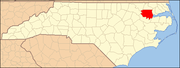
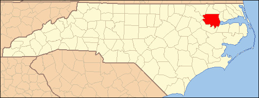
- National Register of Historic Places listings in Bertie County, North Carolina
-

This list includes properties and districts listed on the National Register of Historic Places in Bertie County, North Carolina. Click the "Map of all coordinates" link to the right to view a Google map of all properties and districts with latitude and longitude coordinates in the table below.[1]
-
- This National Park Service list is complete through NPS recent listings posted November 10, 2011.[2]
[3] Landmark name [4] Image Date listed Location City or town Summary 1 Ashland April 18, 2003 NC 45, 0.25 N of jct. with NC 1360
36°05′22″N 76°46′11″W / 36.089444°N 76.769722°WAshland 2 Bertie County Courthouse May 10, 1979 King and Dundee Sts.
35°59′50″N 76°56′49″W / 35.997222°N 76.946944°WWindsor 3 Bertie Memorial Hospital June 22, 2004 401 Sterlingworth St.
36°00′00″N 76°57′13″W / 36.0°N 76.953611°WWindsor 4 Elmwood January 15, 2003 637 Avoca Farm Rd.
36°00′07″N 76°43′35″W / 36.001944°N 76.726389°WMerry Hill 5 Elmwood June 8, 1982 W of Windsor on SR 1101
36°00′26″N 76°58′46″W / 36.007222°N 76.979444°WWindsor 6 Freeman Hotel September 9, 1982 York and Granville Sts.
35°59′57″N 76°56′43″W / 35.999167°N 76.945278°WWindsor 7 Garrett-White House June 28, 1982 Northeast of the junction of NC 42 and Bud Taylor Rd., west of Colerain
36°12′45″N 76°52′58″W / 36.2125°N 76.88278°W[5]Colerain 8 The Hermitage June 8, 1982 N of Merry Hill
36°05′12″N 76°44′00″W / 36.086667°N 76.733333°WMerry Hill 9 Hope Plantation April 17, 1970 4 miles NW of Windsor, off NC 308
36°01′43″N 77°01′03″W / 36.028708°N 77.017608°WWindsor 10 Jordan House August 26, 1971 S of Windsor on SR 1522
35°53′28″N 76°57′25″W / 35.891111°N 76.956944°WWindsor 11 King House August 26, 1971 NW of Windsor off NC 308
36°01′49″N 77°01′09″W / 36.030278°N 77.019167°WWindsor 12 King-Freeman-Speight House December 2, 1982 W of Republican on NC 308
36°04′38″N 77°05′42″W / 36.077222°N 77.095°WRepublican 13 Liberty Hall June 8, 1982 Off SR 1108
35°57′54″N 77°02′06″W / 35.964967°N 77.035022°WWindsor 14 Oaklana April 15, 1982 NE of Roxobel off SR 1249
36°13′10″N 77°13′22″W / 36.219444°N 77.222778°WRoxobel 15 Pineview June 28, 1982 Off SR 1249
36°11′43″N 77°14′00″W / 36.195278°N 77.233333°WRoxobel 16 Rhodes Site (31BR90) August 28, 1986 Address Restricted Hamilton 17 Rosefield August 26, 1982 212 W. Gray St.
35°59′42″N 76°56′50″W / 35.994903°N 76.947128°WWindsor 18 Scotch Hall April 29, 1982 E of Merry Hill on SR 1511
35°58′26″N 76°42′29″W / 35.973889°N 76.708056°WMerry Hill 19 St. Frances Methodist Church April 29, 1982 Off NC 308
36°07′24″N 77°10′40″W / 36.123333°N 77.177778°WLewiston 20 Windsor Historic District July 29, 1991 Roughly bounded by York, Water, Sutton, and Elmo Sts.
35°59′49″N 76°56′44″W / 35.996944°N 76.945556°WWindsor 21 Woodbourne August 26, 1971 W of Roxobel on SR 1139
36°11′15″N 77°15′54″W / 36.1875°N 77.265°WRoxobel 22 Woodville Historic District August 28, 1998 Roughly along NC 11
36°06′13″N 77°10′59″W / 36.103611°N 77.183056°WLewiston Woodville See also
- National Register of Historic Places listings in North Carolina
- List of National Historic Landmarks in North Carolina
References
- ^ The latitude and longitude information provided in this table was derived originally from the National Register Information System, which has been found to be fairly accurate for about 99% of listings. For about 1% of NRIS original coordinates, experience has shown that one or both coordinates are typos or otherwise extremely far off; some corrections may have been made. A more subtle problem causes many locations to be off by up to 150 yards, depending on location in the country: most NRIS coordinates were derived from tracing out latitude and longitudes off of USGS topographical quadrant maps created under the North American Datum of 1927, which differs from the current, highly accurate WGS84 GPS system used by Google maps. Chicago is about right, but NRIS longitudes in Washington are higher by about 4.5 seconds, and are lower by about 2.0 seconds in Maine. Latitudes differ by about 1.0 second in Florida. Some locations in this table may have been corrected to current GPS standards.
- ^ "National Register of Historic Places: Weekly List Actions". National Park Service, United States Department of the Interior. Retrieved on November 10, 2011.
- ^ Numbers represent an ordering by significant words. Various colorings, defined here, differentiate National Historic Landmark sites and National Register of Historic Places Districts from other NRHP buildings, structures, sites or objects.
- ^ "National Register Information System". National Register of Historic Places. National Park Service. . http://nrhp.focus.nps.gov/natreg/docs/All_Data.html.
- ^ Location derived from coordinates; the NRIS provides coordinates but lists the property as "Address Restricted"
U.S. National Register of Historic Places Topics Lists by states Alabama • Alaska • Arizona • Arkansas • California • Colorado • Connecticut • Delaware • Florida • Georgia • Hawaii • Idaho • Illinois • Indiana • Iowa • Kansas • Kentucky • Louisiana • Maine • Maryland • Massachusetts • Michigan • Minnesota • Mississippi • Missouri • Montana • Nebraska • Nevada • New Hampshire • New Jersey • New Mexico • New York • North Carolina • North Dakota • Ohio • Oklahoma • Oregon • Pennsylvania • Rhode Island • South Carolina • South Dakota • Tennessee • Texas • Utah • Vermont • Virginia • Washington • West Virginia • Wisconsin • WyomingLists by territories Lists by associated states Other Municipalities and communities of Bertie County, North Carolina Towns Askewville | Aulander | Colerain | Kelford | Lewiston Woodville | Merry Hill | Powellsville | Roxobel | Windsor
Unincorporated
communitiesCategories:- Bertie County, North Carolina
- National Register of Historic Places in North Carolina
- Buildings and structures in Bertie County, North Carolina
-
Wikimedia Foundation. 2010.