- National Register of Historic Places listings in Chowan County, North Carolina
-
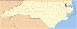
This list includes properties and districts listed on the National Register of Historic Places in Chowan County, North Carolina. Click the "Map of all coordinates" link to the right to view a Google map of all properties and districts with latitude and longitude coordinates in the table below.[1]
-
- This National Park Service list is complete through NPS recent listings posted November 10, 2011.[2]
[3] Landmark name[4] Image Date listed Location City or Town Summary 1 Albania May 13, 1976 U.S. 17 W of jct. with NC 32
36°3′37″N 76°37′8″W / 36.06028°N 76.61889°WEdenton 2 Athol 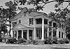
May 22, 1980 SE of Edenton on SR 1114
36°0′43″N 76°33′38″W / 36.01194°N 76.56056°WEdenton 3 Barker House March 24, 1972 S Terminus of Broad St.
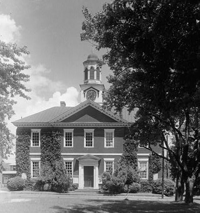
36°3′21.95″N 76°36′33.64″W / 36.0560972°N 76.6093444°WEdenton 4 Chowan County Courthouse 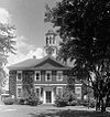
April 15, 1970 E. King St.
36°3′28″N 76°36′30″W / 36.05778°N 76.60833°WEdenton 5 Cullins-Baker House April 29, 1982 NC 32
36°17′41″N 76°39′1″W / 36.29472°N 76.65028°WSmalls Crossroads 6 Cupola House 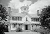
April 15, 1970 408 S. Broad St.
36°3′28″N 76°36′38″W / 36.05778°N 76.61056°WEdenton 7 Edenton Cotton Mill Historic District February 5, 1999 Bounded by E. Church St., Bount's Creek, Queen Anne's Creek, and Wood Ave.
36°3′27″N 76°36′7″W / 36.0575°N 76.60194°WEdenton 8 Edenton Historic District July 16, 1973 Roughly bounded by E. and W. Freemason, S. Oakum, E. and W. Water, and Mosely Sts.; also both sides of the 300 block of E. King St.; also roughly bounded by Filberts Creek, W. Hicks St., Park Ave., the railroad right of way, and the original Edenton Historic District
36°3′35″N 76°36′37″W / 36.05972°N 76.61028°WEdenton Second and third sets of boundaries represent boundary increases of October 5, 2001 and September 28, 2007 respectively 9 Edenton Peanut Factory September 20, 1979 E. Church St.
36°3′39″N 76°31′7″W / 36.06083°N 76.51861°WEdenton 10 Edenton Station, United States Fish and Fisheries Commission September 14, 2002 200 blk. Old Fish Hatchery Rd.
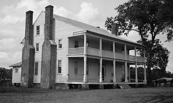
36°3′21.23″N 76°37′32.63″W / 36.0558972°N 76.6257306°WEdenton 11 Greenfield Plantation May 6, 1976 E of Edenton on SR 1109
36°3′13″N 76°26′33″W / 36.05361°N 76.4425°WSomer 12 Hayes Plantation 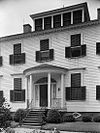
February 26, 1974 E. Water St. Extension
36°3′0″N 76°36′8″W / 36.05°N 76.60222°WEdenton 13 Hicks Field September 13, 1995 Jct. of Freemason and Woodard Sts., NE corner
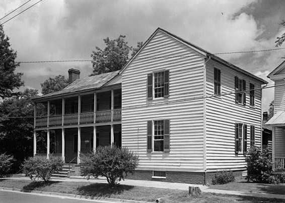
36°3′54″N 76°36′20″W / 36.065°N 76.60556°WEdenton 14 James Iredell House 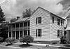
February 26, 1970 107 E. Church St.
36°3′38″N 76°36′25″W / 36.06056°N 76.60694°WEdenton 15 Cullen and Elizabeth Jones House May 3, 2006 2732 Rocky Hock Rd.
36°10′57″N 76°41′25″W / 36.1825°N 76.69028°WEdenton 16 Susan J. Armistead Moore House May 18, 2005 NC 32, 0.25 miles W of jct. with NC 37
36°1′50″N 76°32′16″W / 36.03056°N 76.53778°WEdenton 17 Mulberry Hill 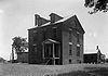
May 13, 1976 SE of Edenton on SR 1114
36°0′38″N 76°32′11″W / 36.01056°N 76.53639°WEdenton 18 Pembroke Hall November 7, 1976 W. King St.
36°3′28.97″N 76°36′41.04″W / 36.0580472°N 76.6114°WEdenton 19 Sandy Point 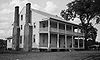
April 25, 1985 Off NC 32 East of NC 1114
36°0′40″N 76°31′15″W / 36.01111°N 76.52083°WEdenton 20 Shelton Plantation House October 29, 1974 Off NC 32
36°4′56″N 76°37′47″W / 36.08222°N 76.62972°WEdenton 21 Speight House and Cotton Gin September 22, 1980 E. Church St.
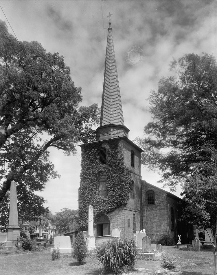
36°7′33″N 76°36′30″W / 36.12583°N 76.60833°WEdenton 22 St. Paul's Episcopal Church and Churchyard 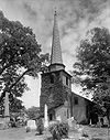
May 29, 1975 W. Church and Broad Sts.
36°3′42″N 76°36′34″W / 36.06167°N 76.60944°WEdenton 23 Strawberry Hill May 22, 1980 Church St.
36°3′40″N 76°35′48″W / 36.06111°N 76.59667°WEdenton 24 Wessington House March 20, 1973 120 W. King St.
36°3′27″N 76°36′37″W / 36.0575°N 76.61028°WEdenton See also
- National Register of Historic Places listings in North Carolina
- List of National Historic Landmarks in North Carolina
References
- ^ The latitude and longitude information provided in this table was derived originally from the National Register Information System, which has been found to be fairly accurate for about 99% of listings. For about 1% of NRIS original coordinates, experience has shown that one or both coordinates are typos or otherwise extremely far off; some corrections may have been made. A more subtle problem causes many locations to be off by up to 150 yards, depending on location in the country: most NRIS coordinates were derived from tracing out latitude and longitudes off of USGS topographical quadrant maps created under the North American Datum of 1927, which differs from the current, highly accurate WGS84 GPS system used by Google maps. Chicago is about right, but NRIS longitudes in Washington are higher by about 4.5 seconds, and are lower by about 2.0 seconds in Maine. Latitudes differ by about 1.0 second in Florida. Some locations in this table may have been corrected to current GPS standards.
- ^ "National Register of Historic Places: Weekly List Actions". National Park Service, United States Department of the Interior. Retrieved on November 10, 2011.
- ^ Numbers represent an ordering by significant words. Various colorings, defined here, differentiate National Historic Landmark sites and National Register of Historic Places Districts from other NRHP buildings, structures, sites or objects.
- ^ "National Register Information System". National Register of Historic Places. National Park Service. 2008-04-24. http://nrhp.focus.nps.gov/natreg/docs/All_Data.html.
U.S. National Register of Historic Places Topics Lists by states Alabama • Alaska • Arizona • Arkansas • California • Colorado • Connecticut • Delaware • Florida • Georgia • Hawaii • Idaho • Illinois • Indiana • Iowa • Kansas • Kentucky • Louisiana • Maine • Maryland • Massachusetts • Michigan • Minnesota • Mississippi • Missouri • Montana • Nebraska • Nevada • New Hampshire • New Jersey • New Mexico • New York • North Carolina • North Dakota • Ohio • Oklahoma • Oregon • Pennsylvania • Rhode Island • South Carolina • South Dakota • Tennessee • Texas • Utah • Vermont • Virginia • Washington • West Virginia • Wisconsin • WyomingLists by territories Lists by associated states Other Municipalities and communities of Chowan County, North Carolina Town 
Unincorporated
communitiesCategories:- Chowan County, North Carolina
- National Register of Historic Places in North Carolina
- Buildings and structures in Chowan County, North Carolina
-


Wikimedia Foundation. 2010.