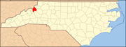
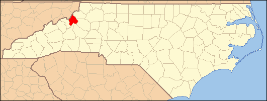
- National Register of Historic Places listings in Avery County, North Carolina
-

This list includes properties and districts listed on the National Register of Historic Places in Avery County, North Carolina. Click the "Map of all coordinates" link to the right to view a Google map of all properties and districts with latitude and longitude coordinates in the table below.[1]
-
- This National Park Service list is complete through NPS recent listings posted November 10, 2011.[2]
[3] Landmark name [4] Image Date listed Location City or town Summary 1 Avery County Courthouse May 10, 1979 Montezuma St. and Courthouse Dr.
36°05′12″N 81°55′37″W / 36.086667°N 81.926944°WNewland 2 Avery County Jail December 9, 1999 1829 Schultz Cir.
36°05′12″N 81°55′34″W / 36.086631°N 81.926003°WNewland 3 Banner Elk Hotel October 6, 2000 309 Banner St.
36°09′38″N 81°52′19″W / 36.160556°N 81.871944°WBanner Elk 4 Crossnore Presbyterian Church March 1, 1996 US 221/NC 194 E side, opposite jct. with Dellinger Rd.
36°01′06″N 81°55′47″W / 36.018364°N 81.929747°WCrossnore 5 Crossnore School Historic District February 18, 2009 Within the campus of Crossnore School, N. side of NC 1143, opposite junction with NC 1148
36°01′25″N 81°55′47″W / 36.023494°N 81.929811°WCrossnore 6 Elk Park School December 16, 2005 253 Elk Park School Rd.
36°09′41″N 81°58′49″W / 36.161389°N 81.980278°WElk Park 7 Linville Falls Tavern, (former) December 28, 2000 25 Rock House Ln.
35°57′32″N 81°56′35″W / 35.958889°N 81.943056°WLinville Falls 8 Linville Historic District March 7, 1979 U.S. 221
36°03′58″N 81°52′10″W / 36.066111°N 81.869444°WLinville 9 Weaving Room of Crossnore School April 25, 2001 205 Johnson Ln.
36°01′25″N 81°55′50″W / 36.023611°N 81.930556°WCrossnore 10 Milligan Shuford Wise and Theron Colbert Dellinger Houses August 27, 2008 152 and 158 Hemlock Ln., 142 Dellinger Rd., 110 Pine St.
36°1′13.8″N 81°55′48.21″W / 36.0205°N 81.9300583°W
36°01′17″N 81°55′52″W / 36.021467°N 81.931239°WCrossnore 11 Ray Wiseman House November 29, 1996 7540 Linville Falls Hwy.
35°59′34″N 81°56′34″W / 35.992778°N 81.942778°WAltamont See also
- National Register of Historic Places listings in North Carolina
- List of National Historic Landmarks in North Carolina
References
- ^ The latitude and longitude information provided in this table was derived originally from the National Register Information System, which has been found to be fairly accurate for about 99% of listings. For about 1% of NRIS original coordinates, experience has shown that one or both coordinates are typos or otherwise extremely far off; some corrections may have been made. A more subtle problem causes many locations to be off by up to 150 yards, depending on location in the country: most NRIS coordinates were derived from tracing out latitude and longitudes off of USGS topographical quadrant maps created under the North American Datum of 1927, which differs from the current, highly accurate WGS84 GPS system used by Google maps. Chicago is about right, but NRIS longitudes in Washington are higher by about 4.5 seconds, and are lower by about 2.0 seconds in Maine. Latitudes differ by about 1.0 second in Florida. Some locations in this table may have been corrected to current GPS standards.
- ^ "National Register of Historic Places: Weekly List Actions". National Park Service, United States Department of the Interior. Retrieved on November 10, 2011.
- ^ Numbers represent an ordering by significant words. Various colorings, defined here, differentiate National Historic Landmark sites and National Register of Historic Places Districts from other NRHP buildings, structures, sites or objects.
- ^ "National Register Information System". National Register of Historic Places. National Park Service. . http://nrhp.focus.nps.gov/natreg/docs/All_Data.html.
U.S. National Register of Historic Places Topics Lists by states Alabama • Alaska • Arizona • Arkansas • California • Colorado • Connecticut • Delaware • Florida • Georgia • Hawaii • Idaho • Illinois • Indiana • Iowa • Kansas • Kentucky • Louisiana • Maine • Maryland • Massachusetts • Michigan • Minnesota • Mississippi • Missouri • Montana • Nebraska • Nevada • New Hampshire • New Jersey • New Mexico • New York • North Carolina • North Dakota • Ohio • Oklahoma • Oregon • Pennsylvania • Rhode Island • South Carolina • South Dakota • Tennessee • Texas • Utah • Vermont • Virginia • Washington • West Virginia • Wisconsin • WyomingLists by territories Lists by associated states Other Municipalities and communities of Avery County, North Carolina Towns Banner Elk | Beech Mountain‡ | Crossnore | Elk Park | Newland | Seven Devils‡
Villages Unincorporated
communitiesAltamont | Cranberry | Frank | Gragg | Heaton | Ingalls | Linville | Linville Falls‡ | Minneapolis | Montezuma | Pineola | Plumtree | Roaring Creek | Three Mile | Vale
Footnotes ‡This populated place also has portions in an adjacent county or counties
Categories:- Avery County, North Carolina
- National Register of Historic Places in North Carolina
- Buildings and structures in Avery County, North Carolina
-
Wikimedia Foundation. 2010.