- National Register of Historic Places listings in Avoyelles Parish, Louisiana
-
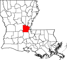 Location of Avoyelles Parish in Louisiana
This is a list of the National Register of Historic Places listings in Avoyelles Parish, Louisiana.
This is intended to be a complete list of the properties and districts on the National Register of Historic Places in Avoyelles Parish, Louisiana, United States. The locations of National Register properties and districts for which the latitude and longitude coordinates are included below, may be seen in a Google map.[1]
There are 31 properties and districts listed on the National Register in the parish, including 1 National Historic Landmark.
-
- This National Park Service list is complete through NPS recent listings posted November 10, 2011.[2]
Current listings
[3] Landmark name [4] Image Date listed Location City or town Summary 1 Bailey Hotel August 5, 1999 102 Magnolia St.
30°57′13″N 92°11′07″W / 30.953611°N 92.185278°WBunkie 2 Bailey Theatre July 26, 1979 Oak St.
30°57′17″N 92°11′06″W / 30.954722°N 92.185°WBunkie 3 Bayou Rouge Baptist Church December 3, 1980 Church and College Sts.
30°57′18″N 92°06′11″W / 30.955°N 92.103056°WEvergreen 4 Alfred H. Bordelon House November 6, 1986 511 N. Washington
31°07′45″N 92°03′48″W / 31.129167°N 92.063333°WMarksville 5 Hypolite Bordelon House October 16, 1980 Louisiana Highway 1
31°07′30″N 92°04′03″W / 31.125°N 92.0675°WMarksville 6 Bordelonville Floodgate March 14, 1991 Camber Rd. and Louisiana Highway 451, on the Bayou des Glaises levee
31°05′58″N 91°51′52″W / 31.099444°N 91.864444°WBordelonville 7 Calliham Plantation House July 22, 1982 Old Louisiana Highway 1
31°01′35″N 91°55′50″W / 31.026389°N 91.930556°WHamburg 8 Central Bank and Trust Co. May 8, 1998 2472 Main St.
31°03′31″N 92°07′18″W / 31.058611°N 92.121667°WHessmer 9 Corey Roblin's house, Bordelonville September 1, 2005 2057 L'Eglise St.
31°03′28″N 92°02′56″W / 31.057778°N 92.048889°WBordelonville 10 Clarendon Plantation House May 9, 1985 Louisiana Highway 29
30°57′03″N 92°07′46″W / 30.950833°N 92.129444°WEvergreen 11 Dr. Jules Charles Des Fosse House April 23, 1976 L'Eglise St.
31°03′43″N 92°03′05″W / 31.061944°N 92.051389°WMansura 12 Edwin Epps House April 12, 1984 U.S. Route 71
30°57′40″N 92°11′36″W / 30.961111°N 92.193333°WBunkie 13 Fort No. 2 at Yellow Bayou April 17, 1997 Louisiana Highway 1, approximately 1.5 miles west of Simmesport
30°59′26″N 91°50′30″W / 30.990556°N 91.841667°WSimmesport 14 Frithland May 9, 1985 Louisiana Highway 29
30°56′19″N 92°11′25″W / 30.938611°N 92.190278°WBunkie 15 Joffrion House August 11, 1982 605 N. Monroe
31°07′51″N 92°03′51″W / 31.130833°N 92.064167°WMarksville 16 Lacour's Fish and Ice Company Building September 8, 1983 Louisiana Highway 1
30°59′16″N 91°48′35″W / 30.987778°N 91.809722°WSimmesport 17 Thomas A. Lemoine House (Hamburg) July 18, 1985 Louisiana Highway 451
31°01′55″N 91°56′08″W / 31.031944°N 91.935556°WHamburg House built in 1885 18 Thomas A. Lemoine House (Moreauville) July 18, 1985 Louisiana Highway 451
31°02′32″N 91°58′42″W / 31.042222°N 91.978333°WMoreauville House built in 1916 19 Lone Pine October 28, 1982 Off Louisiana Highway 361
30°56′42″N 92°06′10″W / 30.945°N 92.102778°WEvergreen 20 Louisiana Railway and Navigation Company Depot November 1, 1996 Junction of Depot and Cleco Sts.
31°03′24″N 92°03′02″W / 31.056667°N 92.050556°WMansura 21 Marksville Commercial Historic District March 16, 1983 Roughly bounded by Monroe, Washington, N. Ogden, and Bontempt Sts.
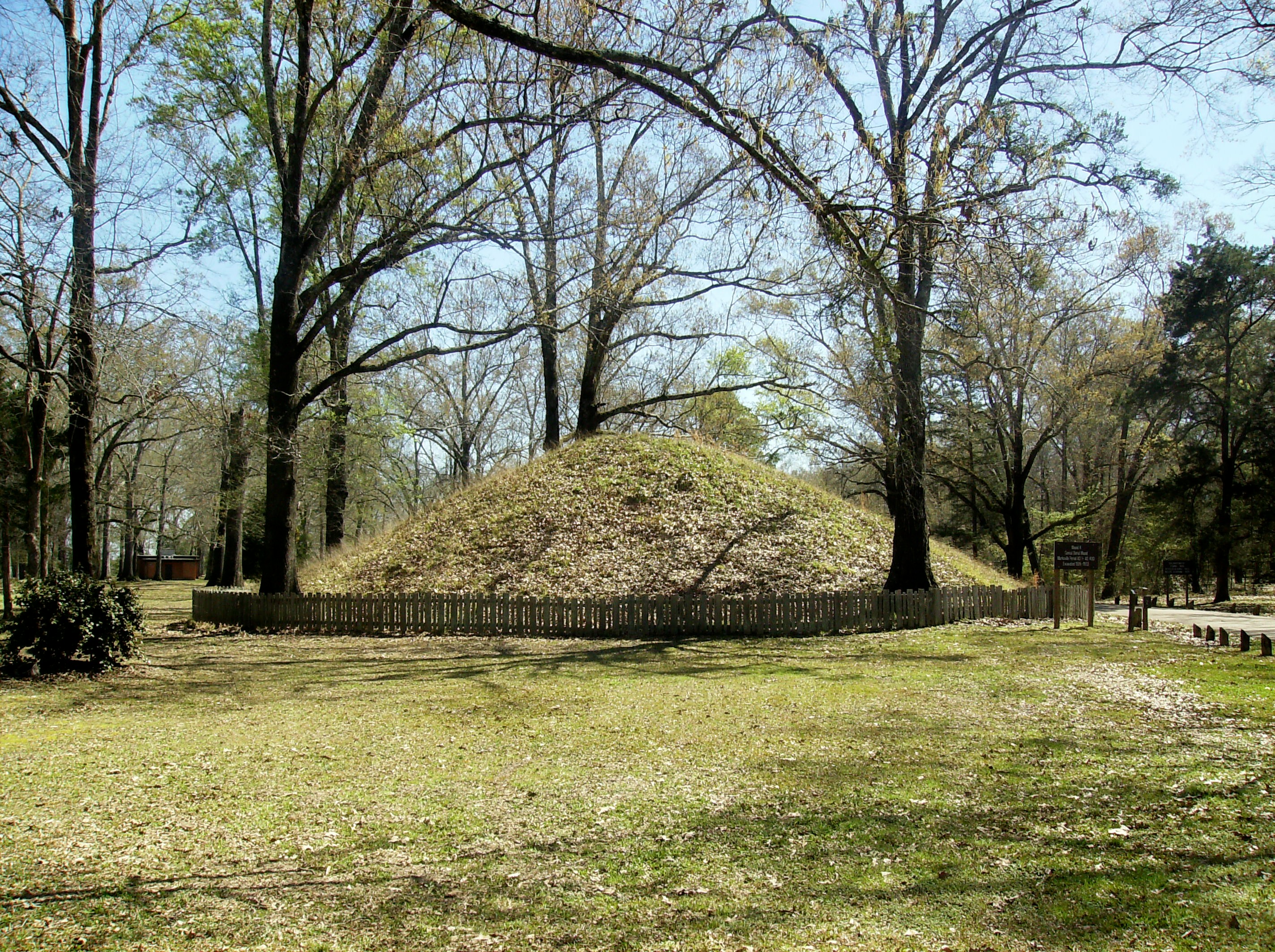
31°07′38″N 92°03′56″W / 31.127222°N 92.065556°WMarksville 22 Marksville Prehistoric Indian Site 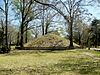
October 15, 1966 Marksville Prehistoric Indian Park State Monument
31°07′33″N 92°02′54″W / 31.125778°N 92.048222°WMarksville 23 Moreauville High School February 14, 2008 287 Main St.
31°02′06″N 91°58′23″W / 31.035°N 91.973056°WMoreauville 24 Oak Hall November 6, 1986 Louisiana Highway 29
30°53′29″N 92°12′42″W / 30.891389°N 92.211667°WBunkie 25 Oakwold Plantation House July 23, 1980 West of Evergreen off Louisiana Highway 29
30°57′10″N 92°07′22″W / 30.952778°N 92.122778°WEvergreen 26 Adam Ponthieu Store-Big Bend Post Office January 24, 2002 8554 Louisiana Highway 451
31°04′25″N 91°47′37″W / 31.073611°N 91.793611°WBig Bend 27 Dr. Thomas A. Roy, Sr., House May 9, 1985 L'Eglise St.
31°03′33″N 92°02′58″W / 31.059167°N 92.049444°WMansura 28 St. Mary's Assumption Church May 1, 1989 Front St.
30°59′11″N 92°03′17″W / 30.986389°N 92.054722°WCottonport 29 St. Paul Lutheran Church March 1, 1990 Louisiana Highway 107, north of Mansura
31°05′15″N 92°02′53″W / 31.0875°N 92.048056°WMansura 30 Sarto Bridge November 21, 1989 Off Louisiana Highway 451 over Bayou Des Glaises
31°04′26″N 91°47′33″W / 31.073889°N 91.7925°WBig Bend 31 Texas and Pacific Railroad Depot March 22, 1991 Junction of W. Main and Oak Sts.
30°57′18″N 92°11′05″W / 30.955°N 92.184722°WBunkie See also
- List of National Historic Landmarks in Louisiana
- National Register of Historic Places listings in Louisiana
References
- ^ The latitude and longitude information provided in this table was derived originally from the National Register Information System, which has been found to be fairly accurate for about 99% of listings. For about 1% of NRIS original coordinates, experience has shown that one or both coordinates are typos or otherwise extremely far off; some corrections may have been made. A more subtle problem causes many locations to be off by up to 150 yards, depending on location in the country: most NRIS coordinates were derived from tracing out latitude and longitudes off of USGS topographical quadrant maps created under the North American Datum of 1927, which differs from the current, highly accurate WGS84 GPS system used by Google maps. Chicago is about right, but NRIS longitudes in Washington are higher by about 4.5 seconds, and are lower by about 2.0 seconds in Maine. Latitudes differ by about 1.0 second in Florida. Some locations in this table may have been corrected to current GPS standards.
- ^ "National Register of Historic Places: Weekly List Actions". National Park Service, United States Department of the Interior. Retrieved on November 10, 2011.
- ^ Numbers represent an ordering by significant words. Various colorings, defined here, differentiate National Historic Landmark sites and National Register of Historic Places Districts from other NRHP buildings, structures, sites or objects.
- ^ "National Register Information System". National Register of Historic Places. National Park Service. . http://nrhp.focus.nps.gov/natreg/docs/All_Data.html.
U.S. National Register of Historic Places Topics Lists by states Alabama • Alaska • Arizona • Arkansas • California • Colorado • Connecticut • Delaware • Florida • Georgia • Hawaii • Idaho • Illinois • Indiana • Iowa • Kansas • Kentucky • Louisiana • Maine • Maryland • Massachusetts • Michigan • Minnesota • Mississippi • Missouri • Montana • Nebraska • Nevada • New Hampshire • New Jersey • New Mexico • New York • North Carolina • North Dakota • Ohio • Oklahoma • Oregon • Pennsylvania • Rhode Island • South Carolina • South Dakota • Tennessee • Texas • Utah • Vermont • Virginia • Washington • West Virginia • Wisconsin • WyomingLists by territories Lists by associated states Other Municipalities and communities of Avoyelles Parish, Louisiana Cities 
Towns Cottonport | Evergreen | Mansura | Simmesport
Villages Unincorporated
communityCategories:- Avoyelles Parish, Louisiana
- National Register of Historic Places in Louisiana by parish
- Buildings and structures in Avoyelles Parish, Louisiana
-

Wikimedia Foundation. 2010.