- Beauregard Parish, Louisiana
-
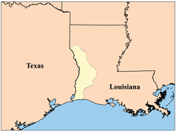
Beauregard Parish, Louisiana 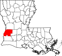
Location in the state of Louisiana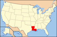
Louisiana's location in the U.S.Founded June 12, 1912 Named for Confederate General P.G.T. Beauregard Seat DeRidder Largest city DeRidder Area
- Total
- Land
- Water
1,166 sq mi (3,020 km²)
1,160 sq mi (3,005 km²)
6 sq mi (15 km²), 0.51%Population
- (2000)
- Density
32,986
28/sq mi (11/km²)Time zone Central: UTC-6/-5 Beauregard Parish [p] (French: Paroisse de Beauregard) is a parish located in the U.S. state of Louisiana. Beauregard Parish was formed on 1 January 1913. The parish seat is DeRidder. As of 2000, the population was 32,986. Beauregard Parish is part of the DeRidder Micropolitan Statistical Area as well as the Fort Polk South–DeRidder Combined Statistical Area. The governing body is by the police jury system.
Contents
History
The Parish was named after P.G.T. Beauregard, a Confederate general and one of the designers of the Confederate Battle Flag.[1]
Neutral Ground
The area which was to become Beauregard Parish was part of the Neutral Ground—the eastern boundary of which was the Calcasieu River—from 1806 to 1821.[2] After the Louisiana Purchase, the new territory was quickly opened to settlement by the United States government; but those who settled in the No Man's Land of Louisiana were considered squatters. During this period, the armies in the area—those of the U.S. and Spain—allowed the running of a ferry, enabling places such as Burr's Ferry in Vernon Parish, to prosper. The rest of the area was lawless—except for the occasional joint military venture to rid the area of "undesirables". The Adams-Onís Treaty, signed in 1819 and ratified in 1821, recognized the U.S. claim, setting the final Louisiana western border at the Sabine River.[3] This did not stop the lawlessness, however, which lasted well into the 1840s.
-

The Calcasieu River formed part of the eastern boundary of the Neutral Ground.
-

The Neutral Ground, or Sabine Free State. Its western border was the Sabine River.
Parish origin
In 1804 the United States organized present-day Louisiana as the Territory of Orleans. In 1805 the territory was further divided into 12 counties. Opelousas County included the entire southwestern section of the state, and extending almost to the Mississippi River in the northeast. By 1807 the counties were reorganized into parishes. St. Landry was one of the original nineteen civil parishes established by the Louisiana Legislature. St. Landry was the largest parish in Louisiana, called the Imperial St. Landry Parish. For a short period after the fall of New Orleans during the Civil War, Opelousas was not just the county seat but was the state capitol (until it was permanently moved to Shreveport). Calcasieu Parish was created 24 March 1840 from the western portion of Saint Landry Parish. Calcasieu Parish has since been divided into five smaller parishes. The original area of Calcasieu Parish was called Imperial Calcasieu Parish. Beauregard Parish was formed out of the northern area of Imperial Calasieu Parish.[4]
Parish organization
Although there was a faction that wanted the town of Singer to be the parish seat, DeRidder was chosen by a majority of voters on 15 October 1912. (Today, the unincorporated community of Singer still exists, including a post office, store, and school.) The parish was organized with a police jury as the governing body. Interim, county-wide police jury, judge and justice were appointed. However, on 3 December 1912, an election was held for the offices of sheriff, clerk of court, assessor, coroner, superintendent of public education, police juror, justice of the peace, constable, and members of the school board in each of the wards in the parish.
Native Americans
There were at least 4 tribes in Beauregard Parish around the time it was founded. One was about six miles south of Sugartown on Indian Branch, another was just north of the old W.B. Welborn home on Bundick Creek, another was along the mouth of Anacoco Creek and another at Merryville, just across the street from where Merryville High School now stands.[5]
Law enforcement
The parish level police agency is the Beauregard Parish Sheriff's Office. The current Sheriff (2010) is Ricky Moses.
The 1941 military build-up
On November 28, 1941 a United Service Organizations(USO) was opened in DeRidder. (Of the more than 500 USO's opened during WW II, this was the first off-post USO to open in the U.S.) 89,000 soldiers visited the DeRidder USO; 15,000 took showers; and 27,000 viewed movies. The building was entered into the National Register of Historic Places on 25 February 1992.[6]
August through September 1941 saw the locally stationed military engaged in the Louisiana Maneuvers—the largest military maneuver in United States history (with more than 500,000 soldiers training for war).[7] The rapid influx of so many military personnel created a lot of problems concerning alcohol, so Beauregard Parish voted at that time to become a dry parish.
Geography
The parish has a total area of 1,166 square miles (3,019.9 km2), of which 1,160 square miles (3,004.4 km2) is land and 6 square miles (15.5 km2) (0.51%) is water.
Major highways
 U.S. Highway 171
 U.S. Highway 190
 Louisiana Highway 12
 Louisiana Highway 26
 Louisiana Highway 27
Adjacent parishes
- Vernon Parish (north)
- Allen Parish (east)
- Jefferson Davis Parish (southeast)
- Calcasieu Parish (south)
- Newton County, Texas (west)

Vernon Parish Newton County, Texas 
Allen Parish  Beauregard Parish, Louisiana

Calcasieu Parish Jefferson Davis Parish Demographics
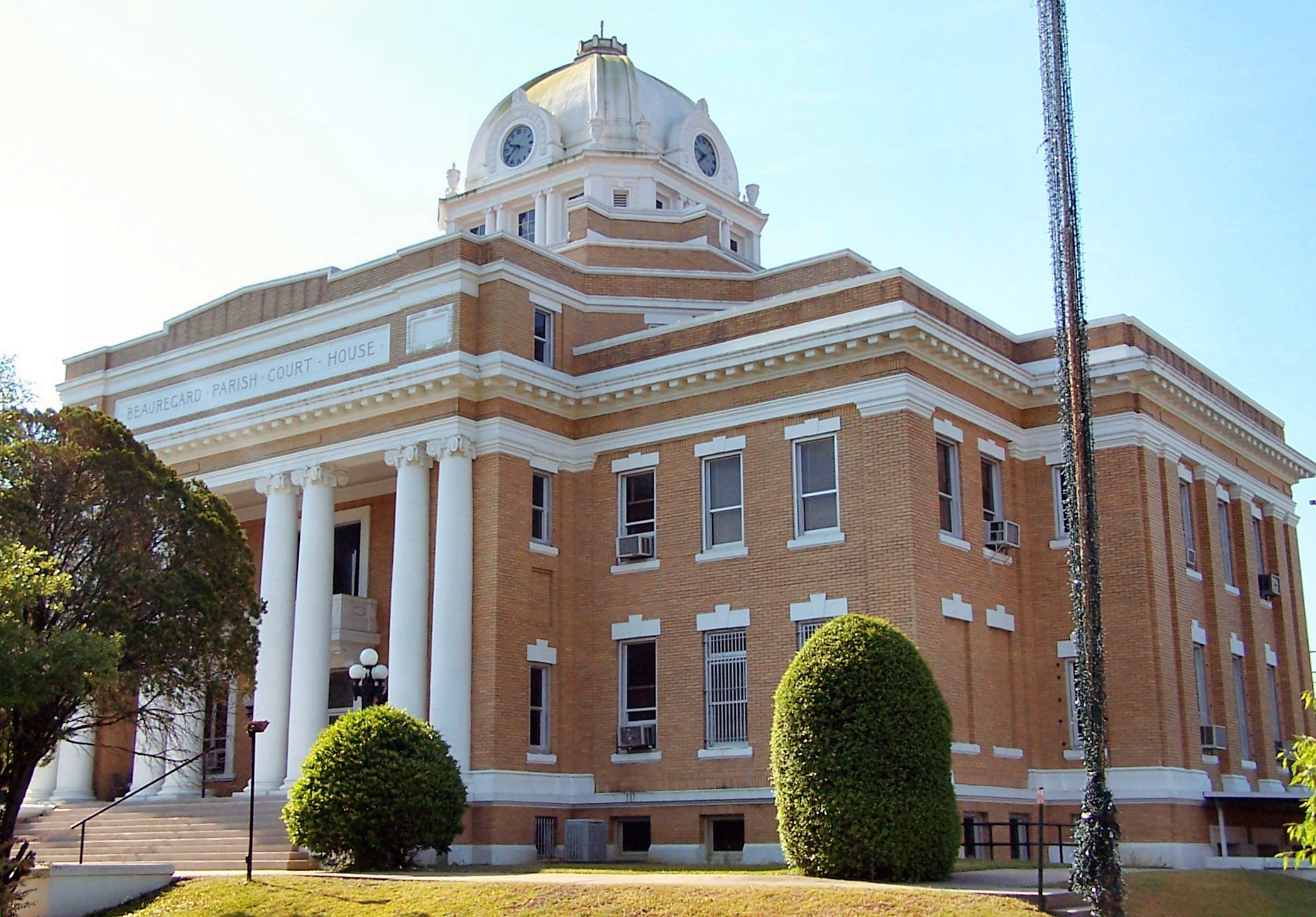
 The Beauregard Parish Courthouse in downtown DeRidder.
Census Pop. %± 1920 20,767 — 1930 14,569 −29.8% 1940 14,847 1.9% 1950 17,766 19.7% 1960 19,191 8.0% 1970 22,888 19.3% 1980 29,692 29.7% 1990 30,083 1.3% 2000 32,986 9.6% Est. 2006 35,130 [8] 6.5% Beauregard Parish Census Data[9] As of the census[10] of 2000, there were 32,986 people, 12,104 households, and 9,078 families residing in the parish. The population density was 28 people per square mile (11/km²). There were 14,501 housing units at an average density of 12 per square mile (5/km²). The racial makeup of the parish was 84.25% White, 12.92% Black or African American, 0.66% Native American, 0.60% Asian, 0.05% Pacific Islander, 0.30% from other races, and 1.23% from two or more races. 1.42% of the population were Hispanic or Latino of any race.
There were 12,104 households, out of which 36.20% had children under the age of 18 living with them, 60.60% were married couples living together, 10.90% had a female householder with no husband present, and 25.00% were non-families. 22.20% of all households were made up of individuals and 9.10% had someone living alone who was 65 years of age or older. The average household size was 2.63 and the average family size was 3.07.
In the parish, 27.50% of the population are under the age of 18; 8.60% aged from 18 to 24; 28.70% aged from 25 to 44; 23.30% aged from 45 to 64; and 11.90% who were 65 years of age or older. The median age was 36 years. For every 100 females, there were 100.60 males. For every 100 females age 18 and over, there were 98.90 males.
The median income for a household in the parish was $32,582, and the median income for a family was $37,886. Males had a median income of $35,268 versus $19,639 for females. The per capita income for the parish was $15,514. About 13.00% of families and 15.60% of the population were below the poverty line, including 19.50% of those under age 18 and 15.50% of those age 65 or over.
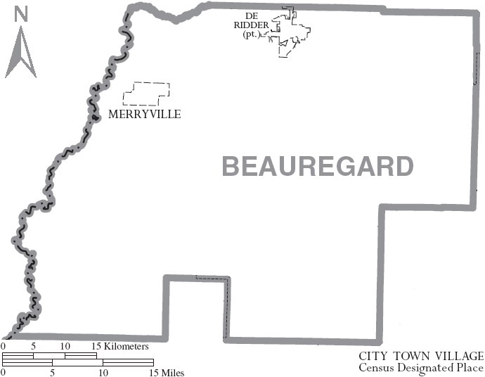
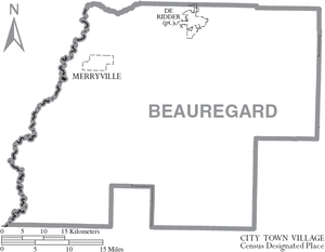 Map of Beauregard Parish, Louisiana, with town labels
Communities
Cities and Towns
Unincorporated Areas
- Dry Creek
- Graybow
- Longville
- Ragley[11]
- Singer
- Sugartown
- Junction
Government and infrastructure
The Louisiana Department of Public Safety & Corrections operates the C. Paul Phelps Correctional Center in unincorporated Beauregard Parish, about 3 miles (4.8 km) north of DeQuincy.[12]
Education
Beauregard Parish School Board operates the parish public schools.[13]
National Register of Historic Places
There are 12 places listed on the National Register of Historic Places including the Beauregard Parish Courthouse, the Beauregard Parish Jail, the Beauregard Parish Training School, the DeRidder Commercial Historic District and the Burks House. See National Register of Historic Places listings in Beauregard Parish, Louisiana.
See also
- Louisiana (New France)
- H.O. West
References
[p] - The name "Beauregard" is pronounced "bo-ruh-gard" with even emphasis on all syllables.
- ^ [1] -Naming the parish
- ^ [2] -neutral Strip
- ^ [3] -Treaty
- ^ [4] -Beauregard Parish
- ^ http://www.mylouisianagenealogy.com/la-county-beauregard.html
- ^ [5] -USO
- ^ [6]
- ^ United States Census Bureau. "Beauregard Parish Quickfacts". http://quickfacts.census.gov/qfd/states/22/22011.html. Retrieved 2008-02-02.
- ^ United States Census Bureau. "Louisiana Population of Counties by Decennial Census: 1900 to 1990". http://www.census.gov/population/cencounts/la190090.txt. Retrieved 2008-02-02.
- ^ "American FactFinder". United States Census Bureau. http://factfinder.census.gov. Retrieved 2008-01-31.
- ^ Ragley isn't incorporated according to the State's official website for Beauregard Parish
- ^ "C. Paul Phelps Correctional Center." Louisiana Department of Public Safety & Corrections. Retrieved on October 28, 2010.
- ^ [7] -School Board
External links
Geology
- Snead, J., P. V. Heinrich, and R. P. McCulloh, 2002, De Ridder 30 x 60 minute geologic quadrangle. Louisiana Geological Survey, Baton Rouge, Louisiana.
Municipalities and communities of Beauregard Parish, Louisiana City 
Town CDP Longville
Unincorporated
communitiesFootnotes ‡This populated place also has portions in an adjacent parish or parishes
Categories:- Louisiana parishes
- Beauregard Parish, Louisiana
- National Register of Historic Places in Louisiana
- Cities in Louisiana
- Towns in Louisiana
- Unincorporated communities in Louisiana
- Territorial disputes of the United States
-


Wikimedia Foundation. 2010.