- St. Mary Parish, Louisiana
-
Saint Mary Parish, Louisiana 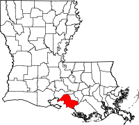
Location in the state of Louisiana
Louisiana's location in the U.S.Founded 1811 Named for Saint Mary Seat Franklin Largest city Morgan City Area
- Total
- Land
- Water
1,119 sq mi (2,898 km²)
613 sq mi (1,587 km²)
506 sq mi (1,311 km²), 45.23%Population
- (2000)
- Density
53,500
87/sq mi (34/km²)Time zone Central: UTC-6/-5 St. Mary Parish (French: Paroisse de Sainte-Marie) is a parish located in the U.S. state of Louisiana. The parish seat is Franklin. As of 2000, the population was 53,500.
The Morgan City Micropolitan Statistical Area includes all of St. Mary Parish.
Contents
Geography
The parish has a total area of 2,898 km2 (1,119 mi2). 613 square miles (1,590 km2) of it is land and 506 square miles (1,310 km2) of it is water. The total area is 45.23% water.
Major highways
 U.S. Highway 90
- Louisiana Highway 83
- Louisiana Highway 87
- Louisiana Highway 317
Adjacent parishes
- Iberia Parish (north)
- St. Martin Parish (east)
- Assumption Parish (southeast)
- Terrebonne Parish (south)

Iberia Parish Gulf of Mexico 
St. Martin Parish  St. Mary Parish, Louisiana

Terrebonne Parish Assumption Parish National protected area
Demographics
As of the census[1] of 2000, there were 53,500 people, 19,317 households, and 14,082 families residing in the parish. The population density was 87 people per square mile (34/km²). There were 21,650 housing units at an average density of 35 per square mile (14/km²). The racial makeup of the parish was 62.79% White, 31.79% Black or African American, 1.39% Native American, 1.64% Asian, 0.02% Pacific Islander, 0.88% from other races, and 1.50% from two or more races. 2.15% of the population were Hispanic or Latino of any race. 5.43% reported speaking French or Cajun French at home, while 2.45% speak Spanish and 1.59% Vietnamese.[1]
Census Pop. %± 1900 34,145 — 1910 39,368 15.3% 1920 30,754 −21.9% 1930 29,397 −4.4% 1940 31,458 7.0% 1950 35,848 14.0% 1960 48,833 36.2% 1970 60,752 24.4% 1980 64,253 5.8% 1990 58,086 −9.6% 2000 53,500 −7.9% Est. 2006 51,867 [2] −3.1% St. Mary Parish Census Data[3] There were 19,317 households out of which 36.70% had children under the age of 18 living with them, 51.00% were married couples living together, 16.50% had a female householder with no husband present, and 27.10% were non-families. 23.20% of all households were made up of individuals and 8.70% had someone living alone who was 65 years of age or older. The average household size was 2.74 and the average family size was 3.23.
In the parish the population was spread out with 29.70% under the age of 18, 8.70% from 18 to 24, 28.70% from 25 to 44, 21.90% from 45 to 64, and 11.00% who were 65 years of age or older. The median age was 34 years. For every 100 females there were 95.00 males. For every 100 females age 18 and over, there were 92.20 males.
The median income for a household in the parish was $28,072, and the median income for a family was $33,064. Males had a median income of $31,570 versus $18,341 for females. The per capita income for the parish was $13,399. About 20.60% of families and 23.60% of the population were below the poverty line, including 31.30% of those under age 18 and 19.00% of those age 65 or over.
Communities
Cities and towns
 Map of St. Mary Parish, Louisiana With Municipal Labels
Census-designated places
- Amelia
- Bayou Vista
- Charenton
- Franklin, Louisiana [Franklin]
- Baldwin, Louisiana [Baldwin]
Education
St. Mary Parish School Board operates local public schools.
The Bureau of Indian Affairs has the Chitimacha Day School in the Charenton community of unincorporated St. Mary Parish.[4]
Newspapers
St. Mary Parish has two daily newspapers, the Morgan City Daily Review (circulation under 6,000) and the Franklin Banner-Tribune in Franklin (circulation 3,350).
Notable natives and residents
- Clarence C. "Taddy" Aycock (1915–1987) was the state House Speaker from 1952–1956 and lieutenant governor from 1960-1972.
- V.J. Bella (born 1927), former state representative (1972–1990) and state fire marshal (1990–1992; 1996–2004)
- Elizabeth Bisland (1861–1929), noted journalist and author[5]
- Lewis Strong Clarke, a sugar planter and 19th century Republican politician, owned the plantation Lagonda near Patterson.[6]
- Murphy James "Mike" Foster, Jr. (born 1930), of St. Mary Parish served as governor from 1996-2004.
- Percy Saint (1870-1958), Louisiana attorney general (1924-1932)
See also
References
- ^ "American FactFinder". United States Census Bureau. http://factfinder.census.gov. Retrieved 2008-01-31.
- ^ United States Census Bureau. "St. Mary Parish Quickfacts". http://quickfacts.census.gov/qfd/states/22/22101.html. Retrieved 2008-02-02.
- ^ United States Census Bureau. "Louisiana Population of Counties by Decennial Census: 1900 to 1990". http://www.census.gov/population/cencounts/la190090.txt. Retrieved 2008-02-02.
- ^ http://www.bia.edu/bie/contact_bie/school_directory.cfm
- ^ Marks, Jason. Around the World in 72 Days: The race between Pulitzer's Nellie Bly and Cosmopolitan's Elizabeth Bisland (Gemittarius Press 1993) (ISBN 978-09633696283)
- ^ "Clarke, Lewis Strong". Louisiana Historical Association, A Dictionary of Louisiana Biography (lahistory.com). http://www.lahistory.org/site20.php. Retrieved December 21, 2010.
Municipalities and communities of St. Mary Parish, Louisiana Cities Franklin | Morgan City‡ | Patterson

Towns CDPs Unincorporated
communitiesAdeline | Alice B | Ashton | Avalon | Balco | Bodin | Bonvillain | Burns | Cabot | Caffery | Calumet | Camperdown | Caneland | Choupique | Clausen | Cote Blanche Landing | Cypremort | Dumesnil | Ellerslie | Englewood | Fairfax | Fairville | Farmers | Fivemile Oaks | Florence | Four Corners | Freetown | Garden City | Glencoe | Glenwild | Gold Mine | Gordy | Greenwood | Home Place | Idlewild | Irish Bend | Ivanhoe | Johnson | Julien | Katy | Kemper | Kilgore Plantation | Landry | Linwood | Luke Landing | Marguerite | Maria | Maryland | Matilda | Midway | Morgan City Beach | North Bend | Oaklawn | Oxford | Prevost | Ramos | Richland | Richard | Ricohoc | Rodriguez | Shadyside | Siracusaville | South Bend | Sorrel | Sterling | Todd | United | Verdunville | Wilsons Landing | Wyandotte
Footnotes ‡This populated place also has portions in an adjacent parish or parishes
Categories:- Louisiana parishes
- Acadiana
- St. Mary Parish, Louisiana


Wikimedia Foundation. 2010.