- Iberia Parish, Louisiana
-
Iberia Parish, Louisiana 
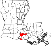
Location in the state of Louisiana
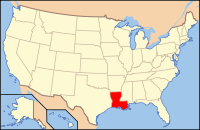
Louisiana's location in the U.S.Founded October 30, 1868 Named for Iberian Peninsula Seat New Iberia Largest city New Iberia Area
- Total
- Land
- Water
1,031 sq mi (2,670 km²)
575 sq mi (1,490 km²)
456 sq mi (1,180 km²), 44.21%Population
- (2000)
- Density
73,266
127/sq mi (49/km²)Time zone Central: UTC-6/-5 Iberia Parish (French: Paroisse de l'Ibérie) is a parish located in the U.S. state of Louisiana. The parish seat is New Iberia. As of 2000, the population was 73,266.
Iberia Parish is part of the New Iberia Micropolitan Statistical Area as well as the Lafayette–Acadiana Combined Statistical Area.
Iberia, along with Vermilion Parish, is represented in the Louisiana House of Representatives by the Republican Simone B. Champagne of Jeanerette. From 2002 to 2007, she was the chief administrative officer for the combined parish and New Iberia government.
Contents
Geography
The parish has a total area of 1,031 square miles (2,670.3 km2), of which 575 square miles (1,489.2 km2) is land and 456 square miles (1,181.0 km2) (44.21%) is water.
Major highways
 U.S. Highway 90
 Louisiana Highway 14
 Louisiana Highway 31
Adjacent parishes
- St. Martin Parish (north, south)
- Iberville Parish (northeast)
- Assumption Parish (east)
- St. Mary Parish (southeast)
- Gulf of Mexico (south)
- Vermilion Parish (west)
- Lafayette Parish (northwest)

Lafayette Parish St. Martin Parish Iberville Parish 
Vermilion Parish 
Assumption Parish  Iberia Parish, Louisiana

St. Martin Parish and Gulf of Mexico St. Mary Parish National protected area
Demographics
Census Pop. %± 1900 29,015 — 1910 31,262 7.7% 1920 26,855 −14.1% 1930 28,192 5.0% 1940 37,183 31.9% 1950 40,059 7.7% 1960 51,657 29.0% 1970 57,397 11.1% 1980 63,752 11.1% 1990 68,297 7.1% 2000 73,266 7.3% 2010 73,240 0% Iberia Parish Census Data[1] As of the census[2] of 2000, there were 73,266 people, 25,381 households, and 19,162 families residing in the parish. The population density was 127 people per square mile (49/km²). There were 27,844 housing units at an average density of 48 per square mile (19/km²). The racial makeup of the parish was 65.08% White, 30.81% Black or African American, 0.31% Native American, 1.93% Asian, 0.02% Pacific Islander, 0.60% from other races, and 1.25% from two or more races. 1.50% of the population were Hispanic or Latino of any race. 11.99% reported speaking French or Cajun French at home, while 1.48% speak Lao and 1.29% Spanish.[1]
There were 25,381 households out of which 39.50% had children under the age of 18 living with them, 53.20% were married couples living together, 17.20% had a female householder with no husband present, and 24.50% were non-families. 21.10% of all households were made up of individuals and 8.70% had someone living alone who was 65 years of age or older. The average household size was 2.82 and the average family size was 3.28.
In the parish the population was spread out with 30.00% under the age of 18, 9.60% from 18 to 24, 28.40% from 25 to 44, 20.60% from 45 to 64, and 11.40% who were 65 years of age or older. The median age was 33 years. For every 100 females there were 92.80 males. For every 100 females age 18 and over, there were 89.80 males.
The median income for a household in the parish was $31,204, and the median income for a family was $36,017. Males had a median income of $32,399 versus $18,174 for females. The per capita income for the parish was $14,145. About 20.20% of families and 23.60% of the population were below the poverty line, including 31.50% of those under age 18 and 20.20% of those age 65 or over.
Cities and towns
- Delcambre (partially in another parish)
- Jeanerette
In addition, Avery Island, home of the Tabasco factory, is an unincorporated area located in Iberia Parish.
Education
Iberia Parish School System serves the parish.
See also
References
- ^ United States Census Bureau. "Louisiana Population of Counties by Decennial Census: 1900 to 1990". http://www.census.gov/population/cencounts/la190090.txt. Retrieved 2008-02-02.
- ^ "American FactFinder". United States Census Bureau. http://factfinder.census.gov. Retrieved 2008-01-31.
External links
Geology
- Heinrich, P. V., and W. J. Autin, 2000, Baton Rouge 30 x 60 minute geologic quadrangle. Louisiana Geological Survey, Baton Rouge, Louisiana.
Municipalities and communities of Iberia Parish, Louisiana Cities Town Village CDP Unincorporated
communitiesAvery Island | Belle Place | Berard | Bob Acres | Boudreaux | Bourgeois Landing | Brannon | Bronson | Brousville | Burke | Caroline | Charlotte | Coopersville | Coteau | Daspit | Dauterive Landing | Davids | Delaware | Dennison | Deslatte | Derouen | Duboin | Emma | Fish Island | Gajan | Gall | Georgetown | Greig | Hope | Hubertville | Independent | Jefferson Island | Lasalle | Leesburg | Leleux | Lifenite | Little Valley Plantation | Loisel | Lozes | Ludger | Lyons | Marce | Masters | Mestayer | Migues | Morbihan | Nicholas | Norbert | Numa | Olivier | Oubre | Patoutville | Pesson | Port Of Iberia | Poufette | Rynella | Santiague | Segura | Sumerall | Tony | Ulyssee | Vida | Walet | Weeks
Footnotes ‡This populated place also has portions in an adjacent parish or parishes
Categories:- Louisiana parishes
- Acadiana
- Iberia Parish, Louisiana
Wikimedia Foundation. 2010.


