- Delcambre, Louisiana
-
Town of Delcambre Town Country United States State Louisiana Parishes Iberia, Vermilion Elevation 7 ft (2.1 m) Coordinates 29°57′01″N 91°59′20″W / 29.95028°N 91.98889°W Area 0.8 sq mi (2.1 km2) - land 0.8 sq mi (2 km2) - water 0.0 sq mi (0 km2), 0% Population 2,168 (2000) Density 2,610.9 / sq mi (1,008.1 / km2) Timezone CST (UTC-6) - summer (DST) CDT (UTC-5) Area code 337 
 Location of Delcambre in Louisiana
 Location of Louisiana in the United States
Delcambre is a town in Iberia and Vermilion parishes in the U.S. state of Louisiana, located twelve miles (20 km) east of Abbeville on Louisiana Highway 14[1] in the Cajun Heartland of Acadiana. The Delcambre Canal, also known as Bayou Carlin,[2] passes through the town and is home for much of the local fishing industry. The population was 2,168 at the 2000 census.
The Iberia Parish portion of Delcambre is part of the New Iberia Micropolitan Statistical Area, while the Vermilion Parish portion is part of the Abbeville Micropolitan Statistical Area.
Contents
History
In 2005, much of the town was flooded by the storm surge forced inland by Hurricane Rita. Water in many parts of town was up to six feet deep. The mayor of Delcambre was quoted as saying that only 25 of 900 homes in the town were not flooded.[citation needed]
The Delcambre town council and mayor Carrol Brousard, passed an ordinance in June 2007 making sagging illegal, expanding an existing state indecent exposure law to add underwear to the list of what cannot be exposed.[3]
Geography
Delcambre is located at 29°57′1″N 91°59′20″W / 29.95028°N 91.98889°W (29.950207, -91.988815)[4].
According to the United States Census Bureau, the town has a total area of 0.8 square miles (2.1 km²).None of the area is covered with water.
Demographics
Historically, the area that became known as Delcambre was first settled by Acadians who were expelled from Nova Scotia in the mid-18th century.[5]
As of the census[6] of 2000, there were 2,168 people, 826 households, and 593 families residing in the town. The population density was 2,610.9 people per square mile (1,008.5/km²). There were 903 housing units at an average density of 1,087.5 per square mile (420.1/km²). The racial makeup of the town was 82.70% White, 14.44% African American, 0.88% Native American, 0.51% Asian, 0.05% Pacific Islander, 0.23% from other races, and 1.20% from two or more races. Hispanic or Latino of any race were 1.89% of the population.
There were 826 households out of which 35.6% had children under the age of 18 living with them, 51.0% were married couples living together, 16.3% had a female householder with no husband present, and 28.1% were non-families. 24.2% of all households were made up of individuals and 12.2% had someone living alone who was 65 years of age or older. The average household size was 2.62 and the average family size was 3.10.
In the town the population was spread out with 27.7% under the age of 18, 10.9% from 18 to 24, 27.4% from 25 to 44, 21.4% from 45 to 64, and 12.6% who were 65 years of age or older. The median age was 33 years. For every 100 females there were 95.0 males. For every 100 females age 18 and over, there were 89.9 males.
The median income for a household in the town was $27,500, and the median income for a family was $34,643. Males had a median income of $27,750 versus $17,438 for females. The per capita income for the town was $13,245. About 17.4% of families and 20.2% of the population were below the poverty line, including 25.1% of those under age 18 and 19.2% of those age 65 or over.
Education
Residents of Delcambre in Vermilion Parish and Iberia Parish are zoned to Iberia Parish School System schools.
Residents in Delcambre are zoned to Delcambre Elementary School and Delcambre High School.[7]
References
- ^ Delcambre from the website of the Vermilion Parish Tourist Commission
- ^ Delcambre Canal
- ^ US town set to ban saggy trousers from BBC News
- ^ "US Gazetteer files: 2010, 2000, and 1990". United States Census Bureau. 2011-02-12. http://www.census.gov/geo/www/gazetteer/gazette.html. Retrieved 2011-04-23.
- ^ Delcambre from the website of the Iberia Parish Convention & Visitors Bureau
- ^ "American FactFinder". United States Census Bureau. http://factfinder.census.gov. Retrieved 2008-01-31.
- ^ "Feeder School Information." Iberia Parish School System. Retrieved on September 7, 2011.
Municipalities and communities of Iberia Parish, Louisiana Cities 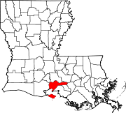
Town Delcambre‡
Village CDP Unincorporated
communitiesAvery Island | Belle Place | Berard | Bob Acres | Boudreaux | Bourgeois Landing | Brannon | Bronson | Brousville | Burke | Caroline | Charlotte | Coopersville | Coteau | Daspit | Dauterive Landing | Davids | Delaware | Dennison | Deslatte | Derouen | Duboin | Emma | Fish Island | Gajan | Gall | Georgetown | Greig | Hope | Hubertville | Independent | Jefferson Island | Lasalle | Leesburg | Leleux | Lifenite | Little Valley Plantation | Loisel | Lozes | Ludger | Lyons | Marce | Masters | Mestayer | Migues | Morbihan | Nicholas | Norbert | Numa | Olivier | Oubre | Patoutville | Pesson | Port Of Iberia | Poufette | Rynella | Santiague | Segura | Sumerall | Tony | Ulyssee | Vida | Walet | Weeks
Footnotes ‡This populated place also has portions in an adjacent parish or parishes
Municipalities and communities of Vermilion Parish, Louisiana Cities 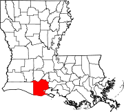
Town Village Unincorporated
communitiesAndrew | Bancker | Boston | Camille | Charon | Chenier Au Tigre | Cossinade | Cow Island | Esther | Forked Island | Grosse Isle | Henry | Indian Bayou | Intracoastal City | Laurents Point | Leleux | Leroy | Mack | Marceaux | Meaux | Mouton Cove | Mulvey | Nunez | Pecan Island | Perry | Riceville | Rose Hill | Theall | Woodlawn | Wright | Youngs
Footnotes ‡This populated place also has portions in an adjacent parish or parishes
Categories:- Acadiana
- Towns in Louisiana
- Populated places in Iberia Parish, Louisiana
- Populated places in Vermilion Parish, Louisiana


Wikimedia Foundation. 2010.