- National Register of Historic Places listings in Iberia Parish, Louisiana
-
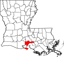 Location of Iberia Parish in Louisiana
This is a list of the National Register of Historic Places listings in Iberia Parish, Louisiana.
This is intended to be a complete list of the properties and districts on the National Register of Historic Places in Iberia Parish, Louisiana, United States. The locations of National Register properties and districts for which the latitude and longitude coordinates are included below, may be seen in a Google map.[1]
There are 31 properties and districts listed on the National Register in the parish, including 1 National Historic Landmark.
-
- This National Park Service list is complete through NPS recent listings posted November 10, 2011.[2]
Current listings
[3] Landmark name[4] Image Date listed Location City or Town Summary 1 Alice June 14, 1984 Louisiana Highway 87
29°56′14″N 91°41′13″W / 29.93722°N 91.68694°WJeanerette 2 Bayside 
January 29, 1987 Louisiana Highway 87
29°55′55″N 91°40′46″W / 29.93194°N 91.67944°WJeanerette 3 Amant Broussard House June 9, 1980 1400 E. Main St.
29°59′36″N 91°47′40″W / 29.99333°N 91.79444°WNew Iberia 4 Conrad Rice Mill November 10, 1982 307 Ann St.
29°59′53″N 91°48′40″W / 29.99806°N 91.81111°WNew Iberia 5 Darby Plantation March 26, 1973 North of Iberia on Darby Lane
30°1′49″N 91°50′5″W / 30.03028°N 91.83472°WNew Iberia 6 Dulcito Plantation House July 22, 1994 5918 Old Spanish Trail, W. (Louisiana Highway 182)
30°3′49″N 91°52′37″W / 30.06361°N 91.87694°WNew Iberia 7 East Main Street Historic District July 28, 1983 E. Main, Lee, Ann, and Phillip Sts.
30°0′4″N 91°48′29″W / 30.00111°N 91.80806°WNew Iberia 8 Enterprise Plantation March 17, 1975 2 miles west of Jeanerette in Patoutville
29°54′28″N 91°43′19″W / 29.90778°N 91.72194°WJeanerette 9 Episcopal Church of the Epiphany April 29, 1977 303 W. Main St.
30°0′30″N 91°49′17″W / 30.00833°N 91.82139°WNew Iberia 10 Auguste Erath Building October 5, 1995 333-335 W. St. Peter St.
30°0′30″N 91°49′22″W / 30.00833°N 91.82278°WNew Iberia 11 Evangeline Theater February 18, 1999 129 E. Main St.
30°0′18″N 91°49′2″W / 30.005°N 91.81722°WNew Iberia 12 First United Methodist Church November 16, 1989 119 Jefferson St.
30°0′28″N 91°49′17″W / 30.00778°N 91.82139°WNew Iberia 13 Hewes House January 19, 2005 1617 W. Main St.
29°55′10″N 91°40′12″W / 29.91944°N 91.67°WJeanerette 14 Joseph Jefferson House June 4, 1973 On Jefferson Island
29°58′29″N 91°58′27″W / 29.97472°N 91.97417°WJefferson Island 15 Santiago Lamperez House October 17, 1985 203 Front St.
30°0′26″N 91°49′1″W / 30.00722°N 91.81694°WNew Iberia 16 LeJeune's Bakery April 22, 2003 1510 W. Main St.
29°55′5″N 91°40′4″W / 29.91806°N 91.66778°WJeanerette 17 Lutzenberger Foundry and Pattern Shop Building March 12, 1998 502 and 505 Jane St.
30°0′41″N 91°49′17″W / 30.01139°N 91.82139°WNew Iberia 18 The Magnolias December 6, 1979 115 Jefferson St.
30°0′28″N 91°49′16″W / 30.00778°N 91.82111°WNew Iberia 19 Mintmere June 6, 1980 1400 E. Main St.
29°59′39″N 91°47′40″W / 29.99417°N 91.79444°WNew Iberia 20 New Iberia 21 New Iberia High School March 17, 1994 415 Center St.
29°59′58″N 91°49′11″W / 29.99944°N 91.81972°WNew Iberia 22 Olivier Store October 25, 1982 Louisiana Highway 83
29°55′10″N 91°47′54″W / 29.91944°N 91.79833°WLydia 23 Pascal Building November 21, 1985 223 E. Main St.
30°0′15″N 91°48′59″W / 30.00417°N 91.81639°WNew Iberia 24 People's National Bank March 22, 2006 119 W. Main St.
30°0′22″N 91°49′7″W / 30.00611°N 91.81861°WNew Iberia 25 Andrew Romero House October 30, 1989 310 Marie St.
30°0′18″N 91°48′48″W / 30.005°N 91.81333°WNew Iberia 26 Shadows-on-the-Teche 
October 5, 1972 E. Main St.
30°0′15″N 91°48′54″W / 30.00417°N 91.815°WNew Iberia 27 Southern Pacific Railroad Depot November 30, 1987 402 W. Washington
30°0′30″N 91°49′26″W / 30.00833°N 91.82389°WNew Iberia 28 Steamboat House July 27, 1979 623 E. Main St.
30°0′1″N 91°48′26″W / 30.00028°N 91.80722°WNew Iberia 29 John R. Taylor Drugstore January 22, 1996 145 W. Main St.
30°0′23″N 91°49′9″W / 30.00639°N 91.81917°WNew Iberia 30 Vida Shaw Bridge July 6, 2010 Vida Shaw Rd. near intersection with Louisiana Highway 344
30°1′54″N 91°44′12″W / 30.03167°N 91.73667°WLoreauville 31 Wormser's Department Store October 5, 1995 112 E. Main St.
30°0′18″N 91°49′5″W / 30.005°N 91.81806°WNew Iberia See also
- List of National Historic Landmarks in Louisiana
- National Register of Historic Places listings in Louisiana
References
- ^ The latitude and longitude information provided in this table was derived originally from the National Register Information System, which has been found to be fairly accurate for about 99% of listings. For about 1% of NRIS original coordinates, experience has shown that one or both coordinates are typos or otherwise extremely far off; some corrections may have been made. A more subtle problem causes many locations to be off by up to 150 yards, depending on location in the country: most NRIS coordinates were derived from tracing out latitude and longitudes off of USGS topographical quadrant maps created under the North American Datum of 1927, which differs from the current, highly accurate WGS84 GPS system used by Google maps. Chicago is about right, but NRIS longitudes in Washington are higher by about 4.5 seconds, and are lower by about 2.0 seconds in Maine. Latitudes differ by about 1.0 second in Florida. Some locations in this table may have been corrected to current GPS standards.
- ^ "National Register of Historic Places: Weekly List Actions". National Park Service, United States Department of the Interior. Retrieved on November 10, 2011.
- ^ Numbers represent an ordering by significant words. Various colorings, defined here, differentiate National Historic Landmark sites and National Register of Historic Places Districts from other NRHP buildings, structures, sites or objects.
- ^ "National Register Information System". National Register of Historic Places. National Park Service. 2009-03-13. http://nrhp.focus.nps.gov/natreg/docs/All_Data.html.
U.S. National Register of Historic Places Topics Lists by states Alabama • Alaska • Arizona • Arkansas • California • Colorado • Connecticut • Delaware • Florida • Georgia • Hawaii • Idaho • Illinois • Indiana • Iowa • Kansas • Kentucky • Louisiana • Maine • Maryland • Massachusetts • Michigan • Minnesota • Mississippi • Missouri • Montana • Nebraska • Nevada • New Hampshire • New Jersey • New Mexico • New York • North Carolina • North Dakota • Ohio • Oklahoma • Oregon • Pennsylvania • Rhode Island • South Carolina • South Dakota • Tennessee • Texas • Utah • Vermont • Virginia • Washington • West Virginia • Wisconsin • WyomingLists by territories Lists by associated states Other Municipalities and communities of Iberia Parish, Louisiana Cities 
Town Village CDP Unincorporated
communitiesAvery Island | Belle Place | Berard | Bob Acres | Boudreaux | Bourgeois Landing | Brannon | Bronson | Brousville | Burke | Caroline | Charlotte | Coopersville | Coteau | Daspit | Dauterive Landing | Davids | Delaware | Dennison | Deslatte | Derouen | Duboin | Emma | Fish Island | Gajan | Gall | Georgetown | Greig | Hope | Hubertville | Independent | Jefferson Island | Lasalle | Leesburg | Leleux | Lifenite | Little Valley Plantation | Loisel | Lozes | Ludger | Lyons | Marce | Masters | Mestayer | Migues | Morbihan | Nicholas | Norbert | Numa | Olivier | Oubre | Patoutville | Pesson | Port Of Iberia | Poufette | Rynella | Santiague | Segura | Sumerall | Tony | Ulyssee | Vida | Walet | Weeks
Footnotes ‡This populated place also has portions in an adjacent parish or parishes
Categories:- Iberia Parish, Louisiana
- National Register of Historic Places in Louisiana by parish
- Buildings and structures in Iberia Parish, Louisiana
-


Wikimedia Foundation. 2010.