- DeSoto Parish, Louisiana
-
DeSoto Parish, Louisiana 

Location in the state of Louisiana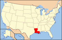
Louisiana's location in the U.S.Founded 1843 Named for settler, Marcel DeSoto Seat Mansfield Largest city Mansfield Area
- Total
- Land
- Water
894 sq mi (2,317 km²)
877 sq mi (2,272 km²)
17 sq mi (45 km²), 1.93%Population
- (2010)
- Density
26,656
29/sq mi (11/km²)Time zone Central: UTC-6/-5 DeSoto Parish (French: Paroisse DeSoto) is a parish located in the U.S. state of Louisiana. Its seat is Mansfield. In the 2010 census, the parish population was 26,656.
DeSoto Parish is part of the Shreveport–Bossier City Metropolitan Statistical Area as well as the Shreveport–Bossier City–Minden Combined Statistical Area.
Contents
History
It is a common misperception that the parish is named for Hernando de Soto, the Spaniard who explored the future southeastern United States and discovered and named the Mississippi River. The parish is in fact named after the unrelated Marcel DeSoto, who led the first group of European settlers there, to a settlement historically known as Bayou Pierre.[1] The county name is also commonly misspelled following the explorer's name as "De Soto Parish," but it is properly spelled following the settler's name as "DeSoto Parish."[2]
The Battle of Mansfield was fought in DeSoto Parish on April 8, 1864. General Alfred Mouton was killed in the fighting, but his position was carried forward by Prince de Polignac, a native of France. The battle is commemorated at the Mansfield State Historic Site four miles south of Mansfield off Louisiana Highway 175. The Confederate victory prevented a planned Union invasion thereafter of Texas.[3]Mansfield, also known as the Battle of Sabine Crossroads, a Confederate victory, occurred with one year and one day left in the duration of the war. Mansfield was quickly followed by the Battle of Pleasant Hill to the south.[4]
Geography
The parish has a total area of 894 square miles (2,315.4 km2), of which 877 square miles (2,271.4 km2) is land and 17 square miles (44.0 km2) (1.93%) is water.
Major highways
 Interstate 49
 U.S. Highway 84
 U.S. Highway 171
 U.S. Highway 371
 Louisiana Highway 5
Adjacent parishes
- Caddo Parish (north)
- Red River Parish (east)
- Natchitoches Parish (southeast)
- Sabine Parish (south)
- Shelby County, Texas (southwest)
- Panola County, Texas (west)

Caddo Parish Panola County, Texas 
Red River Parish  DeSoto Parish, Louisiana

Shelby County, Texas Sabine Parish Natchitoches Parish National protected area
Demographics
As of the census[5] of 2010, there were 26,656 people, 9,691 households, and 6,967 families residing in the parish. The population density was 29 people per square mile (11/km²). There were 11,204 housing units at an average density of 13 per square mile (5/km²). The racial makeup of the parish was 55.97% White, 42.16% Black or African American, 0.51% Native American, 0.11% Asian, 0.05% Pacific Islander, 0.54% from other races, and 0.66% from two or more races. 1.55% of the population were Hispanic or Latino of any race.
Census Pop. %± 1900 25,063 — 1910 27,689 10.5% 1920 29,376 6.1% 1930 31,016 5.6% 1940 31,803 2.5% 1950 24,398 −23.3% 1960 24,248 −0.6% 1970 22,764 −6.1% 1980 25,727 13.0% 1990 25,346 −1.5% 2000 25,494 0.6% 2010 26,656 4.6% DeSoto Parish Census Data[6] There were 9,691 households out of which 33.50% had children under the age of 18 living with them, 48.70% were married couples living together, 18.60% had a female householder with no husband present, and 28.10% were non-families. 25.40% of all households were made up of individuals and 11.60% had someone living alone who was 65 years of age or older. The average household size was 2.60 and the average family size was 3.11.
In the parish the population was spread out with 28.40% under the age of 18, 8.30% from 18 to 24, 26.30% from 25 to 44, 23.00% from 45 to 64, and 14.10% who were 65 years of age or older. The median age was 36 years. For every 100 females there were 90.80 males. For every 100 females age 18 and over, there were 87.00 males.
The median income for a household in the parish was $28,252, and the median income for a family was $33,196. Males had a median income of $30,780 versus $20,182 for females. The per capita income for the parish was $13,606. About 21.00% of families and 25.10% of the population were below the poverty line, including 33.80% of those under age 18 and 24.90% of those age 65 or over.
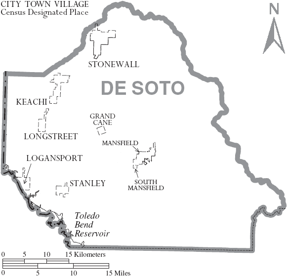
Communities
Cities
 Map of DeSoto Parish, Louisiana With Municipal Labels
Towns
Villages
Unincorporated areas
Education
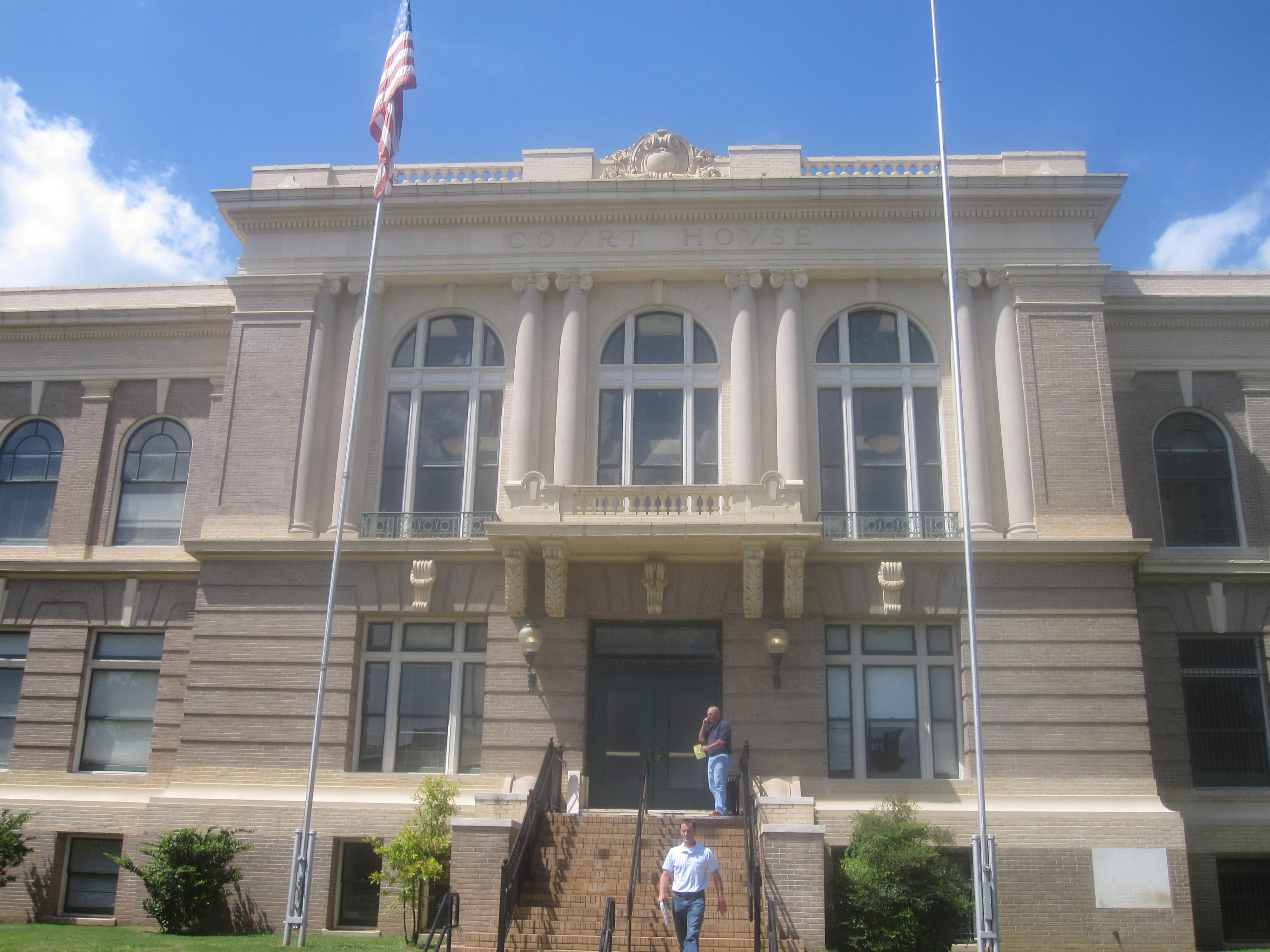
Public schools in DeSoto Parish are operated by the DeSoto Parish School Board.
Notable people
- Terry Bradshaw (1948-) professional football player, sportscaster, singer, and actor
- Richard Burford (1946-) Louisiana State Representative
- Vida Blue (1949-) professional baseball player
- Sherri Smith Cheek (born 1966) represents DeSoto Parish in the Louisiana State Senate
- Joe Henry Cooper (1920–1980) Louisiana State Representative
- John H. Eastman (1861-1938) Mayor of Shreveport
- Joseph Barton Elam (1821–1885) United States Congressman
- Charles Wheaton Elam (1866–1917) Louisiana State Representative
- Major General T.B. Herndon (1902–1964) "United States Air Force"
- Albert Lewis (1960-) professional football player
- Walter M. Lowrey (1921-1980), historian at Centenary College of Louisiana
- Garnie W. McGinty (1900-1984), Louisiana historian, was a school principal in DeSoto Parish in the 1920s.
- O. E. Price (1924-2006) judge
- Mack Charles Reynolds (1935–1991) professional football player
- O.C. Smith (1932–2001) singer
See also
References
- ^ Means, Emilia Gay Griffith, and Liz Chrysler. DeSoto Parish. Arcadia Publishing, 2011, p. 8.
- ^ http://www.desotoparishclerk.org/
- ^ Brochure, Mansfield State Historic Site, 15149 Highway 175, Mansfield, Louisiana 71052
- ^ John D. Winters, The Civil War in Louisiana, Baton Rouge: Louisiana State University Press, 1963, ISBN 0-8071-0834-0, pp. 340-347
- ^ "American FactFinder". United States Census Bureau. http://factfinder.census.gov. Retrieved 2008-01-31.
- ^ United States Census Bureau. "Louisiana Population of Counties by Decennial Census: 1900 to 1990". http://www.census.gov/population/cencounts/la190090.txt. Retrieved 2008-02-02.
Municipalities and communities of DeSoto Parish, Louisiana City 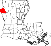
Towns Villages Unincorporated
communitiesCategories:- Louisiana parishes
- DeSoto Parish, Louisiana
- Shreveport – Bossier City metropolitan area


Wikimedia Foundation. 2010.