- Natchitoches Parish, Louisiana
-
Natchitoches Parish, Louisiana 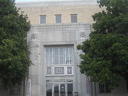 Natchitoches Parish Courthouse (completed 1939)
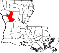
Location in the state of Louisiana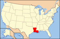
Louisiana's location in the U.S.Founded 1805 Named for Natchitoches Native Americans Seat Natchitoches Largest city Natchitoches Area
- Total
- Land
- Water
1,299 sq mi (3,365 km²)
1,255 sq mi (3,252 km²)
44 sq mi (114 km²), 3.37%Population
- (2000)
- Density
39,080
31/sq mi (12/km²)Time zone Central: UTC-6/-5 Website www.historicnatchitoches.com  The Natchitoches Parish Library.
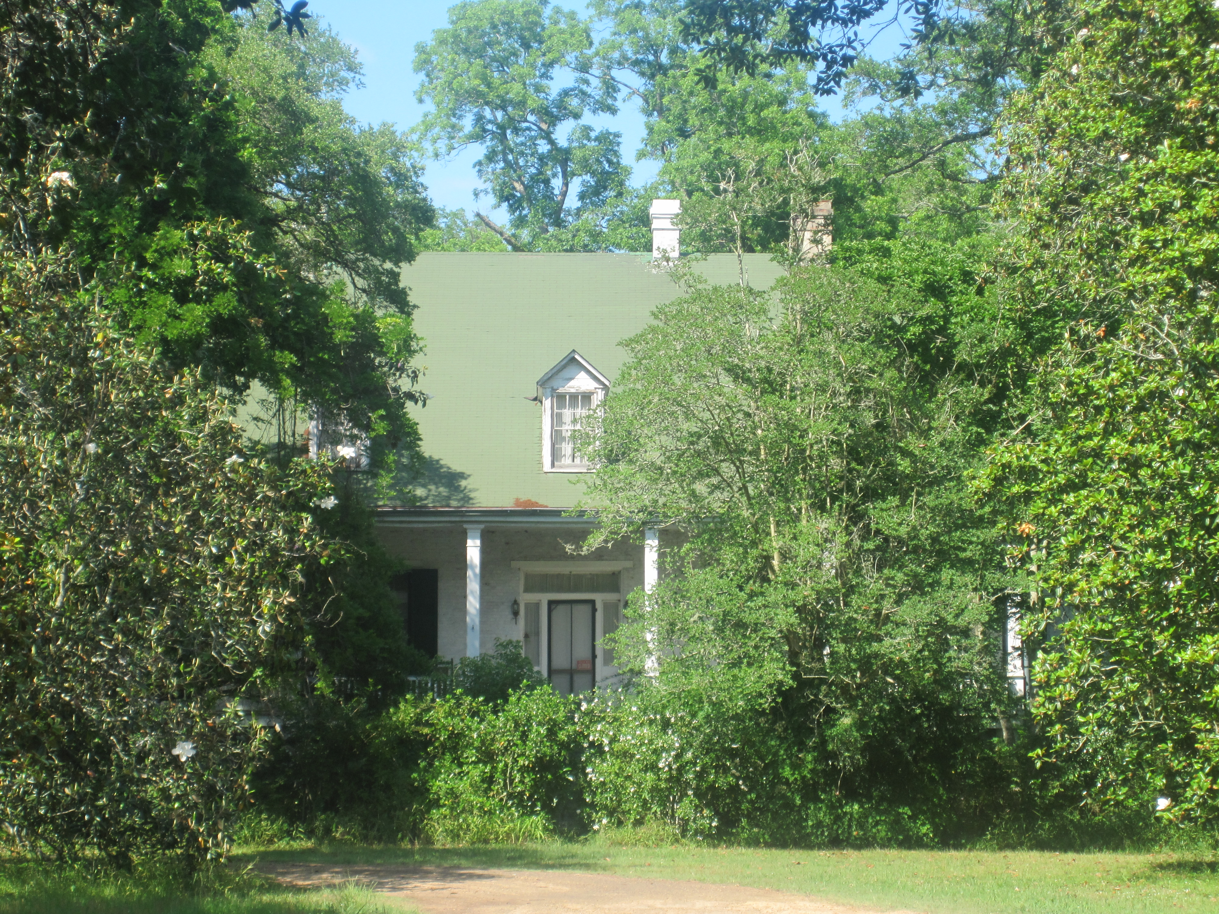
 Hidden by trees, the Magnolia Plantation is located in the Cane River Creole National Historical Park.
Natchitoches Parish (French: Paroisse des Natchitoches) is a parish located in the U.S. state of Louisiana. The parish seat is Natchitoches. As of 2000, the population was 39,080. This is the heart of the Cane River Louisiana Creole community. The Natchitoches Micropolitan Statistical Area includes all of Natchitoches Parish.
Including extensive outbuildings at Magnolia and Oakland plantations, the Cane River Creole National Historical Park interprets the history and culture of the Louisiana Creoles. It was designated one of the original sites on the Louisiana African American Heritage Trail.
Contents
History
Natchitoches Parish was created by the act of April 10, 1805 that divided the Territory of Orleans into 12 parishes, including Orleans, Iberville, Rapides and Natchitoches.
Geography
The parish is one of the largest in the state in terms of land area. It has a total area of 1,299 square miles (3,365 km²), of which, 1,255 square miles (3,252 km²) of it is land and 44 square miles (114 km²) of it (3.37%) is water.
Demographics
Census Pop. %± 1900 33,216 — 1910 36,455 9.8% 1920 38,602 5.9% 1930 38,477 −0.3% 1940 40,997 6.5% 1950 38,144 −7.0% 1960 35,653 −6.5% 1970 35,219 −1.2% 1980 39,863 13.2% 1990 36,689 −8.0% 2000 39,080 6.5% Est. 2006 38,719 [1] −0.9% Natchitoches Parish Census Data[2] As of the census[3] of 2000, there were 39,080 people, 14,263 households, and 9,499 families residing in the parish. The population density was 31 people per square mile (12/km²). There were 16,890 housing units at an average density of 14 per square mile (5/km²). The racial makeup of the parish was 57.85% White, 38.43% Black or African American, 1.08% Native American, 0.44% Asian, 0.02% Pacific Islander, 0.92% from other races, and 1.27% from two or more races. 1.45% of the population were Hispanic or Latino of any race.
There were 14,263 households out of which 33.00% had children under the age of 18 living with them, 45.30% were married couples living together, 17.70% had a female householder with no husband present, and 33.40% were non-families. 27.10% of all households were made up of individuals and 10.90% had someone living alone who was 65 years of age or older. The average household size was 2.56 and the average family size was 3.14.
In the parish the population was spread out with 26.00% under the age of 18, 17.90% from 18 to 24, 24.30% from 25 to 44, 19.70% from 45 to 64, and 12.10% who were 65 years of age or older. The median age was 30 years. For every 100 females there were 90.60 males. For every 100 females age 18 and over, there were 85.80 males.
The median income for a household in the parish was $25,722, and the median income for a family was $32,816. Males had a median income of $29,388 versus $19,234 for females. The per capita income for the parish was $13,743. About 20.90% of families and 26.50% of the population were below the poverty line, including 32.70% of those under age 18 and 19.00% of those age 65 or over.
National Guard
A Troop 2-108TH CAV is heaquarted in behind the local college and the airport. This unit has deployed twice to Iraq, first as part of the 1-156TH Armor Battalion in 2004-2005 and then as part of the 2-108TH CAV SQDN in 2010. Both times this company sized element deployed with the 256th Infantry Brigade.
National protected areas
- Cane River Creole National Historical Park
- Kisatchie National Forest (part)
- Red River National Wildlife Refuge (part)
- Saline Bayou
Notable natives and residents
- H. Welborn Ayres (1900–1985), born in Ashland, judge of the Louisiana Third Judicial District Court in Jonesboro and the Second Circuit Court of Appeal in Shreveport
- Leopold Caspari (1830-1915), merchant in Cloutierville from 1849-1858 and thereafter businessman and banker in Natchitoches. He served nonconsecutively in both houses of the Louisiana State Legislature between 1884 and 1914.[4]
- Caroline Dormon (1888–1971), naturalist, botanist, and preservationist (1888–1971) was born and lived on her family estate of Briarwood in Natchitoches Parish.
- Boyd B. Durr (1926-2010), Ajax native, United States Army Air Corps service in World War II, law-enforcement officer from 1946-2000, Natchitoches town marshal, Democratic sheriff of Natchitoches Parish during the 1990s until unseated in the 1999 nonpartisan blanket primary by Victor E. Jones, Jr.[5]
- Andrew R. Johnson (1856–1933), Louisiana state senator and former mayor of Homer, Louisiana, in 1901 named and sold lots to establish the village of Ashland in Natchitoches Parish.[6]
- Bob Reese (1929-2004), Co-chairman of the Natchitoches Parish Republican Party, 1968-2004.[7]
Communities
 Map of Natchitoches Parish, Louisiana With Municipal Labels
Cities
Towns
Villages
Unincorporated areas
- Melrose
- Readhimer
Education
Natchitoches Parish School Board operates local public schools. Several former rural schools, such as Ashland High School and Goldonna High School in the villages of Ashland and Goldonna, have closed over the years under school consolidation.
Major highways
 Interstate 49
 U.S. Highway 71
 U.S. Highway 84
 Louisiana Highway 1
 Louisiana Highway 6
 Louisiana Highway 9
 Louisiana Highway 117
 Louisiana Highway 119
 Louisiana Highway 126
 Louisiana Highway 153
 Louisiana Highway 156
 Louisiana Highway 1226
Adjacent parishes
- Bienville Parish (north)
- Winn Parish (northeast)
- Grant Parish (east)
- Rapides Parish (southeast)
- Vernon Parish (south)
- Sabine Parish (west)
- De Soto Parish (northwest)
- Red River Parish (northwest)

De Soto Parish Red River Parish Bienville Parish Sabine Parish 
Winn Parish  Natchitoches Parish, Louisiana

Vernon Parish Rapides Parish Grant Parish See also: List of counties bordering eight counties
See also
References
- ^ United States Census Bureau. "Natchitoches Parish Quickfacts". http://quickfacts.census.gov/qfd/states/22/22069.html. Retrieved 2008-02-02.
- ^ United States Census Bureau. "Louisiana Population of Counties by Decennial Census: 1900 to 1990". http://www.census.gov/population/cencounts/la190090.txt. Retrieved 2008-02-02.
- ^ "American FactFinder". United States Census Bureau. http://factfinder.census.gov. Retrieved 2008-01-31.
- ^ "Caspari, Leopold". Louisiana Historical Association, A Dictionary of Louisiana Biography (lahistory.org). http://www.lahistory.org/site20.php. Retrieved December 22, 2010.
- ^ "Obituary of Boyd B. Durr". Alexandria Daily Town Talk, September 6, 2010. http://www.legacy.com/obituaries/thetowntalk/obituary.aspx?n=boyd-durr&pid=145134811. Retrieved September 11, 2010.
- ^ "Mike Miller, "Andrew R. Johnson," from Henry E. Chambers, A History of Louisiana, Vol. II, Chicago and New York City, 1925, pp. 147-148". usgarchives.rog. http://files.usgwarchives.org/la/claiborne/bios/johnsar.txt. Retrieved May 25, 2010.
- ^ Obituary of Bob Reese. Shreveport Times, November 27, 2004
Municipalities and communities of Natchitoches Parish, Louisiana City 
Town Villages Unincorporated
communitiesAllen | Ajax | Chopin | Cloutierville | Flora | Grand Ecore | Marthaville | Melrose | Mink | Readhimer
Categories:- Louisiana parishes
- Natchitoches Parish, Louisiana
- Louisiana African American Heritage Trail


Wikimedia Foundation. 2010.