- Marthaville, Louisiana
-
Marthaville Unincorporated community Country United States State Louisiana Parish Natchitoches Elevation 243 ft (74.1 m) Coordinates 31°44′20″N 93°23′48″W / 31.73889°N 93.39667°W Founded 1851 Timezone CST (UTC-6) - summer (DST) CDT (UTC-5) Area code 318 
 Location of Marthaville in Louisiana
 Location of Louisiana in the United States
Marthaville is an unincorporated community in Natchitoches Parish, Louisiana, United States. It is part of the Natchitoches Micropolitan Statistical Area.
Contents
History
Marthaville was founded in 1851, The founder named the town after his wife, Martha Rains, The town, during its peak, had a train stop, a bank, general store, bar, and hotel, etc. Unfortunately, in the late 1960s, the railroad was removed, and the town experienced an economic downturn. Now it is an unincorporated village in Natchitoches Parish, still having the Store, Post Office, and is home to at least a dozen churches in the area.
Geography
Marthaville is located on the western edge of Natchitoches Parish, 7 Miles west of Robeline
Arts and culture
The Marthaville Good Ole Days Festival[1] is "A two-day September festival that celebrates the past with activities for the whole family, including games, live entertainment, arts and crafts, a parade, and delicious food." The Marthaville Good Ole Days Festival attracts about 1,500 people to the area.
References
Municipalities and communities of Natchitoches Parish, Louisiana City 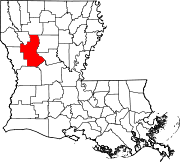
Town Villages Unincorporated
communitiesCategories:- Unincorporated communities in Louisiana
- Populated places in Natchitoches Parish, Louisiana


Wikimedia Foundation. 2010.