- Morgan City, Louisiana
-
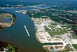
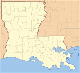
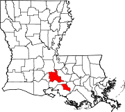
City of Morgan City City Motto: Right in the Middle of Everything Country United States State Louisiana Parishes St. Martin, St. Mary Elevation 7 ft (2.1 m) Coordinates 29°42′03″N 91°11′50″W / 29.70083°N 91.19722°W Area 6.0 sq mi (15.5 km2) - land 5.9 sq mi (15 km2) - water 0.1 sq mi (0 km2), 1.67% Population 12,404 (2010) Density 2,166.5 / sq mi (836.5 / km2) Mayor Tim Matte Timezone CST (UTC-6) - summer (DST) CDT (UTC-5) ZIP code 70380 Area code 985 Website: http://www.cityofmc.com Morgan City (previously known as Brashear City) is a city in St. Martin and St. Mary parishes in the U.S. state of Louisiana. The population was 12,404 at the 2010 census.
The St. Mary Parish portion of Morgan City is part of the Morgan City Micropolitan Statistical Area, while the small St. Martin Parish portion is part of the Lafayette Metropolitan Statistical Area.
Contents
History
Morgan City sits on the banks of the Atchafalaya River. Morgan City was originally called Tiger Island by surveyors appointed by U.S. Secretary of War John Calhoun because of a particular type of wild cat seen in the area. It was later called Brashear City after Walter Brashear, a prominent Kentucky physician who purchased large tracts of land and acquired numerous sugar mills.[1] It was incorporated in 1860 as Brashear City.
Capture of Brashear City
During the American Civil War Star Fort, also known as Fort Brashear was the larger of two works erected by the Union Army occupying the city to defend a Federal military depot and the town. During the Bayou Teche Campaign, on the night of June 22, 1863, 325 Confederates of Gen. A. A. Mouton's command led by Major Sherod Hunter landed their skiffs and flats in the rear of the town. Attacking the next day, they surprised and captured the city, 1,300 Union prisoners, 11 heavy siege guns, 2,500 stands of rifles, immense quantities of quartermaster, commissary and ordinance stores, as well as 2,000 negroes and between 200 and 300 wagons and tents, while suffering losses of only 3 killed, 18 wounded.[2]
Morgan City
In 1876, the community's name was changed to Morgan City in tribute to Charles Morgan, rail and steamship magnate who first dredged the Atchafalaya Bay Ship Channel to accommodate ocean-going vessels.[3][4]
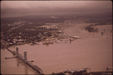
In Spring of 1973 the Morganza Spillway was opened during high water on the Mississippi River, resulting in flooding of parts of Morgan City. Flooding was actually caused by the massive rains that year and not the opening of the Morganza Spillway.
On October 28, 1985 Hurricane Juan (not to be confused with the 2003 storm of the same name) made landfall near Morgan City, flooding many parts of the city. Then made another cyclonic loop, moving off shore and came onshore again in Alabama.
On August 26, 1992 Hurricane Andrew came ashore 20 miles to the southwest of town. Andrew was the second most destructive hurricane in U.S. History, after having crossed Florida and then regaining strength in the Gulf of Mexico.
Geography
Morgan City is located at 29°42′3″N 91°11′50″W / 29.70083°N 91.19722°W (29.700828, -91.197314)[5] and has an elevation of 7 feet (2.1 m)[6].
According to the United States Census Bureau, the city has a total area of 6.0 square miles (16 km2), of which, 5.9 square miles (15 km2) of it is land and 0.2 square miles (0.52 km2) of it (2.65%) is water.
If the Mississippi River were to experience a major course change in the vicinity of the Old River Control Structure or Morganza Spillway, the main channel of the river would likely enter the Gulf of Mexico near Morgan City instead of New Orleans.[7][8][9]
Demographics
Historical populations Census Pop. %± 1880 2,015 — 1890 2,291 13.7% 1900 2,332 1.8% 1910 5,477 134.9% 1920 5,429 −0.9% 1930 5,985 10.2% 1940 6,969 16.4% 1950 9,789 40.5% 1960 13,540 38.3% 1970 16,586 22.5% 1980 16,114 −2.8% 1990 14,531 −9.8% 2000 12,703 −12.6% 2010 12,404 −2.4% U.S. Decennial Census As of the census[10] of 2000, there were 12,703 people, 5,037 households, and 3,394 families residing in the city. The population density was 2,166.5 people per square mile (837.0/km²). There were 5,627 housing units at an average density of 959.7 per square mile (370.8/km²). The racial makeup of the city was 71.28% White, 23.90% African American, 0.91% American Indian (U.S. Census), 1.02% Asian, 0.01% Pacific Islander, 1.18% from other races, and 1.69% from two or more races. Hispanic of any race were 3.37% of the population.
There were 5,037 households out of which 31.2% had children under the age of 18 living with them, 47.0% were married couples living together, 15.8% had a female householder with no husband present, and 32.6% were non-families. 28.0% of all households were made up of individuals and 10.8% had someone living alone who was 65 years of age or older. The average household size was 2.48 and the average family size was 3.04.
In the city the population was spread out with 26.4% under the age of 18, 8.7% from 18 to 24, 27.7% from 25 to 44, 23.3% from 45 to 64, and 13.9% who were 65 years of age or older. The median age was 36 years. For every 100 females there were 93.0 males. For every 100 females age 18 and over, there were 91.8 males.
The median income for a household in the city was $28,324, and the median income for a family was $36,196. Males had a median income of $31,712 versus $19,550 for females. The per capita income for the city was $14,577. About 17.7% of families and 20.7% of the population were below the poverty line, including 27.3% of those under age 18 and 17.7% of those age 65 or over.
Notable natives and residents
- Bill Burgo (1988) baseball player.
- Carla Blanchard Dartez, former state representative
- Charles deGravelles (1913–2008), Louisiana State Republican chairman from 1968–1972
- Eddie Dyer (b. October 11, 1899) Major League Baseball player, St. Louis Cardinals pitcher.
- Sid Gautreaux (1980) baseball player.
- Mark Hall (1965) football player
- Burt Lancon was an Olympic Ice Skater in the 1984 Winter Games.
- Geronimo Pratt (1947-2011) – Black panther
- Bishop Sam Seamans – Reformed Episcopal Church
- Nigel Smith (1980) - humanitarian and advocate for women's rights
Culture
- Denzel Washington shot a scene in Morgan City for his 2006 film, Déjà Vu.
- The Tampico Mexican Restaurant chain was founded, and established its headquarters here in 1962.
- All the King's Men (2006 film) was partially shot in Morgan City.
- Morgan City is home to the Louisiana Shrimp and Petroleum Festival.
- The Iguanas (New Orleans) recorded a song called "Morgan City" on their album "If You Should Ever Fall on Hard Times".
- The first Tarzan movie starring Elmo Lincoln was filmed in Morgan City in 1917.
- Morgan City achieved national recognition when the first oil well out of sight of land was drilled. It was called the Black Gold Rush.
- Morgan City is gateway to the Atchafalaya Basin, the largest overflow swamp in the US.
The Old Spanish Trail runs through Morgan City and will be celebrating its centennial in 2019 with a motorcade drive through. It follows the route of old US 90.
- Morgan City is the name of a band based in Austin, Texas. http://www.reverbnation.com/morgancity
- The Movie Easy Rider (1969) directed by Dennis Hopper, starring Peter Fonda, Jack Nicholson, Dennis Hopper, and Phil Spector, featured four landmarks in Morgan City:
-
- The "Old Bridge" headed west,
- The "Old Bridge" in Amelia,
- The Greenwood Overpass headed west near Wyandotte,
- The ESSO , Humble Station near the La. 182 exit ramp of the "New Bridge". This was once the location of the Municipal Pool, and is now the location of a ball park.
In 1969 Kris Kristopherson While Flying Helicopters for Petroleum Helicopters Inc. in Morgan City wrote the Janis Joplin hit song,"Me and Bobbie Magee" .http://books.google.com/books?id=BSHTGsnI8skC&pg=PA320&lpg=PA320&dq=%22Me+and+Bobby+McGee+morgan+city&source=bl&ots=Kl8QdV6OuN&sig=pRFGkgVf0LbzwM_4FaaBzXa2v3U&hl=en&ei=UJb5TNmaNsGAlAfN3IXhBw&sa=X&oi=book_result&ct=result&resnum=4&ved=0CCkQ6AEwAw#v=onepage&q=%22Me%20and%20Bobby%20McGee%20morgan%20city&f=false
References
- ^ www.cajuncoast.com "Morgan City"
- ^ L. Boyd Finch, "Surprise at Brashear City: Sherod Hunter’s Sugar Cooler Cavalry," LOUISIANA HISTORY, Fall 1984, pp. 403-435.
- ^ www.oceanmarine.com "THE AREA OF MORGAN CITY, LOUISIANA HISTORY"
- ^ Louisiana Department of Culture, Recreation and Tourism. "Morgan City Historical Marker". http://www.stoppingpoints.com/louisiana/St.-Mary/Morgan+City/.
- ^ "US Gazetteer files: 2010, 2000, and 1990". United States Census Bureau. 2011-02-12. http://www.census.gov/geo/www/gazetteer/gazette.html. Retrieved 2011-04-23.
- ^ "US Board on Geographic Names". United States Geological Survey. 2007-10-25. http://geonames.usgs.gov. Retrieved 2008-01-31.
- ^ "Will the Mississippi River change its course in 2011 to the red line?". Mappingsupport. http://www.mappingsupport.com/p/gmap4.php?q=https://sites.google.com/site/gmap4files/p/news/mississippi_course_change.txt&ll=30.417887,-91.201416&t=h&z=9&label=on. Retrieved 2011-05-08.
- ^ Controlling the Mighty Mississippi's path to the sea
- ^ "Mississippi Rising: Apocalypse Now? (April 28, 2011)". Daily Impact. http://www.dailyimpact.net/2011/04/28/mississippi-rising-apocalypse-now/. Retrieved 10 May 2011.
- ^ "American FactFinder". United States Census Bureau. http://factfinder.census.gov. Retrieved 2008-01-31.
http://www.oldspanishtrailcentennial.com/index.htm http://www.gomr.boemre.gov/PI/PDFImages/ESPIS/4/4532.pdf
External links
Municipalities and communities of St. Martin Parish, Louisiana Parish seat: St. Martinville Cities Breaux Bridge | Broussard‡ | Morgan City‡ | St. Martinville
Towns Village CDP Unincorporated
communitiesAnse La Butte | Atchafalaya | Banker Plantation | Bankers | Bayou Geneve | Bushville | Butte La Rose | Cade | Catahoula | Catahoula Cove | Champagne | Coteau Holmes | Coteau Rodaire | Darby | Declouet | Delacroix | Duchamp | Gecko | Grand Annse | Huron | Gecko | Isle Labbe | Keystone | Levert | Nina Station | Patin | Pelba | Poché Bridge | Portage | Romero | Ruth | Rycade | St. John | Stephenville
Ghost town Footnotes ‡This populated place also has portions in an adjacent parish or parishes
Municipalities and communities of St. Mary Parish, Louisiana Parish seat: Franklin Cities Towns CDPs Unincorporated
communitiesAdeline | Alice B | Ashton | Avalon | Balco | Bodin | Bonvillain | Burns | Cabot | Caffery | Calumet | Camperdown | Caneland | Choupique | Clausen | Cote Blanche Landing | Cypremort | Dumesnil | Ellerslie | Englewood | Fairfax | Fairville | Farmers | Fivemile Oaks | Florence | Four Corners | Freetown | Garden City | Glencoe | Glenwild | Gold Mine | Gordy | Greenwood | Home Place | Idlewild | Irish Bend | Ivanhoe | Johnson | Julien | Katy | Kemper | Kilgore Plantation | Landry | Linwood | Luke Landing | Marguerite | Maria | Maryland | Matilda | Midway | Morgan City Beach | North Bend | Oaklawn | Oxford | Prevost | Ramos | Richland | Richard | Ricohoc | Rodriguez | Shadyside | Siracusaville | South Bend | Sorrel | Sterling | Todd | United | Verdunville | Wilsons Landing | Wyandotte
Footnotes ‡This populated place also has portions in an adjacent parish or parishes
Categories:- Cities in Louisiana
- Populated places in St. Martin Parish, Louisiana
- Populated places in St. Mary Parish, Louisiana
- Populated places established in 1860
- Lafayette, Louisiana metropolitan area
Wikimedia Foundation. 2010.

