- Cranberry, North Carolina
-
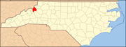
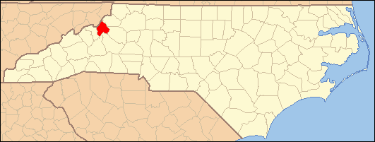
Cranberry — Unincorporated — Location within the state of North Carolina
 Cranberry
Coordinates: 36°08′35″N 81°58′01″W / 36.14306°N 81.96694°WCoordinates: 36°08′35″N 81°58′01″W / 36.14306°N 81.96694°W Country United States State North Carolina County Avery County Founded 1850 Elevation 3,130 ft (954 m) Time zone Eastern (EST) (UTC-5) - Summer (DST) EDT (UTC-4) ZIP code 28622 Area code(s) 828 GNIS feature ID 1019844[1] Cranberry is an unincorporated community in Avery County, North Carolina, United States. The community was founded in 1850 and was named after Cranberry Creek, which flows in the area. The community is located one mile south from the town of Elk Park, along US 19-E.
History
Before the settlement of Cranberry, the area was already known for one of the largest veins of iron ore in the United States[2]. During the Civil War, iron was produced for the Confederate Army. In 1882, the East Tennessee and Western North Carolina Railroad ("Tweetsie") linked Cranberry with Johnson City, Tennessee; it was later extended on to Montezuma in 1904, eventually reaching Boone by 1919. During this time, Cranberry was incorporated as a town until sometime after 1929 when the Cranberry Furnace was closed. Eventually the railroad to Cranberry was decommissioned in 1950.
References
Municipalities and communities of Avery County, North Carolina County seat: Newland Towns Banner Elk | Beech Mountain‡ | Crossnore | Elk Park | Newland | Seven Devils‡
Villages Unincorporated
communitiesAltamont | Cranberry | Frank | Gragg | Heaton | Ingalls | Linville | Linville Falls‡ | Minneapolis | Montezuma | Pineola | Plumtree | Roaring Creek | Three Mile | Vale
Footnotes ‡This populated place also has portions in an adjacent county or counties
Categories:- Populated places in Avery County, North Carolina
- Unincorporated communities in North Carolina
- Populated places established in 1850

Wikimedia Foundation. 2010.