- National Register of Historic Places listings in Johnston County, North Carolina
-

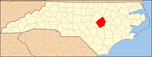
This list includes properties and districts listed on the National Register of Historic Places in Johnston County, North Carolina. Click the "Map of all coordinates" link to the right to view a Google map of all properties and districts with latitude and longitude coordinates in the table below.[1]
-
- This National Park Service list is complete through NPS recent listings posted November 10, 2011.[2]
[3] Landmark name[4] Image Date listed Location City or Town Summary 1 Atkinson-Smith House June 5, 1975 10 miles E of Smithfield off SR 1007
35°42′50″N 78°14′17″W / 35.71389°N 78.23806°WSmithfield 2 Benson Historic District May 9, 1985 Roughly bounded by E. Hill, N. Lee, E. Parish and Farmers Dr. on Main and Church Sts.
35°22′54″N 78°32′51″W / 35.38167°N 78.5475°WBenson 3 Bentonville Battleground State Historic Site February 26, 1970 S of Princeton, off U.S. 701 and SR 1008
35°18′23″N 78°19′26″W / 35.30639°N 78.32389°WPrinceton 4 Boyette Slave House September 20, 1979 NW of Kenly on SR 2110
35°39′9.32″N 78°10′52.43″W / 35.6525889°N 78.1812306°WKenly 5 Brooklyn Historic District May 5, 2000 Roughly bounded by Spring Branch Creek, S. Fifth St., S. Third St., and Lee St.
35°30′22″N 78°20′52″W / 35.50611°N 78.34778°WSmithfield 6 Clayton Banking Company Building December 6, 1996 301 E. Main St.
35°38′59″N 78°27′29″W / 35.64972°N 78.45806°WClayton 7 Clayton Graded School and Clayton Grammar School-Municipal Auditorium October 20, 2001 101 and 111 2nd St.
35°39′13″N 78°27′38″W / 35.65361°N 78.46056°WClayton 8 Clayton Historic District June 7, 2010 Bounded by Mulberry St., W Barnes St., Mill St., S Lombard St., Blanche St.
35°39′2.56″N 78°27′23.01″W / 35.6507111°N 78.4563917°WClayton 9 Cleveland School September 7, 2005 8968 Cleveland Rd.
35°34′6″N 78°31′43″W / 35.56833°N 78.52861°WClayton 10 Downtown Selma Historic District August 30, 2010 Includes portions of both sides of N. and S. Raiford, E. & W. Anderson, E. and W. Waddell, and E. and W. Railroad Sts, and W Web
35°32′12″N 78°17′4″W / 35.53667°N 78.28444°WSelma 11 Downtown Smithfield Historic District October 14, 1993 S. Third and Market Sts.
35°30′39″N 78°20′46″W / 35.51083°N 78.34611°WSmithfield 12 Noah Edward Edgerton House June 24, 1982 301 W. Railroad St.
35°32′10″N 78°17′49″W / 35.53611°N 78.29694°WSelma 13 Ellington-Ellis Farm July 21, 1983 SR 1004
35°40′18″N 78°28′46″W / 35.67167°N 78.47944°WClayton 14 Four Oaks Commercial Historic District August 9, 2006 100-300 blks N. Main, 100-200 blks S. Main, 100 blk S.W. Railroad, 100 blk W Wellons St. & 100 blk W. Woodall St.
35°26′46″N 78°25′46″W / 35.44611°N 78.42944°WFour Oaks 15 Hannah's Creek Primitive Baptist Church January 25, 1991 NC 301 SW of jct. with NC 1171
35°24′36″N 78°30′20″W / 35.41°N 78.50556°WBenson 16 Harper House February 26, 1970 Near jct. of SR 1008 and 1188
35°18′5″N 78°19′57″W / 35.30139°N 78.3325°WHarper 17 Hastings-McKinnie House September 8, 1983 201 S. Pierce St.
35°27′43″N 78°9′24″W / 35.46194°N 78.15667°WPrinceton 18 Hood Brothers Building August 14, 1986 100-104 S. Third St.
35°30′40″N 78°20′48″W / 35.51111°N 78.34667°WSmithfield 19 Hood-Strickland House August 23, 1990 415 S. 4th St.
35°30′21″N 78°20′51″W / 35.50583°N 78.3475°WSmithfield 20 Johnston County Courthouse May 10, 1979 Martin and 2nd Sts
35°30′40″N 78°20′52″W / 35.51111°N 78.34778°WSmithfield 21 Walter R. and Eliza Smith Moore House May 4, 2005 3919 Raleigh Rd.
35°33′7″N 78°31′43″W / 35.55194°N 78.52861°WClayton 22 North Smithfield Historic District May 26, 2000 Roughly bounded by Market, Front, North, and Seventh Sts.
35°30′49″N 78°20′38″W / 35.51361°N 78.34389°WSmithfield 23 Nowell-Mayerburg-Oliver House June 24, 1982 312 W. Anderson St.
35°32′14″N 78°17′11″W / 35.53722°N 78.28639°WSelma 24 Princeton Graded School October 4, 2005 601-611 W. Edwards St.
35°28′11.11″N 78°10′7.25″W / 35.4697528°N 78.1686806°WPrinceton 25 Sanders-Hairr House May 6, 1971 S of Clayton on SR 1525
35°36′46″N 78°32′5″W / 35.61278°N 78.53472°WClayton 26 Shiloh Primitive Baptist Church January 31, 2008 9495 Brogden Rd.
35°24′21″N 78°12′41″W / 35.40583°N 78.21139°WBrogden 27 William E. Smith House June 24, 1982 309 W. Railroad St.
35°32′8″N 78°17′13″W / 35.53556°N 78.28694°WSelma 28 Smithfield Masonic Lodge September 28, 2007 115 N. Second St.
35°30′51″N 78°20′51″W / 35.51417°N 78.3475°WSmithfield 29 Stallings-Carpenter House March 28, 1983 SR 1713
35°41′26″N 78°27′27″W / 35.69056°N 78.4575°WClayton 30 Everitt P. Stevens House June 24, 1982 SR 1003
35°33′33″N 78°17′49″W / 35.55917°N 78.29694°WSelma 31 Union Station 
June 24, 1982 E. Railroad St.
35°31′57″N 78°16′50″W / 35.5325°N 78.28056°WSelma 32 U.S. Post Office, Former April 22, 1993 405 E. Market St.
35°30′37″N 78°20′40″W / 35.51028°N 78.34444°WSmithfield 33 Watson-Sanders House January 26, 2001 2810 Brogden Rd.
35°28′7″N 78°19′34″W / 35.46861°N 78.32611°WSmithfield See also
- National Register of Historic Places listings in North Carolina
- List of National Historic Landmarks in North Carolina
References
- ^ The latitude and longitude information provided in this table was derived originally from the National Register Information System, which has been found to be fairly accurate for about 99% of listings. For about 1% of NRIS original coordinates, experience has shown that one or both coordinates are typos or otherwise extremely far off; some corrections may have been made. A more subtle problem causes many locations to be off by up to 150 yards, depending on location in the country: most NRIS coordinates were derived from tracing out latitude and longitudes off of USGS topographical quadrant maps created under the North American Datum of 1927, which differs from the current, highly accurate WGS84 GPS system used by Google maps. Chicago is about right, but NRIS longitudes in Washington are higher by about 4.5 seconds, and are lower by about 2.0 seconds in Maine. Latitudes differ by about 1.0 second in Florida. Some locations in this table may have been corrected to current GPS standards.
- ^ "National Register of Historic Places: Weekly List Actions". National Park Service, United States Department of the Interior. Retrieved on November 10, 2011.
- ^ Numbers represent an ordering by significant words. Various colorings, defined here, differentiate National Historic Landmark sites and National Register of Historic Places Districts from other NRHP buildings, structures, sites or objects.
- ^ "National Register Information System". National Register of Historic Places. National Park Service. 2008-04-24. http://nrhp.focus.nps.gov/natreg/docs/All_Data.html.
U.S. National Register of Historic Places Topics Lists by states Alabama • Alaska • Arizona • Arkansas • California • Colorado • Connecticut • Delaware • Florida • Georgia • Hawaii • Idaho • Illinois • Indiana • Iowa • Kansas • Kentucky • Louisiana • Maine • Maryland • Massachusetts • Michigan • Minnesota • Mississippi • Missouri • Montana • Nebraska • Nevada • New Hampshire • New Jersey • New Mexico • New York • North Carolina • North Dakota • Ohio • Oklahoma • Oregon • Pennsylvania • Rhode Island • South Carolina • South Dakota • Tennessee • Texas • Utah • Vermont • Virginia • Washington • West Virginia • Wisconsin • WyomingLists by territories Lists by associated states Other Municipalities and communities of Johnston County, North Carolina Towns Archer Lodge | Benson | Clayton‡ | Four Oaks | Kenly‡ | Micro | Pine Level | Princeton | Selma | Smithfield | Wilson's Mills | Zebulon‡

Unincorporated
communitiesFootnotes ‡This populated place also has portions in an adjacent county or counties
Categories:- Johnston County, North Carolina
- National Register of Historic Places in North Carolina
- Buildings and structures in Johnston County, North Carolina
-

Wikimedia Foundation. 2010.