McGee Crossroads, North Carolina

McGee Crossroads, North Carolina

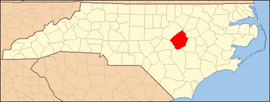
Coordinates: 35°31′02″N 78°34′45″W / 35.51722°N 78.57917°W / 35.51722; -78.57917 McGee Crossroads is an unincorporated community in Johnston County, North Carolina at the intersection of North Carolina Highway 50, and North Carolina Highway 210. It lies at an elevation of 292 feet (89 m).

The community of McGee's Crossroads extends to the intersection of I-40 and Hwy. 210. McGee's Crossroads was put on the map by the late Rudolph Jones, when he sat on the State Highways Commissioners as Chairman. Mr. Jones was a lifelong resident of the community and had great pride in it.


References


Wikimedia Foundation. 2010.

Игры ⚽ Поможем написать курсовую

Look at other dictionaries:

  • Peacocks Crossroads, North Carolina — Coordinates: 35°19′13″N 78°27′18″W / 35.32028°N 78.455°W / 35.32028; 78.455 Peacocks Crossroads (formerly, Meadow …   Wikipedia

  • Hocutts Crossroads, North Carolina — Coordinates: 35°44′01″N 78°17′52″W / 35.73361°N 78.29778°W / 35.73361; 78.29778 Hocutts Crossroads (also Corinth Holde …   Wikipedia

  • McGee — may refer to: Contents 1 People 2 Places 3 Other 4 See also People Darren McGee BPEU Pro Irish Gamer. John Gillespie Magee autho …   Wikipedia

  • Johnston County, North Carolina — Infobox U.S. County county = Johnston County state = North Carolina map size = 250 founded = 1746 seat = Smithfield | area total sq mi =796 area land sq mi =792 area water sq mi =4 area percentage = 0.50% census yr = 2007 pop = 157,437 density… …   Wikipedia

  • Clayton, North Carolina —   Town   Nickname(s): C Town, North Carolina …   Wikipedia

  • Cleveland, Johnston County, North Carolina —   Unincorporated community   …   Wikipedia

  • National Register of Historic Places listings in Johnston County, North Carolina — Map of all coordinates from Google Map of all coordinates from Bing …   Wikipedia

  • Micro, North Carolina —   Town   Location of Micro, North Carolina C …   Wikipedia

  • Benson, North Carolina — Infobox Settlement official name = Benson, North Carolina settlement type = Town nickname = motto = imagesize = image caption = image mapsize = 250x200px map caption = Location of Benson, North Carolina mapsize1 = map caption1 = subdivision type …   Wikipedia

  • Angier, North Carolina — Infobox Settlement official name = Angier, North Carolina settlement type = Town nickname = Town of Crepe Myrtles imagesize = image caption = image mapsize = 250x200px map caption = Location in North Carolina mapsize1 = map caption1 = subdivision …   Wikipedia

Share the article and excerpts

Direct link
Do a right-click on the link above
and select “Copy Link”