- National Register of Historic Places listings in Henderson County, North Carolina
-

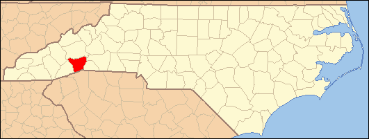
This list includes properties and districts listed on the National Register of Historic Places in Henderson County, North Carolina. Click the "Map of all coordinates" link to the right to view a Google map of all properties and districts with latitude and longitude coordinates in the table below.[1]
-
- This National Park Service list is complete through NPS recent listings posted November 10, 2011.[2]
[3] Landmark name[4] Image Date listed Location City or Town Summary 1 Aloah Hotel February 24, 1989 201 3rd Ave. West
35°18′57″N 82°27′41″W / 35.31583°N 82.46139°WHendersonville 2 Brookland August 19, 1982 N of Flat Rock on SR 1863
35°18′10″N 82°26′57″W / 35.30278°N 82.44917°WFlat Rock 3 Bryn Avon April 9, 1999 Jct. of River Rd. and Mallett Rd.
35°17′48″N 82°34′14″W / 35.29667°N 82.57056°WEtowah 4 Camp Arrowhead December 16, 2005 Cabin Creek Rd., 1 miles W of jct. with Green River Rd.
35°12′47″N 82°28′34″W / 35.21306°N 82.47611°WTuxedo 5 Carl Sandburg Home National Historic Site 
October 17, 1968 W of Flat Rock
35°16′4″N 82°27′6″W / 35.26778°N 82.45167°WFlat Rock 6 The Cedars February 24, 1989 219 7th Ave. West
35°19′10″N 82°27′47″W / 35.31944°N 82.46306°WHendersonville 7 Chewning House February 24, 1989 755 N. Main St.
35°19′14″N 82°27′41″W / 35.32056°N 82.46139°WHendersonville 8 Clarke-Hobbs-Davidson House February 24, 1989 229 5th Ave. West
35°19′4″N 82°27′44″W / 35.31778°N 82.46222°WHendersonville 9 Cold Spring Park Historic District January 8, 2009 Bounded roughly by N. Main St. on the N., Maple St. on the E., 9th Ave. E. on the S., and Locust St. on the W
35°19′28.95″N 82°27′39.09″W / 35.3247083°N 82.4608583°WHendersonville 10 Mary Mills Coxe House August 26, 1994 1210 Greenville Hwy.
35°17′50″N 82°27′5″W / 35.29722°N 82.45139°WHendersonville 11 Druid Hills Historic District August 16, 2000 Roughly bounded by Meadowbrook Terrace, US 25N, Ashwood Rd., and Ridgewood Ave.
35°19′49″N 82°28′16″W / 35.33028°N 82.47111°WHendersonville 12 Flat Rock Historic District October 15, 1973 W of East Flat Rock
35°16′18″N 82°27′41″W / 35.27167°N 82.46139°WFlat Rock 13 Grey Hosiery Mill October 6, 2000 301 Fourth Ave. E
35°19′3″N 82°27′29″W / 35.3175°N 82.45806°WHendersonville 14 Henderson County Courthouse 
May 10, 1979 1st and Main Sts.
35°18′52″N 82°27′37″W / 35.31444°N 82.46028°WHendersonville 15 Hyman Heights-Mount Royal Historic District February 16, 2001 Roughly bounded by Ridgecrest Pl., Highland Ave., Hyman Ave., Patton St., N. Main St., and Oakland St.
35°19′38″N 82°27′53″W / 35.32722°N 82.46472°WHendersonville 16 Kanuga Lake Historic District August 31, 1995 Roughly, area surrounding Kanuga Lake
35°15′43″N 82°31′11″W / 35.26194°N 82.51972°WHendersonville 17 King-Waldrop House June 28, 1989 103 S. Washington St.
35°18′53″N 82°27′45″W / 35.31472°N 82.4625°WHendersonville 18 Lenox Park Historic District December 31, 2002 Roughly bounded by Allen, Spring, and S. Whitted Sts., and Southern RR.
35°18′36″N 82°28′6″W / 35.31°N 82.46833°WHendersonville 19 Main Street Historic District March 30, 1989 Main St. between Sixth Ave. East and First Ave. East; also roughly N. Main St., 2nd Ave., W., W. Allen St., N. Washington, and 1st Ave., E.
35°18′59″N 82°27′37″W / 35.31639°N 82.46028°WHendersonville Second set of boundaries represents a boundary increase of December 20, 2006 20 The Meadows January 11, 1980 N of Fletcher on SR 1547
35°26′11″N 82°29′41″W / 35.43639°N 82.49472°WFletcher 21 Mills River Chapel December 2, 1988 SR 1328, 0.7 miles N of jct. with NC 280
35°23′4″N 82°34′39″W / 35.38444°N 82.5775°WMills River 22 Arthur W. Moore House January 4, 2001 299 Sunset Dr.
35°20′29″N 82°31′39″W / 35.34139°N 82.5275°WHorse Shoe 23 Moss-Johnson Farm February 10, 1987 3346 Haywood Rd.
35°21′34″N 82°30′32″W / 35.35944°N 82.50889°WHendersonville 24 Reese House June 2, 1995 202 S. Washington St.
35°18′46″N 82°27′44″W / 35.31278°N 82.46222°WHendersonville 25 Rugby Grange May 5, 1987 Address Restricted Fletcher 26 Seventh Avenue Depot District March 30, 1989 Seventh Ave. between Grove and Ash
35°19′18″N 82°27′27″W / 35.32167°N 82.4575°WHendersonville 27 Singletary-Reese-Robinson House September 16, 2010 211 Robinson Ln.
35°18′38″N 82°29′57″W / 35.31056°N 82.49917°WLaurel Park 28 Smith-Williams-Durham Boarding House February 24, 1989 247 5th Ave. West
35°19′3″N 82°27′46″W / 35.3175°N 82.46278°WHendersonville 29 Erle Stillwell House November 20, 2001 1300 Pinecrest Dr.
35°19′5″N 82°28′43″W / 35.31806°N 82.47861°WHendersonville 30 Erle Stillwell House II September 6, 2002 541 Blythe St.
35°19′3″N 82°28′41″W / 35.3175°N 82.47806°WHendersonville 31 The Waverly February 24, 1989 783 N. Main St.
35°19′15″N 82°27′42″W / 35.32083°N 82.46167°WHendersonville 32 West Side Historic District December 31, 2001 Roughly bounded by Fifth Ave. W., Washington St., Third Ave. W., and Blythe St.
35°18′56″N 82°28′12″W / 35.31556°N 82.47°WHendersonville See also
- National Register of Historic Places listings in North Carolina
- List of National Historic Landmarks in North Carolina
References
- ^ The latitude and longitude information provided in this table was derived originally from the National Register Information System, which has been found to be fairly accurate for about 99% of listings. For about 1% of NRIS original coordinates, experience has shown that one or both coordinates are typos or otherwise extremely far off; some corrections may have been made. A more subtle problem causes many locations to be off by up to 150 yards, depending on location in the country: most NRIS coordinates were derived from tracing out latitude and longitudes off of USGS topographical quadrant maps created under the North American Datum of 1927, which differs from the current, highly accurate WGS84 GPS system used by Google maps. Chicago is about right, but NRIS longitudes in Washington are higher by about 4.5 seconds, and are lower by about 2.0 seconds in Maine. Latitudes differ by about 1.0 second in Florida. Some locations in this table may have been corrected to current GPS standards.
- ^ "National Register of Historic Places: Weekly List Actions". National Park Service, United States Department of the Interior. Retrieved on November 10, 2011.
- ^ Numbers represent an ordering by significant words. Various colorings, defined here, differentiate National Historic Landmark sites and National Register of Historic Places Districts from other NRHP buildings, structures, sites or objects.
- ^ "National Register Information System". National Register of Historic Places. National Park Service. 2008-04-24. http://nrhp.focus.nps.gov/natreg/docs/All_Data.html.
U.S. National Register of Historic Places Topics Lists by states Alabama • Alaska • Arizona • Arkansas • California • Colorado • Connecticut • Delaware • Florida • Georgia • Hawaii • Idaho • Illinois • Indiana • Iowa • Kansas • Kentucky • Louisiana • Maine • Maryland • Massachusetts • Michigan • Minnesota • Mississippi • Missouri • Montana • Nebraska • Nevada • New Hampshire • New Jersey • New Mexico • New York • North Carolina • North Dakota • Ohio • Oklahoma • Oregon • Pennsylvania • Rhode Island • South Carolina • South Dakota • Tennessee • Texas • Utah • Vermont • Virginia • Washington • West Virginia • Wisconsin • WyomingLists by territories Lists by associated states Other Municipalities and communities of Henderson County, North Carolina Cities 
Towns Village CDPs Unincorporated
communitiesBat Cave | Chestnut Hill | Tuxedo
Footnotes ‡This populated place also has portions in an adjacent county or counties
Categories:- Henderson County, North Carolina
- National Register of Historic Places in North Carolina
- Buildings and structures in Henderson County, North Carolina
-


Wikimedia Foundation. 2010.