- Mills River Chapel
-
Mills River Chapel
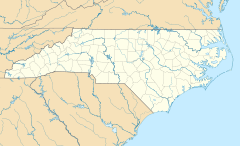

Nearest city: Mills River, North Carolina Coordinates: 35°23′4″N 82°34′39″W / 35.38444°N 82.5775°WCoordinates: 35°23′4″N 82°34′39″W / 35.38444°N 82.5775°W Area: 2.3 acres (0.93 ha) Built: 1860 Architect: Barnett,Americas Architectural style: Greek Revival Governing body: Private NRHP Reference#: 88002660[1] Added to NRHP: December 02, 1988 Mills River Chapel (Mills River United Methodist Church) is a historic chapel in Mills River, North Carolina.
It was built in 1860 and added to the National Register in 1988.
References
- ^ "National Register Information System". National Register of Historic Places. National Park Service. 2009-03-13. http://nrhp.focus.nps.gov/natreg/docs/All_Data.html.
U.S. National Register of Historic Places Topics Lists by states Alabama • Alaska • Arizona • Arkansas • California • Colorado • Connecticut • Delaware • Florida • Georgia • Hawaii • Idaho • Illinois • Indiana • Iowa • Kansas • Kentucky • Louisiana • Maine • Maryland • Massachusetts • Michigan • Minnesota • Mississippi • Missouri • Montana • Nebraska • Nevada • New Hampshire • New Jersey • New Mexico • New York • North Carolina • North Dakota • Ohio • Oklahoma • Oregon • Pennsylvania • Rhode Island • South Carolina • South Dakota • Tennessee • Texas • Utah • Vermont • Virginia • Washington • West Virginia • Wisconsin • WyomingLists by territories Lists by associated states Other Categories:- North Carolina United Methodist Churches
- Chapels in the United States
- Properties of religious function on the National Register of Historic Places in North Carolina
- Religious buildings completed in 1860
- 19th-century church buildings
- Buildings and structures in Henderson County, North Carolina
- North Carolina Registered Historic Place stubs

Wikimedia Foundation. 2010.