- River Tone
Geobox River
name = River Tone
native_name =
other_name =
other_name1 =
image_size =
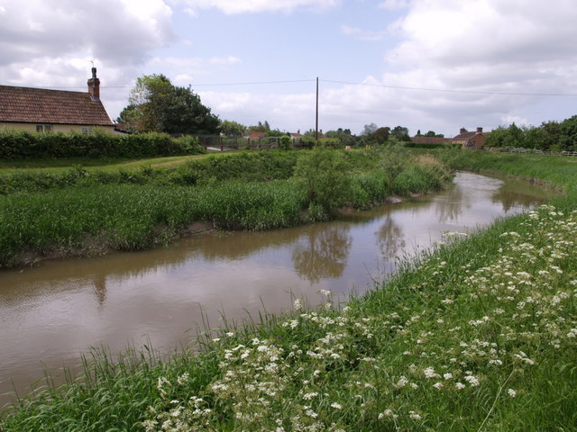
image_caption = The River Tone nearBurrowbridge
etymology =
country = England
country1 =
state = Somerset
state_type = County
state1 =
region =
region1 =
district =
district1 =
city = Taunton
city1 = Creech St Michael
landmark =
landmark1 =
length_imperial = 21
watershed_imperial =
discharge_location =
discharge_imperial =
discharge_max_imperial =
discharge_min_imperial =
discharge1_location =
discharge1_imperial =
source_name = Brendon Hills
source_location = Huish Champflower
source_district = West Somerset
source_region =
source_state = Somerset
source_country = England
source_lat_d = 51
source_lat_m = 06
source_lat_s = 05
source_lat_NS = N
source_long_d = 3
source_long_m = 24
source_long_s = 29
source_long_EW = W
source_elevation_imperial =
source_length_imperial =
mouth_name = River Parrett
mouth_location = Burrowbridge
mouth_district = Taunton Deane
mouth_region =
mouth_state = Somerset
mouth_country = England
mouth_lat_d = 51
mouth_lat_m = 04
mouth_lat_s = 02
mouth_lat_NS = N
mouth_long_d = 2
mouth_long_m = 55
mouth_long_s = 02
mouth_long_EW = W
mouth_elevation_imperial =
tributary_left =
tributary_left1 =
tributary_right =
tributary_right1 =
free_name =
free_value =
map_size =
map_caption = The River Tone is a river inSomerset , that flows throughTaunton and joins theRiver Parrett .The River Tone is about convert|21|mi|km|0|lk=on long. It rises at Beverton Pond near
Huish Champflower in theBrendon Hills and flows throughCurry and Hay Moors which are designated as aSite of Special Scientific Interest .At the end of its journey it joins up with the River Parrett atBurrowbridge .AnAct of Parliament in1699 authorised work that made the river navigable as far asTaunton .cite book |last=Hadfield |first=Charles |authorlink=Charles Hadfield|title=British Canals An Illustrated history|pages= p.206 |year=1974 | edition = Fifth edition |publisher=David & Charles |isbn=0-7153-4863-9 ] The river was straightened in the 1960s to prevent future flooding of Taunton town.History
The river has a long history of improvements to facilitate navigation from
Bridgwater to Taunton, and has also been used to power mills along its length. These two objectives are often antagonistic, and this has been the case on the River Tone.The earliest known record of improvements to the river is recorded in a document of 1325 from the Dean and Chapter of
Wells Cathedral , where it was proposed to widen the river between Ham Mill and a new mill which was to be built at Knapp. The Dean and Chapter owned the river as far asAthelney weir, which was presumably a fish weir, as the river was an important source of fish for the local population. Records from 1494 record the intent to build a new mill atNorth Curry , which was operational in 1504, and caused flooding in 1505, resulting in the Bishop ofWinchester having to complain to the Dean and Chapter ofWells . There is also mention of boats using the river at this time, as their use was restricted by the construction of the new mill at Ham. [http://www.tauntoncivic.org.uk/river_tone_history2.htm Tony Haskell, "The History of the River Tone", Taunton Civic Society] ]River improvements
Navigation on the first convert|7|mi|km from
Burrowbridge to Ham Mill was much easier than on the final stretch to Taunton, and in 1638, John Mallett, the Sheriff of Somerset andMember of Parliament for Bath, obtained a Commission under the Great Seal from King Charles II. This granted him and his heirs sole navigation rights from Bridgwater to Ham Mills, and allowed him to improve the river at his own expense. He saw this as a philanthropic action, as it reduced the price of coal to the poor people of Taunton, as well as improving the transport infrastructure.With the death of Mallett and later his son, work on the maintenance of the river ceased, and its condition declined. By 1697, trade was threatened, and a group of 34 merchants and traders petitioned parliament for powers to take over the navigation. An
Act of Parliament dated 24 March 1699 created the "Conservators of the River Tone", giving them powers "for making and keeping the River Tone navigable from Bridgewater to Taunton, in the county of Somerset"," [http://www.jim-shead.com/waterways/sdoc.php?wpage=PNRC0641#PNRC637 Joseph Priestley, (1831), "Historical Account of the Navigable Rivers, Canals, and Railways, of Great Britain"] ] which included the purchase of the navigation rights from Bridgwater to Ham Mills from the Mallett estate, for which a price of £330 was agreed.The Conservators applied for a second act of parliament in 1707, as they needed a further £3,800 to finance projects including the building of a half-lock and the removal of a shoal just below Knapp Bridge. Boats carrying 15 tons of cargo could reach Taunton by 1717. The navigation included a lock and two or more half-locks, consisting of a pair of gates to hold back the water, and an agreement to build a towpath between Ham Mills and Taunton was reached in 1724.Charles Hadfield, (1967), "The Canals of South West England", David and Charles, ISBN 0-7153-4176-6]
The number of locks on the navigation varied over the years, and by 1804 there were four full or pound locks, situated at Ham,
Creech St Michael , Bathpool and Obridge. In addition, there were at least four half locks. Curry Moor gates were the lowest on the river, which were followed by a second half lock convert|100|yd|m|lk=on further upstream, just below Newbridge. A third gate was located convert|450|yd|m below Ham lock, and the fourth one was just below the lock at Bathpool.Profits
The 1699 act of parliament had stipulated that the Conservators could receive dividends of six per cent on the money they had invested into the undertaking, until the capital was repaid, and that after that the tolls were to be reduced, while profits were to be used for "the benefit and advantage of the poor of Taunton", particularly by the building of hospitals. Because the receipts were initially insufficient to cover the six per cent dividend on the £5,697 that the Conservators had invested, they added the difference to the capital, so that the debt steadily increased. This state of affairs was challenged in 1735, when it was decreed that the original capital had been repaid, and the poor should now benefit, but the decision was overturned in 1738 on appeal.
Profits for the undertaking showed a steady rise, due in part to the low maintenance costs of the river. Tolls rose from £321 in 1712 to £1,137 by 1802. By this time, traffic consisted of about 11,500 tons of coal carried from Bridgwater upstream out of a total tonnage of 14,000 tons. Dividends for 1797 were 11.5 per cent, but the capital debt had risen to £85,466 by 1800, when the auditors refused to examine the accounts, because the likelihood of the poor ever benefitting from the navigation was receding. After much negotiation, the capital debt was reduced to £13,000. An act of parliament dated 14 July 1804 enshrined this position, and ensured that interest was limited to six per cent, with profits being used to reduce the debt. By 1828, the amount owing had reduced to £4,426.
Canal Company Takeover
The building of the
Bridgwater and Taunton Canal , which opened in 1827, directly affected the River Tone Navigation, as it provided a more direct route between Taunton and Bridgwater. The Conservators attempted to limit the supply of water from the river to the canal, while the canal company breached the river bank near Firepool lock, in order to ensure that boats could reach Taunton Bridge wharf from the canal. In order to compete with the canal, they chose to reduce the tolls, although they were unsure of the legality of this action while they had outstanding debts. The canal company challenged their right to reduce the tolls in court, but the action was defeated, and the tolls remained at the lower level.On 28 August 1827, the canal company announced that they were taking over the River Tone Navigation, under the terms of their acts of parliament of 1811 and 1824. This they did in November, when William Goodland, the river superintendent, was evicted from his cottage, the tolls were raised again, and maintenance ceased. This action was ruled to be illegal by the Court of King's Bench, as the canal company had not complied with the time limits enshrined in the act, but the canal company held on to the river despite the order to give it back to the conservators. Both sides took their case to the High Court, which ruled that the Conservators should have the river in February 1830. A further series of legal actions followed, after which the canal company attempted to obtain a new act of parliament to obtain the Tone by compulsory purchase. The Conservators then decided to negotiate, and an act of parliament passed in July 1832 authorised the takeover.
Under the terms of the act, the canal company inherited the debts of the Conservators, and paid them an additional £2,000. They were required to rebuild part of the North Town Bridge in Taunton, and to return the Tone Navigation to good order. The Conservators were empowered to carry out an annual inspection, and to re-possess the river if the canal was not properly maintained. The £2,000 was held by the Conservators until 1838, when they applied for an order to dispose of it, but it was not until 1843 that the order was granted. £1,000 was used to build a new wing for the Taunton and Somerset Hospital, and £1,000 was invested in the Taunton Market Trust, in line with the intentions of the 1699 act.
Decline
Traffic on the river in 1823 was 39,516 tons, which generated tolls of £2,194. After the construction of the canal, traffic steadily declined, until income was insufficient to cover maintenance by the early 1860s. The canal company used a similar accounting practice to manage the Tone debt, inflating it at six per cent each year, to ensure that they could demonstrate that the river was unprofitable.
Navigation was further affected by the passing of the Somersetshire Drainage Act on 1 July 1878, which resulted in the
River Parrett being taken over by the Drainage Commissioners, and abandoned as a navigation. Limited traffic continued to use the lower reaches of the Tone, with the last barge using the Burrowbridge to Ham Mills section in 1929. In 1967, the Somerset River Authority applied to the Ministry of Agriculture for permission to remove the navigation rights, and the original acts of parliament were repealed under section 41 of the "Land Drainage Act (1930)". This allowed the river through Taunton to be straightened, and a weir to be constructed at Firepool, to improve the flood defences for Taunton. Above the weir, the river is still navigable as far as French Weir.Route
The river rises at Beverton Pond, at an elevation of 1,230 ft (375m), to the west of the B3190 road from
Watchet toBampton , and near to Huish Champflower barrow, an ancient earthworks, and the derelict incline of theWest Somerset Mineral Railway . Over its first convert|1.8|mi|km it follows a south-easterly course and drops around convert|490|ft|m before discharging into Clatworthy reservoir, which also impounds the waters of 5 other streams. The reservoir is an important wildlife habitat managed by Wessex Water, and offers facilities for fishing and walking. [ [http://www.wessexwater.co.uk/recreation/sub_clatworthy.aspx Wessex Water, Recreation and Fishing information] ]The river continues as the outflow from the main dam of the reservoir, passing to the west of the village of
Clatworthy before following a southerly course which passes to the east ofHuish Champflower . The river enters a steeply wooded section at Washbattle bridge, with the Dearne Valley Way footpath on its eastern bank. The B3227 road fromWiveliscombe crosses from the east to the west side of the valley at Waterrow bridge, before heading westwards toBampton , after which a former railway line crossed the river on its way to Taunton. By the time it reachesStawley bridge and turns south-east, it has lost another 410 ft (125m) and is just 330 ft (100m) above sea level. At Tracebridge, the river turns to the north-east and then the north. Here the course of the derelictGrand Western Canal joins it.The river passes over weirs at Greenham, Tone and Nynehead, after which is is crossed by the aqueduct of the Grand Western Canal and the railway, both on their own routes to Taunton. A disused bridge, constructed in 1817, which carried the drive to Nynehead Court spans the river at Nynehead, and was Grade II listed in 1956. [ [http://www.imagesofengland.org.uk/Details/default.aspx?pid=2&id=271006 Images of England: Nynehead Bridge] ] The river turns to the north-east near
Bradford on Tone , with its two Grade II listed bridges, originally built in the 15th century, [ [http://www.imagesofengland.org.uk/Details/default.aspx?pid=2&id=270946 Images of England: Bradford Bridge] ] [ [http://www.imagesofengland.org.uk/Details/default.aspx?pid=2&id=270958 Images of England: Hele Bridge, Bradford] ] and then to the east near Upcott bridge, where there were two mills. At Roughmoor its course is crossed by Silk Mills Road. A "Park and Ride" car park is situated just to the north, and there is a scheme to make the river navigable from here to the town centre as a way of encouraging transport with less environmental impact. Project Taunton, which is managing the regeneration of Taunton applied for a Big Lottery grant to fund this development, but were not successful, and so it may take longer to achieve. [ [http://www.projecttaunton.co.uk/296/regeneration-areas-34/river-tone-165.html Project Taunton: River Tone Regeneration Area] ]Soon the river reaches French weir, the head of navigation. As it makes its way through the town centre to Firepool weir and the junction with the
Bridgwater and Taunton Canal , it passes under the North Bridge, constructed in 1895 are including globe lamps which are thought to be part of the earliest electric street lighting scheme in a British town, [ [http://www.imagesofengland.org.uk/Details/default.aspx?pid=2&id=269920 Images of England: Tone Bridge] ] and Priory Bridge Road. Next comes the A358 Obridge viaduct, the A38 Bathpool Bridge and theM5 motorway bridge. Firepool weir was reconstructed in 1967 as part of the plans to straighten the river through the town centre and down to Bathpool in order to provide better flood defences. These works swept away the remains of the original navigation. A disused five-arched railway bridge built in 1863 [ [http://www.imagesofengland.org.uk/Details/default.aspx?pid=2&id=270573 Images of England: Five Arch Bridge, Creech St Michael] ] and the aqueduct that carried theChard Canal over the river, used from 1842 until 1866, still stand, followed by the bridge atCreech St Michael . Ham weir stands as a reminder of the location of the lock there. After Knapp bridge, built in 1820 and Grade II listed, [ [http://www.imagesofengland.org.uk/Details/default.aspx?pid=2&id=270812 Images of England: Knapp Bridge, North Curry] ] the sluice at Newbridge marks the upper tidal limit of the river. Two more bridges atAthelney and Stanmoor cross the river before it joins theRiver Parrett at Burrowbridge. The junction is overshadowed byBurrow Mump , a prominent hill with a ruined chapel on the top.Water Mills
Ham Mills was a site of milling activity from mediaeval times until about 1914. The mill was situated on an island in the middle of the river, with a weir and bypass channel to the north and the lock channel to the south. The Conservators were required to light the area after a boatman fell into the river and drowned while attempting to use the lock after dark in March 1826. The coroner who instructed that the lighting should be installed noted that "boats were passing at all hours of the night." Water levels in the river fell as more water was extracted further upstream, and by the 1890s the waterwheels were assisted by a steam-driven turbine which the miller installed. Milling ceased in 1914, when the boiler which supplied the steam was removed by the War Department, so that it could be fitted into a minesweeper.Tony Haskell, (1994), "By Waterway to Taunton", Somerset Books, ISBN 0-86183-260-4] A surviving mill house which dates from the early 19th century has been designated by
English Heritage as a grade IIlisted building . [cite web|url=http://www.imagesofengland.org.uk/Details/Default.aspx?id=270833|title=Ham Mills - Millhouse with attached outbuilding to south and remains of corn mill, including chimney and waterwheel|work=Images of England|publisher=English Heritage|accessdate=2008-09-21]Milling at Bathpool had a chequered history. There had been a mill at this location for several centuries, which had been rebuilt or adapted as required. In March 1812, the structure was burnt down by a fire, caused, according to the "Taunton Courier", by "the excessive friction excited in the stones used in the process of shelling clover seeds". Stocks of flour, grain and flax valued at £2,500 were destoyed. The mill was rebuilt and later owned by Captain George Beadon. The mill was purchased by Thomas Redler in 1889 on the death of Beadon, but another fire damaged much of it two years later. Redler rebuilt it with safety in mind, and as at Ham, installed a steam-driven turbine as water levels were often inadequate to power the wheels. Two more turbines followed, and the water wheels were removed. Steam from the turbines was also used to heat bread ovens, which were amongst the first in the country to be heated in this way. In September 1915, another fire gutted the building, which was not rebuilt, and the ruins were demolished in the 1920s.
There were originally mills at Firepool and Obridge as well. Because of the difficulties of navigating past the mill pools, the Conservators of the River Tone decided to buy the mill at Firepool in December 1793 with a view to demolishing it "for the benefit of the navigation", and they obtained it for just £32. In 1797, they decided to follow the same course with Obridge Mill. The mill at Creech St Michael was the subject of a court action at the King's Bench. In October 1830, while replacing the mill stones, the millers had opened the flood gates for 16 days, and built a dam across the river, thus preventing navigation. The case was heard in 1831, and the judgement was that both parties were obligated to use the water in a way that did not injure the other party.
References
External links
[http://www.lastrefuge.co.uk/images/html/aerials/UK_aerials/floods/index.htm Aerial pictures of the River Tone in flood] .
Wikimedia Foundation. 2010.