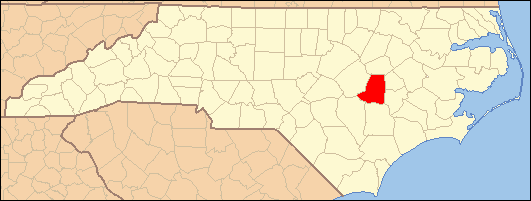
- National Register of Historic Places listings in Wayne County, North Carolina
-

This list includes properties and districts listed on the National Register of Historic Places in Wayne County, North Carolina. Click the "Map of all coordinates" link to the right to view a Google map of all properties and districts with latitude and longitude coordinates in the table below.[1]
-
- This National Park Service list is complete through NPS recent listings posted November 10, 2011.[2]
[3] Landmark name[4] Image Date listed Location City or Town Summary 1 Charles B. Aycock Birthplace February 26, 1970 6 miles from jct. of SR 1542 and U.S. 117
35°31′11″N 77°58′30″W / 35.51972°N 77.975°WFremont 2 Barnes-Hooks Farm September 1, 1995 414 Stuckey Rd.
35°34′15″N 77°59′5″W / 35.57083°N 77.98472°WFremont 3 Borden Manufacturing Company February 2, 2005 800 and 801 N. William St.
35°23′41″N 77°59′19″W / 35.39472°N 77.98861°WGoldsboro 4 Eureka United Methodist Church August 26, 1982 Church St.
35°32′40″N 77°52′47″W / 35.54444°N 77.87972°WEureka 5 First Presbyterian Church May 29, 1979 111 W. Ash St.
35°23′10″N 77°59′50″W / 35.38611°N 77.99722°WGoldsboro 6 L. D. Giddens and Son Jewelry Store March 19, 1979 135 S. Center St.
35°22′56.37″N 77°59′51.84″W / 35.382325°N 77.9977333°WGoldsboro 7 Goldsboro Union Station April 13, 1977 101 North Carolina St.
35°23′5″N 78°0′15″W / 35.38472°N 78.00417°WGoldsboro 8 Harry Fitzhugh Lee House March 1, 1984 310 W. Walnut St.
35°23′3″N 78°0′11″W / 35.38417°N 78.00306°WGoldsboro 9 Mount Olive High School (Former) October 22, 1998 100 Wooten St.
35°12′1″N 78°4′23″W / 35.20028°N 78.07306°WMount Olive 10 Mount Olive Historic District May 27, 1999 Roughly bounded by Park Ave., Wooten, Nelson, and Johnson Sts.
35°11′42″N 78°4′9″W / 35.195°N 78.06917°WMount Olive 11 Odd Fellows Lodge August 3, 1978 111-115 N. John St.
35°22′59.74″N 77°59′43.39″W / 35.3832611°N 77.9953861°WGoldsboro 12 Perry-Cherry House March 13, 1986 308 W. Main St.
35°11′50″N 78°4′14″W / 35.19722°N 78.07056°WMount Olive 13 Southerland-Burnette House February 8, 1988 201 N. Chesnut St.
35°11′51″N 78°4′4″W / 35.1975°N 78.06778°WMount Olive 14 U.S. Post Office, Former June 2, 1995 124 W. James St.
35°11′50″N 78°4′1″W / 35.19722°N 78.06694°WMount Olive 15 Vernon October 9, 1974 Address Restricted Mount Olive Demolished[5] 16 Solomon and Henry Weil Houses December 22, 1976 204 and 200 W. Chestnut St.
35°22′55.81″N 78°0′0.24″W / 35.3821694°N 78.0000667°WGoldsboro 17 Dred and Ellen Yelverton House August 27, 2009 1979 NC 222 E.
35°33′35.63″N 78°0′28.08″W / 35.5598972°N 78.0078°WFremont See also
- National Register of Historic Places listings in North Carolina
- List of National Historic Landmarks in North Carolina
References
- ^ The latitude and longitude information provided in this table was derived originally from the National Register Information System, which has been found to be fairly accurate for about 99% of listings. For about 1% of NRIS original coordinates, experience has shown that one or both coordinates are typos or otherwise extremely far off; some corrections may have been made. A more subtle problem causes many locations to be off by up to 150 yards, depending on location in the country: most NRIS coordinates were derived from tracing out latitude and longitudes off of USGS topographical quadrant maps created under the North American Datum of 1927, which differs from the current, highly accurate WGS84 GPS system used by Google maps. Chicago is about right, but NRIS longitudes in Washington are higher by about 4.5 seconds, and are lower by about 2.0 seconds in Maine. Latitudes differ by about 1.0 second in Florida. Some locations in this table may have been corrected to current GPS standards.
- ^ "National Register of Historic Places: Weekly List Actions". National Park Service, United States Department of the Interior. Retrieved on November 10, 2011.
- ^ Numbers represent an ordering by significant words. Various colorings, defined here, differentiate National Historic Landmark sites and National Register of Historic Places Districts from other NRHP buildings, structures, sites or objects.
- ^ "National Register Information System". National Register of Historic Places. National Park Service. 2008-04-24. http://nrhp.focus.nps.gov/natreg/docs/All_Data.html.
- ^ "North Carolina Listings in the National Register of Historic Places by County". North Carolina State Historic Preservation Office. 22 October 2008. http://www.hpo.ncdcr.gov/nrlist.htm. Retrieved 6 July 2009.
U.S. National Register of Historic Places Topics Lists by states Alabama • Alaska • Arizona • Arkansas • California • Colorado • Connecticut • Delaware • Florida • Georgia • Hawaii • Idaho • Illinois • Indiana • Iowa • Kansas • Kentucky • Louisiana • Maine • Maryland • Massachusetts • Michigan • Minnesota • Mississippi • Missouri • Montana • Nebraska • Nevada • New Hampshire • New Jersey • New Mexico • New York • North Carolina • North Dakota • Ohio • Oklahoma • Oregon • Pennsylvania • Rhode Island • South Carolina • South Dakota • Tennessee • Texas • Utah • Vermont • Virginia • Washington • West Virginia • Wisconsin • WyomingLists by territories Lists by associated states Other Municipalities and communities of Wayne County, North Carolina City 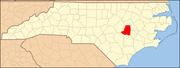
Towns Eureka | Fremont | Mount Olive‡ | Pikeville | Seven Springs
Village CDPs Unincorporated
communitiesFootnotes ‡This populated place also has portions in an adjacent county or counties
Categories:- Wayne County, North Carolina
- National Register of Historic Places in North Carolina
- Buildings and structures in Wayne County, North Carolina
-
Wikimedia Foundation. 2010.