- National Register of Historic Places listings in Alleghany County, North Carolina
-

This list includes properties and districts listed on the National Register of Historic Places in Alleghany County, North Carolina. Click the "Map of all coordinates" link to the right to view a Google map of all properties and districts with latitude and longitude coordinates in the table below.[1]
-
- This National Park Service list is complete through NPS recent listings posted November 10, 2011.[2]
[3] Landmark name Image Date listed Location City or town Summary 1 Alleghany County Courthouse (North Carolina) May 10, 1979 Main and Whitehead Sts.
36°30′21″N 81°07′15″W / 36.505833°N 81.120833°WSparta 2 Brinegar Cabin January 20, 1972 At miles 238.5, Blue Ridge Pkwy.
36°25′06″N 81°08′44″W / 36.418333°N 81.145556°WWhitehead 3 Elbert Crouse Farmstead July 29, 1982 S of Whitehead on Blue Ridge Parkway
36°25′50″N 81°08′56″W / 36.430556°N 81.148889°WWhitehead 4 Robert L. Doughton House August 13, 1979 NC 18
36°24′38″N 81°15′55″W / 36.410556°N 81.265278°WLaurel Springs 5 J.C. Gambill Site J.C. Gambill SiteApril 3, 1978 Address Restricted New Haven 6 Bays Hash Site Bays Hash SiteApril 19, 1978 Address Restricted Amelia 7 Jarvis House October 16, 1991 N end NC 1439, N of jct. with NC 18
36°33′34″N 81°00′43″W / 36.559444°N 81.011944°WSparta 8 Rock House August 11, 2004 7 Chestnut Ln.
36°24′47″N 80°57′46″W / 36.413056°N 80.962778°WRoaring Gap 9 William T. Vogler Cottage September 30, 1991 NC 1478 E side, approx. 1.3 miles NE of US 21
36°24′09″N 80°58′05″W / 36.4025°N 80.968056°WRoaring Gap Destroyed[4] 10 William Weaver House November 7, 1976 SW of Piney Creek on SR 1302
36°30′13″N 81°19′29″W / 36.503611°N 81.324722°WPiney Creek See also
- National Register of Historic Places listings in North Carolina
- List of National Historic Landmarks in North Carolina
References
- ^ The latitude and longitude information provided in this table was derived originally from the National Register Information System, which has been found to be fairly accurate for about 99% of listings. For about 1% of NRIS original coordinates, experience has shown that one or both coordinates are typos or otherwise extremely far off; some corrections may have been made. A more subtle problem causes many locations to be off by up to 150 yards, depending on location in the country: most NRIS coordinates were derived from tracing out latitude and longitudes off of USGS topographical quadrant maps created under the North American Datum of 1927, which differs from the current, highly accurate WGS84 GPS system used by Google maps. Chicago is about right, but NRIS longitudes in Washington are higher by about 4.5 seconds, and are lower by about 2.0 seconds in Maine. Latitudes differ by about 1.0 second in Florida. Some locations in this table may have been corrected to current GPS standards.
- ^ "National Register of Historic Places: Weekly List Actions". National Park Service, United States Department of the Interior. Retrieved on November 10, 2011.
- ^ Numbers represent an ordering by significant words. Various colorings, defined here, differentiate National Historic Landmark sites and National Register of Historic Places Districts from other NRHP buildings, structures, sites or objects.
- ^ "North Carolina Listings in the National Register of Historic Places by County". North Carolina State Historic Preservation Office. 22 October 2008. http://www.hpo.ncdcr.gov/nrlist.htm. Retrieved 14 July 2009.
U.S. National Register of Historic Places Topics Lists by states Alabama • Alaska • Arizona • Arkansas • California • Colorado • Connecticut • Delaware • Florida • Georgia • Hawaii • Idaho • Illinois • Indiana • Iowa • Kansas • Kentucky • Louisiana • Maine • Maryland • Massachusetts • Michigan • Minnesota • Mississippi • Missouri • Montana • Nebraska • Nevada • New Hampshire • New Jersey • New Mexico • New York • North Carolina • North Dakota • Ohio • Oklahoma • Oregon • Pennsylvania • Rhode Island • South Carolina • South Dakota • Tennessee • Texas • Utah • Vermont • Virginia • Washington • West Virginia • Wisconsin • WyomingLists by territories Lists by associated states Other Municipalities and communities of Alleghany County, North Carolina Town 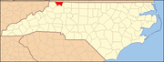
Townships Unincorporated
communitiesCherry Lane | Glade Valley | Piney Creek | Roaring Gap | Scottville | Twin Oaks
Categories:- Alleghany County, North Carolina
- National Register of Historic Places in North Carolina
- Buildings and structures in Alleghany County, North Carolina
-

Wikimedia Foundation. 2010.