- National Register of Historic Places listings in Mitchell County, North Carolina
-

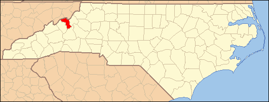
This list includes properties and districts listed on the National Register of Historic Places in Mitchell County, North Carolina. Click the "Map of all coordinates" link to the right to view a Google map of all properties and districts with latitude and longitude coordinates in the table below.[1]
-
- This National Park Service list is complete through NPS recent listings posted November 10, 2011.[2]
Landmark name Image Date listed Location City or Town Summary 1 Church of the Resurrection March 5, 1999 302 High Ridge Rd.
35°51′3″N 82°5′26″W / 35.85083°N 82.09056°WLittle Switzerland 2 Dellinger Mill November 19, 1998 S side of Cane Creek Rd., just W of jct. with NC 1239
36°1′1″N 82°5′53″W / 36.01694°N 82.09806°WHawk 3 Downtown Spruce Pine Historic District 
August 28, 2003 Roughly bounded by Oak Ave., Locust St., Topaz St., and NC 226
35°54′58″N 82°4′12″W / 35.91611°N 82.07°WSpruce Pine 4 Gunter Building March 1, 2002 288 Oak Ave.
35°54′56″N 82°4′6″W / 35.91556°N 82.06833°WSpruce Pine 5 Mitchell County Courthouse May 10, 1979 Main St.
36°0′57″N 82°9′30″W / 36.01583°N 82.15833°WBakersville 6 Penland School Historic District December 10, 2003 NC 1164 (Conley Ridge Rd.)
35°56′26″N 82°7′0″W / 35.94056°N 82.116667°WPenland 7 John N. Peterson Farm December 6, 1990 E side of SR 1321 just N of jct. with SR 1322
36°5′25″N 82°19′48″W / 36.09028°N 82.33°WPoplar 8 Henry Willis House July 14, 1988 SR 1164
35°56′17″N 82°7′47″W / 35.93806°N 82.12972°WPenland See also
- National Register of Historic Places listings in North Carolina
- List of National Historic Landmarks in North Carolina
References
- ^ The latitude and longitude information provided in this table was derived originally from the National Register Information System, which has been found to be fairly accurate for about 99% of listings. For about 1% of NRIS original coordinates, experience has shown that one or both coordinates are typos or otherwise extremely far off; some corrections may have been made. A more subtle problem causes many locations to be off by up to 150 yards, depending on location in the country: most NRIS coordinates were derived from tracing out latitude and longitudes off of USGS topographical quadrant maps created under North American Datum of 1927, which differs from the current, highly accurate GPS system used by Google maps. Chicago is about right, but NRIS longitudes in Washington are higher by about 4.5 seconds, and are lower by about 2.0 seconds in Maine. Latitudes differ by about 1.0 second in Florida. Some locations in this table may have been corrected to current GPS standards.
- ^ "National Register of Historic Places: Weekly List Actions". National Park Service, United States Department of the Interior. Retrieved on November 10, 2011.
U.S. National Register of Historic Places Topics Lists by states Alabama • Alaska • Arizona • Arkansas • California • Colorado • Connecticut • Delaware • Florida • Georgia • Hawaii • Idaho • Illinois • Indiana • Iowa • Kansas • Kentucky • Louisiana • Maine • Maryland • Massachusetts • Michigan • Minnesota • Mississippi • Missouri • Montana • Nebraska • Nevada • New Hampshire • New Jersey • New Mexico • New York • North Carolina • North Dakota • Ohio • Oklahoma • Oregon • Pennsylvania • Rhode Island • South Carolina • South Dakota • Tennessee • Texas • Utah • Vermont • Virginia • Washington • West Virginia • Wisconsin • WyomingLists by territories Lists by associated states Other Municipalities and communities of Mitchell County, North Carolina Towns 
Unincorporated
communitiesBuladean | Clarrissa | Estatoe | Kona | Ledger | Little Switzerland‡ | Loafers Glory | Penland | Poplar | Red Hill
Footnotes ‡This populated place also has portions in an adjacent county or counties
Categories:- Mitchell County, North Carolina
- National Register of Historic Places in North Carolina
- Buildings and structures in Mitchell County, North Carolina
-

Wikimedia Foundation. 2010.