- National Register of Historic Places listings in Camden County, North Carolina
-
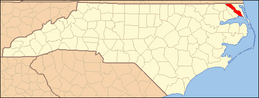
This list includes properties and districts listed on the National Register of Historic Places in Camden County, North Carolina. Click the "Map of all coordinates" link to the right to view a Google map of all properties and districts with latitude and longitude coordinates in the table below.[1]
-
- This National Park Service list is complete through NPS recent listings posted November 10, 2011.[2]
Landmark name Image Date listed Location City or Town Summary 1 William Riley Abbott House August 11, 1978 SE of South Mills on SR 1224
36°25′54″N 76°18′1″W / 36.43167°N 76.30028°WSouth Mills 2 Camden County Courthouse 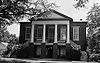
February 1, 1972 NC 343
36°19′48″N 76°10′18″W / 36.33°N 76.17167°WCamden 3 Camden County Jail May 3, 1984 NC 343
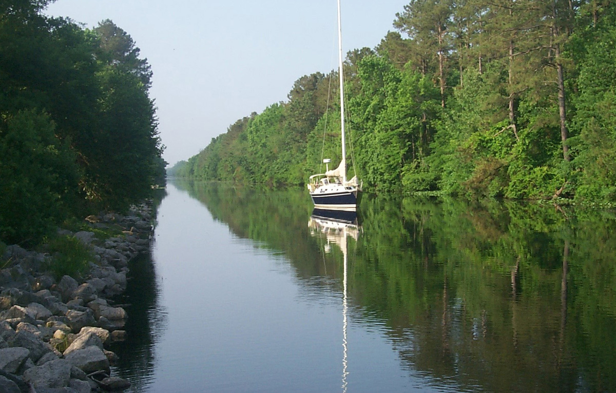
36°19′44″N 76°10′30″W / 36.32889°N 76.175°WCamden 4 Dismal Swamp Canal 
June 6, 1988 Runs between Chesapeake, VA and South Mills, NC
36°26′53.94″N 76°19′42.16″W / 36.4483167°N 76.3283778°WSouth Mills 5 Caleb Grandy House April 29, 1982 Off SR 1145
36°21′8″N 76°10′2″W / 36.35222°N 76.16722°WBelcross 6 Lamb-Ferebee House September 22, 1980 NW of Camden on NC 343
36°21′6.65″N 76°11′45.61″W / 36.3518472°N 76.1960028°WCamden 7 Milford March 16, 1972 On SR 1205, 0.5 miles S of jct. with NC 343
36°21′33″N 76°12′58″W / 36.35917°N 76.21611°WCamden See also
- National Register of Historic Places listings in North Carolina
- List of National Historic Landmarks in North Carolina
References
- ^ The latitude and longitude information provided in this table was derived originally from the National Register Information System, which has been found to be fairly accurate for about 99% of listings. For about 1% of NRIS original coordinates, experience has shown that one or both coordinates are typos or otherwise extremely far off; some corrections may have been made. A more subtle problem causes many locations to be off by up to 150 yards, depending on location in the country: most NRIS coordinates were derived from tracing out latitude and longitudes off of USGS topographical quadrant maps created under the North American Datum of 1927, which differs from the current, highly accurate WGS84 GPS system used by Google maps. Chicago is about right, but NRIS longitudes in Washington are higher by about 4.5 seconds, and are lower by about 2.0 seconds in Maine. Latitudes differ by about 1.0 second in Florida. Some locations in this table may have been corrected to current GPS standards.
- ^ "National Register of Historic Places: Weekly List Actions". National Park Service, United States Department of the Interior. Retrieved on November 10, 2011.
U.S. National Register of Historic Places Topics Lists by states Alabama • Alaska • Arizona • Arkansas • California • Colorado • Connecticut • Delaware • Florida • Georgia • Hawaii • Idaho • Illinois • Indiana • Iowa • Kansas • Kentucky • Louisiana • Maine • Maryland • Massachusetts • Michigan • Minnesota • Mississippi • Missouri • Montana • Nebraska • Nevada • New Hampshire • New Jersey • New Mexico • New York • North Carolina • North Dakota • Ohio • Oklahoma • Oregon • Pennsylvania • Rhode Island • South Carolina • South Dakota • Tennessee • Texas • Utah • Vermont • Virginia • Washington • West Virginia • Wisconsin • WyomingLists by territories Lists by associated states Other  State of North Carolina
Topics - Climate
- Culture
- Economy
- Education
- Geography
- History
- Music
- North Carolinians
- Politics
- State Parks
- Wildlife
- Visitor attractions
Regions Larger cities Smaller cities - Albemarle
- Apex
- Asheboro
- Burlington
- Chapel Hill
- Conover
- Eden
- Elizabeth City
- Goldsboro
- Graham
- Havelock
- Henderson
- Hendersonville
- Hickory
- Kannapolis
- Kings Mountain
- Kinston
- Laurinburg
- Lenoir
- Lexington
- Lumberton
- Monroe
- Morganton
- New Bern
- Newton
- Reidsville
- Roanoke Rapids
- Rocky Mount
- Salisbury
- Sanford
- Shelby
- Statesville
- Thomasville
- Waynesville
- Wilson
Major towns - Beaufort
- Boone
- Carrboro
- Clayton
- Conover
- Cornelius
- Dunn
- Fuquay-Varina
- Garner
- Harrisburg
- Holly Springs
- Hope Mills
- Huntersville
- Indian Trail
- Kernersville
- Knightdale
- Leland
- Matthews
- Midland
- Mint Hill
- Mooresville
- Morehead City
- Morrisville
- Mount Pleasant
- Oxford
- Shallotte
- Smithfield
- Southern Pines
- Tarboro
- Wake Forest
Counties - Alamance
- Alexander
- Alleghany
- Anson
- Ashe
- Avery
- Beaufort
- Bertie
- Bladen
- Brunswick
- Buncombe
- Burke
- Cabarrus
- Caldwell
- Camden
- Carteret
- Caswell
- Catawba
- Chatham
- Cherokee
- Chowan
- Clay
- Cleveland
- Columbus
- Craven
- Cumberland
- Currituck
- Dare
- Davidson
- Davie
- Duplin
- Durham
- Edgecombe
- Forsyth
- Franklin
- Gaston
- Gates
- Graham
- Granville
- Greene
- Guilford
- Halifax
- Harnett
- Haywood
- Henderson
- Hertford
- Hoke
- Hyde
- Iredell
- Jackson
- Johnston
- Jones
- Lee
- Lenoir
- Lincoln
- Macon
- Madison
- Martin
- McDowell
- Mecklenburg
- Mitchell
- Montgomery
- Moore
- Nash
- New Hanover
- Northampton
- Onslow
- Orange
- Pamlico
- Pasquotank
- Pender
- Perquimans
- Person
- Pitt
- Polk
- Randolph
- Richmond
- Robeson
- Rockingham
- Rowan
- Rutherford
- Sampson
- Scotland
- Stanly
- Stokes
- Surry
- Swain
- Transylvania
- Tyrrell
- Union
- Vance
- Wake
- Warren
- Washington
- Watauga
- Wayne
- Wilkes
- Wilson
- Yadkin
- Yancey
Categories:- Camden County, North Carolina
- National Register of Historic Places in North Carolina
- Buildings and structures in Camden County, North Carolina
-


Wikimedia Foundation. 2010.