- Morrisville, North Carolina
-
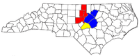
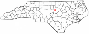
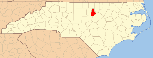
Morrisville, North Carolina — Town — Location of Morrisville, North Carolina
Coordinates: 35°49′39″N 78°49′44″W / 35.8275°N 78.82889°WCoordinates: 35°49′39″N 78°49′44″W / 35.8275°N 78.82889°W Country United States State North Carolina Counties Wake, Durham Government – Mayor Jackie Holcombe Area – Total 6.8 sq mi (17.5 km2) – Land 6.8 sq mi (17.5 km2) – Water 0.0 sq mi (0.0 km2) Elevation 299 ft (91 m) Population (2010) – Total 18,576 – Density 769.0/sq mi (296.9/km2) Time zone Eastern (EST) (UTC-5) – Summer (DST) EDT (UTC-4) ZIP codes 27519, 27560 Area code(s) 919 FIPS code 37-44520[1] GNIS feature ID 1021537[2] Website http://www.ci.morrisville.nc.us/ Morrisville is a town in Wake County, North Carolina, United States.[3] A small portion of the town extends into Durham County.[citation needed] The population was 18,576 according to a April 1, 2010 census.[4] Morrisville is part of the Research Triangle metropolitan region. The regional name originated after the 1959 creation of the Research Triangle Park, located midway between the cities of Raleigh and Durham. The Research Triangle region encompasses the U.S. Census Bureau's Combined Statistical Area (CSA) of Raleigh-Durham-Cary. The estimated population of the Raleigh-Durham-Cary CSA was 1,565,223 as of July 1, 2006, with the Raleigh-Cary Metropolitan Statistical Area (MSA) portion estimated at 994,551 residents.[5]
Contents
Geography
Morrisville is located at 35°49′39″N 78°49′44″W / 35.8275°N 78.82889°W (35.827493, -78.828930)[6].
According to the United States Census Bureau, the town has a total area of 6.8 square miles (17.5 km²).
Morrisville is located in the northeast central region of North Carolina, where the North American Piedmont and Atlantic Coastal Plain regions meet. This area is known as the "fall line" because it marks the elevation inland at which waterfalls begin to appear in creeks and rivers. As a result, most of Morrisville features gently rolling hills that slope eastward toward the state's flat coastal plain. Its central Piedmont location situates the county about three hours west of Atlantic Beach, North Carolina, by car and four hours east of the Great Smoky Mountains of the Appalachian range.
The central downtown core of Morrisville is located essentially along the upper portion of Crabtree Creek, which then feeds into Lake Crabtree, located in the southeastern part of the town.
Climate
Morrisville enjoys a moderate subtropical climate, with moderate temperatures in the spring, fall, and winter. Summers are typically hot with high humidity. Winter highs generally range in the low 50s°F (10 to 13 °C) with lows in the low-to-mid 30s°F (-2 to 2 °C), although an occasional 60 °F (15 °C) or warmer winter day is not uncommon. This is canceled out, however, with several days where highs do not get out of the 30s. There are usually about 1 or 2 substantial snowfalls per winter, occurring mainly in January. Spring and fall days usually reach the low-to-mid 70s°F (low 20s°C), with lows at night in the lower 50s°F (10 to 14 °C). Summer daytime highs often reach the upper 80s to low 90s°F (29 to 35 °C). The rainiest months are July and August.
Early History
The area was originally named in 1852 after Jeremiah Morris. Morris donated land to the North Carolina Railroad for a depot, water tower, and other buildings. The town continued to grow as a result of the rail line and its location at the intersection of roads leading to Chapel Hill, Raleigh, and Hillsborough.
On April 13, 1865, Federal cavalry under the command of Gen. Judson Kilpatrick skirmished with the retreating Confederate armies at Morrisville Station. Battle of Morrisville. The Confederate troops were successful in evacuating their remaining supplies and wounded to the west toward Greensboro, NC, General Sherman's cavalry forced the Confederates to leave the train behind and retreat toward Durham, and the eventual surrender of the largest Confederate force of the war at Bennett Place.[7][original research?]
The town was officially chartered in 1875 but was disincorporated in 1933. Eventually the town charter was restored in 1947.[citation needed]
Morrisville History (as listed on historical marker): Morrisville Station: "On April 16, 1865, Union cavalry under the command of General William T. Sherman, captured Raleigh and pursued the retreating Confederate cavalry west along the railroad. Rearguard skirmishes erupted at points along the Hillsborough Road until the combatants reached Morrisville. Using cavalry and artillery, Union forces attacked a Confederate train loaded with supplies and wounded. Before withdrawing, the Confederate cavalry repelled the attack long enough to allow the railcars of wounded to escape while abandoning the supplies. This was the last major cavalry engagement in Sherman's campaign. The next night, a courier from the Confederate commander, General Joseph E. Johnston, rode into the Union camp at Morrisville with a truce proposal. Subsequent negotiations between Johnston and Sherman led to the largest Confederate surrender of the Civil War at the Bennett Farm in Durham on April 26." History marker notes it was given in memory of Commissioner C.T. Moore.[8]
Government
Morrisville operates under the Council-Manager form of government. The citizens elect a Mayor and Town Council as the town's governing body. The Town Manager is appointed by the Council to serve as the chief operating officer administering all municipal affairs.[9] The current mayor is Jackie Holcombe and current Council Members include Pete Martin (Mayor Pro Tem), Linda Lyons, Liz Johnson , Steve Diehl, Margaret Broadwell and Tom Murry.[10]
Demographics
Historical populations Census Pop. %± 1950 221 — 1960 222 0.5% 1970 209 −5.9% 1980 251 20.1% 1990 1,022 307.2% 2000 5,208 409.6% 2010 18,576 256.7% U.S. Decennial Census As of the 2000 census, there were 5,208 people, 2,476 households, and 1,297 families residing in the town. The population density was 769.0 people per square mile (297.0/km²). There were 3,210 housing units at an average density of 474.0 per square mile (183.1/km²). The racial makeup of the town was 76.46% White, 11.00% African American, 0.44% Native American, 9.06% Asian, 1.17% from other races, and 1.86% from two or more races. Hispanic or Latino of any race were 3.26% of the population.[1]
However, since the last census, the population has grown to near 15,000 residents.[11] Many of the new residents are from India, and a large Indian population now inhabits the Town of Morrisville.[citation needed] However the new influx of residents is apparent in the changing racial makeup of schools. Cedar Fork Elementary has over 40% of its population as Indian origin.[citation needed]
In 2000, there were 2,476 households out of which 24.7% had children under the age of 18 living with them, 42.0% were married couples living together, 7.1% had a female householder with no husband present, and 47.6% were non-families. 36.6% of all households were made up of individuals and 2.3% had someone living alone who was 65 years of age or older. The average household size was 2.10 and the average family size was 2.80.[1]
In the town the population was spread out with 20.6% under the age of 18, 11.2% from 18 to 24, 50.0% from 25 to 44, 14.2% from 45 to 64, and 4.0% who were 65 years of age or older. The median age was 30 years. For every 100 females there were 106.5 males. For every 100 females age 18 and over, there were 104.9 males.[1]
The median income for a household in the town was $56,548, and the median income for a family was $64,625. Males had a median income of $46,750 versus $34,528 for females. The per capita income for the town was $32,243. About 3.4% of families and 4.6% of the population were below the poverty line, including 4.1% of those under age 18 and 13.0% of those age 65 or over.[1]
Economy
Morrisville's location adjacent to the Research Triangle Park (RTP), RDU, and I-40 makes it an attractive location for offices, light industry and hotels. Companies based in Morrisville include Lenovo (U.S.A. headquarters), Lulu.com, Tekelec and QBE First.[citation needed]
Prior to its disestablishment, Midway Airlines had its headquarters in Morrisville.[12]
The Morrisville Chamber of Commerce serves as the economic development arm for the Town.
Parks and recreation
Morrisville is home to six parks[13] and a community center. They include:
- Morrisville Community Park - includes Hatcher Creek greenway in addition to rentable shelters, athletic fields, gazebo and picnic shelters[14]
- Shiloh Community Park & Luther Green Community Center - includes athletic field, picnic shelters, basketball court and playground[15]
- Crabtree Creek Nature Park - 34-acre (140,000 m2) wooded and wetland site with a multi-purpose field[16]
- Ruritan Park - includes a gazebo, open areas,[17] and sand volleyball courts,[citation needed]
- Indian Creek Greenway and Trailhead - includes two picnic shelters, a playground, restrooms, and a 1.8-mile trail[18]
- Cedar Fork District Park - 37 acres (150,000 m2) that includes eight multi-purpose fields[19]
Morrisville has several youth sports groups, such as youth basketball,[20] baseball, softball, soccer,[21] and cricket.[22]
Employers
- Tekelec
- iContact
- Cisco Systems
- NetApp
- Quintiles
- Fidelity
- IBM
- JDSU
- Lenovo
- Salix
- Sheraton
- Time Warner Cable
- Triangle United Way
- QBE First
- AT&T
- Hotel Indigo
- Merge Healthcare
Transportation
Passenger
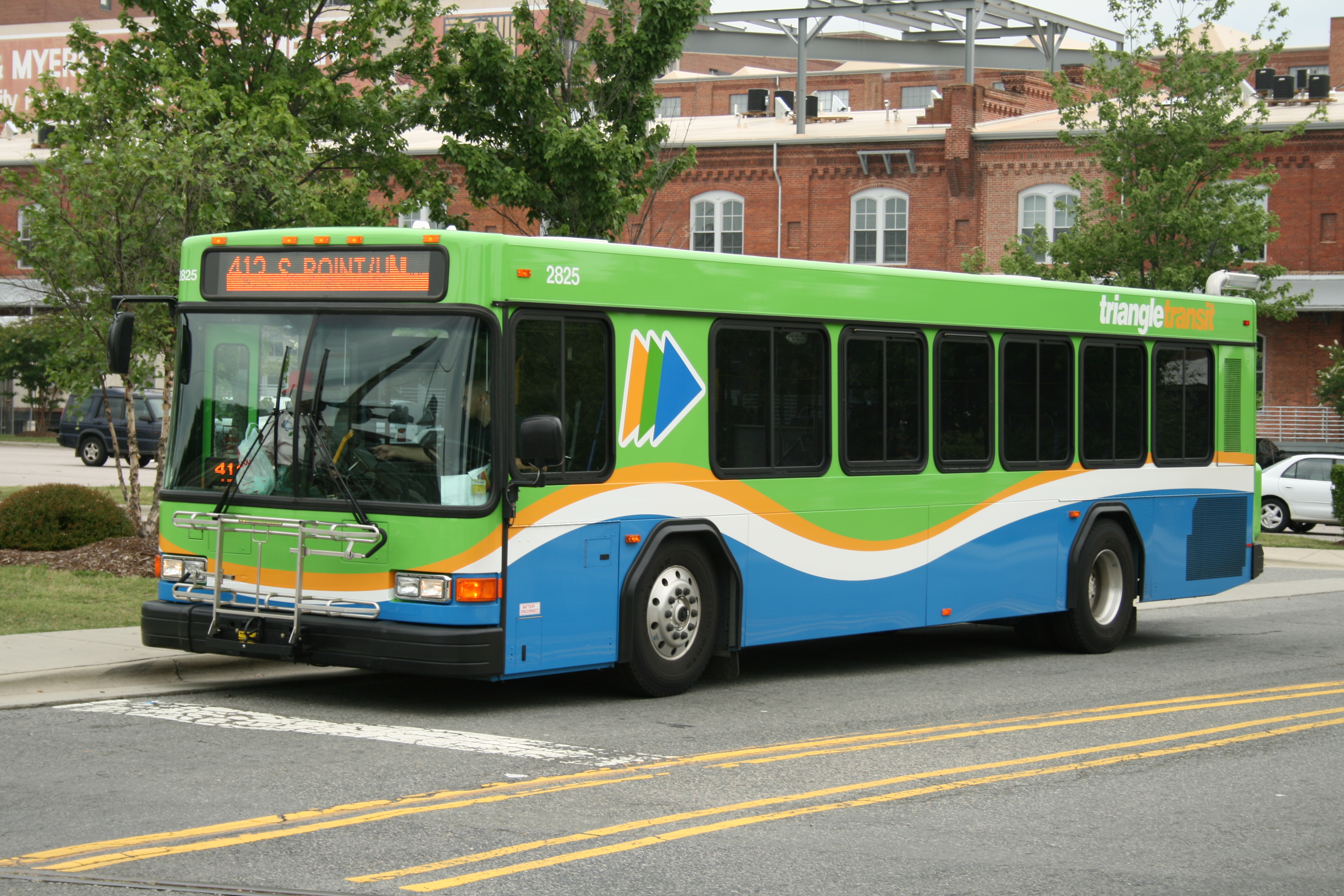
 Triangle Transit bus
- Air: Raleigh-Durham International Airport is located in northwestern Wake county on I-40, just to the north of Morrisville.
- Interstate Highway: I-40 is the closest Interstate to Morrisville and is accessible by driving northeast on Aviation Parkway.
- Morrisville is not served directly by passenger trains. Amtrak serves the nearby municipalities of Cary and Raleigh.
- Local Bus: The Triangle Transit operates buses that serve the region and connect to municipal bus systems in Raleigh, Durham and Chapel Hill.
Roads
- I-540 serves the Morrisville area and is located to the west of the town. The highway offers access to I-40, North Raleigh, RDU airport and eastern Wake County. The completed portion south of I-40 in the Morrisville area is technically called the Western Wake Parkway until the entire I-540 loop is completed.
- NC 54 is the only other highway that serves the town.
References
- ^ a b c d e "American FactFinder". United States Census Bureau. http://factfinder.census.gov. Retrieved 2008-01-31.
- ^ "US Board on Geographic Names". United States Geological Survey. 2007-10-25. http://geonames.usgs.gov. Retrieved 2008-01-31.
- ^ "General Information". Town of Morrisville. http://www.ci.morrisville.nc.us/index.aspx?nid=275. Retrieved 2010-06-16.
- ^ "2010 Census Redistricting Data (Public Law 94-171) Summary File". American FactFinder. United States Census Bureau. http://factfinder2.census.gov/faces/tableservices/jsf/pages/productview.xhtml?pid=DEC_10_PL_GCTPL2.ST13&prodType=table. Retrieved 11 August 2011.
- ^ "Annual Estimates of the Population of Metropolitan and Micropolitan Statistical Areas: April 1, 2000 to July 1, 2006 (CBSA-EST2006-01)" (CSV). 2006 Population Estimates. United States Census Bureau, Population Division. 2007-04-05. Archived from the original on 2007-09-14. http://web.archive.org/web/20070914155415/http://www.census.gov/population/www/estimates/metro_general/2006/CBSA-EST2006-01.csv. Retrieved 2007-04-05.
- ^ "US Gazetteer files: 2010, 2000, and 1990". United States Census Bureau. 2011-02-12. http://www.census.gov/geo/www/gazetteer/gazette.html. Retrieved 2011-04-23.
- ^ Dollar, Ernest. "Morrisville History". http://www.mindspring.com/~nixnox/history2.html. Retrieved 2010-06-16.
- ^ "Morrisville Historical Marker". http://www.civilwaralbum.com/misc7/morrisville_station1a.htm. Retrieved 2011-10-09.
- ^ "Town Council". Town of Morrisville. http://www.ci.morrisville.nc.us/index.aspx?nid=300. Retrieved 2010-06-16.
- ^ "Council Members". Town of Morrisville. http://www.ci.morrisville.nc.us/index.aspx?nid=301. Retrieved 2010-06-16.
- ^ "July 2008 Municipal Estimates by Municipality". North Carolina Office of State Budget and Management. http://www.osbm.state.nc.us/ncosbm/facts_and_figures/socioeconomic_data/population_estimates/demog/muntot08.htm. Retrieved 2010-06-16.
- ^ "Corporate Information". Midway Airlines. April 18, 2000. Archived from the original on April 18, 2000. http://web.archive.org/web/20000418205805/http://midwayair.com/corp.html. Retrieved January 29, 2010.
- ^ "Parks and Greenways". Town of Morrisville. http://www.ci.morrisville.nc.us/index.aspx?nid=195. Retrieved 2010-06-16.
- ^ "Morrisville Community Park". Town of Morrisville. http://www.ci.morrisville.nc.us/index.aspx?NID=199. Retrieved 2010-06-16.
- ^ "Shiloh Park / Luthor Green Center". Town of Morrisville. http://www.ci.morrisville.nc.us/index.aspx?NID=201. Retrieved 2010-06-16.
- ^ "Crabtree Creek Nature Park". Town of Morrisville. http://www.ci.morrisville.nc.us/index.aspx?NID=197. Retrieved 2010-06-16.
- ^ "Ruritan Park". Town of Morrisville. http://www.ci.morrisville.nc.us/index.aspx?NID=200. Retrieved 2010-06-16.
- ^ "Indian Creek Greenway and Trailhead". Town of Morrisville. http://www.ci.morrisville.nc.us/index.aspx?NID=198. Retrieved 2010-06-16.
- ^ "Cedar Fork District Park". Town of Morrisville. http://www.ci.morrisville.nc.us/index.aspx?NID=196. Retrieved 2010-06-16.
- ^ "Youth Basketball". Town of Morrisville. http://www.ci.morrisville.nc.us/index.aspx?nid=184. Retrieved 2010-06-16.
- ^ "Athletics". Town of Morrisville. http://www.ci.morrisville.nc.us/index.aspx?nid=181. Retrieved 2010-06-16.
- ^ "Youth Cricket". Town of Morrisville. http://www.ci.morrisville.nc.us/index.aspx?nid=187. Retrieved 2010-06-16.
External links
Municipalities and communities of Durham County, North Carolina Cities 
Towns Chapel Hill‡ | Morrisville‡
CDP Unincorporated
communitiesTownships Footnotes ‡This populated place also has portions in an adjacent county or counties
Municipalities and communities of Wake County, North Carolina Cities 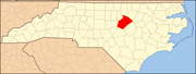
Towns Apex | Cary‡ | Clayton‡ | Fuquay-Varina | Garner | Holly Springs | Knightdale | Morrisville‡ | Rolesville | Wake Forest‡ | Wendell | Zebulon‡
Townships Bartons Creek | Buckhorn | Cary | Cedar Fork | Holly Springs | House Creek | Leesville | Little River | Marks Creek | Meredith | Middle Creek | Neuse | New Light | Panther Branch | Raleigh | St. Mary's | St. Matthew's | Swift Creek | Wake Forest | White Oak
Unincorporated
communitiesAuburn | Bonsal | Carpenter | Chestnut Hills | Clegg | Eagle Rock | Falls | Feltonville | Forestville | Friendship | Green Level | Holland | Hopkins | Kennebec | Lizard Lick | McCullers Crossroads | Neuse | New Hill | Riley Hill | Shotwell | Stony Hill | Swift Creek | Willow Spring
Footnotes ‡This populated place also has portions in an adjacent county or counties
Other significant cities Counties Major universities Miscellaneous Categories:- Populated places in Durham County, North Carolina
- Populated places in Wake County, North Carolina
- Towns in North Carolina
- Populated places established in 1840


Wikimedia Foundation. 2010.