- Colerain, North Carolina
-
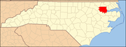
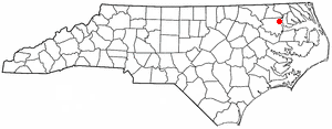
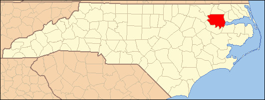
Colerain, North Carolina — Town — Location of Colerain, North Carolina
Coordinates: 36°12′4″N 76°46′5″W / 36.20111°N 76.76806°WCoordinates: 36°12′4″N 76°46′5″W / 36.20111°N 76.76806°W Country United States State North Carolina County Bertie Area – Total 0.3 sq mi (0.7 km2) – Land 0.3 sq mi (0.7 km2) – Water 0.0 sq mi (0.0 km2) Elevation 59 ft (18 m) Population (2008) – Total 201 – Density 821.1/sq mi (317.0/km2) Time zone Eastern (EST) (UTC-5) – Summer (DST) EDT (UTC-4) ZIP code 27924 Area code(s) 252 FIPS code 37-13560[1] GNIS feature ID 1019733[2] Colerain is a town in Bertie County, North Carolina, United States. The population was 201 at the 2008 census.
Geography
Colerain is located at 36°12′4″N 76°46′5″W / 36.20111°N 76.76806°W (36.201138, -76.768050).[3]
According to the United States Census Bureau, the town has a total area of 0.3 square miles (0.78 km2), all of it land. On April 16,2011 the town was hit by an EF-3 tornado that killed 12 people and caused extensive damage.
Demographics
As of the census[1] of 2000, there were 221 people, 103 households, and 66 families residing in the town. The population density was 821.1 people per square mile (316.0/km²). There were 121 housing units at an average density of 449.5 per square mile (173.0/km²). The racial makeup of the town was 93.21% White, 2.71% African American and 4.07% Native American. Hispanic or Latino of any race were 4.07% of the population.
There were 103 households out of which 19.4% had children under the age of 18 living with them, 61.2% were married couples living together, 1.0% had a female householder with no husband present, and 35.9% were non-families. 32.0% of all households were made up of individuals and 18.4% had someone living alone who was 65 years of age or older. The average household size was 2.15 and the average family size was 2.70.
In the town the population was spread out with 16.7% under the age of 18, 5.0% from 18 to 24, 24.4% from 25 to 44, 29.4% from 45 to 64, and 24.4% who were 65 years of age or older. The median age was 47 years. For every 100 females there were 85.7 males. For every 100 females age 18 and over, there were 91.7 males.
The median income for a household in the town was $33,281, and the median income for a family was $38,750. Males had a median income of $39,028 versus $21,786 for females. The per capita income for the town was $24,573. About 1.4% of families and 4.5% of the population were below the poverty line, including none of those under the age of eighteen and 12.0% of those sixty five or over.
References
- ^ a b "American FactFinder". United States Census Bureau. http://factfinder.census.gov. Retrieved 2008-01-31.
- ^ "US Board on Geographic Names". United States Geological Survey. 2007-10-25. http://geonames.usgs.gov. Retrieved 2008-01-31.
- ^ "US Gazetteer files: 2010, 2000, and 1990". United States Census Bureau. 2011-02-12. http://www.census.gov/geo/www/gazetteer/gazette.html. Retrieved 2011-04-23.
Municipalities and communities of Bertie County, North Carolina Towns Askewville | Aulander | Colerain | Kelford | Lewiston Woodville | Merry Hill | Powellsville | Roxobel | Windsor
Unincorporated
communitiesCategories:- Populated places in Bertie County, North Carolina
- Towns in North Carolina
Wikimedia Foundation. 2010.