Coleridge, North Carolina

Coleridge, North Carolina

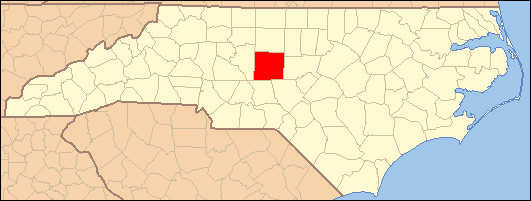
Coleridge is an unincorporated community along the Deep River in Randolph County, North Carolina, United States. It lies near Ramseur and southeast of Greensboro. Major roads through the town are Highway 22 and is joined in the middle by Highway 42, which then travels to Bennett.This community was named for James A. Cole, a local merchant. It is in the Eastern Standard Time zone (GMT -5). The elevation is 436 feet. Former and merged names include Foust's Mill[1]

References

Coordinates: 35°38′24″N 79°36′54″W / 35.64°N 79.615°W / 35.64; -79.615


Wikimedia Foundation. 2010.

Игры ⚽ Поможем решить контрольную работу

Look at other dictionaries:

  • North Carolina Highway 49 — NC 49 Route information Maintained by NCDOT Length: 180 mi (290 km) Existed …   Wikipedia

  • North Carolina Highway 22 — NC 22 Route information Maintained by NCDOT Length: 59 mi (95 km) Existed …   Wikipedia

  • List of unincorporated communities in North Carolina — The following is a partial list of named, but unincorporated communities in the state of North Carolina. To be listed, the unincorporated community should either be a Census Designated Place (CDP) or a place with at least a few commercial… …   Wikipedia

  • Erect, North Carolina — Infobox Settlement name = Erect, North Carolina settlement type = Unincorporated community nickname = motto = imagesize = image caption = image pushpin pushpin label position = none pushpin map caption = Location of Erect in North Carolina… …   Wikipedia

  • National Register of Historic Places listings in Randolph County, North Carolina — Map of all coordinates from Google Map of all coordinates from Bing …   Wikipedia

  • High Point, North Carolina — For other places named High Point, see High Point (disambiguation). High Point   City   City of High Point …   Wikipedia

  • Randolph County, North Carolina — Infobox U.S. County county = Randolph County state = North Carolina map size = 255 founded = 1779 seat = Asheboro | area total sq mi =790 area land sq mi =787 area water sq mi =3 area percentage = 0.33% census yr = 2000 pop = 130454 density km2… …   Wikipedia

  • List of townships in North Carolina — The U.S. state of North Carolina is divided into 1,035 townships in 100 counties.[1] Township County 2010 Census Abbotts Township Bladen 1,094 Abbotts Creek Township Davidson 12,846 Abbotts Creek Township Fors …   Wikipedia

  • Randolph County (North Carolina) — Verwaltung US Bundesstaat: North Carolina Verwaltungssitz: Asheboro Adresse des Verwaltungssitzes: County Courthouse P.O. Box 4728 Asheboro, NC 27204 4728 Gründung: 1779 …   Deutsch Wikipedia

  • Coleridge — may refer to: People Samuel Taylor Coleridge (1772–1834), English poet and philosopher Coleridge (surname), other people with the surname Coleridge Places Coleridge, Cambridgeshire, a ward in the City of Cambridge Coleridge, Nebraska, a village… …   Wikipedia

Share the article and excerpts

Direct link
Do a right-click on the link above
and select “Copy Link”