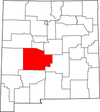
- National Register of Historic Places listings in Socorro County, New Mexico
-
This is not a list of the National Register of Historic Places listings in Socorro County, New Mexico.
This is intended to be a complete list of the properties and districts on the National Register of Historic Places in Socorro County, New Mexico, United States. Latitude and longitude coordinates are provided for many National Register properties and districts; these locations may be seen together in a Google map.[1]
There are 49 properties and districts listed on the National Register in the county, including 1 National Historic Landmark.
-
- This National Park Service list is complete through NPS recent listings posted November 10, 2011.[2]
Contents: Counties in New Mexico Bernalillo – Catron – Chaves – Cibola – Colfax – Curry – De Baca – Doña Ana – Eddy – Grant – Guadalupe – Harding – Hidalgo – Lea – Lincoln – Los Alamos – Luna – McKinley – Mora – Otero – Quay – Rio Arriba – Roosevelt – San Juan – San Miguel – Sandoval – Santa Fe – Sierra – Socorro – Taos – Torrance – Union – Valencia Current listings
[3] Landmark name [4] Image Date listed Location City or town Summary 1 Aragon House August 2, 1982 2nd and Oak Sts.
34°06′56″N 107°14′43″W / 34.115556°N 107.245278°WMagdalena 2 Archeological Site No. LA 1069 April 15, 1993 Address Restricted Bingham 3 Archeological Site No. LA 1070 April 15, 1993 Address Restricted Bingham 4 Archeological Site No. LA 1071 April 15, 1993 Address Restricted Bingham 5 Archeological Site No. LA 1072 April 15, 1993 Address Restricted Bingham 6 Archeological Site No. LA 1073 April 15, 1993 Address Restricted Bingham 7 Archeological Site No. LA 1074 April 15, 1993 Address Restricted Bingham 8 Archeological Site No. LA 1075 April 15, 1993 Address Restricted Bingham 9 Archeological Site No. LA 1076 April 15, 1993 Address Restricted Bingham 10 Archeological Site No. LA 1181 April 15, 1993 Address Restricted Bingham 11 Archeological Site No. LA 1201 April 15, 1993 Address Restricted Bingham 12 Atchison, Topeka and Santa Fe Railway Depot December 29, 1978 Off U.S. Route 60
34°07′04″N 107°14′36″W / 34.117778°N 107.243333°WMagdalena 13 A.B. Baca House February 20, 1991 201 School of Mines Rd.
34°03′31″N 106°53′38″W / 34.058611°N 106.893889°WSocorro 14 Bank of Magdalena August 2, 1982 1st and Main Sts.
34°07′03″N 107°14′36″W / 34.1175°N 107.243333°WMagdalena 15 Brown Hall May 16, 1989 New Mexico Institute of Mining and Technology
34°03′59″N 106°54′17″W / 34.066389°N 106.904722°WSocorro 16 Bursum House June 18, 1975 326 Church St.
34°03′20″N 106°53′46″W / 34.055556°N 106.896111°WSocorro 17 Clemens Ranchhouse April 18, 1979 South of Magdalena
34°05′03″N 107°13′46″W / 34.084167°N 107.229444°WMagdalena 18 Captain Michael Cooney House February 20, 1991 309 McCutcheon Ave.
34°03′19″N 106°53′40″W / 34.055278°N 106.894444°WSocorro 19 Anthony Cortesy House February 20, 1991 327 McCutcheon Ave.
34°03′19″N 106°53′46″W / 34.055278°N 106.896111°WSocorro 20 Nestor P. Eaton House February 20, 1991 313 McCutcheon Ave.
34°03′19″N 106°53′41″W / 34.055278°N 106.894722°WSocorro 21 Fitch Hall May 16, 1989 New Mexico Institute of Mining and Technology
34°03′55″N 106°54′15″W / 34.065278°N 106.904167°WSocorro 22 James Gurden Fitch House February 20, 1991 311 McCutcheon Ave.
34°03′19″N 106°53′40″W / 34.055278°N 106.894444°WSocorro 23 Fort Craig October 15, 1970 37 miles south of Socorro
33°38′25″N 107°00′46″W / 33.640278°N 107.012778°WSocorro 24 Gallinas Springs Ruin September 4, 1970 Address Restricted Magdalena 25 Garcia Opera House August 13, 1974 Terry Ave. and California St.
34°03′30″N 106°53′28″W / 34.058333°N 106.891111°WSocorro 26 Juan Nepomuceno Garcia House February 20, 1991 108 Bernard St.
34°03′29″N 106°53′32″W / 34.058056°N 106.892222°WSocorro 27 Gutierrez House August 2, 1982 3rd and Popular Sts.
34°07′01″N 107°14′20″W / 34.116944°N 107.238889°WMagdalena 28 Hall Hotel August 2, 1982 2nd and Spruce Sts.
34°07′01″N 107°14′30″W / 34.116944°N 107.241667°WMagdalena 29 Hilton House August 2, 1982 U.S. Route 60
34°07′15″N 107°14′01″W / 34.120833°N 107.233611°WMagdalena 30 August Holver Hilton House February 20, 1991 601 Park St.
34°03′05″N 106°53′35″W / 34.051389°N 106.893056°WSocorro 31 House at 303 Eaton Avenue February 20, 1991 303 Eaton Ave.
34°03′20″N 106°53′50″W / 34.055556°N 106.897222°WSocorro 32 House at 405 Park Street February 20, 1991 405 Park St.
34°03′17″N 106°53′36″W / 34.054722°N 106.893333°WSocorro 33 Ilfeld Warehouse August 2, 1982 Main St.
34°07′06″N 107°14′38″W / 34.118333°N 107.243889°WMagdalena 34 Illinois Brewery September 2, 1975 Neal Ave. and 6th St.
34°03′46″N 106°53′25″W / 34.062778°N 106.890278°WSocorro 35 Lewellen House August 2, 1982 2nd and Chestnut Sts.
34°07′03″N 107°14′20″W / 34.1175°N 107.238889°WMagdalena 36 MacDonald Merchandise Building September 25, 1980 U.S. Route 90
34°06′58″N 107°14′40″W / 34.116111°N 107.244444°WMagdalena 37 MacTavish House August 2, 1982 Elm St.
34°06′51″N 107°14′37″W / 34.114167°N 107.243611°WMagdalena 38 Magdaline House August 2, 1982 3rd and Chestnut Sts.
34°07′01″N 107°14′18″W / 34.116944°N 107.238333°WMagdalena 39 Main Street Commercial Building August 2, 1982 Main St.
34°07′03″N 107°14′36″W / 34.1175°N 107.243333°WMagdalena 40 Sagrada Familia de Lemitar Church, Los Dulces Nombres February 24, 1983 Off Interstate 25
34°09′37″N 106°54′28″W / 34.160278°N 106.907778°WLemitar 41 Salinas Pueblo Missions National Monument October 15, 1966 1 mile east of Gran Quivira on State Road 10
34°15′35″N 106°05′25″W / 34.259722°N 106.090278°WGran Quivira 42 Salome Store August 2, 1982 1st St.
34°06′58″N 107°14′42″W / 34.116111°N 107.245°WMagdalena 43 Salome Warehouse August 2, 1982 1st St.
34°06′59″N 107°14′43″W / 34.116389°N 107.245278°WMagdalena 44 San Felipe Pueblo Ruin April 25, 1983 Near the confluence of Milligan Gulch and the Rio Grande
33°36′46.188″N 107°1′32.736″W / 33.61283°N 107.02576°W[5]Socorro 45 Seco Ruin June 17, 1994 Address Restricted Chupadera 46 Teypama Piro Site October 21, 1983 Address Restricted Socorro 47 Trinity Site October 15, 1966 25 miles south of U.S. Route 380 on the White Sands Missile Range
33°39′08″N 106°29′34″W / 33.652222°N 106.492778°WBingham 48 Val Verde Hotel September 13, 1977 203 Manzanares St.
34°03′28″N 106°53′22″W / 34.057778°N 106.889444°WSocorro 49 Rufina Vigil House February 20, 1991 407 Park St.
34°03′16″N 106°53′37″W / 34.054444°N 106.893611°WSocorro See also
- List of National Historic Landmarks in New Mexico
- National Register of Historic Places listings in New Mexico
References
- ^ The latitude and longitude information provided in this table was derived originally from the National Register Information System, which has been found to be fairly accurate for about 99% of listings. For about 1% of NRIS original coordinates, experience has shown that one or both coordinates are typos or otherwise extremely far off; some corrections may have been made. A more subtle problem causes many locations to be off by up to 150 yards, depending on location in the country: most NRIS coordinates were derived from tracing out latitude and longitudes off of USGS topographical quadrant maps created under North American Datum of 1927, which differs from the current, highly accurate GPS system used by Google maps. Chicago is about right, but NRIS longitudes in Washington are higher by about 4.5 seconds, and are lower by about 2.0 seconds in Maine. Latitudes differ by about 1.0 second in Florida. Some locations in this table may have been corrected to current GPS standards.
- ^ "National Register of Historic Places: Weekly List Actions". National Park Service, United States Department of the Interior. Retrieved on November 10, 2011.
- ^ Numbers represent an ordering by significant words. Various colorings, defined here, differentiate National Historic Landmark sites and National Register of Historic Places Districts from other NRHP buildings, structures, sites or objects.
- ^ "National Register Information System". National Register of Historic Places. National Park Service. . http://nrhp.focus.nps.gov/natreg/docs/All_Data.html.
- ^ Location derived from its GNIS feature record; the NRIS lists it as "Address Restricted"
U.S. National Register of Historic Places Topics Lists by states Alabama • Alaska • Arizona • Arkansas • California • Colorado • Connecticut • Delaware • Florida • Georgia • Hawaii • Idaho • Illinois • Indiana • Iowa • Kansas • Kentucky • Louisiana • Maine • Maryland • Massachusetts • Michigan • Minnesota • Mississippi • Missouri • Montana • Nebraska • Nevada • New Hampshire • New Jersey • New Mexico • New York • North Carolina • North Dakota • Ohio • Oklahoma • Oregon • Pennsylvania • Rhode Island • South Carolina • South Dakota • Tennessee • Texas • Utah • Vermont • Virginia • Washington • West Virginia • Wisconsin • WyomingLists by territories Lists by associated states Other  Category:National Register of Historic Places •
  Portal:National Register of Historic Places
Municipalities and communities of Socorro County, New Mexico County seat: Socorro City Village CDP Unincorporated
communitiesAbeytas | Alamillo | Luis Lopez | Lemitar | Polvadera | Sabinal | San Acacia | San Antonio | Veguita
Categories:- National Register of Historic Places in New Mexico by county
- Socorro County, New Mexico
- History of Socorro County, New Mexico
-
Wikimedia Foundation. 2010.


