- U.S. Route 380
Infobox U.S. Route
article_route=380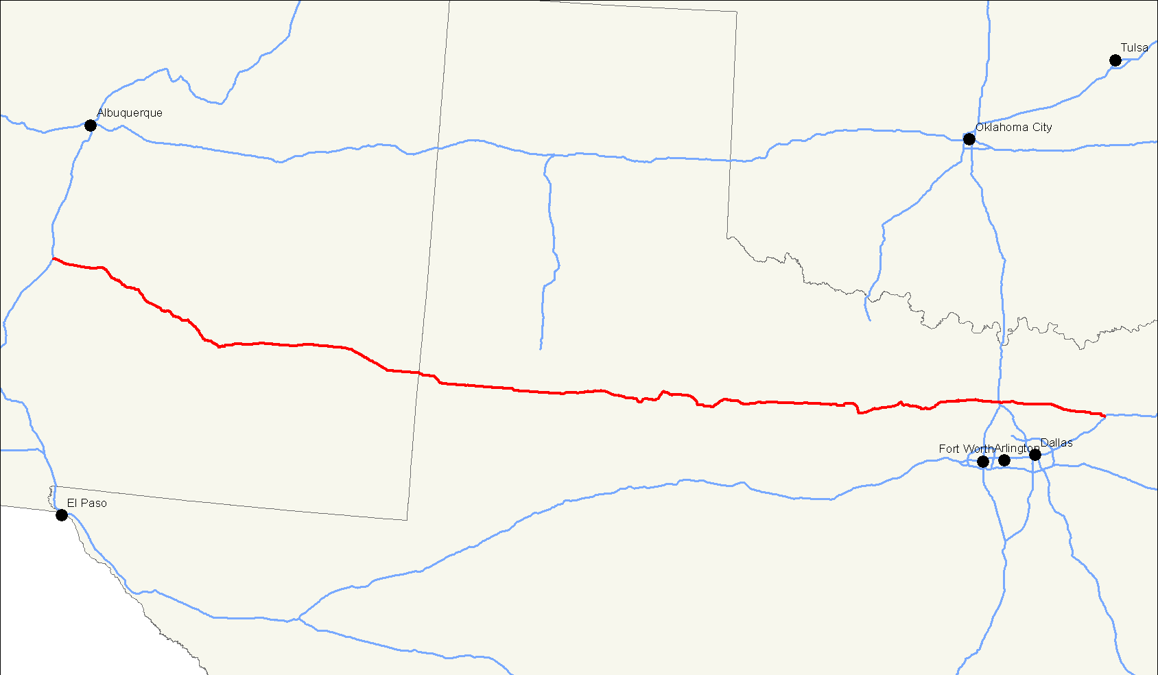
length_mi=673
length_round=0
length_ref=
yrcom=1932
direction_a=West
from=
junction=
direction_b=East
to=
spur_of=80U.S. Route 380 is an east-west
United States highway . The highway's eastern terminus is inGreenville, Texas at an intersection withInterstate 30 , of which the easternmost 3-4 miles are co-located with US 69 in a loop around the west and south sides of Greenville. Its western terminus is atSan Antonio, New Mexico , south of Socorro at an intersection withInterstate 25 . It never intersected with its nominal parent, US 80, instead connecting with US 180 in Albany,Texas . With later routing changes, the highway no longer connects to any x80 route. US 380 passes through some of the far northern suburbs of theDallas/Fort Worth Metroplex , including Denton, Frisco, and McKinney.When US 380 was commissioned in
1932 , it took over the entire former route of U.S. Route 566, an original1926 route. The entire route of US 566 was within the state ofNew Mexico , from an intersection with US 366 (modern-day US 70) east of Ruidoso to US 85 inSocorro, New Mexico . US 566 never intersected with its nominal parent,U.S. Route 66 . [http://www.fhwa.dot.gov/infrastructure/us666.htm]Route description
New Mexico
Texas
US 380's eastern terminus is at an intersection with
US 69 on the west side of Greenville. Leaving Greenville, the highway passes through the small community of Floyd, where it is signed as Business 380. After passing through Farmersville (where it is signed as theAudie Murphy Parkway), US 380 crossesLake Lavon and then passes through Princeton on its way to McKinney, where it is known as University Drive. After McKinney, the highway takes an almost due westerly bearing, passing through the small communities of Navo and Lincoln Park and crossing over the far north end ofLake Lewisville before passing into the city of Denton, through which it is the designated truck route along with State Highway Loop 288. The highway crossesInterstate 35 on the north side of the city, and heads west toward Decatur. After leaving Decatur, US 380 maintains a fairly due westerly bearing until Bridgeport, where it merges withTexas State Highway 114 and takes a sharp turn to the southwest and crosses Lake Bridgeport. From there, US 380 passes through the small resort community of Runaway Bay and, once in Jack County, out into the rural plains of North-Central Texas. Just south of Jacksboro,US 380/TX 114 merges withTexas State Highway 199 andUS 281 ; in town, TX 114 leaves the route and follows US 281/TX 199 to the northwest, while US 380 takes on more of a southwesterly bearing toward Bryson and then on into Graham.At Graham, US 380 takes a sharp turn toward the north, passing just north of Lake Eddleman and Lake Graham before turning back to the west toward the town of Newcastle, where it makes a brief turn due south, and then back west again at a junction with
Texas State Highway 61 maintaining a generally due-westerly heading all the way through the communities of Throckmorton, Haskell and Rule. After Rule, US 380 takes a turn to the southwest and passes through the tiny community of Old Glory before making another abrupt turn back toward the north to the town of Aspermont, where it briefly shares a route withUS 83 before breaking off again in a northwesterly bearing toward the community of Swenson.From Swenson, US 380 passes thorugh several thousand acres of private ranch land throughout rural Stonewall and Kent Counties before coming to an intersection with
Texas State Highway 70 just south of Jayton where it takes another sharp turn to the southwest. It follows this southwesterly bearing for approximately 6.5 miles, where TX 70 leaves the route and continues on to the southeast, and US 380 resumes its near due-westerly heading all the way to theghost town of Clairemont. After Clairemont, the highway winds its way through the rest of rural Kent and Garza Counties before coming to an intersection withUS 84 in downtown Post.West of Post, US 380 again maintains an almost due-westerly bearing and passes through the towns of Tahoka and Brownfield, where it meets up with
US 82 .After passing through Brownfield, US 380/82 treks west through the ghost towns of Gomez and Tokio and on into Plains, where US 82 leaves the route with a turn toward the southwest and US 380 veers off to the northwest. After approximately 3 miles, the highway once again turns due-west, where it passes through the tiny community of Bronco and passes into New Mexico at an intersection with New Mexico State Highway 769.ee also
Related routes
*
U.S. Route 80
*U.S. Route 180
*U.S. Route 280 References
*Endpoints of US highways: [http://www.geocities.com/usend8089/End380/end380.htm U.S. Highway 380] and [http://www.geocities.com/mapguy_denver/HwyEnds/End566/end566.htm U.S. Highway 566]
Wikimedia Foundation. 2010.