- Magdalena, New Mexico
-
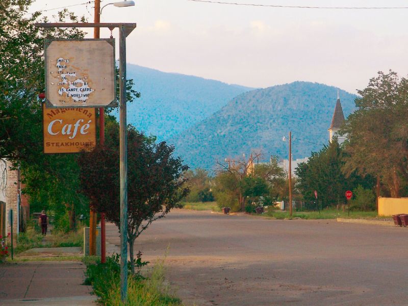
Magdalena, New Mexico — Village — Main Street in Magdalena, 2007 Location of Magdalena, New Mexico
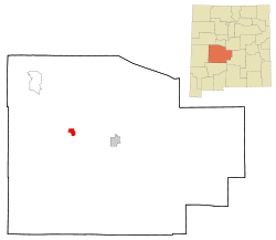
Coordinates: 34°6′45″N 107°14′16″W / 34.1125°N 107.23778°WCoordinates: 34°6′45″N 107°14′16″W / 34.1125°N 107.23778°W Country United States State New Mexico County Socorro Area – Total 6.2 sq mi (16.1 km2) – Land 6.2 sq mi (16.1 km2) – Water 0.0 sq mi (0.0 km2) Elevation 6,572 ft (2,003 m) Population (2010) – Total 938 – Density 150.9/sq mi (58.3/km2) Time zone Mountain (MST) (UTC-7) – Summer (DST) MDT (UTC-6) ZIP code 87825 Area code(s) 575 FIPS code 35-46310 GNIS feature ID 0908353  The old Kelly Mine headframe south of Magdalena (2005 photo)
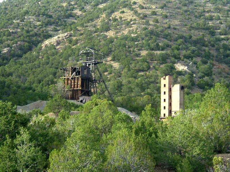

Magdalena is a village in Socorro County, New Mexico, United States. The population was 938 at the 2010 census.
"The Lady on the Mountain" is a rock formation on Magdalena Peak overlooking Magdalena. Spanish soldiers saw the face of a woman on the west face of the peak. A priest with them was reminded of a similar peak in Spain called "La Sierra de Maria Magdalena", so he called the New Mexico one "La Sierra de Magdalena". The natural pass to the south of the peak became known as Magdalena Gap, and when a town grew up it received the same name.[1][2]
Magdalena has recently been trying to transform itself into an art center and cultural destination. The opening of at least a dozen art galleries, a woolery, the renovation of the Bank West Building and the Magdalena Hall Hotel have all made their mark on this mountain village. Several rock and mineral shops have been around since the mining boom days. The ghost town of Kelly and two important festivals, the Lady Magdalen Art Walk and the Old Timers Reunion and Rodeo, bring tourists to the area.
Newly-paved roads, additions to the large school, a public water system, trash disposal service and the opening of a new mini-mart and gas station have improved the quality of life for its citizens. In late 2010, a Family Dollar opened right next to the locally owned Trails End Market. In 2011 a tire shop and a blacksmith shop have also opened.
The Very Large Array is located close to the community.
Contents
Geography
Magdalena is located at 34°6′45″N 107°14′16″W / 34.1125°N 107.23778°W (34.112596, -107.237904)[3].
According to the United States Census Bureau, the village has a total area of 6.2 square miles (16 km2), all of it land.
History
In 1883, about 2.5 miles (4.0 km) south of Magdalena, the Kelly Mine opened in Kelly, New Mexico. In 1884, the village of Magdalena was named after Magdalena Peak when its post office opened. The next year the railroad completed a spur out from Socorro, originally intended to ship cattle from the Plains of San Agustin, but which also proceeded to ship out ore from the Kelly Mine and others. The Kelly Mine was a significant producer of silver and zinc. Magdalena was incorporated in 1913.
Media
Magdalena has a local newspaper, the Mountain Mail, which is the only locally owned newspaper in Socorro County.
Demographics
As of the census[4] of 2000, there were 913 people, 372 households, and 244 families residing in the village. The population density was 146.8 people per square mile (56.7/km²). There were 470 housing units at an average density of 75.6 per square mile (29.2/km²). The racial makeup of the village was 62.65% White, 0.55% African American, 9.97% Native American, 21.80% from other races, and 5.04% from two or more races. Hispanic or Latino of any race were 48.30% of the population.
There were 372 households out of which 30.1% had children under the age of 18 living with them, 46.2% were married couples living together, 13.4% had a female householder with no husband present, and 34.4% were non-families. 30.9% of all households were made up of individuals and 12.6% had someone living alone who was 65 years of age or older. The average household size was 2.45 and the average family size was 3.06.
In the village the population was spread out with 27.2% under the age of 18, 5.4% from 18 to 24, 23.7% from 25 to 44, 27.8% from 45 to 64, and 16.0% who were 65 years of age or older. The median age was 41 years. For every 100 females there were 90.6 males. For every 100 females age 18 and over, there were 86.3 males.
The median income for a household in the village was $22,917, and the median income for a family was $30,625. Males had a median income of $26,000 versus $21,875 for females. The per capita income for the village was $13,064. About 20.8% of families and 25.1% of the population were below the poverty line, including 30.0% of those under age 18 and 23.0% of those age 65 or over.
References
- ^ "Historic Markers on the Information Superhighway: Magdalena" New Mexico Department of Tourism, from Internet Archive of 27 September 2007
- ^ Everleth, Robert W. (2006) "Our Lady on the Mountain—history, folklore, and geology of Magdalena Peak" New Mexico Geology 28(2): pp. 43-51,53
- ^ "US Gazetteer files: 2010, 2000, and 1990". United States Census Bureau. 2011-02-12. http://www.census.gov/geo/www/gazetteer/gazette.html. Retrieved 2011-04-23.
- ^ "American FactFinder". United States Census Bureau. http://factfinder.census.gov. Retrieved 2008-01-31.
- McKenna, James A.; Leslie, Shane; and Simon, Howard (1936) "Story of the Lost Canyon Diggings", in Black Range Tales: chronicling sixty years of life and adventure in the Southwest Wilson-Erickson, Inc., New York;
- Barrington, Jacky (ed.) (1984) Magdalena: celebrating one hundred years of frontier living Magdalena Old Timers' Association, Magdalena, NM, ISBN 0-9617036-2-8 ;
External links
- Magdalena Chamber of Commerce
- "Historic Markers: Magdalena" New Mexico Department of Cultural Affairs

Wikimedia Commons has media related to: Municipalities and communities of Socorro County, New Mexico City 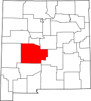
Village Magdalena
CDP Unincorporated
communitiesAbeytas | Alamillo | Luis Lopez | Lemitar | Polvadera | Sabinal | San Acacia | San Antonio | Veguita
Categories:- Populated places in Socorro County, New Mexico
- Villages in New Mexico


Wikimedia Foundation. 2010.