- National Register of Historic Places listings in Solano County, California
-
s
This list includes properties and districts listed on the National Register of Historic Places in Solano County, California. Click the "Map of all coordinates" link to the right to view a Google map of all properties and districts with latitude and longitude coordinates in the table below.[1]
-
- This National Park Service list is complete through NPS recent listings posted November 10, 2011.[2]
Current listings
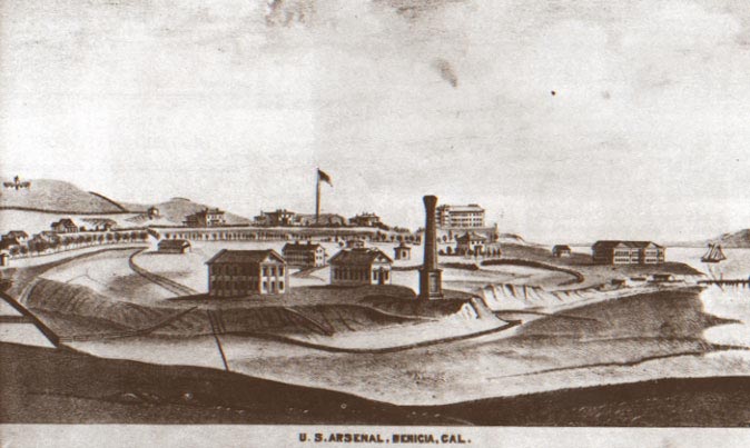
[3] Landmark name[4] Image Date listed Location City or Town Summary 1 Benicia Arsenal 
November 7, 1976 Army Point and I-680
38°3′0″N 122°8′8″W / 38.05°N 122.13556°WBenicia 2 Benicia Capitol State Historic Park 
February 12, 1971 1st and G Sts.
38°3′1″N 122°9′28″W / 38.05028°N 122.15778°WBenicia 3 Bird and Dinkelspiel Store 
October 21, 1999 2145 Collinsville Rd.
38°7′58″N 121°52′12″W / 38.13278°N 121.87°WBirds Landing General store built in 1875. 4 Jackson Fay Brown House November 7, 2002 6751 Maine Prairie Rd.
38°19′59″N 121°48′50″W / 38.33306°N 121.81389°WDixon 5 Will H. Buck House October 24, 1985 301 Buck Ave.
38°21′24″N 121°59′38″W / 38.35667°N 121.99389°WVacaville 6 Carr House 
September 13, 1979 165 E. D St
38°2′49″N 122°9′28″W / 38.04694°N 122.15778°WBenicia 7 Crooks Mansion 
November 14, 1978 285 W. G St.
38°3′7″N 122°9′40″W / 38.05194°N 122.16111°WBenicia 8 Dixon Carnegie Library February 4, 2011 135 E. B St.
38°26′48″N 121°49′20″W / 38.44667°N 121.82222°WDixon California Carnegie Libraries MPS 9 Joseph Fischer House May 24, 1979 135 G St.
38°3′0″N 122°9′29″W / 38.05°N 122.15806°WBenicia 10 Hastings Adobe June 13, 1972 NE of Collinsville off CA 68
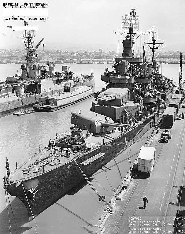
38°4′36″N 121°49′50″W / 38.07667°N 121.83056°WCollinsville 11 Mare Island Naval Shipyard 
May 15, 1975 Mare Island
38°5′24″N 122°15′48″W / 38.09°N 122.26333°WVallejo Boundary increase (added January 21, 1997): Mare Island Historic District, Vallejo, California 12 Samuel Martin House May 26, 1977 293 Suisun Valley Rd.
38°14′10″N 122°7′32″W / 38.23611°N 122.12556°WSuisun City 13 Old Masonic Hall 
March 16, 1972 106 W. J St.
38°3′9″N 122°9′24″W / 38.0525°N 122.15667°WBenicia 14 Pena Adobe January 7, 1972 2 mi. SW of Vacaville on I-80
38°20′14″N 122°0′51″W / 38.33722°N 122.01417°WVacaville 15 Pleasants Ranch April 7, 2006 8212 Pleasants Valley Rd.
38°27′54″N 122°2′52″W / 38.465°N 122.04778°WVacaville 16 Saint Vincent's Hill Historic District November 21, 2003 Roughly bounded by Mare Island Way almost to Sonoma Blvd. and from Quincy Alley to Kissel Alley
38°6′20″N 122°15′30″W / 38.10556°N 122.25833°WVallejo 17 Benicia 18 Suisun Masonic Lodge No. 55 
December 18, 1978 623 Main St.
38°14′17″N 122°2′22″W / 38.23806°N 122.03944°WSuisun City 19 Vacaville Town Hall September 18, 1978 620 E. Main St.
38°21′23″N 121°59′5″W / 38.35639°N 121.98472°WVacaville 20 Vallejo City Hall and County Building Branch 
November 7, 1976 734 Marin St.
38°6′10″N 122°15′19″W / 38.10278°N 122.25528°WVallejo 21 Vallejo Old City Historic District March 20, 1973 Sonoma Blvd., and Monterey, Carolina, and York Sts.
38°6′7″N 122°14′59″W / 38.10194°N 122.24972°WVallejo Sites moved to a different location
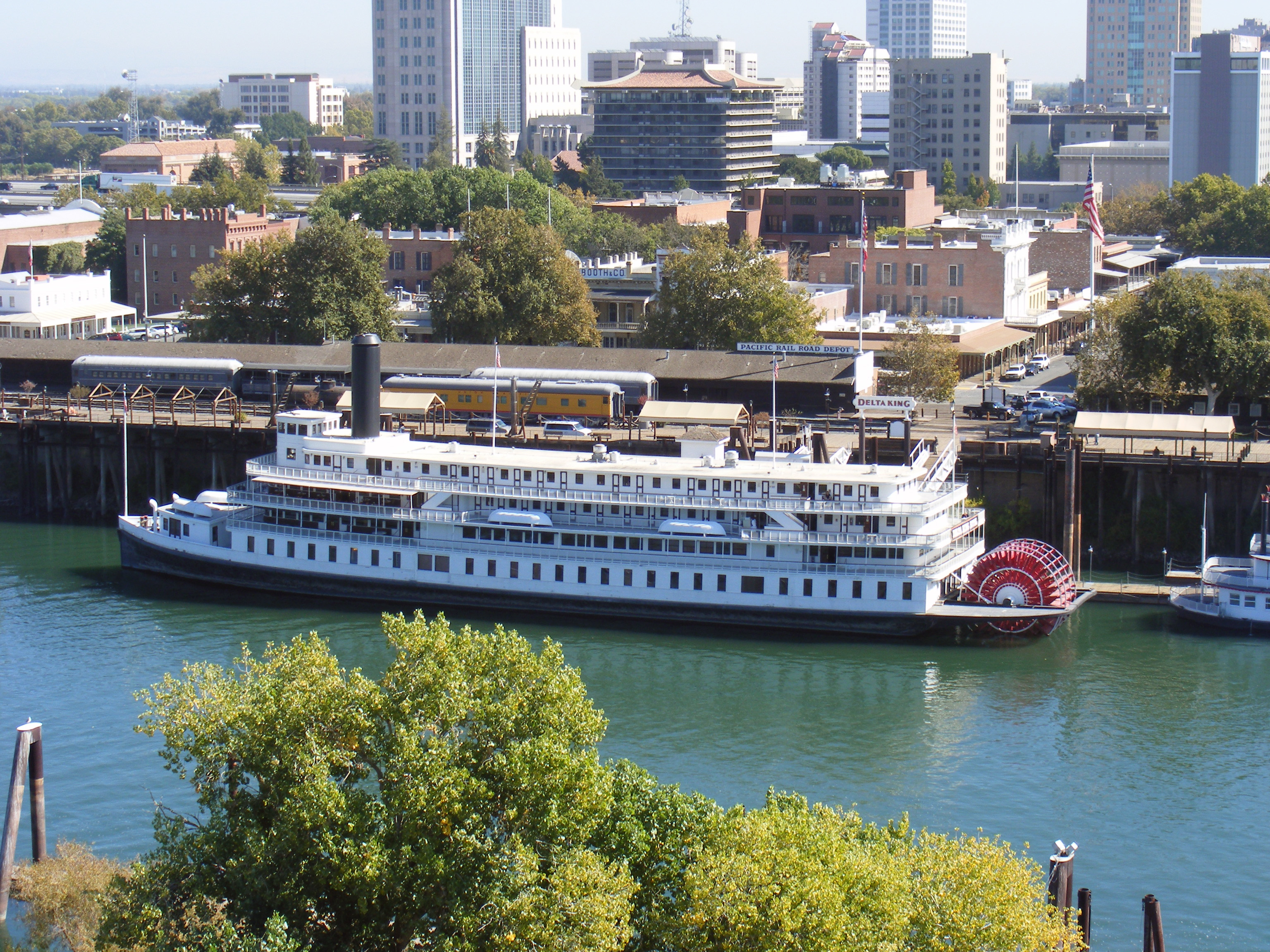
Landmark name Image Date eligible Location City or Town Summary 1 Delta King 
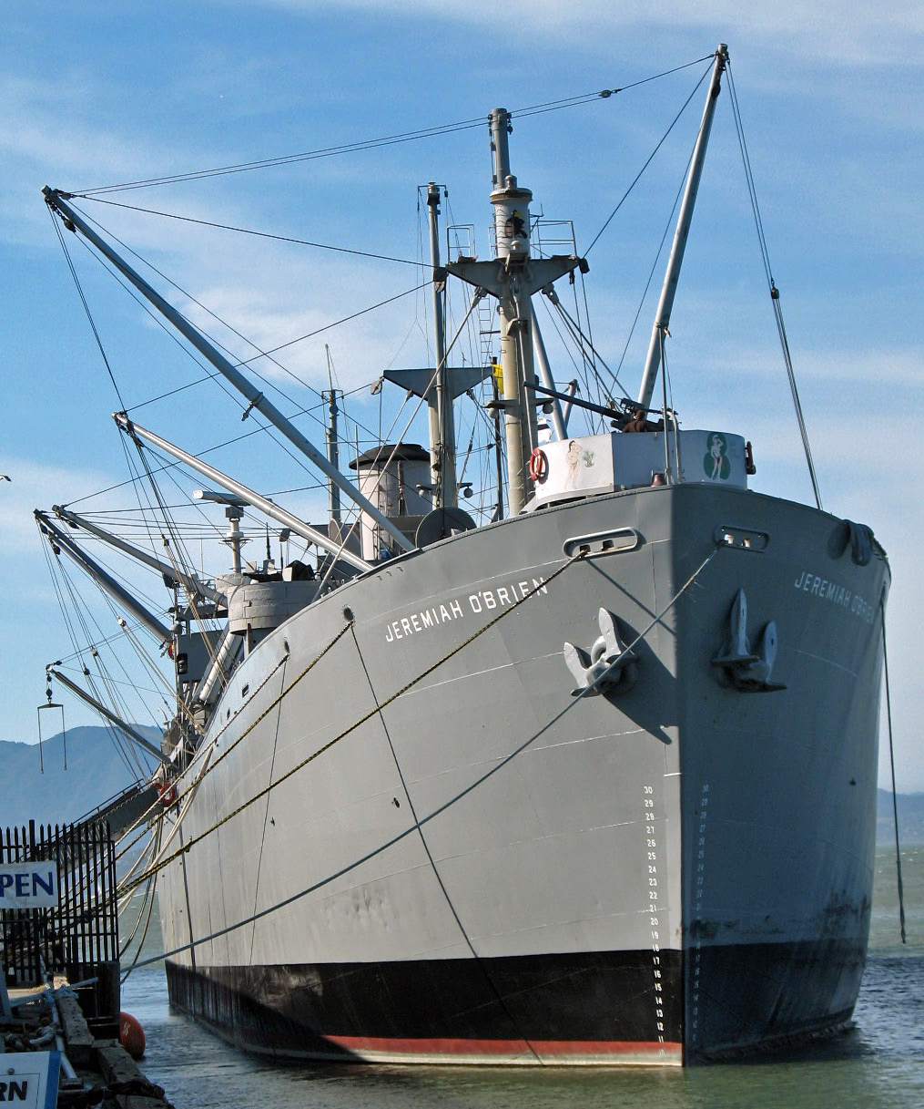
March 31, 1978 Moved to 1000 Front St., Sacramento in 1984 Sacramento Now a hotel, restaurant and theater located in Old Sacramento[5] 2 SS Jeremiah O'Brien 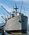
July 7, 1978 Moved to Pier 45, Fisherman's Wharf, San Francisco[6] San Francisco World War II era liberty ship; now a museum ship at Pier 45 in San Francisco See also
- National Register of Historic Places listings in California
- List of National Historic Landmarks in California
References
- ^ The latitude and longitude information provided in this table was derived originally from the National Register Information System, which has been found to be fairly accurate for about 99% of listings. For about 1% of NRIS original coordinates, experience has shown that one or both coordinates are typos or otherwise extremely far off; some corrections may have been made. A more subtle problem causes many locations to be off by up to 150 yards, depending on location in the country: most NRIS coordinates were derived from tracing out latitude and longitudes off of USGS topographical quadrant maps created under North American Datum of 1927, which differs from the current, highly accurate GPS system used by Google maps. Chicago is about right, but NRIS longitudes in Washington are higher by about 4.5 seconds, and are lower by about 2.0 seconds in Maine. Latitudes differ by about 1.0 second in Florida. Some locations in this table may have been corrected to current GPS standards.
- ^ "National Register of Historic Places: Weekly List Actions". National Park Service, United States Department of the Interior. Retrieved on November 10, 2011.
- ^ Numbers represent an ordering by significant words. Various colorings, defined here, differentiate National Historic Landmark sites and National Register of Historic Places Districts from other NRHP buildings, structures, sites or objects.
- ^ "National Register Information System". National Register of Historic Places. National Park Service. 2008-04-24. http://nrhp.focus.nps.gov/natreg/docs/All_Data.html.
- ^ "The Story of the Delta King". Sacramento, California. http://www.deltaking.com/index.php?option=com_content&view=article&id=9. Retrieved February 13, 2011.
- ^ "S.S. Jeremiah O'Brien". San Francisco, California. http://www.ssjeremiahobrien.org/. Retrieved February 13, 2011.
External links
U.S. National Register of Historic Places Topics Lists by states Alabama • Alaska • Arizona • Arkansas • California • Colorado • Connecticut • Delaware • Florida • Georgia • Hawaii • Idaho • Illinois • Indiana • Iowa • Kansas • Kentucky • Louisiana • Maine • Maryland • Massachusetts • Michigan • Minnesota • Mississippi • Missouri • Montana • Nebraska • Nevada • New Hampshire • New Jersey • New Mexico • New York • North Carolina • North Dakota • Ohio • Oklahoma • Oregon • Pennsylvania • Rhode Island • South Carolina • South Dakota • Tennessee • Texas • Utah • Vermont • Virginia • Washington • West Virginia • Wisconsin • WyomingLists by territories Lists by associated states Other  Category:National Register of Historic Places •
  Portal:National Register of Historic Places
Municipalities and communities of Solano County, California County seat: Fairfield Cities 
CDPs Allendale | Elmira | Green Valley | Hartley
Unincorporated
communitiesBahia | Batavia | Birds Landing | Bucktown | Collinsville | Montezuma | Rockville | Yolano
Categories:- History of Solano County, California
- Solano County, California
- Geography of Solano County, California
- National Register of Historic Places in the San Francisco Bay Area
- National Register of Historic Places in California by county
- Lists of National Register of Historic Places in California
-


Wikimedia Foundation. 2010.