- Rio Vista, California
Infobox Settlement
official_name = Rio Vista, California
other_name =
native_name = Riverview
nickname =
settlement_type =City
motto = The Gateway to the Delta
imagesize =
image_caption =
flag_size =
image_
seal_size =
image_shield =
shield_size =
image_blank_emblem =
blank_emblem_type =
blank_emblem_size =
imagesize =
image_caption =
flag_size =
image_
seal_size =
image_shield =
shield_size =
image_blank_emblem =
blank_emblem_type =
blank_emblem_size =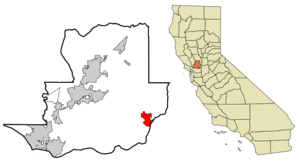
mapsize = 250x200px
map_caption = Location in Solano County and the state ofCalifornia
mapsize1 =
map_caption1 =
image_dot_
dot_mapsize =
dot_map_caption =
dot_x =
dot_y =
pushpin_
pushpin_label_position =
pushpin_map_caption =
pushpin_mapsize =
subdivision_type = Country
subdivision_name =United States
subdivision_type1 = State
subdivision_name1 =California
subdivision_type2 = County
subdivision_name2 = Solano
subdivision_type3 =
subdivision_name3 =
subdivision_type4 =
subdivision_name4 =
government_footnotes =
government_type =
leader_title =
leader_name =
leader_title1 =
leader_title1 = Senate
leader_name1 =Pat Wiggins (D)
leader_title2 = Assembly
leader_name2 =Lois Wolk (D)
leader_title3 = U. S. Congress
leader_name3 =Dan Lungren (R)
leader_title4 =
leader_name4 =
established_title =
established_date =
established_title2 =
established_date2 =
established_title3 =
established_date3 =
area_magnitude =
unit_pref =
area_footnotes =
area_total_km2 = 18.4
area_land_km2 = 17.5
area_water_km2 = 0.9
area_total_sq_mi = 7.2
area_land_sq_mi = 6.8
area_water_sq_mi = 0.4
area_water_percent =
area_urban_km2 =
area_urban_sq_mi =
area_metro_km2 =
area_metro_sq_mi =
area_blank1_title =
area_blank1_km2 =
area_blank1_sq_mi =
population_as_of = 2007
population_footnotes =
population_note =
population_total = 7876
population_density_km2 = 248.4
population_density_sq_mi = 634.9
population_metro =
population_density_metro_km2 =
population_density_metro_sq_mi =
population_urban =
population_density_urban_km2 =
population_density_urban_sq_mi =
population_blank1_title =
population_blank1 =
population_density_blank1_km2 =
population_density_blank1_sq_mi =
timezone = PST
utc_offset = -8
timezone_DST = PDT
utc_offset_DST = -7
latd = 38 |latm = 9 |lats = 50 |latNS = N
longd = 121 |longm = 41 |longs = 45 |longEW = W
elevation_footnotes =
elevation_m = 6
elevation_ft = 20
postal_code_type =ZIP code
postal_code = 94571
area_code = 707
blank_name = FIPS code
blank_info = 06-60984
blank1_name = GNIS feature ID
blank1_info = 0277585
website =
footnotes =Rio Vista is a city located in the eastern end of
Solano County, California , on theSacramento River , in theSacramento River Delta region [ [http://www.rio-vista-ca.com/ The City of Rio Vista Website] , Retrieved onJuly,26 2008 ] . The population was 4,571 at the 2000 Census.Rio Vista was visited by a lost
Humpback whale in 1985, despite being 60 miles (100 kilometers) upriver from thePacific Ocean . The young whale, nicknamed "Humphrey", attracted throngs of curiosity seekers before he was eventually guided back to sea by rescuers. Again in May 2007, Humpbacks were sighted in Rio Vista. "Delta" and "Dawn," mother and calf, stopped at least twice in the river near the town.Rio Vista is home to the annual
Bass Festival in October.Geography
Rio Vista is located at coor dms|38|9|50|N|121|41|45|W|city (38.163913, -121.695849)GR|1.
Rio Vista is approximately 60 miles (100 kilometers) northeast of
San Francisco , on theSacramento River in theSacramento River Delta .According to the
United States Census Bureau , the city has a total area of 7.1square mile s (18.4km² ), of which, 6.8 square miles (17.5 km²) of it is land and 0.4 square miles (0.9 km²) of it (5.06%) is water.Demographics
As of 2007, there were 7,876 people, 1,881 households, and 1,286 families residing in the city. The population is predicted to be 22,000 by 2020. The
population density was 676.9 people per square mile (261.5/km²). There were 1,974 housing units at an average density of 292.3/sq mi (112.9/km²). The racial makeup of the city was 88.34% White, 1.18% African American, 0.92% Native American, 1.60% Asian, 0.02% Pacific Islander, 4.09% from other races, and 3.85% from two or more races. Hispanic or Latino of any race were 11.42% of the population.There were 1,881 households, out of which 29.0% had children under the age of 18 living with them, 55.9% were married couples living together, 8.7% had a female householder with no husband present, and 31.6% were non-families. 26.4% of all households were made up of individuals and 13.9% had someone living alone who was 65 years of age or older. The average household size was 2.43 and the average family size was 2.92.
In the city the population was spread out with 25.0% under the age of 18, 6.1% from 18 to 24, 25.6% from 25 to 44, 23.6% from 45 to 64, and 19.7% who were 65 years of age or older. The median age was 41 years. For every 100 females there were 95.4 males. For every 100 females age 18 and over, there were 92.4 males.
The median
income for a household in the city was $44,534, and the median income for a family was $52,007. Males had a median income of $43,458 versus $28,665 for females. Theper capita income for the city was $24,627. About 6.6% of families and 10.2% of the population were below thepoverty line , including 17.7% of those under age 18 and 2.5% of those age 65 or over.Industry
Natural gas was discovered in the Rio Vista area in 1936 [ [http://www.rosettaresources.com/FocusCalifornia.html Natural gas was discovered in the Rio Vista area in 1936] , Retrieved on
July 26, 2008 ] and the Rio Vista Field became a major source of employment for the remainder of the 20th century. Although it is still being worked there has been a growth in agriculture, manufacturing and tourism. Rio Vista is home to the largest American producer of Belgian Endive [ [http://www.endive.com/story_overview.cfm Endive World] , Retrieved onJuly,26 2008 ] in the USA.Craig Breedlove , five-time world land speed record holder, lives and has an engineering facility in the city.The city is served by
Rio Vista Municipal Airport and is on CA-12 between Fairfield, CA and Lodi, CA. CA-12 crosses the Sacramento River via the Helen Madere Memorial Bridge, colloquially known as the Rio Vista Bridge.References
External links
* [http://www.rio-vista-ca.com/ The City of Rio Vista Website]
* [http://www.riovista.org Rio Vista Chamber of Commerce]
* [http://www.endive.com/story_overview.cfm Endive World]
* [http://avatoo.com/california/sacramento_river_delta_rio_vista_california/ Photo Gallery of Rio Vista and the Sacramento River Delta]
* [http://www.rosettaresources.com/FocusCalifornia.html Rio Vista Field]
Wikimedia Foundation. 2010.