- California State Route 12
Infobox road
state=CA
type=SR
route=12
section=312
maint=Caltrans 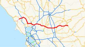
length_mi=140.64
length_ref= [http://www.dot.ca.gov/hq/structur/strmaint/brlog2.htm January 1, 2006 California Log of Bridges on State Highways] ]
length_round=2
established=1934 [http://cahighways.org/009-016.html#012 California Highways: State Route 12] ]
direction_a=West
terminus_a=jct|state=CA|SR|116 in Sebastopol
junction=jct|state=CA|US|101 in Santa Rosa
jct|state=CA|SR|29 near Napa
jct|state=CA|I|80 near Fairfield
jct|state=CA|SR|99 in Lodi
direction_b=East
terminus_b=jct|state=CA|SR|49 at San Andreas
previous_type=I
previous_route=10
next_type=SR
next_route=13
commons=categoryState Route 12 is a
state highway in theU.S. state ofCalifornia that travels in an east-west direction from Sebastopol in Sonoma County to State Route 49 just north of San Andreas in Calaveras County. It is constructed tofreeway standards from the Fulton Road/South Wright Road stoplight in Santa Rosa, to its partial interchange with Farmers Lane (also in Santa Rosa).This route is part of the
California Freeway and Expressway System [http://www.leginfo.ca.gov/cgi-bin/displaycode?section=shc&group=00001-01000&file=250-257 CA Codes (shc:250-257)] ] and is eligible for the State Scenic Highway System [http://www.leginfo.ca.gov/cgi-bin/displaycode?section=shc&group=00001-01000&file=260-284 CA Codes (shc:260-284)] ] .Route description
State Route 12 overlaps with Interstate 80 near Fairfield from near I-80's junction (the Cordelia Junction) with Interstate 680, to just southwest of Fairfield near the Budweiser plant. Entering
Sonoma Valley it proceeds north through theSonoma Creek watershed, with a crossing ofCalabazas Creek ; Route 12 exits the Sonoma Valley with Mount Hood dominating the skyline on the east. Further west State Route 12 crossesSanta Rosa Creek in the eastern part of the city of Santa Rosa. Just east of the Santa Rosa downtown it crosses Brush Creek and makes a ninety degree left turn at Farmers Lane. Proceeding west from Farmers Lane, State Route 12 attains a freeway status for a length of about four miles up to approximately the western city limit of the city of Santa Rosa. It has freeway interchanges with U.S. Route 101 in Santa Rosa, with I-80/I-680 (West) near Fairfield, with I-80 (East) near Fairfield with Interstate 5 outside of Lodi, and with California (former US) State Route 99 in Lodi.History
Before the 1964 renumbering, this route was signed as Sign Route 12 for most of its length. However, SR 12 was designated as LRN 51 from SR 116 to SR 121 before the 1964 renumbering. Portions of the route from SR 29 to I-80 ran concurrently with State Route 29 or with State Route 37; this was also LRN 8 and a former routing of U.S. Route 40. The portion from I-80 to then-US 99 was designated as LRN 53 in 1919; from US 99 to SR 49, it was designated as LRN 24. [http://www.cahighways.org/009-016.html#012 California Highways (www.cahighways.org): Routes 9 through 16] ]
In 1976, the discontinuity resulting from the concurrency with State Route 84 was removed.
Future aspirations
Plans call for a western extension of its western terminus to State Route 1 near Bodega Bay. Plans also call for Route 12 to be built from Farmers Lane to Melita Road, however this project was delayed due to community opposition. There will be interchanges at Yulupa Avenue, Summerfield Road, Channel Drive and Sonoma Highway.
Major intersections and exit list
:"Note: Except where prefixed with a letter,
postmile s were measured in 1964, based on the alignment as it existed at that time, and do not necessarily reflect current mileage. The numbers reset at county lines; the start and end postmiles in each county are given in the county column."Other names
Route 12 has the following names, as designated by various state laws: [cite book | url=http://www.dot.ca.gov/hq/tsip/hseb/products/Named_Freeways.pdf | title=2007 Named Freeways, Highways, Structures and Other Appurtenances in California | publisher=
Caltrans | pages=122-123 | accessdate=2007-03-28]*Luther Burbank Memorial Highway: From Santa Rosa to Sebastopol. Named for botanist
Luther Burbank .
*Officer Rick Charles Cromwell Memorial Freeway: From Lower Sacramento Road to Route 99 at the Lodi city limits.
*Valley of the Moon Scenic RouteFact|date=December 2007Route 12 also has the following names:
*"Jameson Canyon Road:" between Route 29 and Interstate 80. [ [http://www.solanolinks.com/projects.html#jamison STA Projects and Construction: Highway 12 - Jameson Canyon] . Solano Transportation Authority. Accessed on2007-10-01 .]
*"Rio Vista Highway:" from Interstate 80 to Route 160 east of Rio Vista. [ [http://www.google.com/search?q=cache:dqs8YnubzREJ:cad.chp.ca.gov/sa_list.asp%3Fcenterin%3DGGCCstyle%3Dl+%22Rio+Vista+Hwy%22&hl=en&ct=clnk&cd=7&gl=us&client=firefox-a California Highway Patrol: CADWEB] Name from CHP traffic reports. Archived on Google cache on2007-09-24 . Accessed on2007-10-01 .] [ [http://maps.google.com/maps?f=q&hl=en&geocode=&q=%22Rio+Vista+Hwy%22&sll=38.18356,-121.79881&sspn=0.181078,0.32135&ie=UTF8&ll=38.224156,-121.882324&spn=0.361953,0.6427&z=11&om=1 Google Maps] . Map of Route 12 showing Rio Vista Highway name from I-80 to SR 160. Accessed on2007-10-01 .]
*"Blood Alley:" stretch of Highway 12 that connects Lodi and Fairfield [cite book |url=http://www.recordnet.com/apps/pbcs.dll/section?Category=A_SPECIAL45 | title=Deaths on Highway 12 | publisher=San Joaquin Record All Eyes on Blood Alley. Recordnet.com. Accessed on2008-05-12 .]
=Rio Vista Bridge and the "Wayward Whales"=Highway 12 crosses the
Sacramento River at Rio Vista. This stretch of river has twice been the site of much-publicized inland excursions by humpback whales, presumably veering off course while making their annual migrations along the Pacific coast. In 1985Humphrey the whale swam about as far as the Rio Vista Bridge. In 2007 a humpback mother and calf circled for several days just upstream of the bridge, seemingly reluctant to pass under it again after having spent the previous three or four weeks upriver near Sacramento.References

Wikimedia Foundation. 2010.