- National Register of Historic Places listings in Tarrant County, Texas
-
List of Registered Historic Places in Tarrant County, Texas
This is intended to be a complete list of properties and districts listed on the National Register of Historic Places in Tarrant County, Texas. The locations of National Register properties and districts (at least for all showing latitude and longitude coordinates below) may be seen in a Google map by clicking on "Map of all coordinates".[1]
-
- This National Park Service list is complete through NPS recent listings posted November 10, 2011.[2]
[3] Landmark name [4] Image Date listed Location City or town Summary 1 Allen Chapel AME Church 
October 18, 1984 116 Elm St.
32°45′32″N 97°19′38″W / 32.758889°N 97.327222°WFort Worth 2 American Airways Hangar and Administration Building 
April 16, 2008 201 Aviation Wy
32°45′03″N 97°19′56″W / 32.750833°N 97.332222°WFort Worth 3 Neil P. Anderson Building 
March 8, 1978 411 W. 7th St.
32°45′03″N 97°19′56″W / 32.750833°N 97.332222°WFort Worth 4 Arlington Post Office 
March 9, 2000 200 W. Main St.
32°44′10″N 97°06′30″W / 32.736111°N 97.108333°WArlington 5 Stephen F. Austin Elementary School 
March 10, 1983 319 Lipscomb St.
32°44′28″N 97°19′57″W / 32.741111°N 97.3325°WFort Worth 6 Bedford School 
August 14, 1997 2400 School Ln
32°50′46″N 97°08′26″W / 32.846111°N 97.140556°WBedford 7 M. A. Benton House 
May 22, 1978 1730 6th Ave.
32°43′31″N 97°20′24″W / 32.725278°N 97.34°WFort Worth 8 Blackstone Hotel 
February 2, 1984 601 Main St.
32°45′13″N 97°19′48″W / 32.753611°N 97.33°WFort Worth 9 Botts-Fowler House 
July 1, 1999 115 N. Fourth Ave.
32°33′55″N 97°08′45″W / 32.565278°N 97.145833°WMansfield 10 Andrew "Cap" and Emma Doughty Bratton House 
May 22, 2003 310 E. Broad St.
32°33′46″N 97°08′19″W / 32.562778°N 97.138611°WMansfield 11 Bryce Building 
February 23, 1984 909 Throckmorton St.
32°45′04″N 97°19′49″W / 32.751111°N 97.330278°WFort Worth 12 William J. Bryce House 
March 1, 1984 4900 Bryce Ave.
32°44′23″N 97°23′35″W / 32.739722°N 97.393056°WFort Worth 13 Buchanan-Hayter-Witherspoon House 
May 22, 2003 306 E. Broad St.
32°33′46″N 97°08′19″W / 32.562778°N 97.138611°WMansfield 14 Burk Burnett Building 
November 12, 1980 500-502 Main St.
32°45′15″N 97°19′51″W / 32.754167°N 97.330833°WFort Worth 15 Butler Place Historic District 
August 4, 2011 Roughly bounded by Luella St., I.M. Terrell Way Cir. M., 19th St. & I-35 West,
32°44′59″N 97°19′01″W / 32.749722°N 97.316944°WFort Worth 16 Central Handley Historic District 
January 17, 2002 Roughly bounded by E. Lancaster Ave., Forest Ave., Kerr St., and Handley Dr.
32°43′58″N 97°13′08″W / 32.732778°N 97.218889°WFort Worth 17 Lester H. and Mabel Bryant Chorn House May 22, 2003 303 E. Broad St.
32°33′48″N 97°08′21″W / 32.563333°N 97.139167°WMansfield 18 Cotton Belt Railroad Industrial Historic District 
September 4, 1997 Along RR tracks, roughly bounded by Hudgins, Dooley, and Dallas Sts.
32°56′00″N 97°04′42″W / 32.933333°N 97.078333°WGrapevine 19 Eddleman-McFarland House 
October 18, 1979 1110 Penn St.
32°44′50″N 97°20′33″W / 32.747222°N 97.3425°WFort Worth 20 Eighth Avenue Historic District 
November 21, 2006 Bounded by 8th Ave., Pennsylvania Ave., 9th Ave., and Pruitt St.
32°44′24″N 97°20′39″W / 32.74°N 97.344167°WFort Worth 21 Electric Building 
February 10, 1995 410 W. 7th St.
32°45′05″N 97°19′58″W / 32.751389°N 97.332778°WFort Worth 22 Elizabeth Boulevard Historic District 
November 16, 1979 1001-1616 Elizabeth Blvd.
32°42′58″N 97°20′20″W / 32.716111°N 97.338889°WFort Worth 23 Fairmount-Southside Historic District 
April 5, 1990 Roughly bounded by Magnolia, Hemphill, Eighth, and Jessamine
32°43′30″N 97°20′15″W / 32.725°N 97.3375°WFort Worth Boundary increase 1998 24 First Christian Church 
October 6, 1983 612 Throckorton St.
32°45′09″N 97°19′55″W / 32.7525°N 97.331944°WFort Worth 25 First National Bank Building 
December 3, 2009 711 Houston St.
32°45′09″N 97°19′50″W / 32.752592°N 97.330572°WFort Worth 26 Flatiron Building 
March 31, 1971 1000 Houston St.
32°45′01″N 97°19′46″W / 32.750278°N 97.329444°WFort Worth 27 Fort Worth Botanic Garden 
January 29, 2009 3220 Botanic Garden Blvd.
32°44′26″N 97°21′46″W / 32.740475°N 97.362658°WFort Worth 28 Fort Worth Club Building-1916 
February 12, 1998 608-610 Main St.
32°44′41″N 97°19′50″W / 32.744722°N 97.330556°WFort Worth 29 Fort Worth Elks Lodge 124 
February 16, 1984 512 W. 4th St.
32°45′10″N 97°20′05″W / 32.752778°N 97.334722°WFort Worth 30 Fort Worth High School 
December 12, 2002 1015 S. Jennings Ave.
32°44′08″N 97°19′46″W / 32.735556°N 97.329444°WFort Worth 31 Fort Worth Public Market 
January 5, 1984 1400 Henderson St.
32°44′39″N 97°20′16″W / 32.744167°N 97.337778°WFort Worth 32 Fort Worth Stockyards Historic District 
June 29, 1976 Roughly bounded by 23rd, Houston, and 28th Sts., and railroad
32°47′25″N 97°20′46″W / 32.790278°N 97.346111°WFort Worth 33 Fort Worth US Courthouse 
April 25, 2001 501 W. 10th St.
32°44′56″N 97°20′02″W / 32.748889°N 97.333889°WFort Worth 34 Grand Avenue Historic District 
March 1, 1990 Roughly Grand Ave. from Northside to Park
32°46′20″N 97°21′38″W / 32.772222°N 97.360556°WFort Worth 35 Grapevine Commercial Historic District 
March 9, 1992 404-432 S. Main St.
32°56′12″N 97°04′43″W / 32.936667°N 97.078611°WGrapevine Boundary increase I 1997
Boundary increase II 2002-12-1936 James E. Guinn School 
May 12, 1998 1200 South Freeway
32°43′54″N 97°19′15″W / 32.731667°N 97.320833°WFort Worth 37 Gulf, Colorado and Sante Fe Railroad Passenger Station 
October 15, 1970 1601 Jones St.
32°44′57″N 97°19′26″W / 32.749167°N 97.323889°WFort Worth 38 Henderson Street Bridge 
March 21, 2011 Henderson Street at the Clear Fork of the Trinity River
32°45′29″N 97°20′32″W / 32.757986°N 97.342222°WFort Worth Historic Bridges of Texas MPS 39 Heritage Park Plaza 
May 10, 2010 W Bluff St at Main St
32°45′29″N 97°20′04″W / 32.758056°N 97.334306°WFort Worth 40 Alexander Hogg School 
December 12, 2002 900 St. Louis Ave.
32°44′13″N 97°19′43″W / 32.736944°N 97.328611°WFort Worth 41 Hotel Texas 
July 3, 1979 815 Main St.
32°45′09″N 97°19′45″W / 32.7525°N 97.329167°WFort Worth 42 Hutcheson-Smith House 
August 2, 1984 312 N. Oak St.
32°44′24″N 97°06′33″W / 32.74°N 97.109167°WArlington 43 Johnson-Elliott House 
May 10, 1984 3 Chase Ct.
32°43′31″N 97°19′54″W / 32.725278°N 97.331667°WFort Worth 44 Knights of Pythias Building 
April 28, 1970 315 Main St.
32°45′19″N 97°19′52″W / 32.755278°N 97.331111°WFort Worth 45 Kress Building 
April 4, 2007 604 Main St.
32°45′12″N 97°19′52″W / 32.753333°N 97.331111°WFort Worth 46 Leuda-May Historic District 
March 30, 2005 301-311 W. Leuda and 805-807 May Sts.
32°44′14″N 97°19′44″W / 32.737222°N 97.328889°WFort Worth 47 Ralph Sandiford and Julia Boisseau Man House May 22, 2003 604 W. Broad St.
32°33′55″N 97°08′57″W / 32.565297°N 97.149072°WMansfield 48 Marine Commercial Historic District 
February 9, 2001 Roughly defined by N. Main St., bet. N. Side Dr. and N. 14th St.
32°46′39″N 97°20′46″W / 32.7775°N 97.346111°WFort Worth 49 Markeen Apartments 
May 2, 2001 210-14 St. Louis Ave. and 406-10 W. Daggett Ave.
32°44′31″N 97°19′41″W / 32.741944°N 97.328056°WFort Worth 50 Marrow Bone Spring Archeological Site November 21, 1978 Address Restricted Arlington 51 Masonic Widows and Orphans Home Historic District January 28, 1992 Roughly bounded by E. Berry St., Mitchell Blvd., Vaughn St., Wichita St. and Glen Garden Dr
32°42′33″N 97°17′00″W / 32.709167°N 97.283333°WFort Worth 52 Miller Manufacturing Company Building 
October 28, 2010 311 Bryan Ave.
32°44′28″N 97°19′29″W / 32.741111°N 97.324722°WFort Worth 53 Montgomery Ward and Company Building 
November 19, 1998 801 Grove St.
32°45′14″N 97°19′34″W / 32.753889°N 97.326111°WFort Worth 54 Morning Chapel Colored Methodist Episcopal Church 
August 27, 1999 901 E. Third St.
32°45′30″N 97°19′30″W / 32.758333°N 97.325°WFort Worth 55 Thomas J. and Elizabeth Nash Farm 
October 28, 2010 626 Ball St.
32°56′03″N 97°05′09″W / 32.934167°N 97.085833°WGrapevine 56 Near Southeast Historic District 
April 26, 2002 Roughly bounded by New York Ave., E. Terrell Ave., former I&GN Raiway, Verbena St., and N side of E. Terrell Ave,
32°43′58″N 97°14′15″W / 32.732778°N 97.2375°WFort Worth 57 North Fort Worth High School 
February 2, 1995 600 Park St.
32°46′52″N 97°21′24″W / 32.781111°N 97.356667°WFort Worth 58 Oakhurst Historic District 
February 24, 2010 Roughly bounded by Yucca Ave., Sylvania Ave., Watauga Ave., and Oakhurst Scenic Dr.
32°47′08″N 97°18′48″W / 32.785556°N 97.313333°WFort Worth 59 Old Town Historic District 
March 23, 2000 Roughly bounded by Sanford, Elm, North, Prairie and Oak Sts.
32°44′27″N 97°06′05″W / 32.740833°N 97.101389°WArlington 60 Original Town Residential Historic District 
July 10, 1998 Roughly bounded by Texas, Austin, Hudgins and Jenkins Sts.
32°56′11″N 97°04′28″W / 32.936389°N 97.074444°WGrapevine 61 Our Lady of Victory Academy 
August 20, 2004 801 W. Shaw St.
32°42′11″N 97°19′59″W / 32.703056°N 97.333056°WFort Worth 62 Our Mother of Mercy Catholic Church and Parsonage 
July 22, 1999 1100 and 1104 Evans Ave.
32°43′57″N 97°19′05″W / 32.7325°N 97.318056°WFort Worth 63 Our Mother of Mercy School 
June 15, 2006 801 Verbena St.
32°44′06″N 97°19′08″W / 32.735°N 97.318889°WFort Worth 64 Paddock Viaduct 
March 15, 1976 Main St.
32°45′36″N 97°20′05″W / 32.76°N 97.334722°WFort Worth 65 Petroleum Building 
December 3, 2009 210 W. 6th St.
32°45′10″N 97°19′54″W / 32.752828°N 97.331786°WFort Worth 66 Pollock-Capps House 
June 19, 1972 1120 Penn St.
32°44′49″N 97°20′33″W / 32.746944°N 97.3425°WFort Worth 67 Dr. Arvel and Faye Ponton House 
November 29, 2006 1208 Mistletoe Dr.
32°43′50″N 97°21′22″W / 32.730556°N 97.356111°WFort Worth 68 Riverside Public School 
December 30, 1999 2629 LaSalle St.
32°45′29″N 97°18′19″W / 32.758056°N 97.305278°WFort Worth 69 Rogers-O'Daniel House July 5, 1985 2230 Warner Rd.
32°42′35″N 97°20′50″W / 32.709722°N 97.347222°WFort Worth 70 Saint James Second Street Baptist Church 
July 22, 1999 210 Harding St.
32°45′34″N 97°19′28″W / 32.759444°N 97.324444°WFort Worth 71 Sanger Brothers Building 
June 3, 1994 410-412 Houston St.
32°45′15″N 97°19′55″W / 32.754167°N 97.331944°WFort Worth 72 Marshall R. Sanguinet House 
June 7, 1983 4729 Collinwood Ave.
32°44′14″N 97°23′26″W / 32.737222°N 97.390556°WFort Worth 73 Thomas and Marjorie Shaw House 
August 22, 1995 2404 Medford Ct. E.
32°43′03″N 97°21′24″W / 32.7175°N 97.356667°WFort Worth 74 Sinclair Building 
January 7, 1992 512 Main St.
32°45′14″N 97°19′51″W / 32.753889°N 97.330833°WFort Worth 75 South Center Street Historic District 
May 1, 2003 500-600 blks of S. Center St.
32°43′53″N 97°06′24″W / 32.731389°N 97.106667°WArlington 76 South Main St. Historic District 
December 3, 2009 104, 108, 126, & 200 blocks of S. Main St.
32°44′33″N 97°19′33″W / 32.7425°N 97.325903°WFort Worth 77 South Side Masonic Lodge No. 1114 
January 3, 1985 1301 W. Magnolia
32°43′48″N 97°20′16″W / 32.73°N 97.337778°WFort Worth 78 St. Mary of the Assumption Church 
May 10, 1984 501 W. Magnolia Ave.
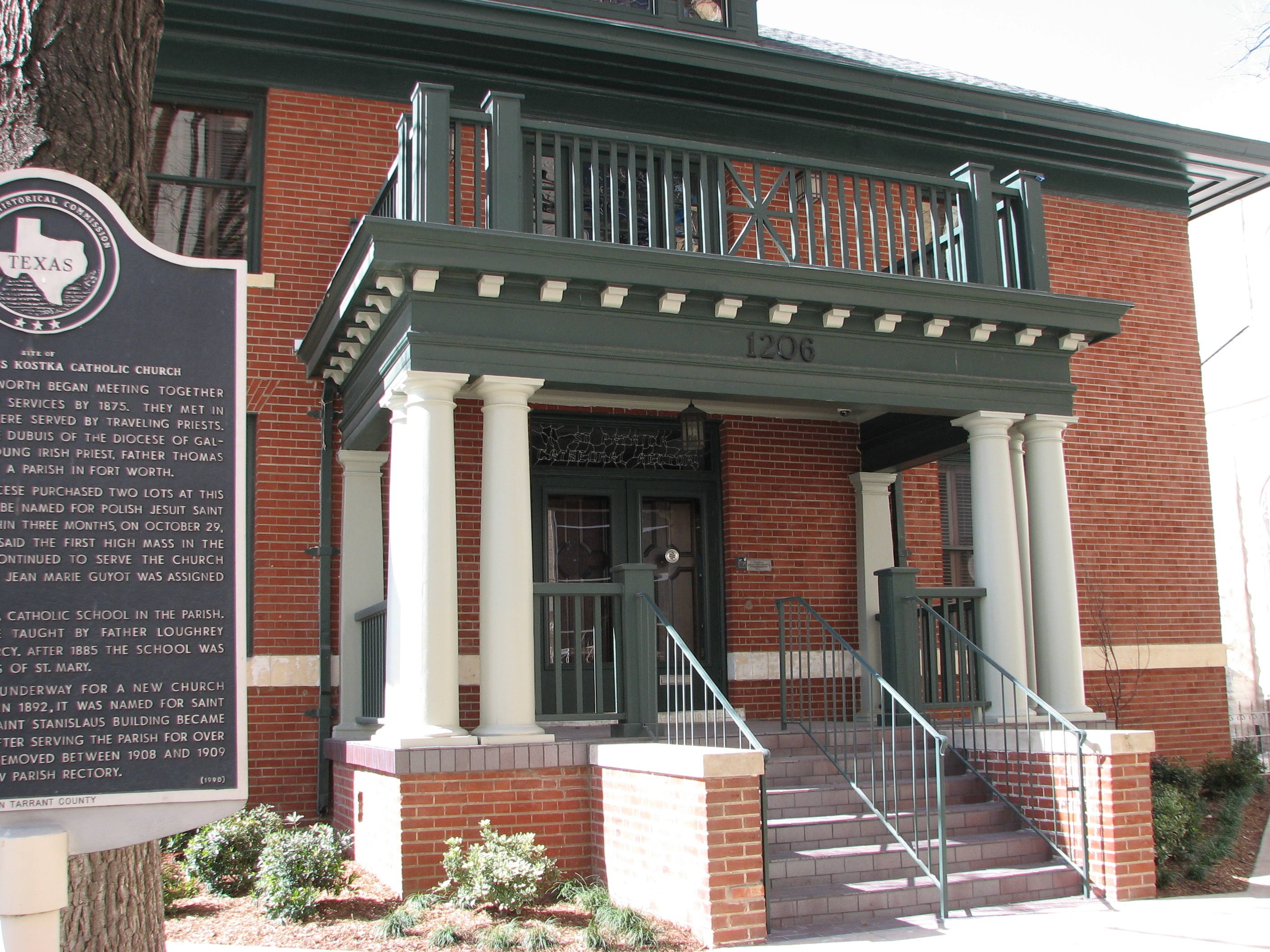
32°43′49″N 97°19′48″W / 32.730278°N 97.33°WFort Worth 79 St. Patrick Cathedral Complex 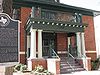
January 7, 1985 1206 Throckmorton
32°44′56″N 97°19′46″W / 32.748889°N 97.329444°WFort Worth 80 Tabernacle Baptist Church 
November 30, 1999 1801 Evans Ave.
32°43′29″N 97°19′03″W / 32.724722°N 97.3175°WFort Worth 81 Tarrant County Courthouse 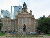
October 15, 1970 Bounded by Houston, Belknap, Weatherford, and Commerce Sts.
32°45′26″N 97°19′58″W / 32.757222°N 97.332778°WFort Worth 82 Texas and Pacific Terminal Complex 
May 26, 1978 Lancaster and Throckmorton Sts.
32°44′45″N 97°19′43″W / 32.745833°N 97.328611°WFort Worth 83 Texas Garden Clubs, Inc., Headquarters 
March 21, 2011 3111 Old Garden Rd.
32°44′09″N 97°21′52″W / 32.735764°N 97.364583°WFort Worth 84 US Post Office 
April 15, 1985 Lancaster and Jennings Ave.
32°44′46″N 97°19′45″W / 32.746111°N 97.329167°WFort Worth 85 Vandergriff Building 
July 26, 2010 100 E Division St.
32°44′20″N 97°06′24″W / 32.738819°N 97.106528°WArlington 86 Vaught House 
August 10, 2005 718 W. Abram St.
32°44′06″N 97°06′56″W / 32.735°N 97.115556°WArlington 87 W. T. Waggoner Building 
July 10, 1979 810 Houston St.
32°45′05″N 97°19′49″W / 32.751389°N 97.330278°WFort Worth 88 Wallace-Hall House 
May 22, 2003 210 S. Main St.
32°33′42″N 97°08′32″W / 32.561667°N 97.142222°WMansfield 89 Roy A. and Gladys Westbrook House 
January 8, 2009 2232 Winton Terrace W.
32°43′15″N 97°21′35″W / 32.720792°N 97.359631°WFort Worth 90 Westover Manor 
December 15, 1988 8 Westover Rd.
32°44′31″N 97°24′14″W / 32.741944°N 97.403889°WWestover Hills 91 Wharton-Scott House 
April 14, 1975 1509 Pennsylvania Ave.
32°44′16″N 97°20′32″W / 32.737778°N 97.342222°WFort Worth 92 F. W. Woolworth Building 
November 25, 1994 501 Houston St.
32°45′12″N 97°19′52″W / 32.753333°N 97.331111°WFort Worth See also
References
- ^ The latitude and longitude information provided in this table was derived originally from the National Register Information System, which has been found to be fairly accurate for about 99% of listings. For about 1% of NRIS original coordinates, experience has shown that one or both coordinates are typos or otherwise extremely far off; some corrections may have been made. A more subtle problem causes many locations to be off by up to 150 yards, depending on location in the country: most NRIS coordinates were derived from tracing out latitude and longitudes off of USGS topographical quadrant maps created under the North American Datum of 1927, which differs from the current, highly accurate WGS84 GPS system used by Google maps. Chicago is about right, but NRIS longitudes in Washington are higher by about 4.5 seconds, and are lower by about 2.0 seconds in Maine. Latitudes differ by about 1.0 second in Florida. Some locations in this table may have been corrected to current GPS standards.
- ^ "National Register of Historic Places: Weekly List Actions". National Park Service, United States Department of the Interior. Retrieved on November 10, 2011.
- ^ Numbers represent an ordering by significant words. Various colorings, defined here, differentiate National Historic Landmark sites and National Register of Historic Places Districts from other NRHP buildings, structures, sites or objects.
- ^ "National Register Information System". National Register of Historic Places. National Park Service. . http://nrhp.focus.nps.gov/natreg/docs/All_Data.html.
U.S. National Register of Historic Places Topics Lists by states Alabama • Alaska • Arizona • Arkansas • California • Colorado • Connecticut • Delaware • Florida • Georgia • Hawaii • Idaho • Illinois • Indiana • Iowa • Kansas • Kentucky • Louisiana • Maine • Maryland • Massachusetts • Michigan • Minnesota • Mississippi • Missouri • Montana • Nebraska • Nevada • New Hampshire • New Jersey • New Mexico • New York • North Carolina • North Dakota • Ohio • Oklahoma • Oregon • Pennsylvania • Rhode Island • South Carolina • South Dakota • Tennessee • Texas • Utah • Vermont • Virginia • Washington • West Virginia • Wisconsin • WyomingLists by territories Lists by associated states Other Categories:- Tarrant County, Texas
- National Register of Historic Places in Texas
- Buildings and structures in Tarrant County, Texas
-


Wikimedia Foundation. 2010.