- National Register of Historic Places listings in Fayette County, Texas
-
List of Registered Historic Places in Angelina County, Texas
This is intended to be a complete list of properties and districts listed on the National Register of Historic Places in Fayette County, Texas. The locations of National Register properties and districts (at least for all showing latitude and longitude coordinates below) may be seen in a Google map by clicking on "Map of all coordinates".[1]
-
- This National Park Service list is complete through NPS recent listings posted November 10, 2011.[2]
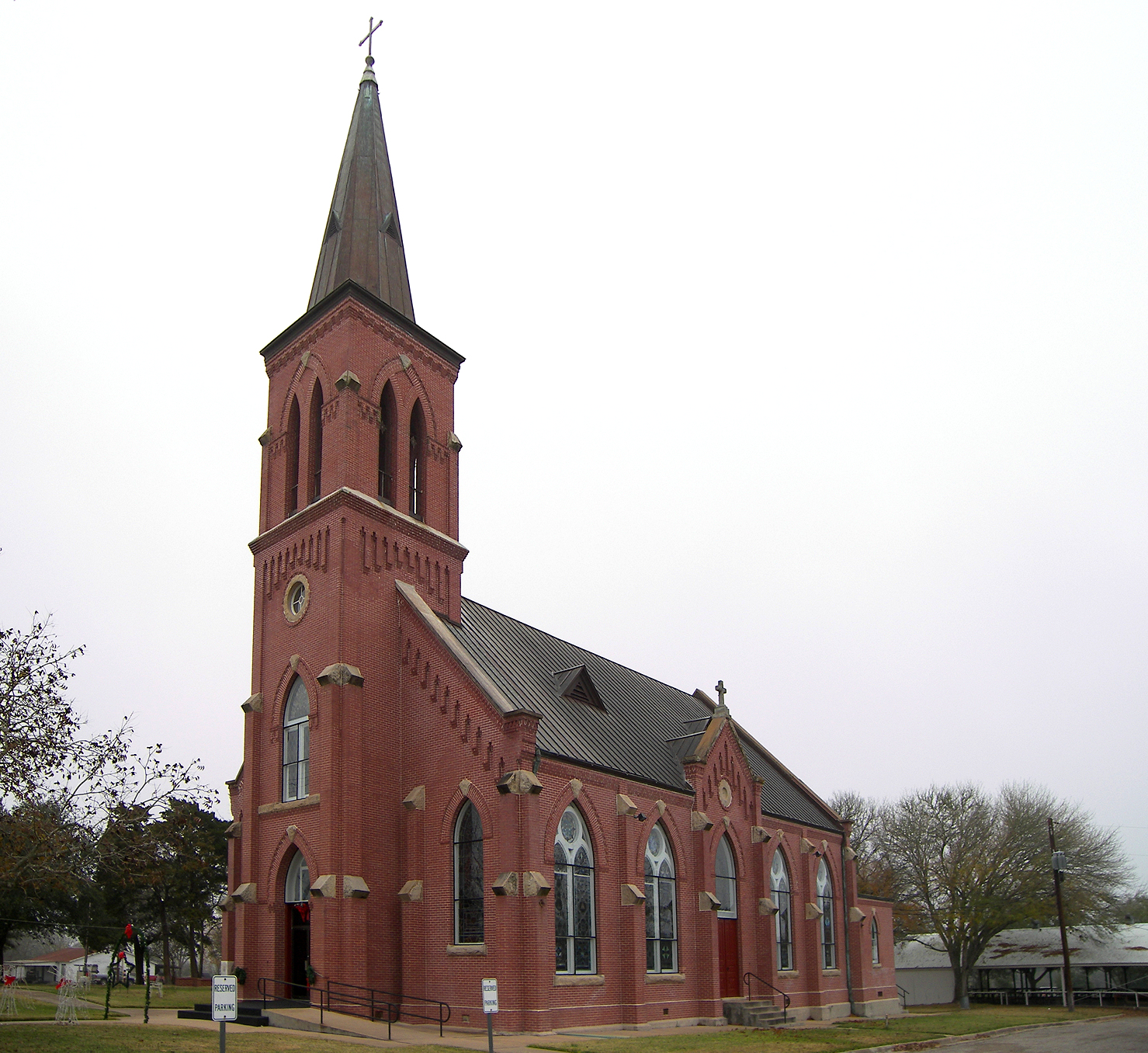
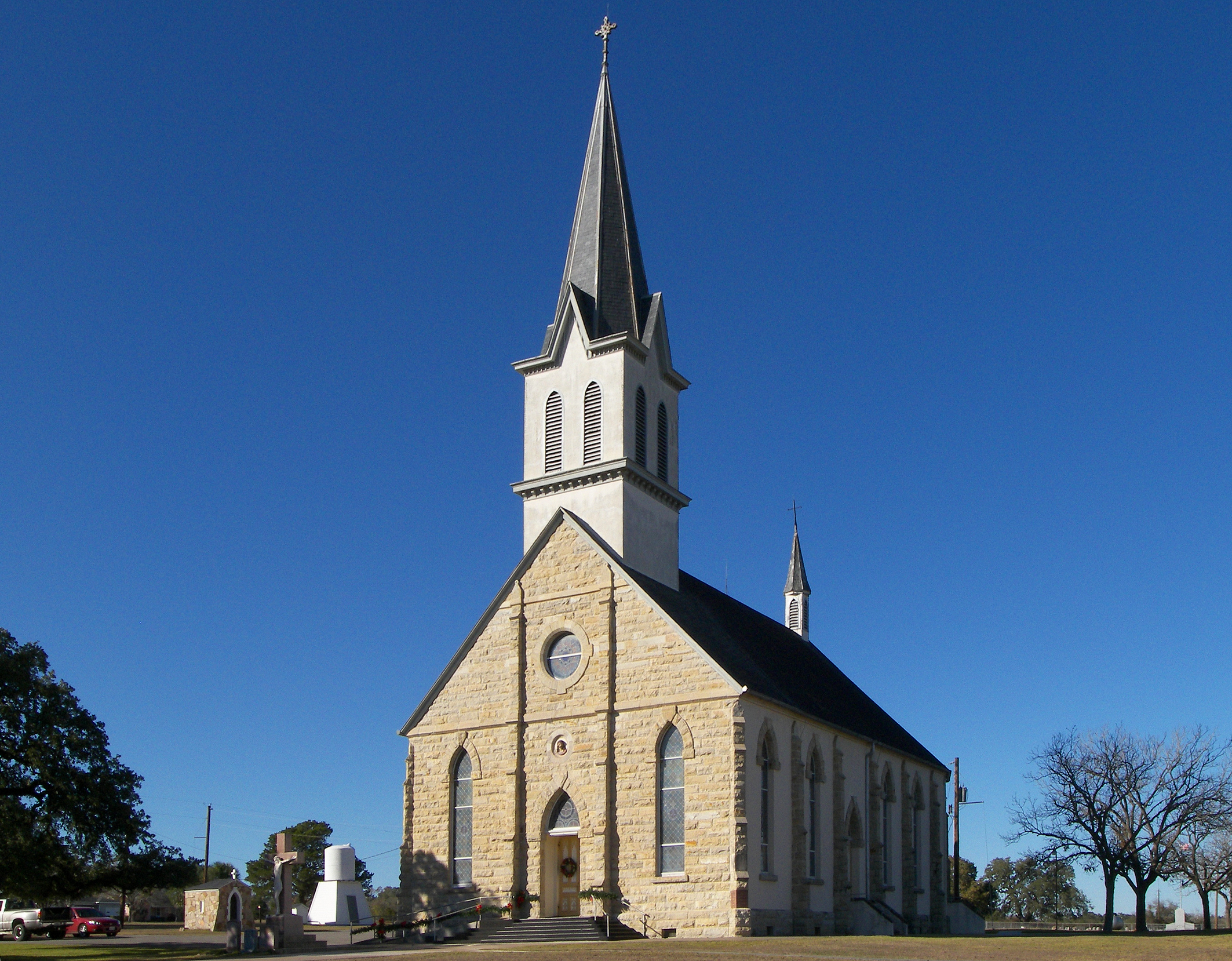
[3] Landmark name [4] Image Date listed Location City or town Summary 1 Bethlehem Lutheran Church 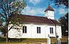
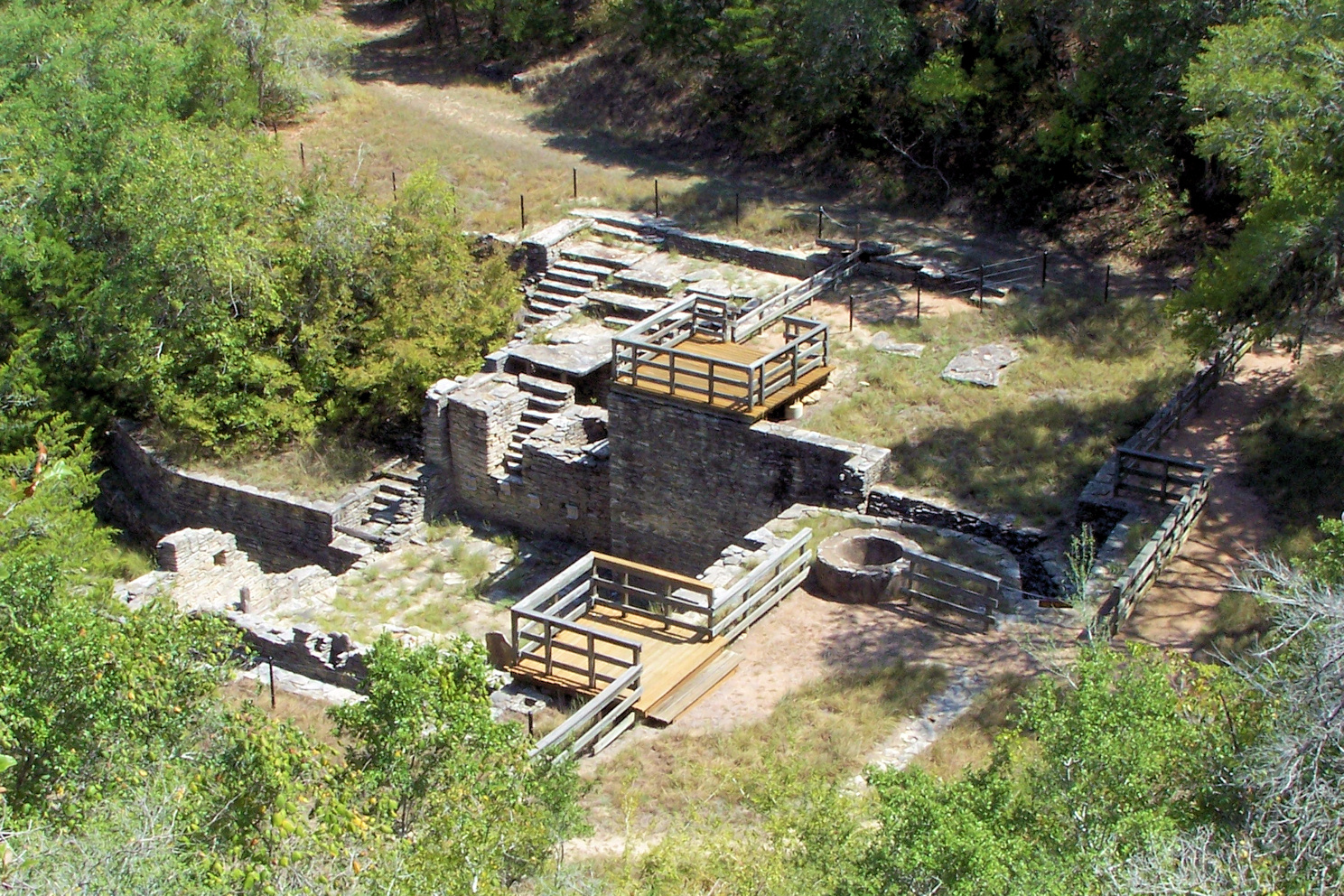
August 10, 1978 White St.
30°03′46″N 96°41′58″W / 30.062778°N 96.699444°WRound Top 2 Cummins Creek Bridge April 21, 1975 2 mi (3.2 km). NW of Round Top over Cummins Creek
30°04′07″N 96°43′09″W / 30.068611°N 96.719167°WRound Top 3 Dubina Historic District September 27, 2003 Roughly bounded by FM 1383 and Cty Rd. 480
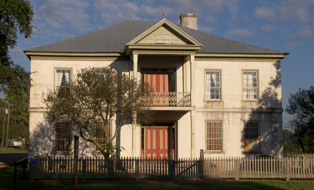
29°43′44″N 96°50′08″W / 29.728889°N 96.835556°WDubina 4 Nathaniel W. Faison House March 11, 2010 822 S. Jefferson
29°53′57″N 96°52′22″W / 29.899206°N 96.872764°WLa Grange 5 Fayette County Courthouse and Jail 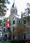
January 23, 1975 Courthouse Sq. and 104 Main St.
29°54′19″N 96°52′43″W / 29.905278°N 96.878611°WLa Grange 6 Fayette County Courthouse Square Historic District January 16, 2001 Roughly bounded by Main, Lafayette, Franklin, Colorado, Jefferson, Washington, and Crockett Sts.
29°54′17″N 96°52′39″W / 29.904722°N 96.8775°WLa Grange 7 Henry L. Kreische Brewery and House 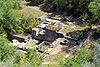
April 16, 1975 S of La Grange off U.S. 77 on Monument Hill
29°53′23″N 96°52′29″W / 29.889722°N 96.874722°WLa Grange 8 Mulberry Creek Bridge April 21, 1975 Wolters Park
29°40′27″N 96°54′39″W / 29.674167°N 96.910833°WSchulenburg Pratt pony truss bridge originally located SW of Schulenburg on Old Praha Rd. Relocated in 2001. 9 Nativity of Mary, Blessed Virgin Catholic Church 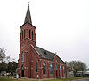
June 21, 1983 FM 2672
29°43′03″N 96°55′40″W / 29.7175°N 96.927778°WHigh Hill 10 William Neese Sr. Homestead 
February 18, 1975 On TX 237
30°01′06″N 96°43′54″W / 30.018333°N 96.731667°WWarrenton 11 Sengelmann Hall and City Meat Market Building June 18, 2009 527 and 529-533 N. Main St.
29°40′47″N 96°54′19″W / 29.679822°N 96.905228°WSchulenburg 12 Simon Pytlovany House April 14, 1975 1.5 mi (2.4 km). S of Dubina on FR 1383
29°42′45″N 96°50′20″W / 29.7125°N 96.838889°WDubina 13 Schulenburg Cotton Compress September 13, 1979 James and Main Sts.
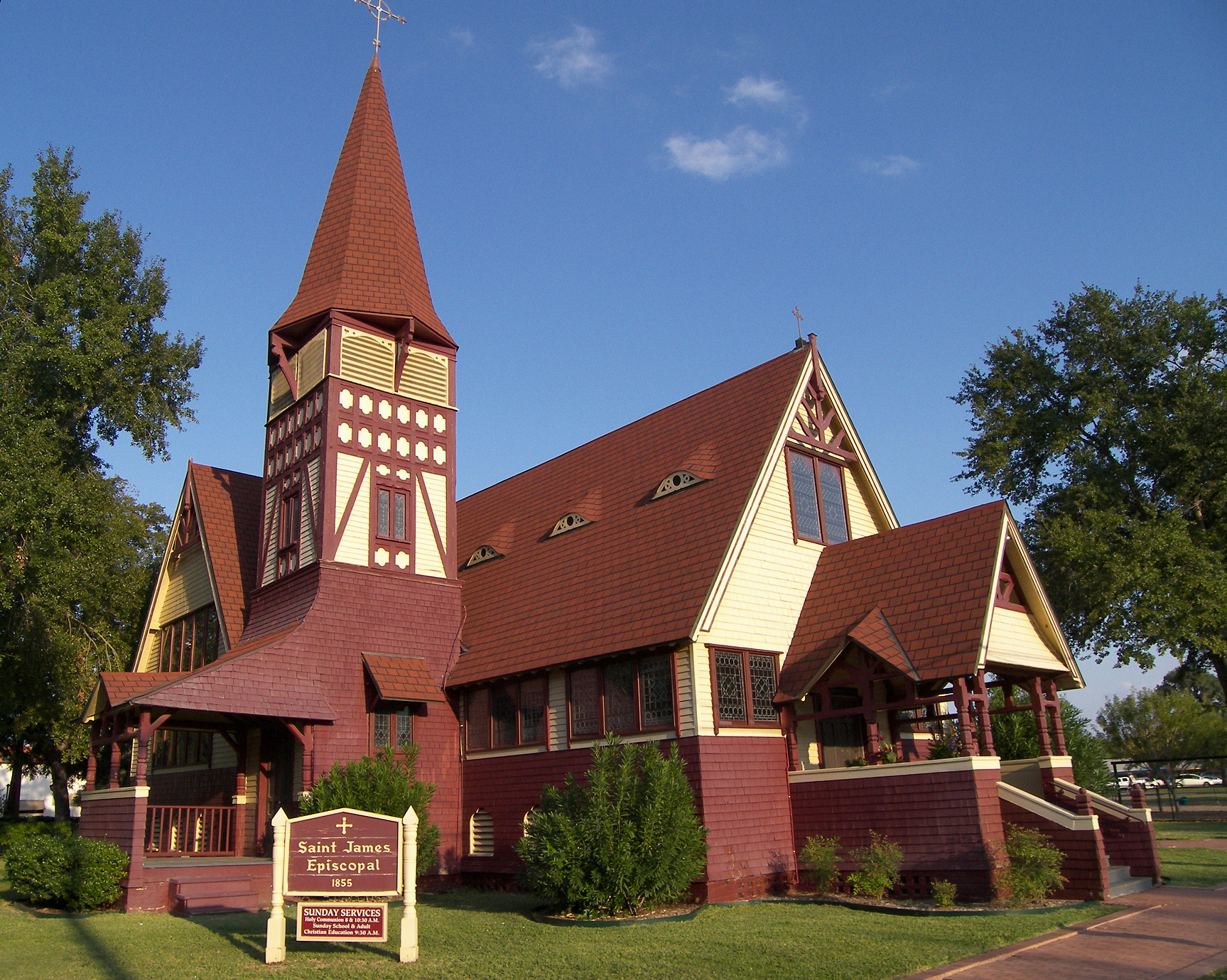
29°40′43″N 96°54′45″W / 29.678611°N 96.9125°WSchulenburg 14 St. James Episcopal Church 
June 18, 1976 Monroe and Colorado Sts.
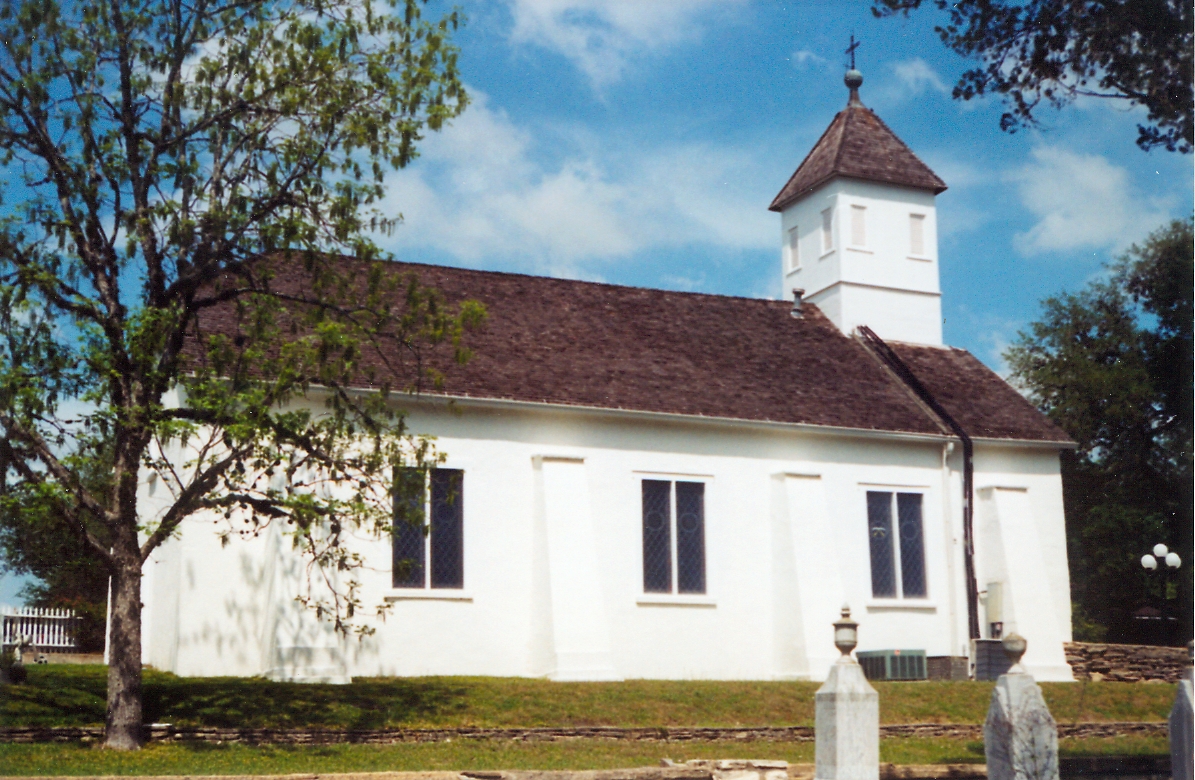
29°54′29″N 96°52′25″W / 29.908056°N 96.873611°WLa Grange 15 St. John the Baptist Catholic Church June 21, 1983 FM 1383
29°47′14″N 96°51′32″W / 29.787222°N 96.858889°WAmmannsville 16 St. Mary's Church of the Assumption 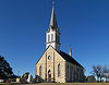
June 21, 1983 FM 1295
29°40′11″N 97°04′00″W / 29.669722°N 97.066667°WPraha 17 State Highway 71 Bridge at the Colorado River 
October 10, 1996 TX 71, .8 mi E of jct. with FM 609
29°54′05″N 96°53′12″W / 29.901389°N 96.886667°WLa Grange 18 Winedale Inn Complex 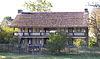
June 22, 1970 Off FM 1457
30°05′11″N 96°38′29″W / 30.086389°N 96.641389°WWinedale Now a division of The Center for American History, The University of Texas at Austin 19 Zapp Building 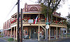
June 23, 1983 Fayette and Washington Sts.
29°54′15″N 96°40′37″W / 29.904167°N 96.676944°WFayetteville Ref. #83003139, Brick two-story Romanesque Revival mercantile building and emporium constructed in 1900. See also
- Registered Historic Places in Texas, Counties A-C
References
- ^ The latitude and longitude information provided in this table was derived originally from the National Register Information System, which has been found to be fairly accurate for about 99% of listings. For about 1% of NRIS original coordinates, experience has shown that one or both coordinates are typos or otherwise extremely far off; some corrections may have been made. A more subtle problem causes many locations to be off by up to 150 yards, depending on location in the country: most NRIS coordinates were derived from tracing out latitude and longitudes off of USGS topographical quadrant maps created under the North American Datum of 1927, which differs from the current, highly accurate WGS84 GPS system used by Google maps. Chicago is about right, but NRIS longitudes in Washington are higher by about 4.5 seconds, and are lower by about 2.0 seconds in Maine. Latitudes differ by about 1.0 second in Florida. Some locations in this table may have been corrected to current GPS standards.
- ^ "National Register of Historic Places: Weekly List Actions". National Park Service, United States Department of the Interior. Retrieved on November 10, 2011.
- ^ Numbers represent an ordering by significant words. Various colorings, defined here, differentiate National Historic Landmark sites and National Register of Historic Places Districts from other NRHP buildings, structures, sites or objects.
- ^ "National Register Information System". National Register of Historic Places. National Park Service. . http://nrhp.focus.nps.gov/natreg/docs/All_Data.html.
U.S. National Register of Historic Places Topics Lists by states Alabama • Alaska • Arizona • Arkansas • California • Colorado • Connecticut • Delaware • Florida • Georgia • Hawaii • Idaho • Illinois • Indiana • Iowa • Kansas • Kentucky • Louisiana • Maine • Maryland • Massachusetts • Michigan • Minnesota • Mississippi • Missouri • Montana • Nebraska • Nevada • New Hampshire • New Jersey • New Mexico • New York • North Carolina • North Dakota • Ohio • Oklahoma • Oregon • Pennsylvania • Rhode Island • South Carolina • South Dakota • Tennessee • Texas • Utah • Vermont • Virginia • Washington • West Virginia • Wisconsin • WyomingLists by territories Lists by associated states Other Categories:- Fayette County, Texas
- National Register of Historic Places in Texas
- Buildings and structures in Fayette County, Texas
-


Wikimedia Foundation. 2010.