- National Register of Historic Places listings in Harris County, Texas
-
List of Registered Historic Places in Harris County, Texas
This is intended to be a complete list of properties and districts listed on the National Register of Historic Places in Harris County, Texas. The locations of National Register properties and districts (at least for all showing latitude and longitude coordinates below) may be seen in a Google map by clicking on "Map of all coordinates".[1]
-
- This National Park Service list is complete through NPS recent listings posted November 10, 2011.[2]
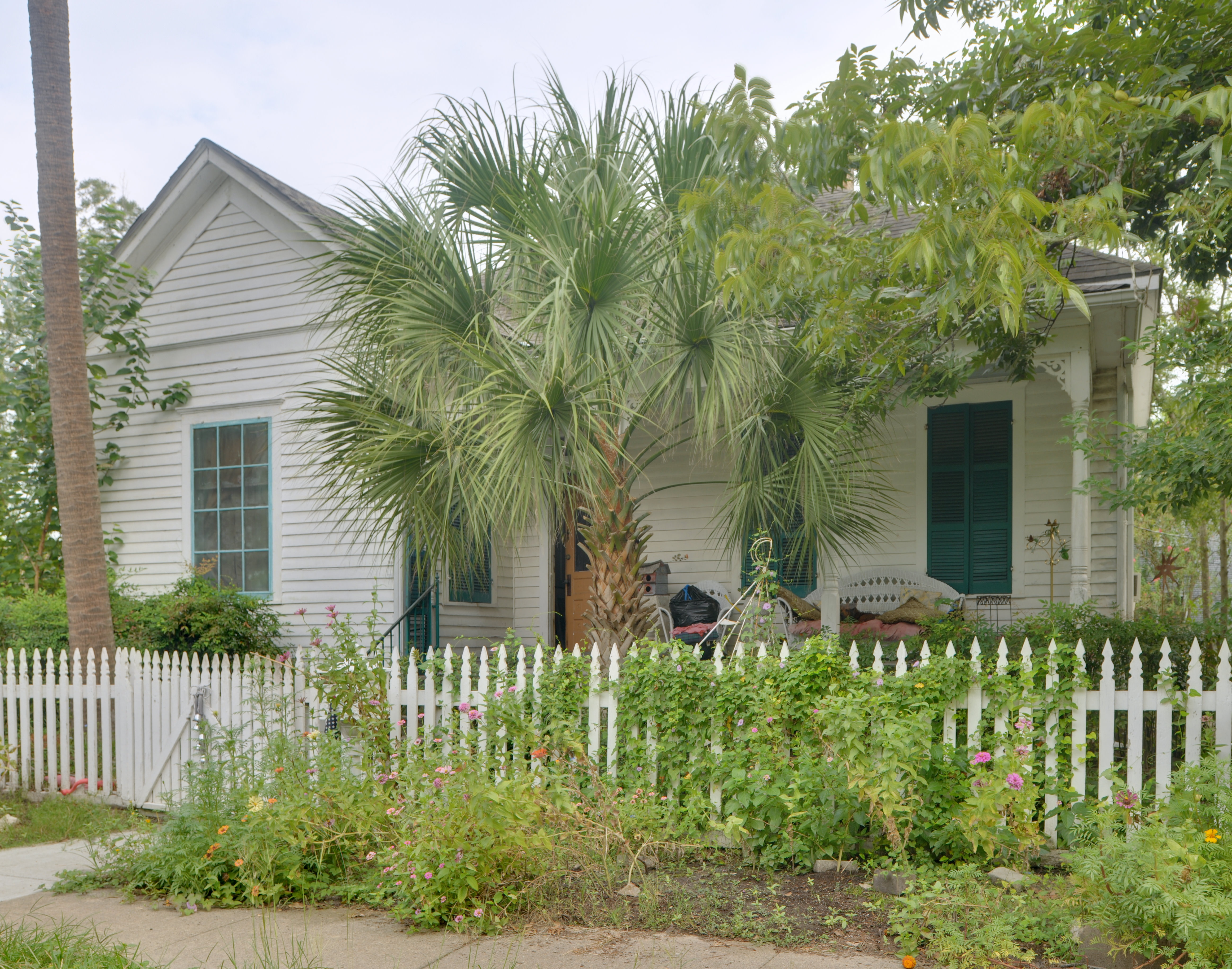
Landmark name Image Date listed Location City or Town Summary 1 1879 Houston Waterworks May 6, 1976 27 Artesian St.
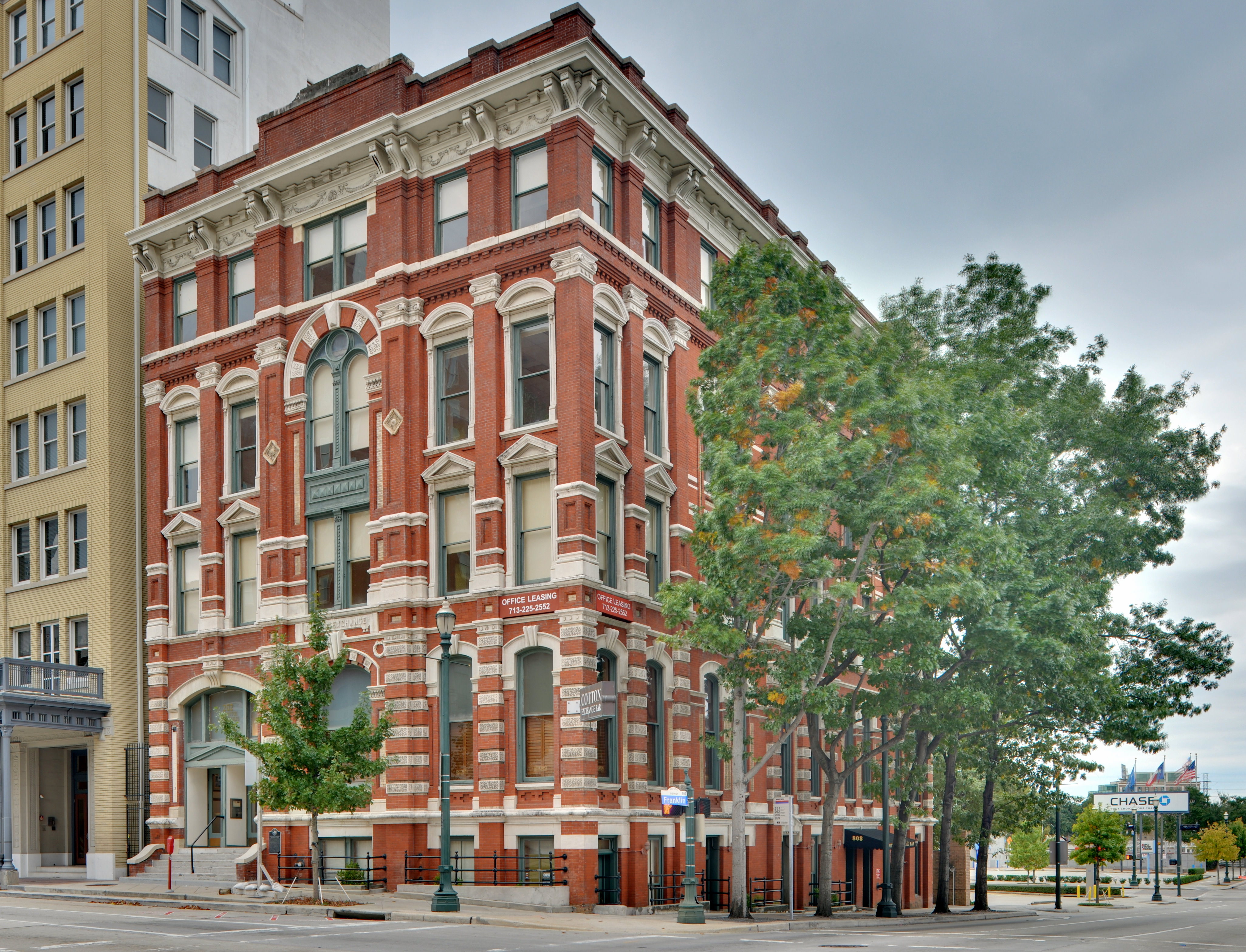
29°45′50″N 95°22′10″W / 29.76389°N 95.36944°WHouston 2 1884 Houston Cotton Exchange Building 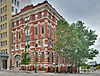
May 6, 1971 202 Travis St.
29°45′49″N 95°21′40″W / 29.76361°N 95.36111°WHouston 3 All Saints Roman Catholic Church June 22, 1983 201 E. 10th St.
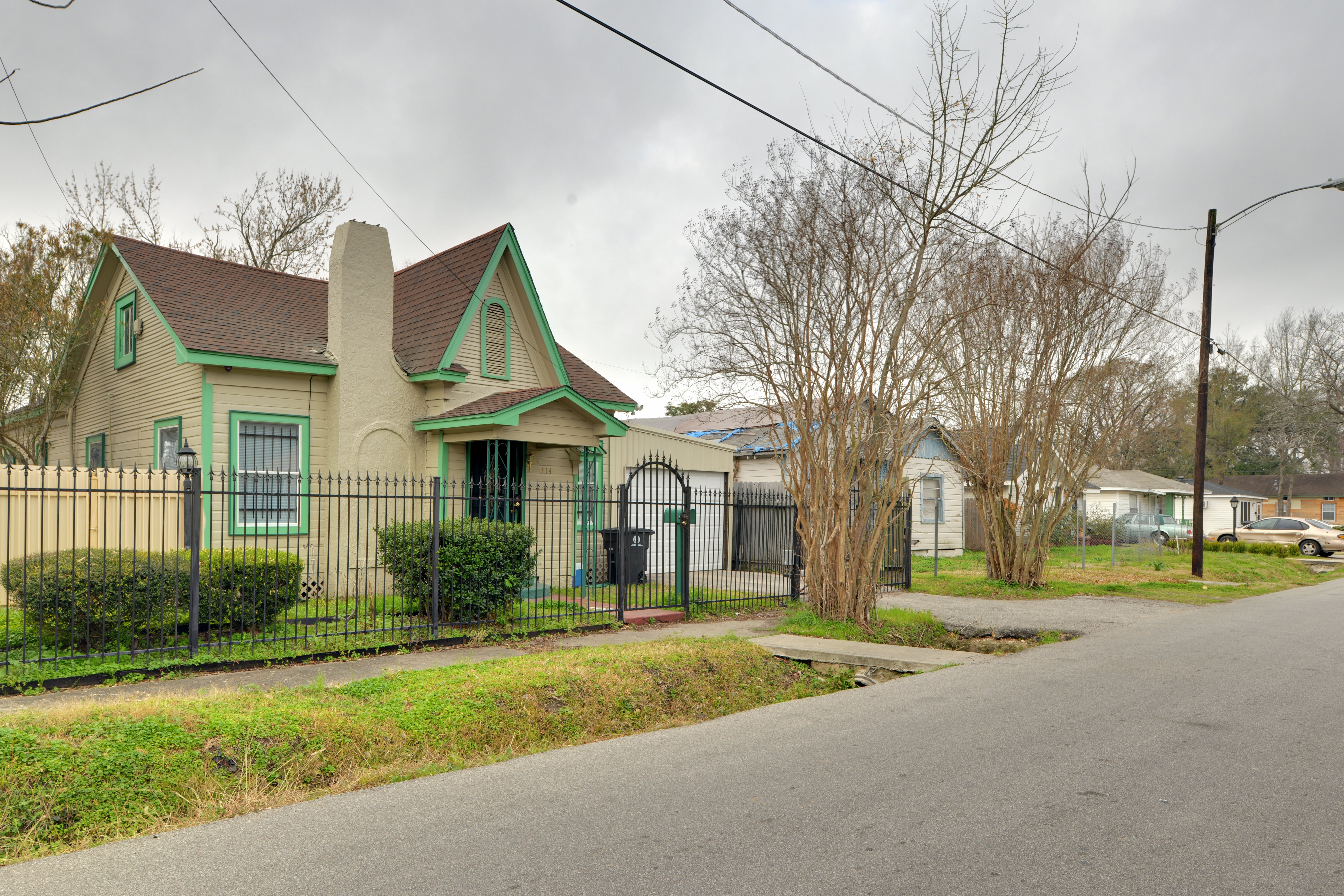
29°47′18″N 95°23′46″W / 29.78833°N 95.39611°WHouston 4 Allbach House June 22, 1983 2023 Arlington St.
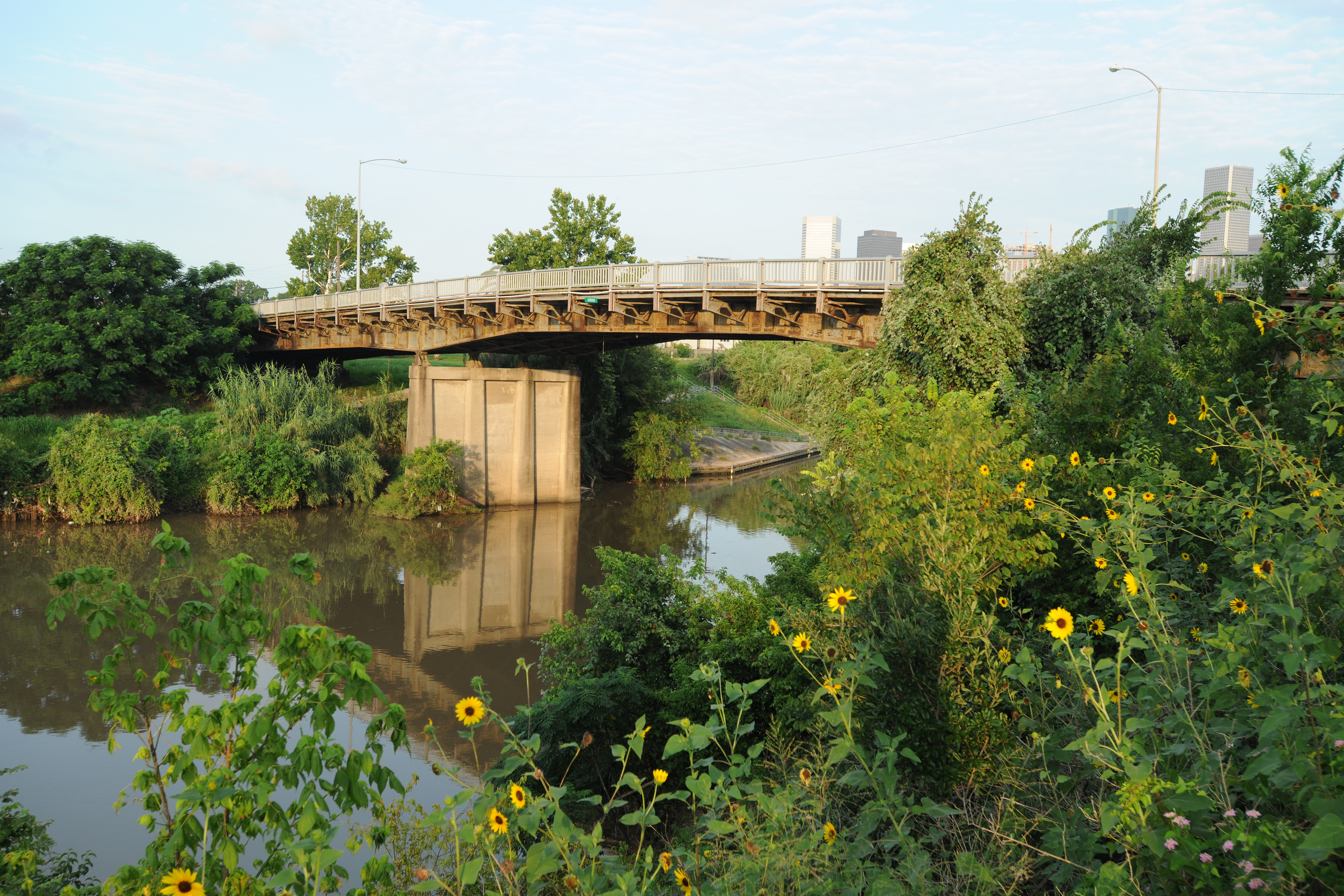
29°48′16″N 95°23′41″W / 29.80444°N 95.39472°WHouston 5 Almeda Road Bridge over Brays Bayou November 29, 2007 Almeda Rd. at Brays Bayou
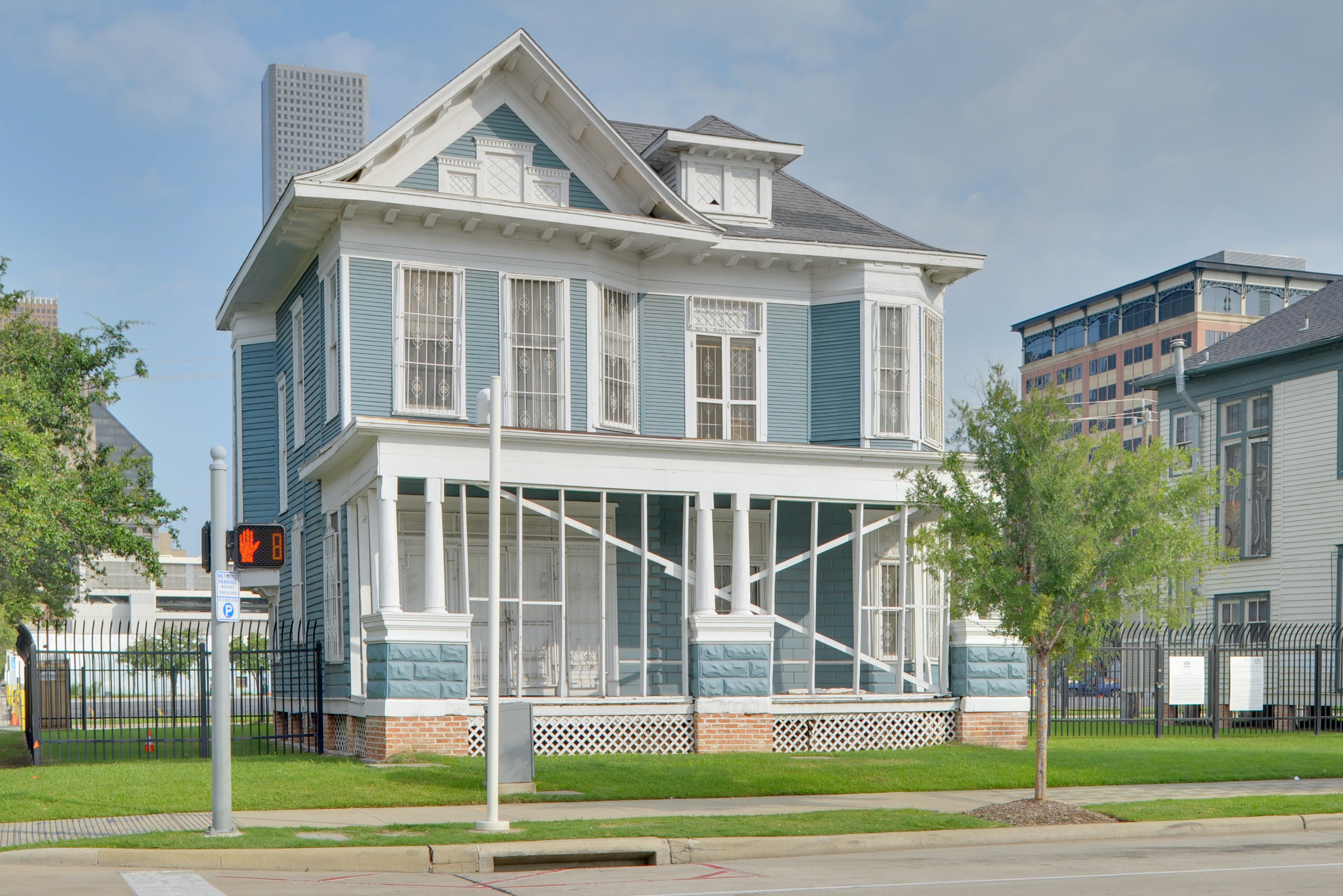
29°42′47.5″N 95°22′55.5″W / 29.713194°N 95.382083°WHouston 6 John W. Anderson House January 15, 1988 711 Columbia
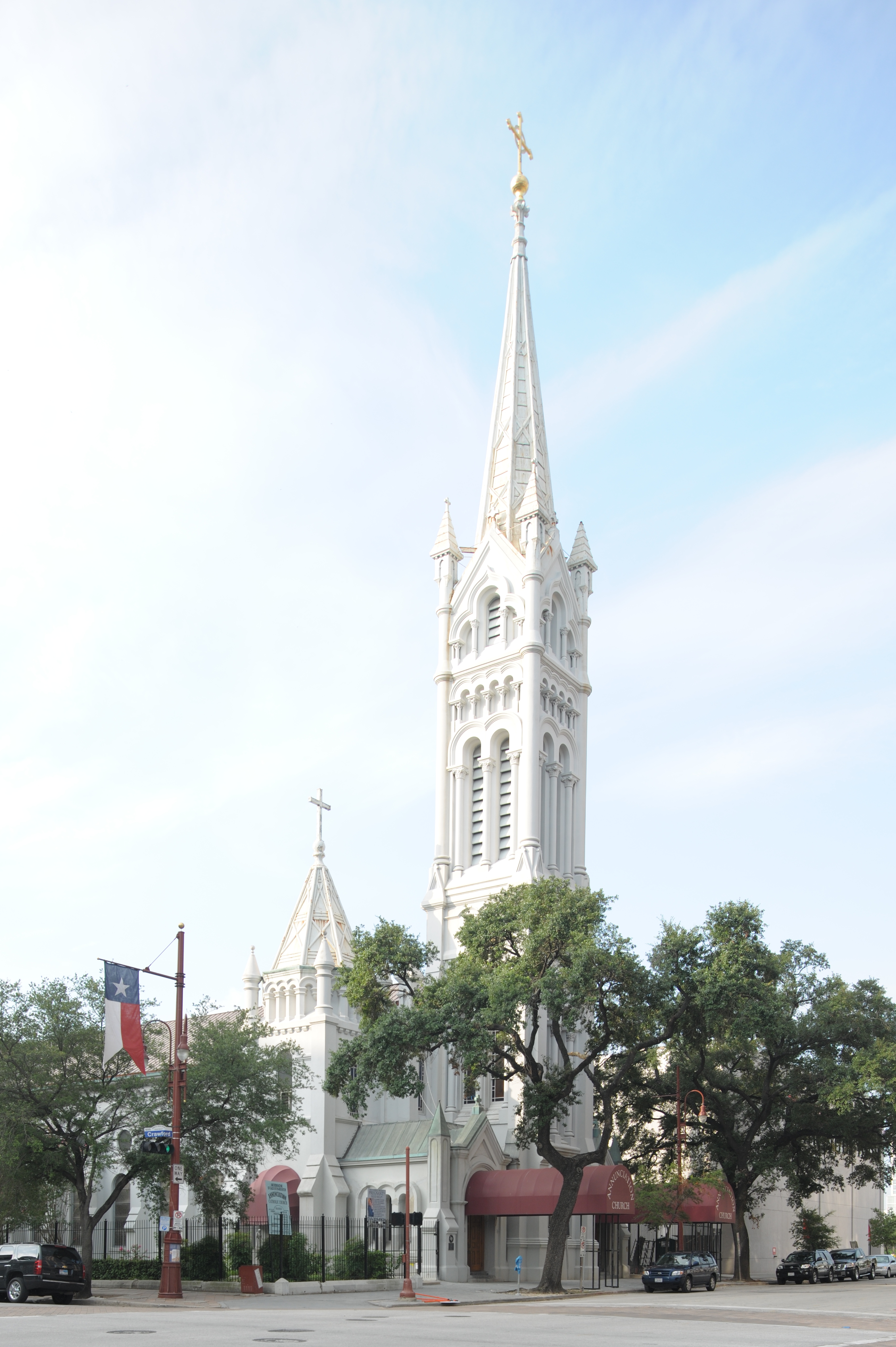
29°47′1″N 95°23′34″W / 29.78361°N 95.39278°WHouston 7 Annunciation Church 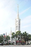
November 3, 1975 1618 Texas Ave.
29°45′23″N 95°21′25″W / 29.75639°N 95.35694°WHouston 8 Antioch Missionary Baptist Church 
December 22, 1976 500 Clay St.
29°45′20″N 95°21′54″W / 29.75556°N 95.365°WHouston 9 Apollo Mission Control Center 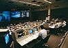
October 3, 1985 Lyndon B. Johnson Space Flight Center
29°33′29″N 95°5′18″W / 29.55806°N 95.08833°WHouston 10 Armand Bayou Archeological District December 12, 1978 Address Restricted Seabrook 11 James L. Autry House June 14, 1979 5 Courtlandt Pl.
29°44′34″N 95°22′56″W / 29.74278°N 95.38222°WHouston 12 Aviary at the Houston Zoo August 9, 2005 1513 N. McGregor
29°42′59″N 95°23′31″W / 29.71639°N 95.39194°WHouston 13 Banta House June 22, 1983 119 E. 20th St.
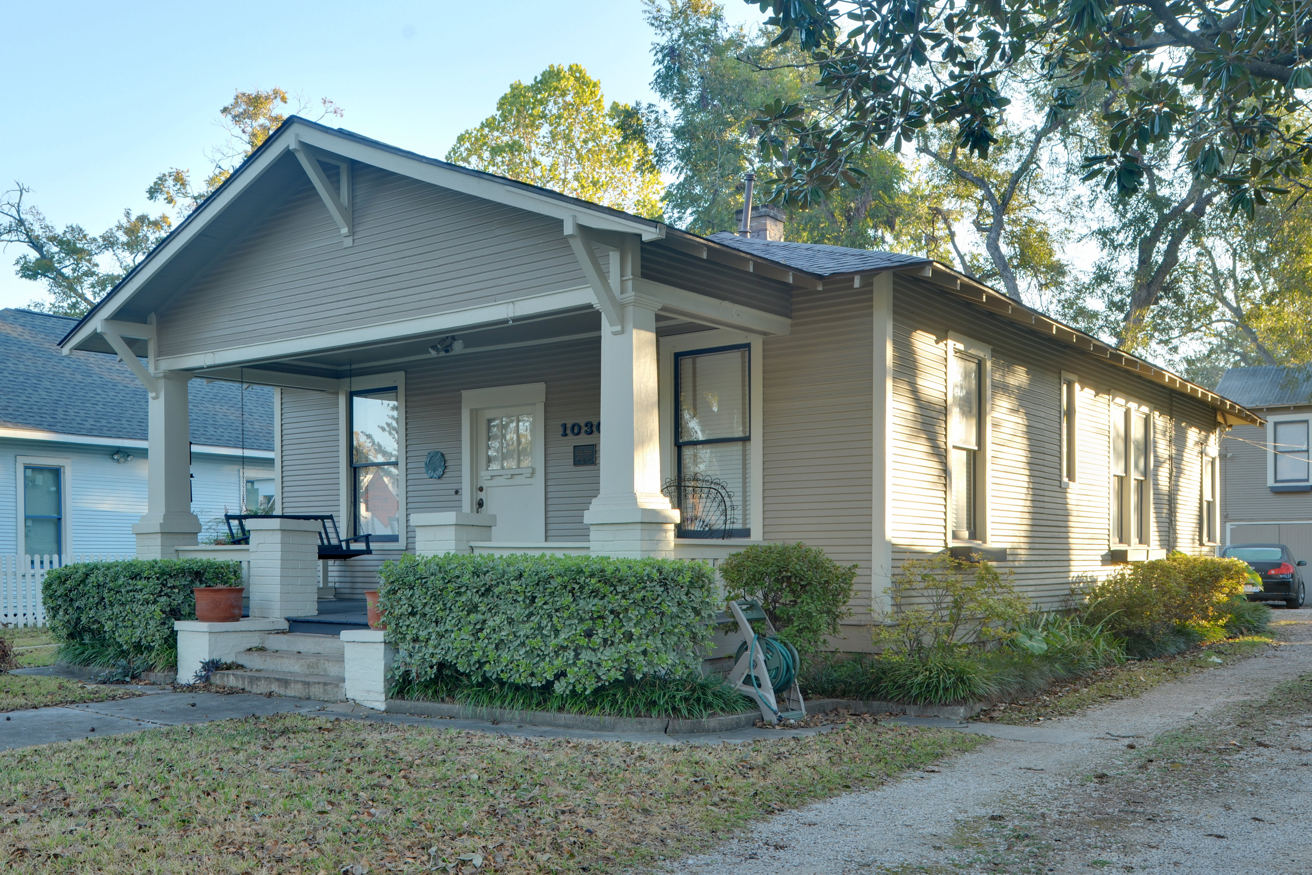
29°48′12″N 95°23′50″W / 29.80333°N 95.39722°WHouston 14 Otto H. Baring House 
January 15, 1988 1030 Rutland
29°47′23″N 95°24′2″W / 29.78972°N 95.40056°WHouston 15 Barker House 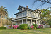
May 14, 1984 121 E. 16th St.
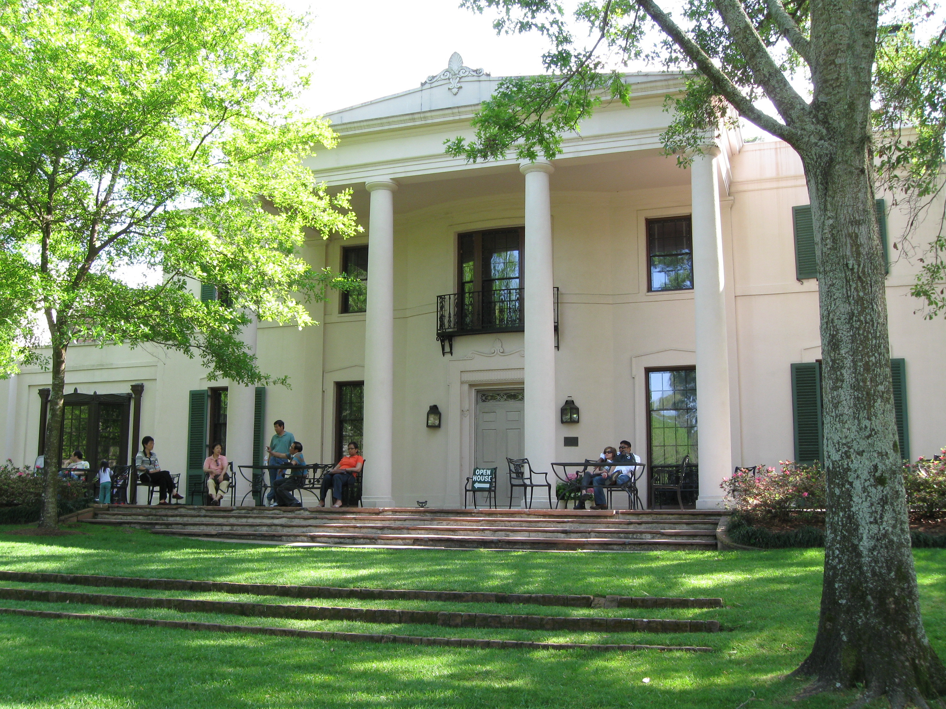
29°47′58″N 95°23′49″W / 29.79944°N 95.39694°WHouston 16 Barker-Cypress Archeological Site (41HR436) April 24, 1984 Address Restricted Houston 17 Bayou Bend 
December 6, 1979 1 Westcott St.
29°45′27″N 95°25′14″W / 29.7575°N 95.42056°WHouston 18 Beaconsfield 
March 29, 1983 1700 Main St.
29°45′20″N 95°22′21″W / 29.75556°N 95.3725°WHouston 19 Benjamin Apartments September 26, 2002 1218 Webster St.
29°44′47″N 95°22′11″W / 29.74639°N 95.36972°WHouston 20 Bethel Baptist Church January 16, 1998 801 Andrews
29°45′4″N 95°22′33″W / 29.75111°N 95.37583°WHouston 21 Borgstrom House 
May 14, 1984 1401 Cortlandt St.
29°47′46″N 95°23′44″W / 29.79611°N 95.39556°WHouston 22 Boulevard Oaks Historic District 
February 22, 2002 Roughly bounded by North Blvd., South Blvd., Hazard and Mandell Sts.
29°43′37″N 95°24′13″W / 29.72694°N 95.40361°WHouston 23 Broadacres Historic District 
April 16, 1980 1300-1506 North Blvd. and 1305-1515 South Blvd.
29°43′37″N 95°23′48″W / 29.72694°N 95.39667°WHouston 24 Burge House 
June 22, 1983 1801 Heights Blvd.
29°48′6″N 95°23′54″W / 29.80167°N 95.39833°WHouston 25 George L. Burlingame House 
January 15, 1988 1238 Harvard
29°47′37″N 95°23′45″W / 29.79361°N 95.39583°WHouston 26 Burnett House August 20, 2004 219 W. Eleventh St.
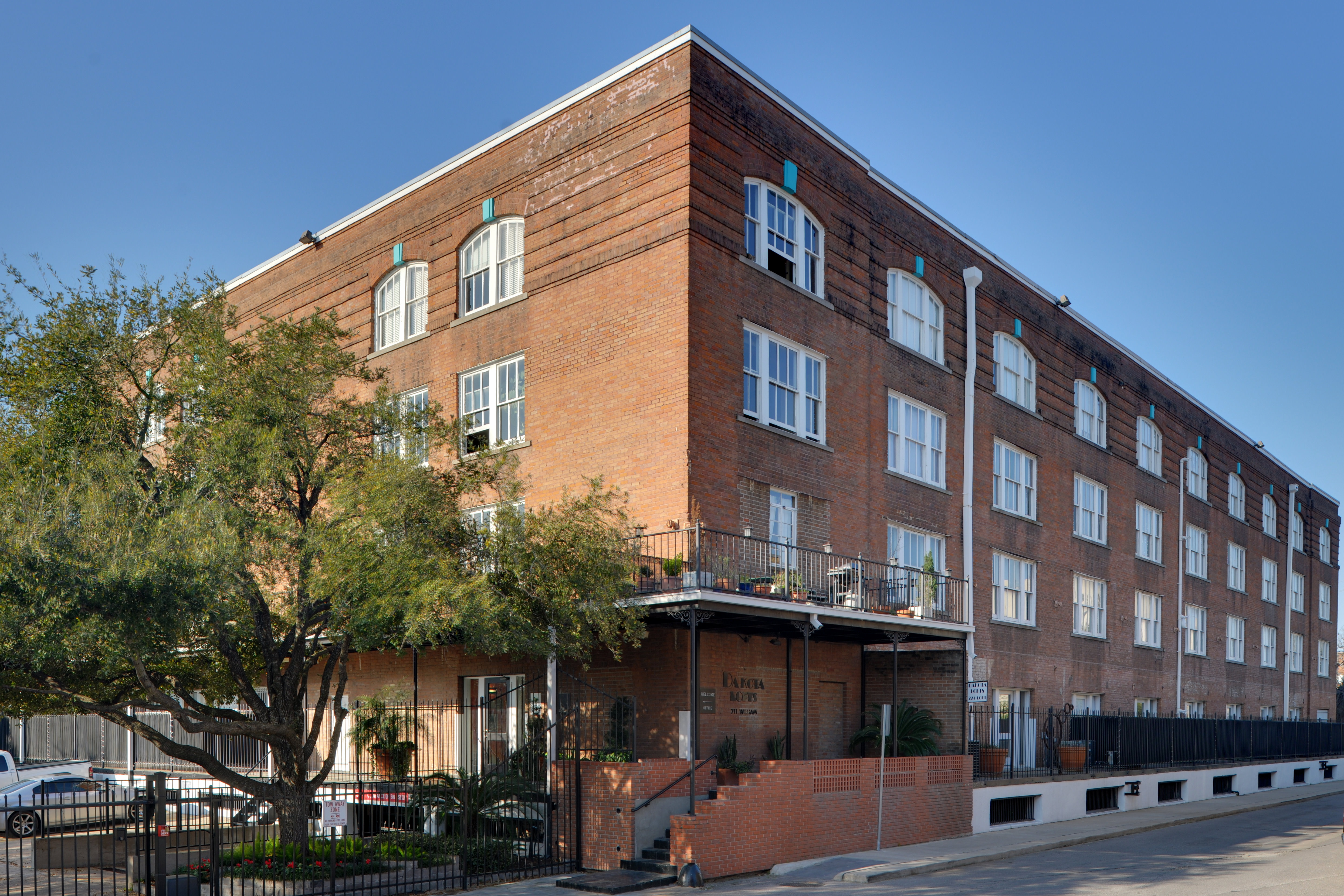
29°47′25″N 95°23′54″W / 29.79028°N 95.39833°WHouston 27 James Bute Company Warehouse 
July 7, 1994 711 William St.
29°46′3″N 95°21′14″W / 29.7675°N 95.35389°WHouston 28 David A. Carden House July 17, 1990 718 W. 17th Ave.
29°48′0″N 95°24′38″W / 29.8°N 95.41056°WHouston 29 J. J. Carroll House June 14, 1979 16 Courtlandt Pl.
29°44′37″N 95°23′2″W / 29.74361°N 95.38389°WHouston 30 W. T. Carter Jr. House June 14, 1979 18 Courtlandt Pl.
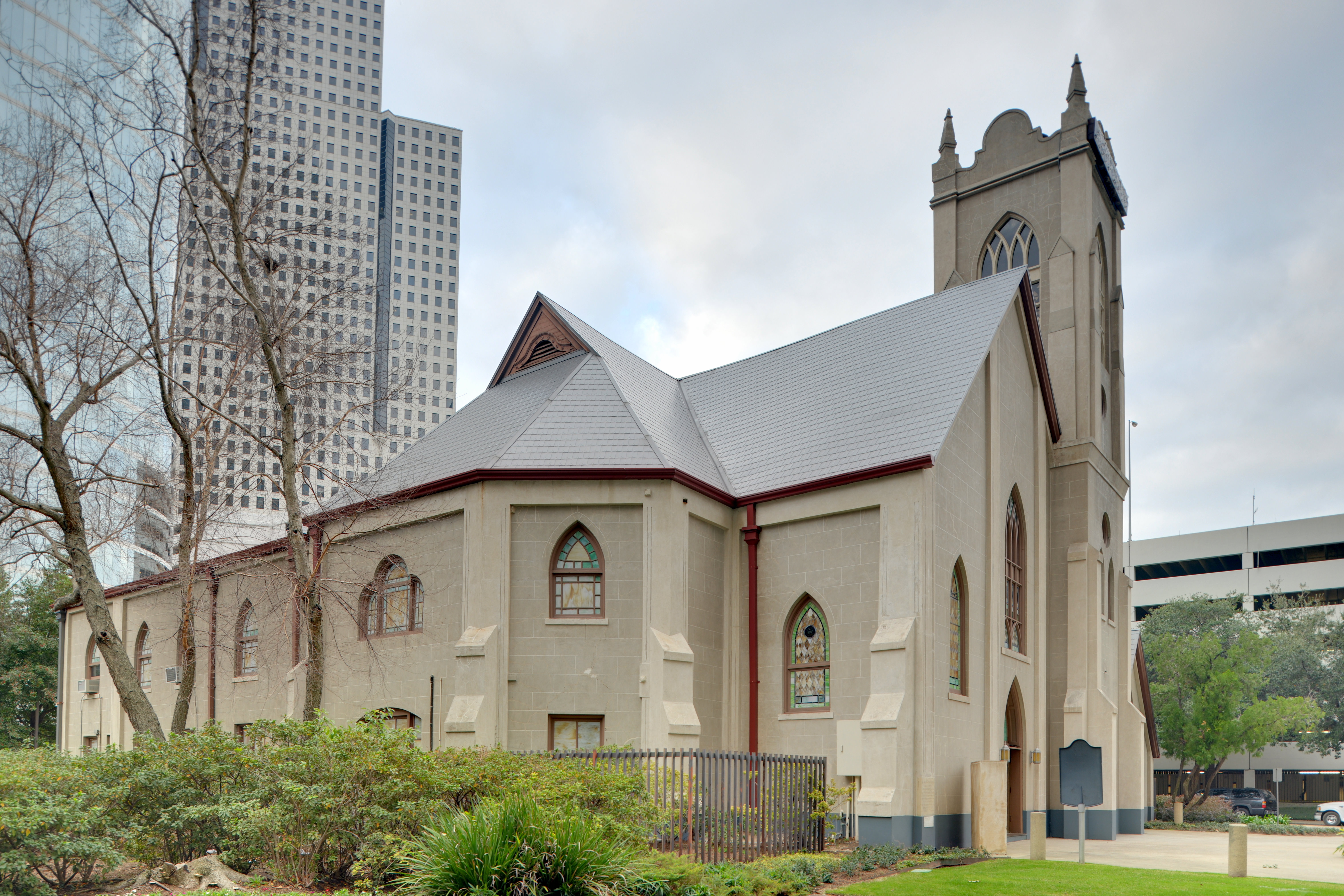
29°44′37″N 95°23′3″W / 29.74361°N 95.38417°WHouston 31 Cedar Bayou Archeological District March 2, 1979 Address Restricted Baytown 32 Christ Church 
June 15, 1979 1117 Texas Ave.
29°45′34″N 95°21′39″W / 29.75944°N 95.36083°WHouston 33 City National Bank Building April 3, 2000 1001 McKinney Ave.
29°45′31″N 95°21′52″W / 29.75861°N 95.36444°WHouston 34 Moses A. Clanton House July 17, 1990 1025 Arlington
29°47′23″N 95°23′39″W / 29.78972°N 95.39417°WHouston 35 J. H. Clare House January 15, 1988 939 Arlington
29°47′17″N 95°23′39″W / 29.78806°N 95.39417°WHouston 36 Clarke & Courts Building April 14, 1994 1210 W. Clay Ave.
29°45′20″N 95°23′38″W / 29.75556°N 95.39389°WHouston 37 William L. Clayton Summer House February 2, 1984 3376 Inwood Dr.
29°46′44″N 95°25′46″W / 29.77889°N 95.42944°WHouston 38 A. S. Cleveland House June 14, 1979 8 Courtlandt Pl.
29°44′37″N 95°22′58″W / 29.74361°N 95.38278°WHouston 39 Arthur B. Cohn House 
November 7, 1985 1711 Rusk Ave.
29°45′16″N 95°21′25″W / 29.75444°N 95.35694°WHouston 40 Charles E. Coombs House July 17, 1990 1037 Columbia
29°47′23″N 95°23′35″W / 29.78972°N 95.39306°WHouston 41 Dr. B. F. Coop House 
May 14, 1984 1536 Heights Blvd.
29°47′56″N 95°23′51″W / 29.79889°N 95.3975°WHouston 42 Austin Copeland House I January 15, 1988 921 Arlington
29°47′15″N 95°23′39″W / 29.7875°N 95.39417°WHouston 43 Austin Copeland House II January 15, 1988 925 Arlington
29°47′16″N 95°23′39″W / 29.78778°N 95.39417°WHouston 44 Countryman House June 22, 1983 402 E. 9th St.
29°47′14″N 95°23′37″W / 29.78722°N 95.39361°WHouston 45 Courtlandt Place Historic District December 3, 1980 2-25 Courtlandt Pl.
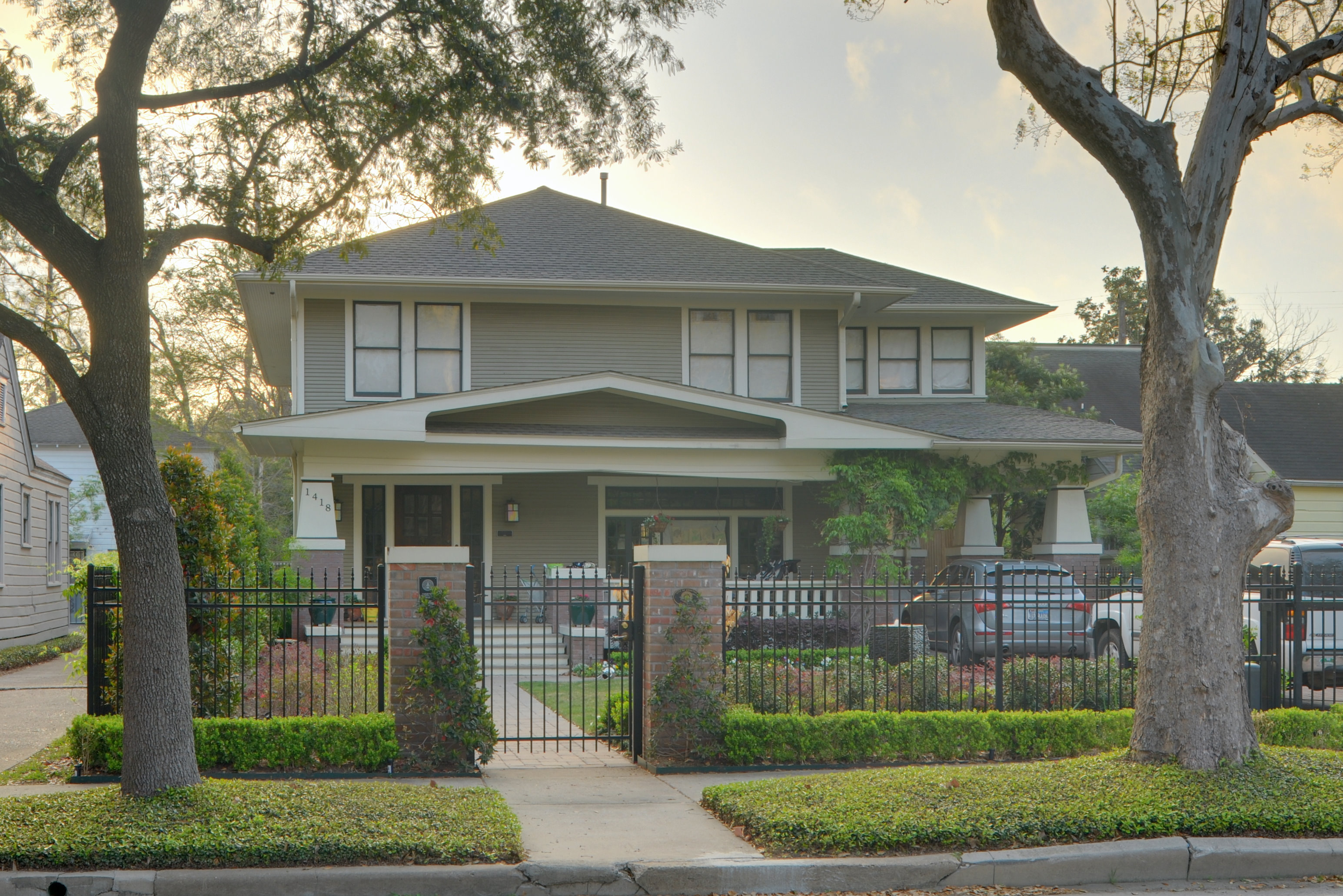
29°44′34″N 95°22′59″W / 29.74278°N 95.38306°WHouston 46 Cummings House 
June 22, 1983 1418 Heights Blvd.
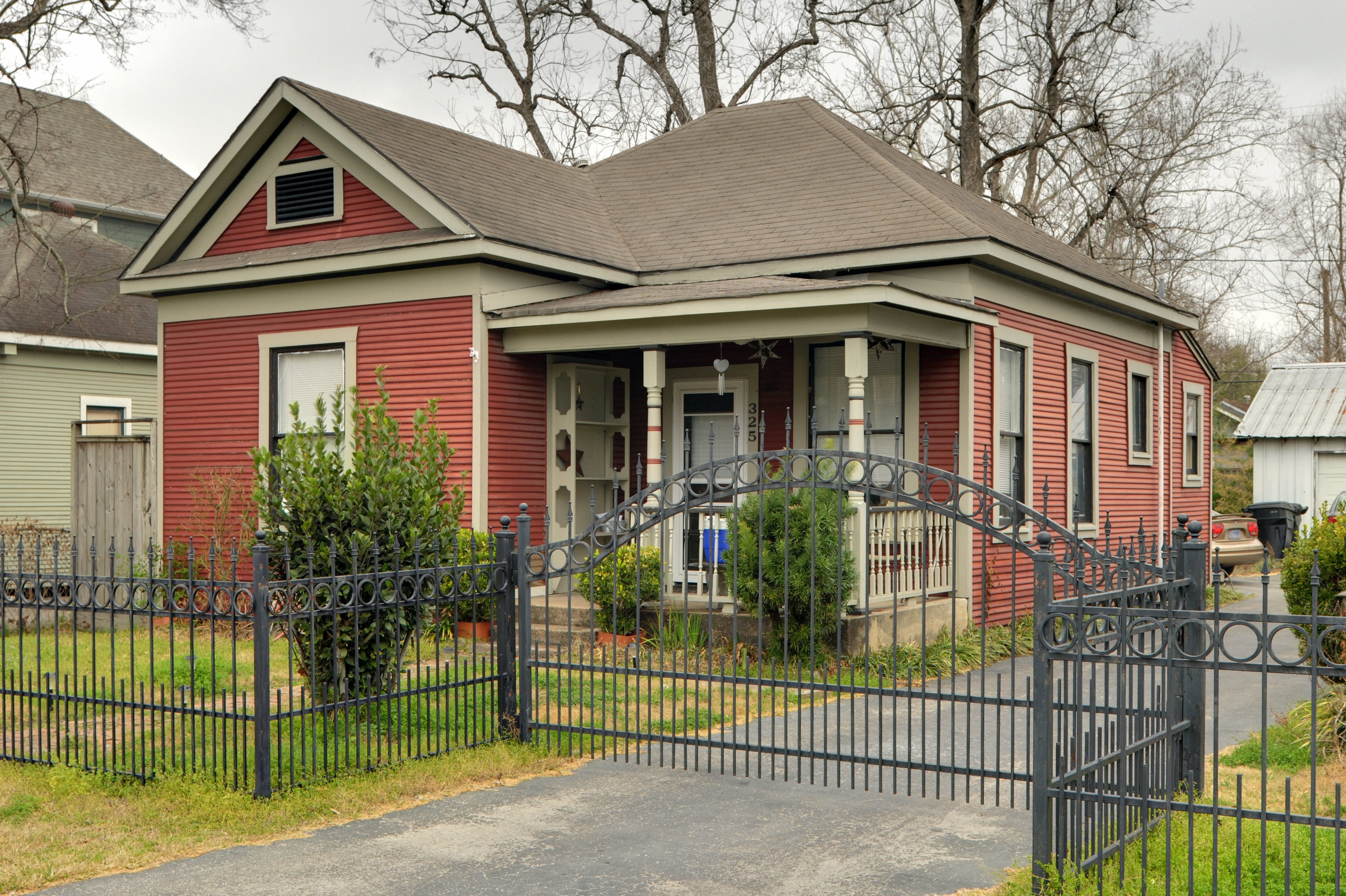
29°47′47″N 95°23′51″W / 29.79639°N 95.3975°WHouston 47 Ben C. and Jenetter Cyrus House 
June 4, 1997 325 E. 25th St.
29°49′5″N 95°23′33″W / 29.81806°N 95.3925°WHouston 48 James A. Dawson House March 17, 1994 400 Emerson Ave.
29°44′34″N 95°23′8″W / 29.74278°N 95.38556°WHouston 49 DePelchin Faith Home August 9, 1984 2700 Albany St.
29°44′56″N 95°22′57″W / 29.74889°N 95.3825°WHouston 50 Dexter House May 14, 1984 224 W. 17th St.
29°48′2″N 95°23′59″W / 29.80056°N 95.39972°WHouston 51 Thomas J. Donoghue House June 14, 1979 17 Courtlandt Pl.
29°44′33″N 95°23′5″W / 29.7425°N 95.38472°WHouston 52 John M. Dorrance House June 14, 1979 9 Courtlandt Pl.
29°44′34″N 95°22′57″W / 29.74278°N 95.3825°WHouston 53 Lula J. Doughty House 
July 17, 1990 1233 Yale St.
29°47′35″N 95°23′57″W / 29.79306°N 95.39917°WHouston 54 Jay L. Durham House 
January 15, 1988 921 Heights Blvd.
29°47′17″N 95°23′11″W / 29.78806°N 95.38639°WHouston 55 Eaton House 
June 22, 1983 510 Harvard St.
29°46′47″N 95°23′45″W / 29.77972°N 95.39583°WHouston 56 Elkins House June 22, 1983 602 E. 9th St.
29°47′13″N 95°23′30″W / 29.78694°N 95.39167°WHouston 57 Dr. Billie V. Ellis House 
June 22, 1983 1515 Heights Blvd.
29°47′54″N 95°23′54″W / 29.79833°N 95.39833°WHouston 58 Ned A. and Linda S. Eppes House 
December 30, 1997 5322 Institute Ln.
29°43′29″N 95°23′50″W / 29.72472°N 95.39722°WHouston 59 Ezzell House 
May 14, 1984 1236 Rutland St.
29°47′37″N 95°24′3″W / 29.79361°N 95.40083°WHouston 60 Farnsworth & Chambers Building 
October 29, 2009 2999 S. Wayside
29°42′21.78″N 95°19′6.1″W / 29.70605°N 95.318361°WHouston 61 Roy and Margaret Farrar House October 4, 2006 511 Lovett Blvd.
29°44′41″N 95°23′16″W / 29.74472°N 95.38778°WHouston 62 Fire Engine House No. 9 October 17, 1985 1810-1812 Keene St.
29°46′31″N 95°21′5″W / 29.77528°N 95.35139°WHouston 63 First Evangelical Church 
November 21, 2006 1311 Holman St.
29°44′25″N 95°22′32″W / 29.74028°N 95.37556°WHouston 64 William F. Fluegel House January 15, 1988 1327 Ashland
29°47′43″N 95°24′12″W / 29.79528°N 95.40333°WHouston 65 Foley, W. L., Building 
October 11, 1978 214-218 Travis St.
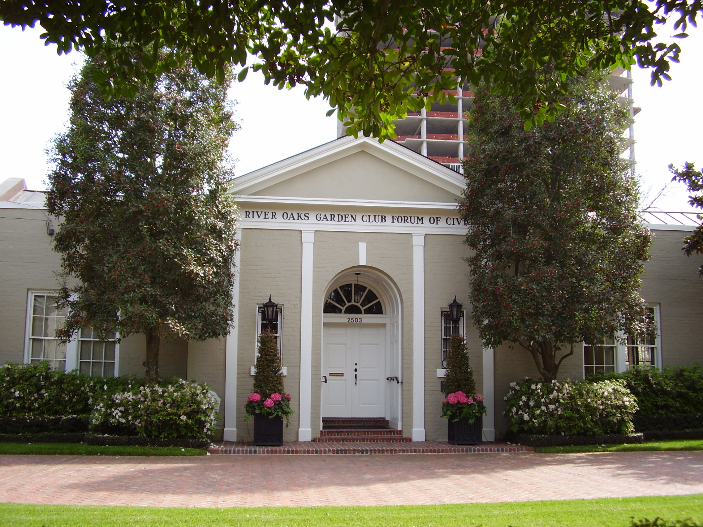
29°45′47″N 95°21′41″W / 29.76306°N 95.36139°WHouston 66 Forum of Civics 
October 13, 1988 2503 Westheimer Rd.
29°44′30″N 95°25′4″W / 29.74167°N 95.41778°WHouston 67 Freedmen's Town Historic District January 17, 1985 Roughly Bounded by Genesse, West Dallas, Arthur and W. Gray Sts.
29°45′19″N 95°22′49″W / 29.75528°N 95.38028°WHouston 68 General Mercantile Store 
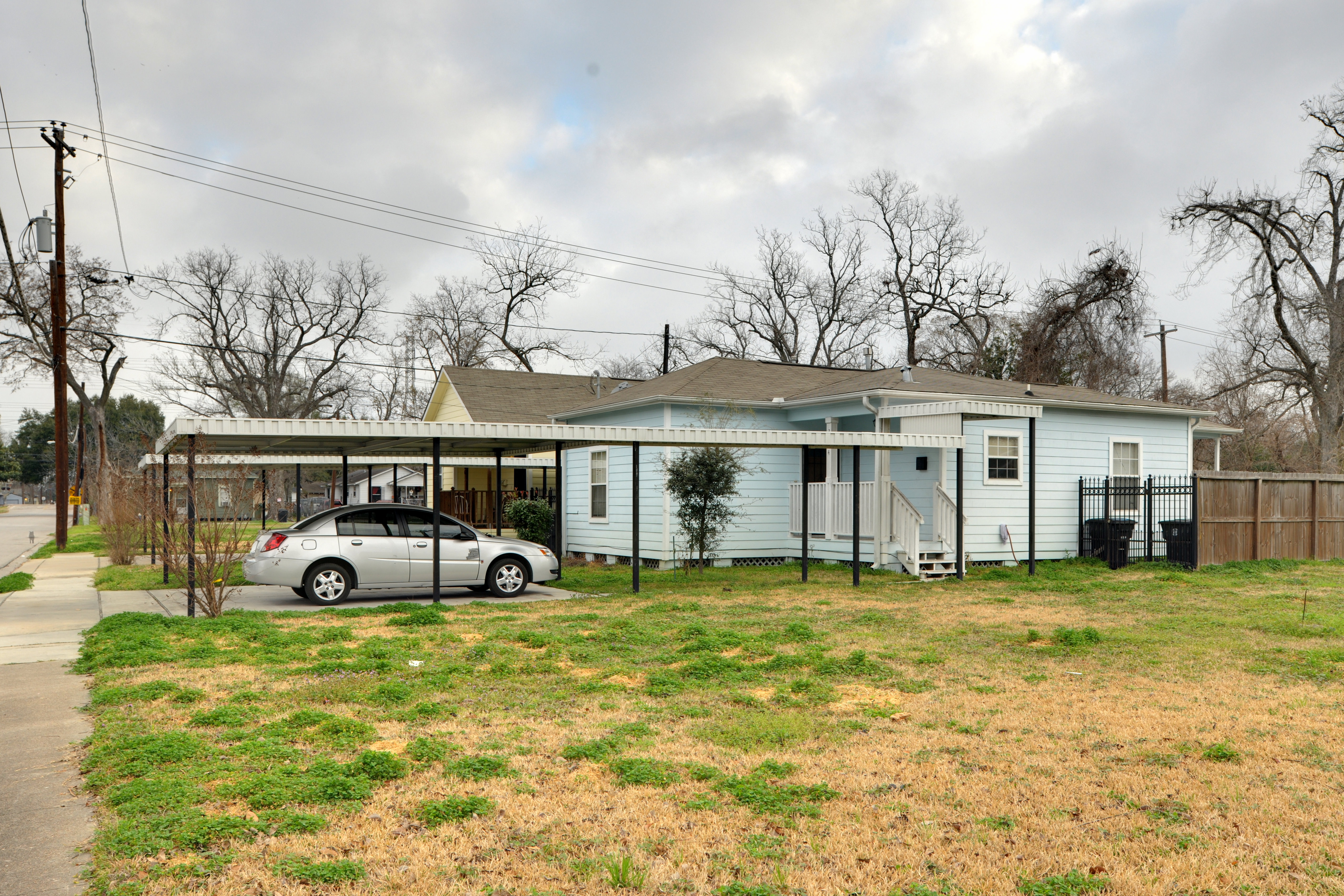
June 4, 1997 7322 N. Main St.
29°49′1″N 95°23′33″W / 29.81694°N 95.3925°WHouston 69 Gerloff House July 17, 1990 221 E. 12th Ave.
29°47′34″N 95°23′45″W / 29.79278°N 95.39583°WHouston 70 Gillette House 
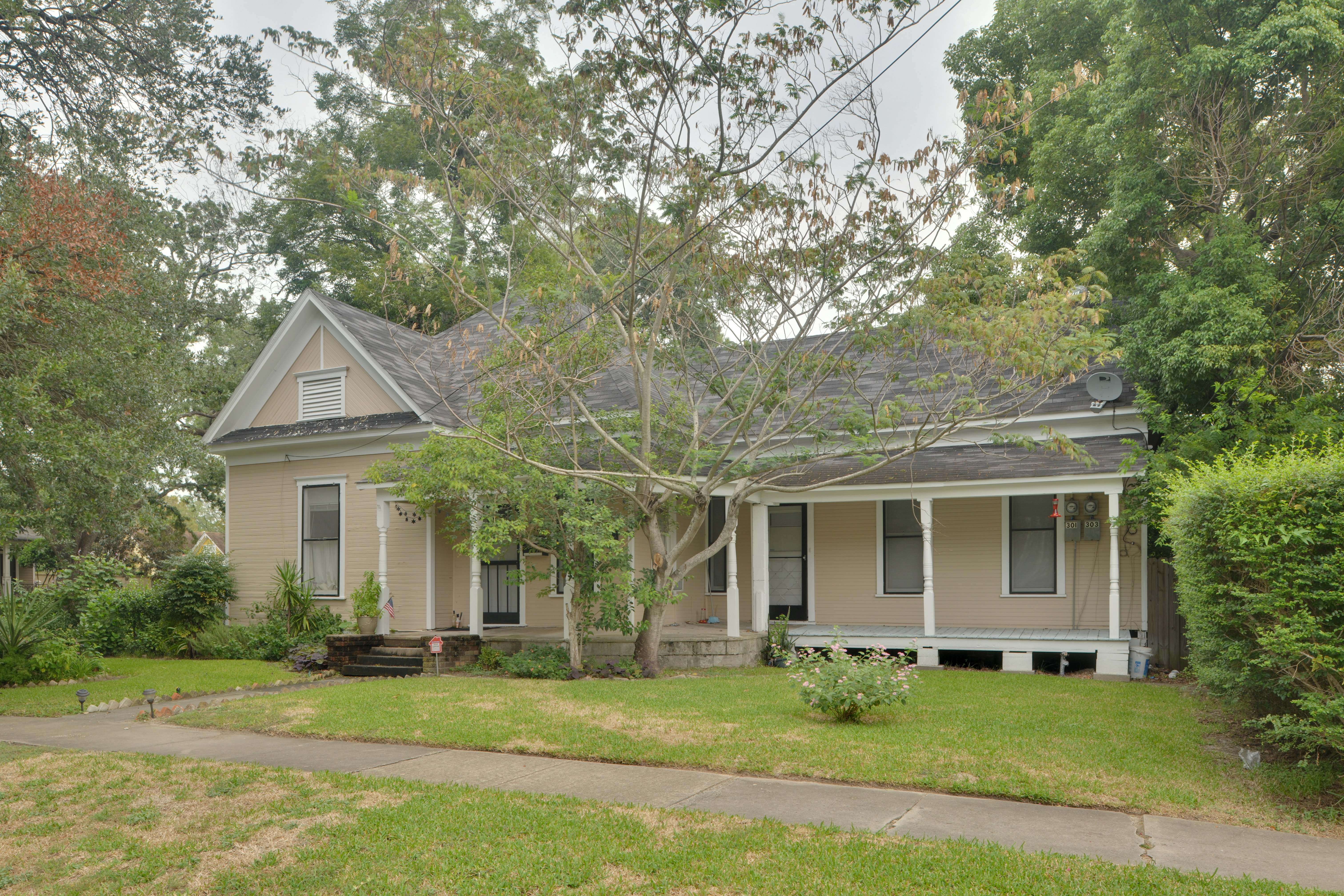
May 14, 1984 301-303 E. 15th St.
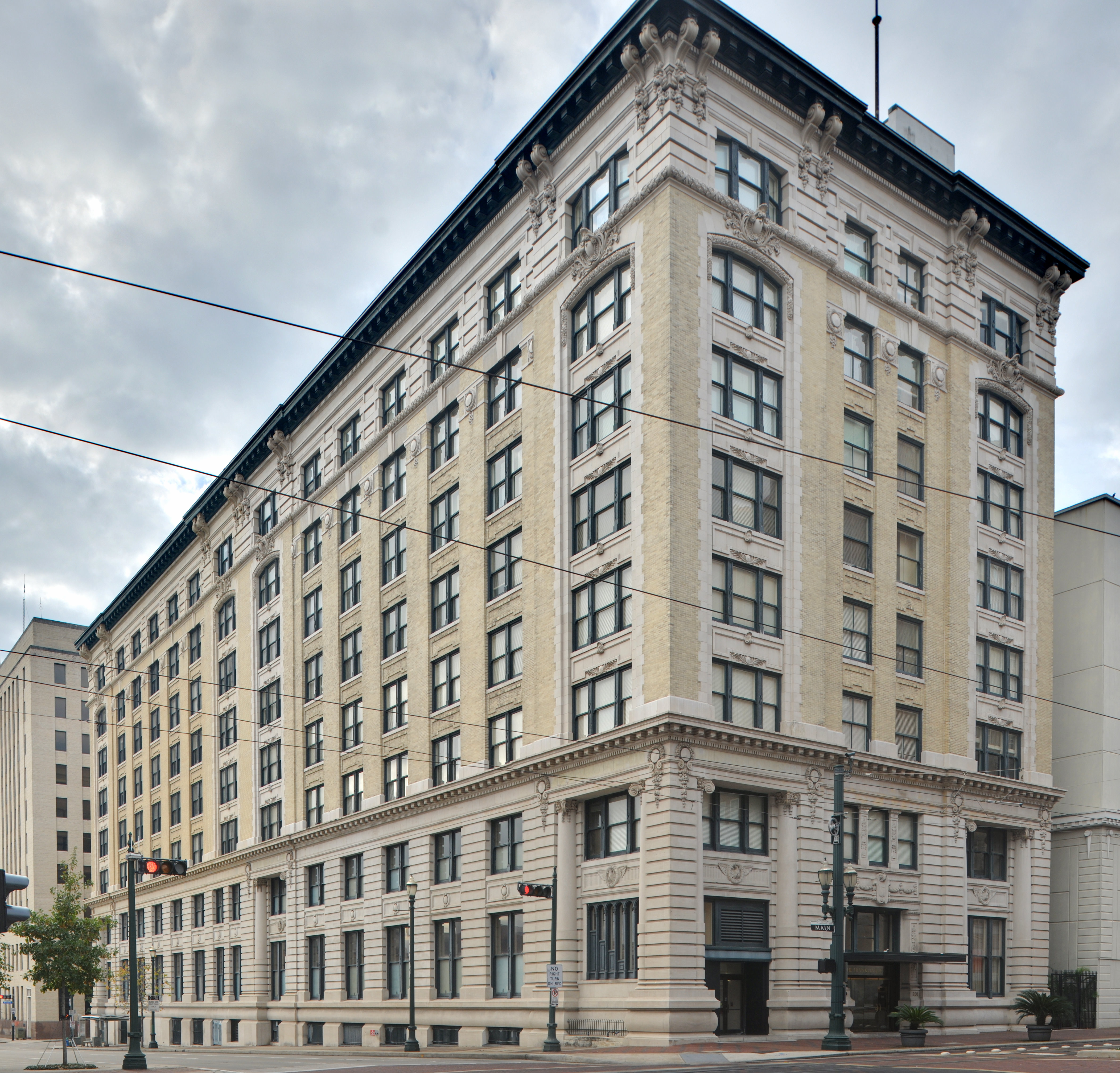
29°47′52″N 95°23′43″W / 29.79778°N 95.39528°WHouston 71 Gulf Building 
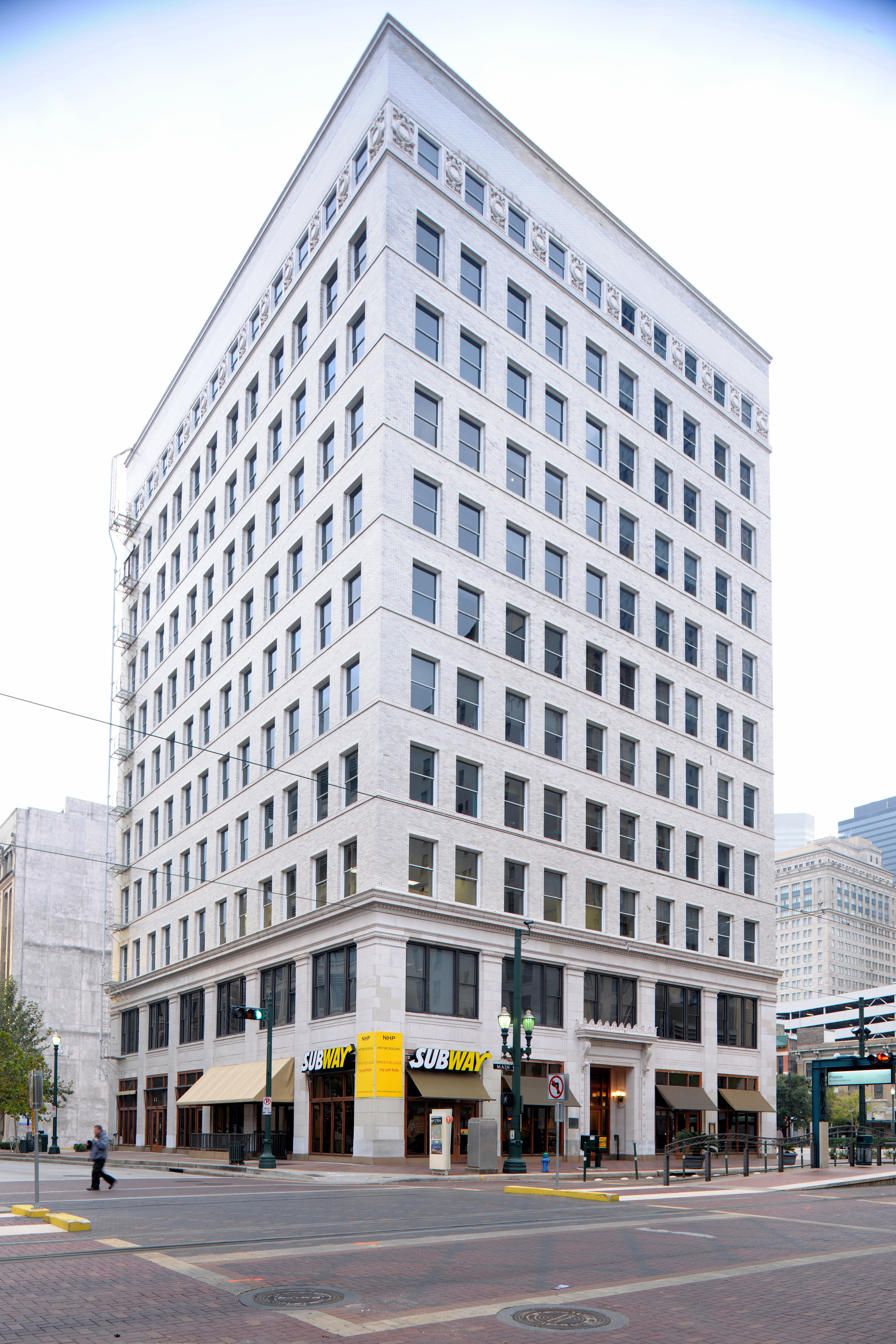
August 30, 1983 710-724 Main St.
29°46′4″N 95°21′50″W / 29.76778°N 95.36389°WHouston 72 Harris County Boy's School Site May 2, 1979 Address Restricted Houston 73 Harris County Courthouse of 1910 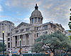
May 13, 1981 301 Fannin St.
29°45′40″N 95°21′34″W / 29.76111°N 95.35944°WHouston 74 Hartley House June 22, 1983 315 W. 17th St.
29°48′1″N 95°24′3″W / 29.80028°N 95.40083°WHouston 75 Hawkins House 
May 14, 1984 1015 Heights Blvd.
29°47′22″N 95°23′53″W / 29.78944°N 95.39806°WHouston 76 Heights Boulevard Esplanade 
May 14, 1984 Heights Boulevard from White Oak Bayou to 20th St.
29°46′10″N 95°23′50″W / 29.76944°N 95.39722°WHouston 77 Heights Christian Church 
June 22, 1983 1703 Heights Blvd.
29°48′3″N 95°23′54″W / 29.80083°N 95.39833°WHouston 78 Heights State Bank Building June 22, 1983 3620 Washington St.
29°46′6″N 95°26′53″W / 29.76833°N 95.44806°WHouston 79 Fred J. Heyne House 
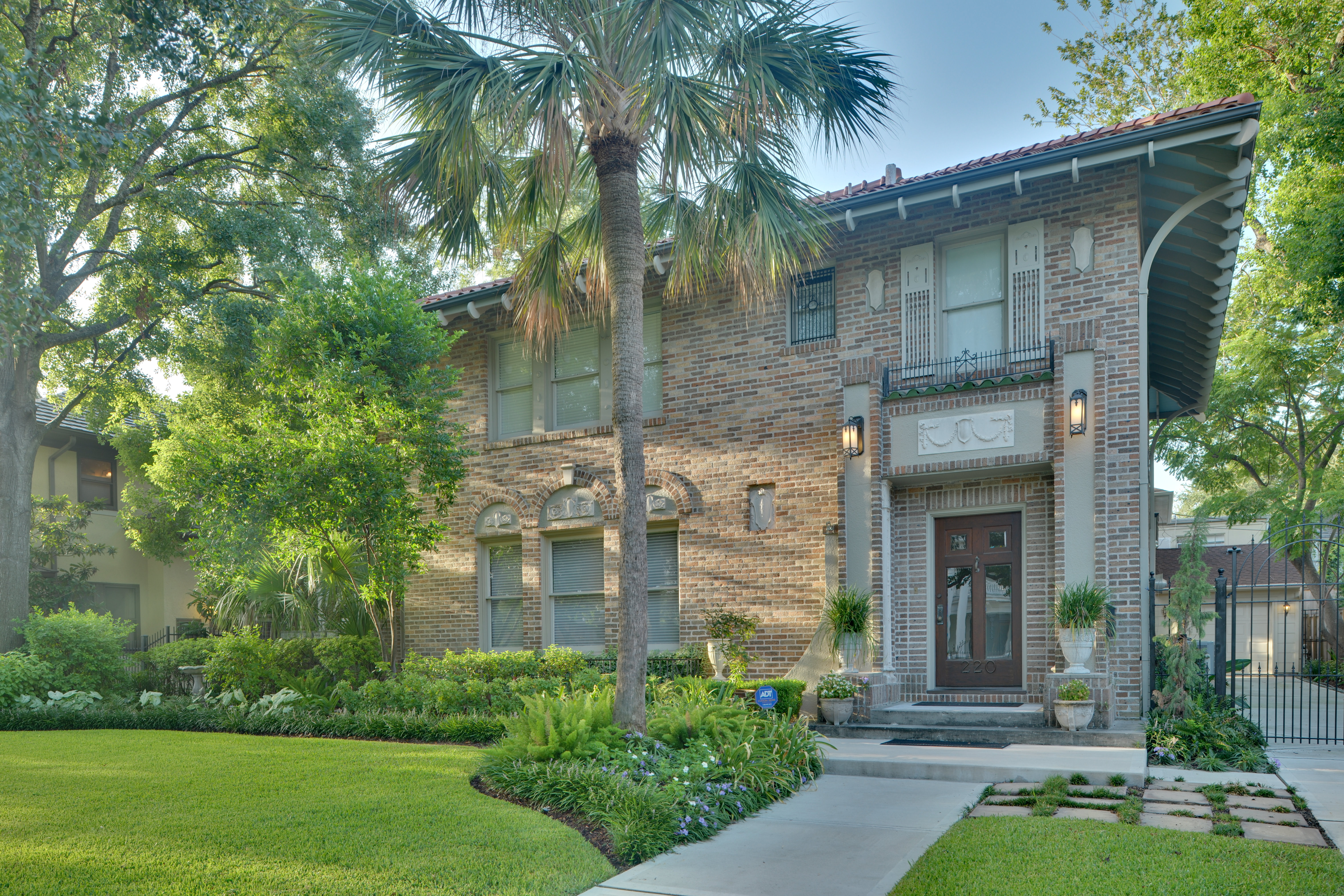
March 25, 1994 220 Westmoreland Ave.
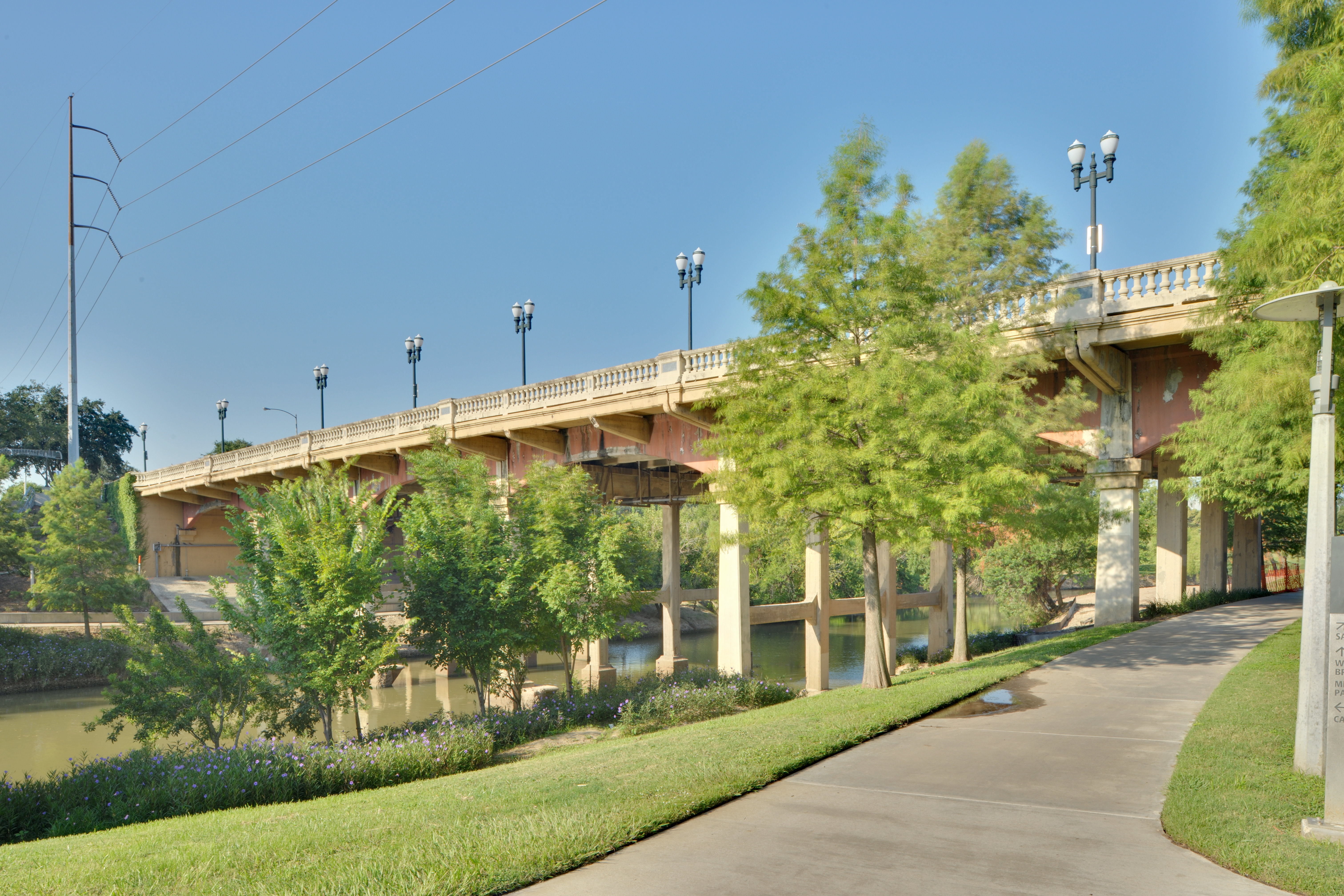
29°44′25″N 95°23′4″W / 29.74028°N 95.38444°WHouston 80 Hill Street Bridge over Buffalo Bayou 
October 31, 2007 S. Jensen Dr. at Buffalo Bayou
29°45′40″N 95°20′36″W / 29.76111°N 95.34333°WHouston 81 Hogg Building 
July 14, 1978 401 Louisiana St.
29°45′45″N 95°21′50″W / 29.7625°N 95.36389°WHouston 82 House at 1111 Heights Boulevard May 14, 1984 1111 Heights Blvd.
29°47′28″N 95°23′53″W / 29.79111°N 95.39806°WHouston 83 House at 112 W. 4th Street 
May 14, 1984 112 W. 4th St.
29°46′40″N 95°23′52″W / 29.77778°N 95.39778°WHouston 84 House at 1210 Harvard Street 
May 14, 1984 1210 Harvard St.
29°47′34″N 95°23′46″W / 29.79278°N 95.39611°WHouston 85 House at 1217 Harvard 
January 15, 1988 1217 Harvard
29°47′35″N 95°23′48″W / 29.79306°N 95.39667°WHouston 86 House at 122 East Fifth Street 
May 14, 1984 122 E. 5th St.
29°46′46″N 95°23′47″W / 29.77944°N 95.39639°WHouston 87 House at 1220 Harvard 
January 15, 1988 1220 Harvard
29°47′35″N 95°23′45″W / 29.79306°N 95.39583°WHouston 88 House at 1222 Harvard Street 
July 17, 1990 1222 Harvard St.
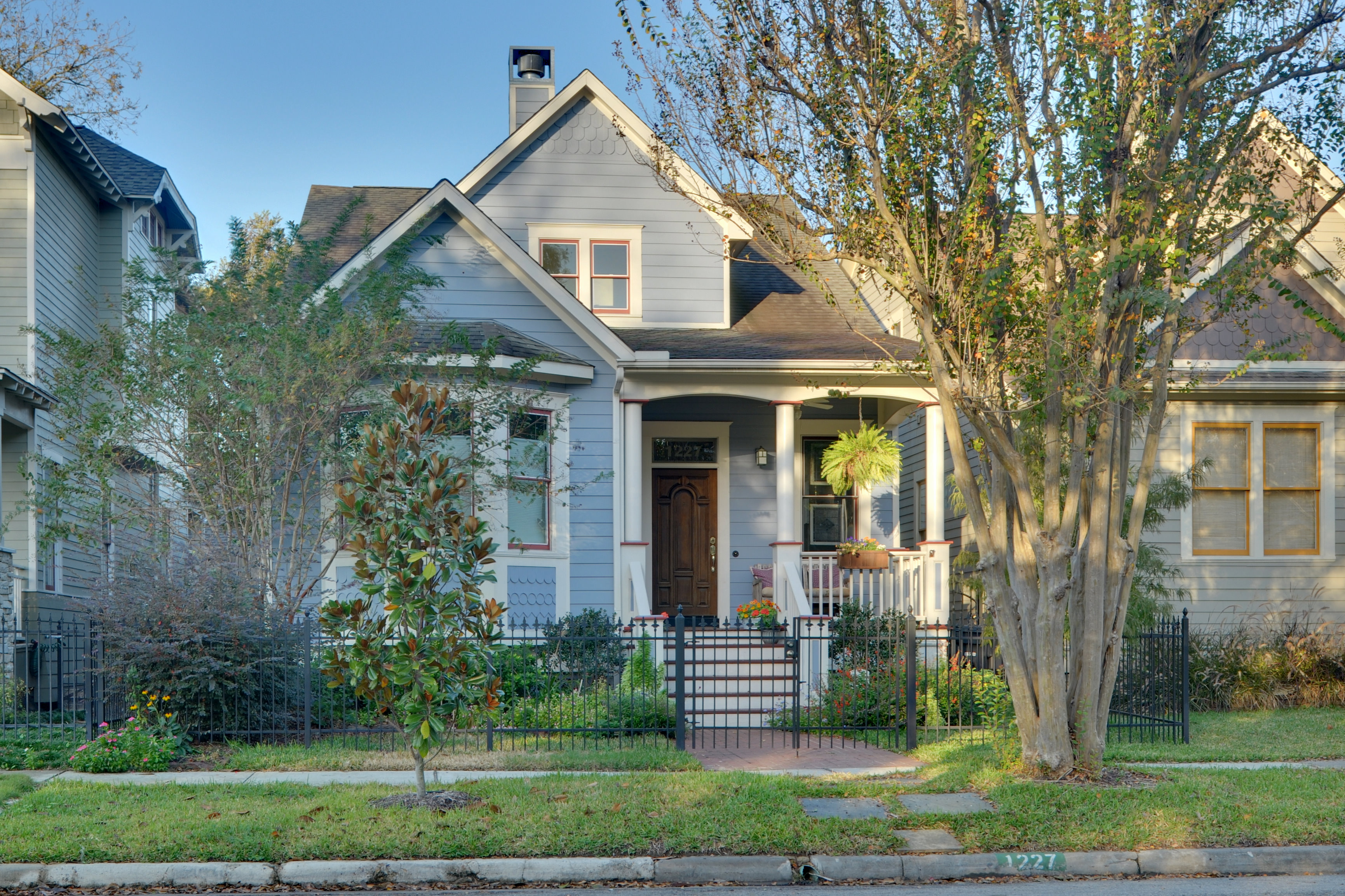
29°47′35″N 95°23′45″W / 29.79306°N 95.39583°WHouston 89 House at 1227 Rutland Street 
May 14, 1984 1227 Rutland St.
29°47′35″N 95°24′4″W / 29.79306°N 95.40111°WHouston 90 House at 1230 Oxford Street May 14, 1984 1230 Oxford St.
29°47′37″N 95°23′32″W / 29.79361°N 95.39222°WHouston 91 House at 1237 Rutland Street 
June 22, 1983 1237 Rutland St.
29°47′37″N 95°24′4″W / 29.79361°N 95.40111°WHouston 92 House at 1304 Cortlandt Street May 14, 1984 1304 Cortlandt St.
29°47′40″N 95°23′42″W / 29.79444°N 95.395°WHouston 93 House at 1343 Allston Street June 22, 1983 1343 Allston St.
29°47′44″N 95°24′1″W / 29.79556°N 95.40028°WHouston 94 House at 1421 Harvard St. June 22, 1983 1421 Harvard St.
29°47′48″N 95°23′48″W / 29.79667°N 95.39667°WHouston 95 House at 1421 Heights Boulevard June 22, 1983 1421 Heights Blvd.
29°47′48″N 95°23′48″W / 29.79667°N 95.39667°WHouston 96 House at 1421-1423 Waverly Street 
June 22, 1983 1421-1423 Waverly St.
29°47′47″N 95°24′16″W / 29.79639°N 95.40444°WHouston 97 House at 1435 Heights Boulevard 
January 15, 1988 1435 Heights Blvd.
29°47′50″N 95°23′53″W / 29.79722°N 95.39806°WHouston 98 House at 1437 Heights Boulevard 
June 22, 1983 1437 Heights Blvd.
29°47′50″N 95°23′54″W / 29.79722°N 95.39833°WHouston 99 House at 1437 Waverly Street 
June 22, 1983 1437 Waverly St.
29°47′49″N 95°24′16″W / 29.79694°N 95.40444°WHouston 100 House at 1443 Allston Street June 22, 1983 1443 Allston St.
29°47′48″N 95°24′1″W / 29.79667°N 95.40028°WHouston 101 House at 1509 Allston Street June 22, 1983 1509 Allston St.
29°47′52″N 95°24′1″W / 29.79778°N 95.40028°WHouston 102 House at 1515 Allston Street June 22, 1983 1515 Allston St.
29°47′53″N 95°24′1″W / 29.79806°N 95.40028°WHouston 103 House at 1517 Cortland Street June 22, 1983 1517 Cortland St.
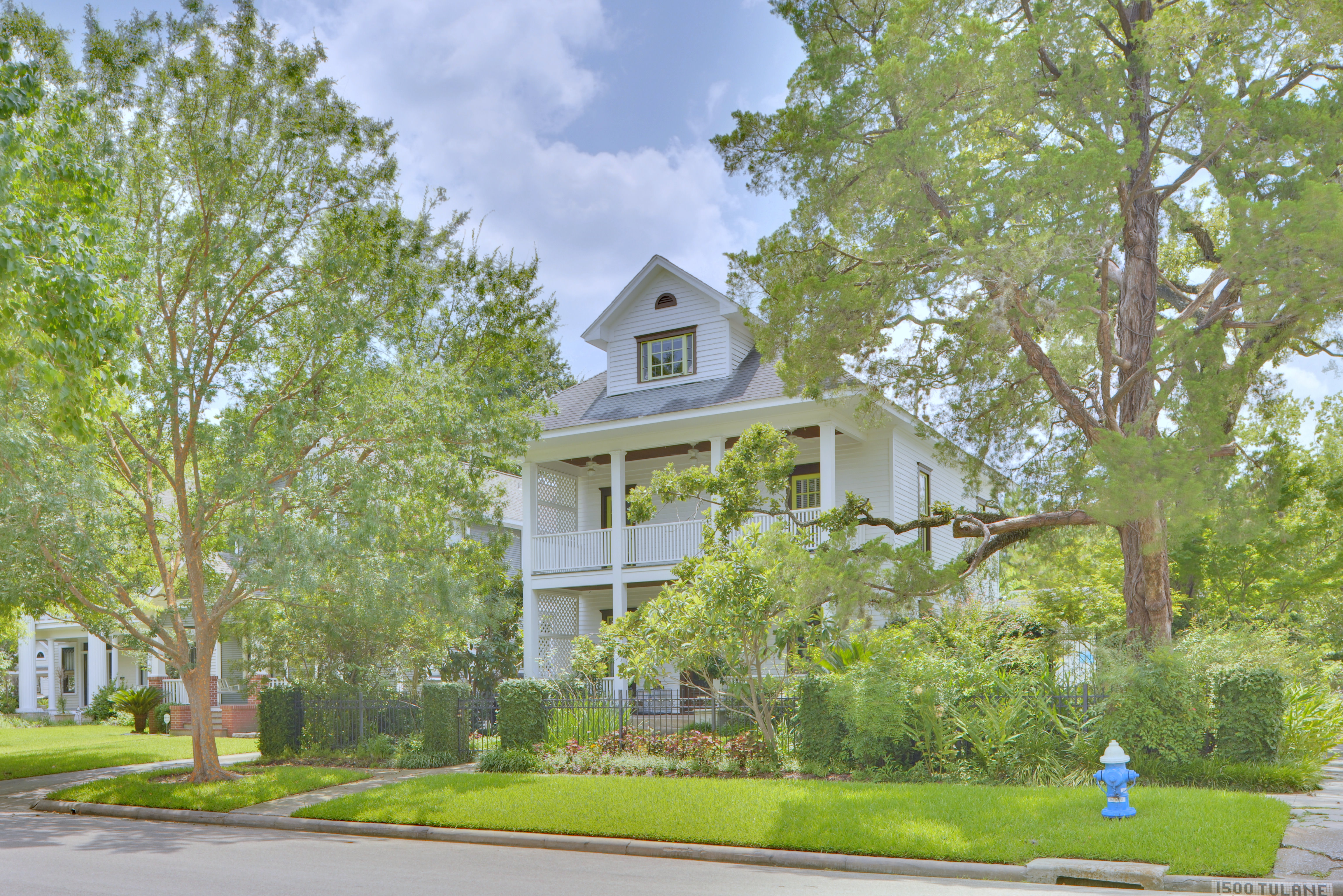
29°47′55″N 95°23′44″W / 29.79861°N 95.39556°WHouston 104 House at 1537 Tulane Street 
June 22, 1983 1537 Tulane Street
29°47′56″N 95°24′8″W / 29.79889°N 95.40222°WHouston 105 House at 1640 Harvard Street June 22, 1983 1640 Harvard St.
29°48′3″N 95°23′46″W / 29.80083°N 95.39611°WHouston 106 House at 201 W. 15th Street 
June 22, 1983 201 W. 15th St.
29°47′51″N 95°23′57″W / 29.7975°N 95.39917°WHouston 107 House at 2035 Rutland Street June 22, 1983 2035 Rutland St.
29°48′16″N 95°24′5″W / 29.80444°N 95.40139°WHouston 108 House at 217 E. 5th Street 
May 14, 1984 217 E. 5th St.
29°46′46″N 95°23′44″W / 29.77944°N 95.39556°WHouston 109 House at 2402 Rutland Street June 22, 1983 2402 Rutland St.
29°48′28″N 95°24′4″W / 29.80778°N 95.40111°WHouston 110 House at 402 E. 11th Street June 22, 1983 402 E. 11th Street
29°47′27″N 95°23′38″W / 29.79083°N 95.39389°WHouston 111 House at 444 West 24th Street 
May 14, 1984 444 W. 24th St.
29°48′28″N 95°24′12″W / 29.80778°N 95.40333°WHouston 112 House at 505 W. 18th Street May 14, 1984 505 W. 18th St.
29°48′5″N 95°24′10″W / 29.80139°N 95.40278°WHouston 113 House at 532 Harvard Street June 22, 1983 532 Harvard St.
29°46′50″N 95°23′45″W / 29.78056°N 95.39583°WHouston 114 House at 828 Heights Boulevard 
June 22, 1983 828 Heights Blvd.
29°47′7″N 95°23′50″W / 29.78528°N 95.39722°WHouston 115 House at 844 Columbia Street June 22, 1983 844 Columbia St.
29°47′12″N 95°23′35″W / 29.78667°N 95.39306°WHouston 116 House at 844 Courtlandt June 22, 1983 844 Cortlandt
29°47′12″N 95°23′41″W / 29.78667°N 95.39472°WHouston 117 House at 917 Heights Boulevard 
May 14, 1984 917 Heights Blvd.
29°47′14″N 95°23′53″W / 29.78722°N 95.39806°WHouston 118 House at 943½ Cortlandt Street January 7, 1993 943½ Cortlandt St.
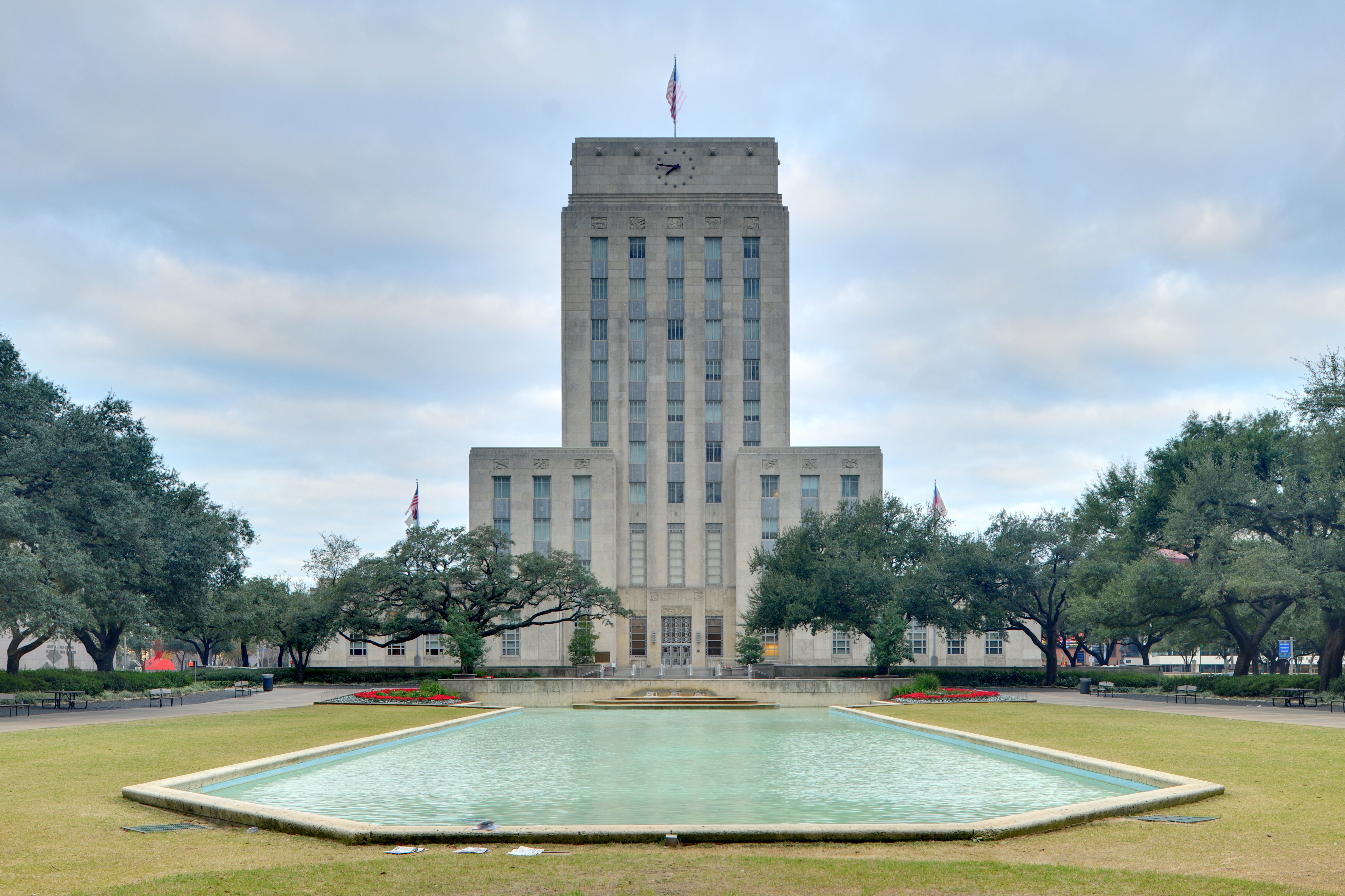
29°47′16″N 95°23′43″W / 29.78778°N 95.39528°WHouston 119 Houston City Hall 
September 18, 1990 901 Bagby St.
29°45′36″N 95°22′9″W / 29.76°N 95.36917°WHouston 120 Houston Fire Station No. 7 April 17, 1986 2304 Milam St.
29°44′49″N 95°22′29″W / 29.74694°N 95.37472°WHouston 121 Houston Heights Fire Station 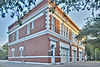
June 22, 1983 Yale and 12th Sts.
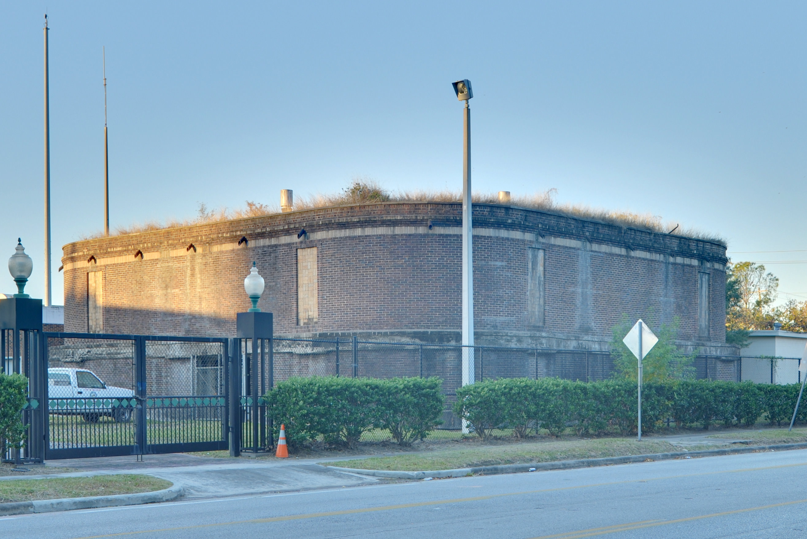
29°47′33″N 95°23′56″W / 29.7925°N 95.39889°WHouston 122 Houston Heights Waterworks Reservoir 
June 22, 1983 W. 20 and Nicolson Sts.
29°48′15″N 95°24′23″W / 29.80417°N 95.40639°WHouston 123 Houston Heights Woman's Club June 22, 1983 1846 Harvard St
29°48′12″N 95°23′47″W / 29.80333°N 95.39639°WHouston 124 Houston Negro Hospital 
December 27, 1982 3204 Ennis St.
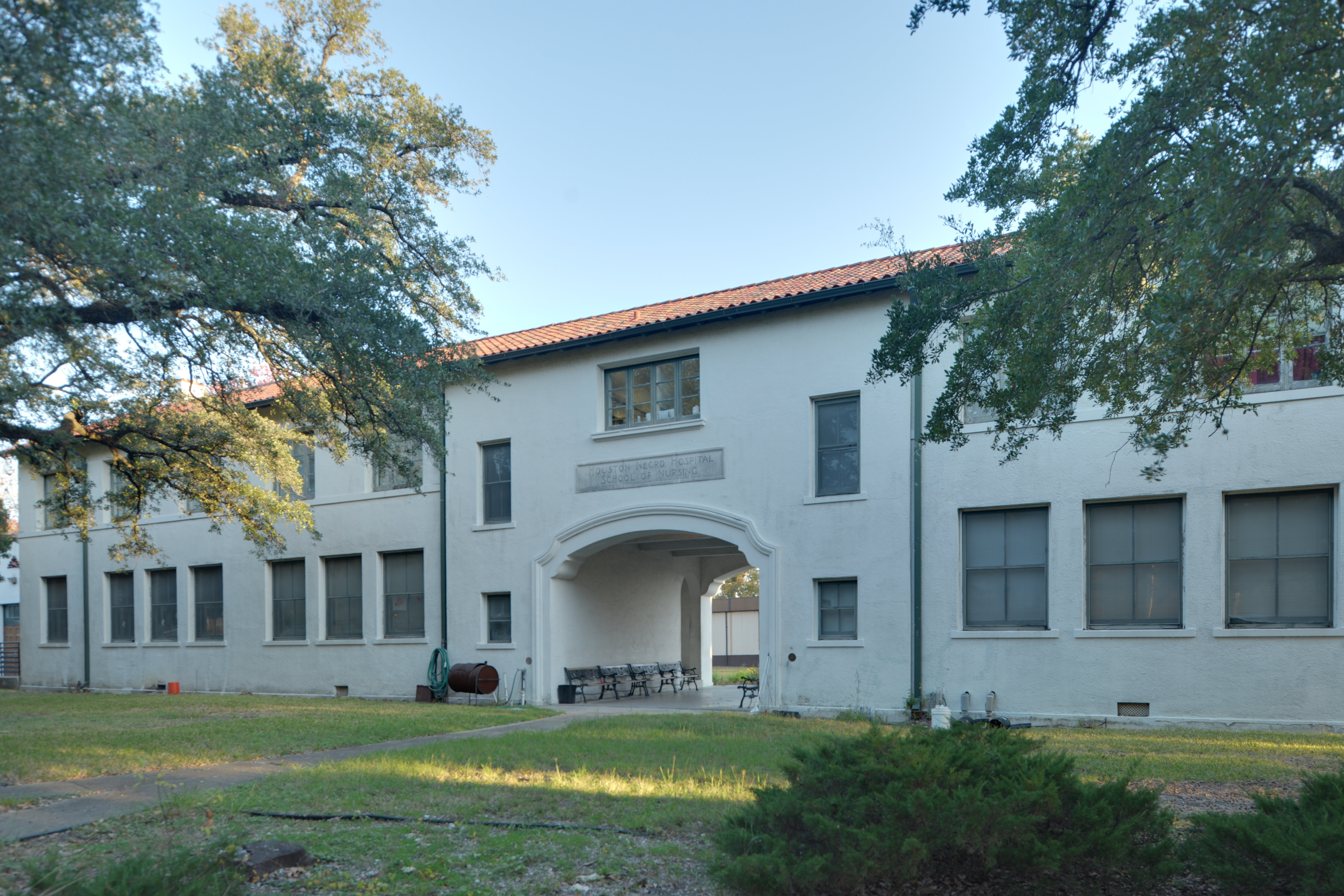
29°43′52″N 95°21′37″W / 29.73111°N 95.36028°WHouston 125 Houston Negro Hospital School of Nursing Building 
December 27, 1982 Holman Ave. and Ennis St.
29°43′34″N 95°21′26″W / 29.72611°N 95.35722°WHouston 126 Houston Post-Dispatch Building 
February 14, 2002 609 Fannin
29°45′32″N 95°21′41″W / 29.75889°N 95.36139°WHouston 127 Houston Public Library 
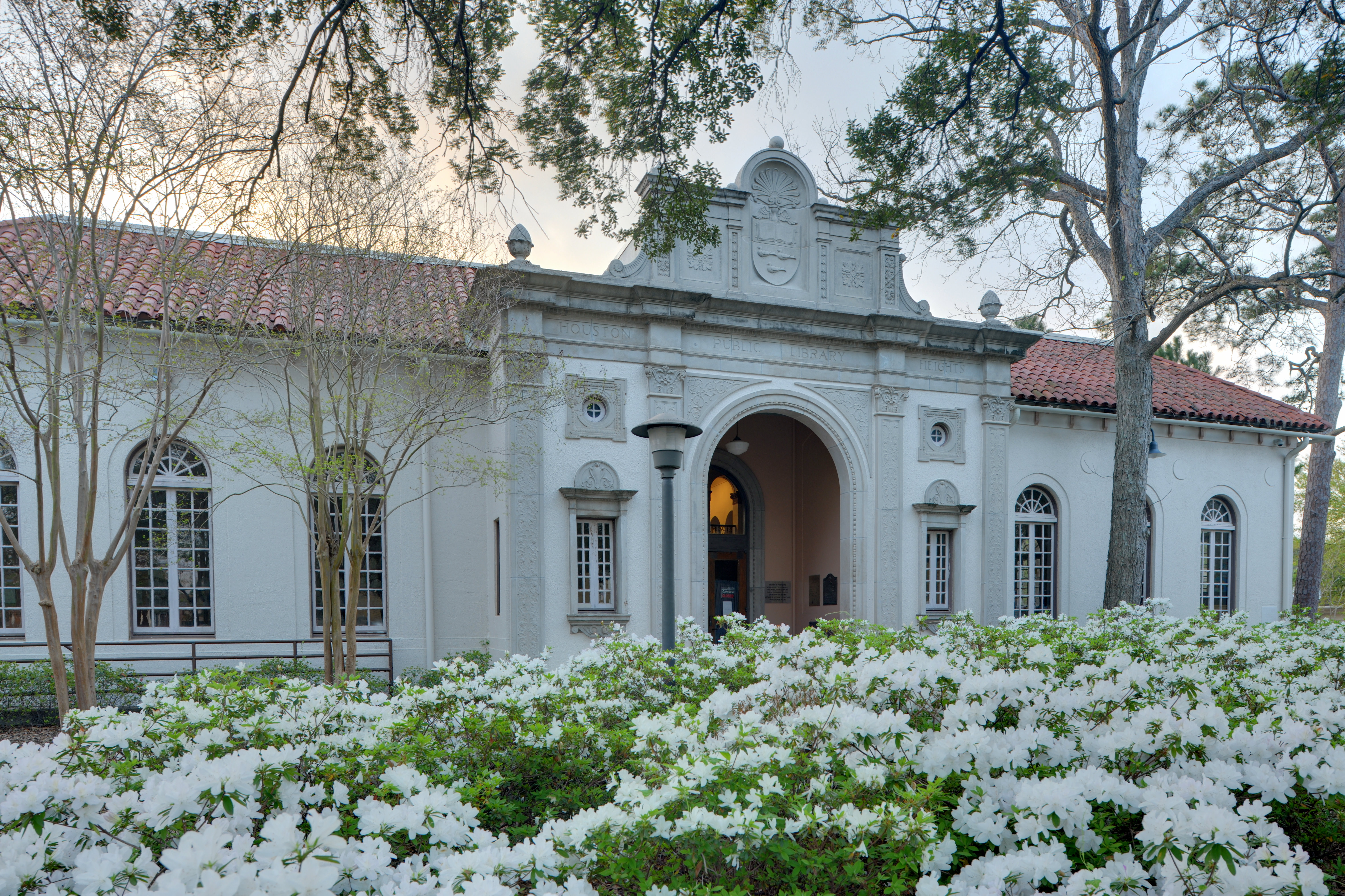
May 14, 1984 1302 Heights Blvd.
29°47′39″N 95°23′51″W / 29.79417°N 95.3975°WHouston 128 Houston Turn-Verein March 21, 1978 5202 Almeda Rd.
29°43′23″N 95°22′44″W / 29.72306°N 95.37889°WHouston 129 Humble Oil Building 
January 27, 1999 1212 Main St.
29°45′18″N 95°22′0″W / 29.755°N 95.366667°WHouston 130 Julia Ideson Building 
November 23, 1977 500 McKinney St.
29°45′32″N 95°22′9″W / 29.75889°N 95.36917°WHouston 131 Idylwood Historic District July 6, 2011 Roughly bounded by Lawndale Ave., N. MacGregor Way, Sylvan Rd. & Wayside Dr.
29°43′15″N 95°18′36″W / 29.72083°N 95.31°WHouston 132 Immanuel Lutheran Church 
June 22, 1983 1448 Cortlandt St.
29°47′52″N 95°23′42″W / 29.79778°N 95.395°WHouston 133 Independence Heights Residential Historic District 
June 4, 1997 Roughly bounded by N. Yale and E. 34th Sts., and I-610
29°48′54″N 95°23′45″W / 29.815°N 95.39583°WHouston 134 Independence Park June 4, 1997 Roughly bounded by 1000 Blk. of E. 40th St.
29°49′21″N 95°23′11″W / 29.8225°N 95.38639°WHouston 135 Isabella Court 
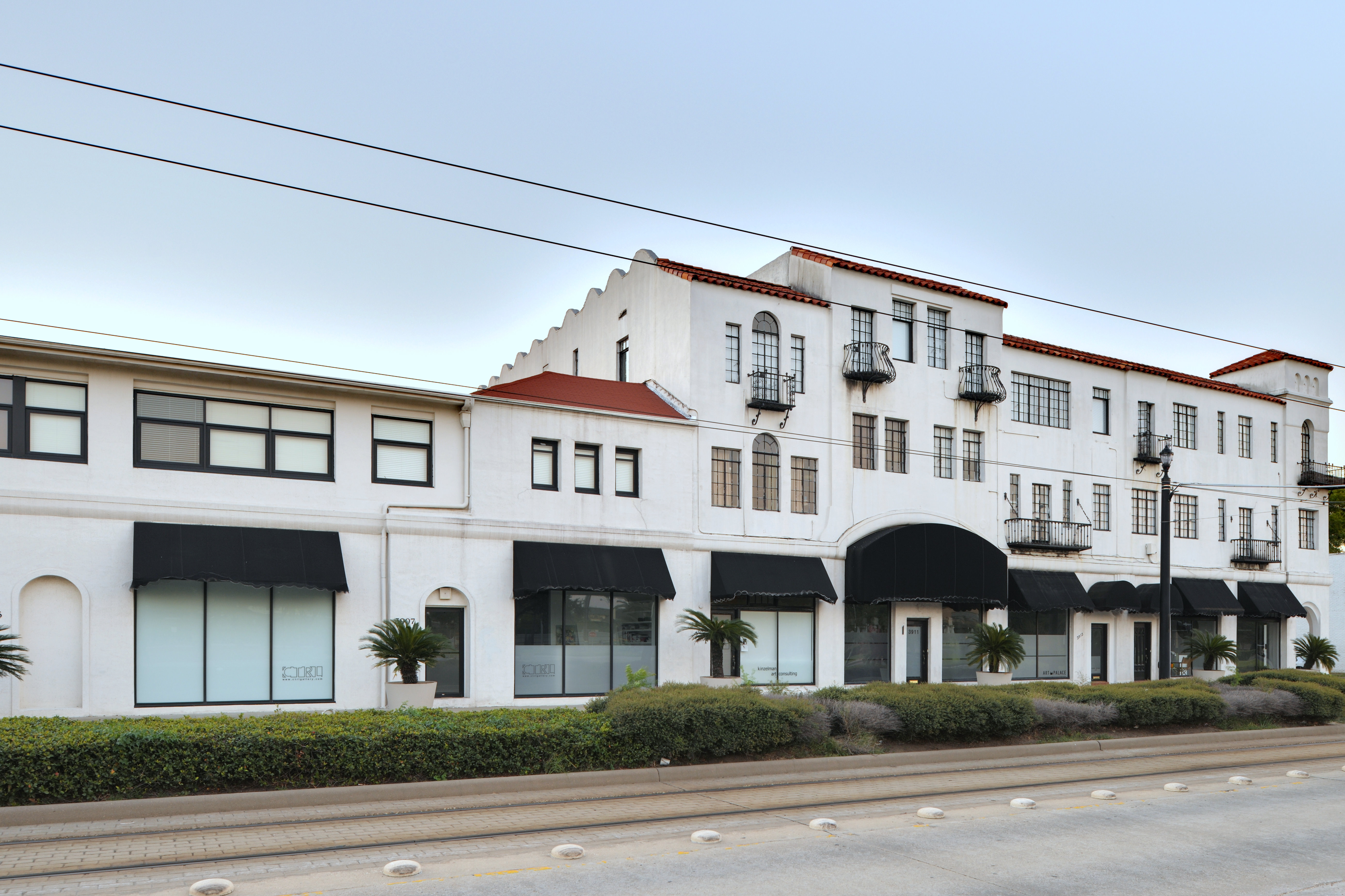
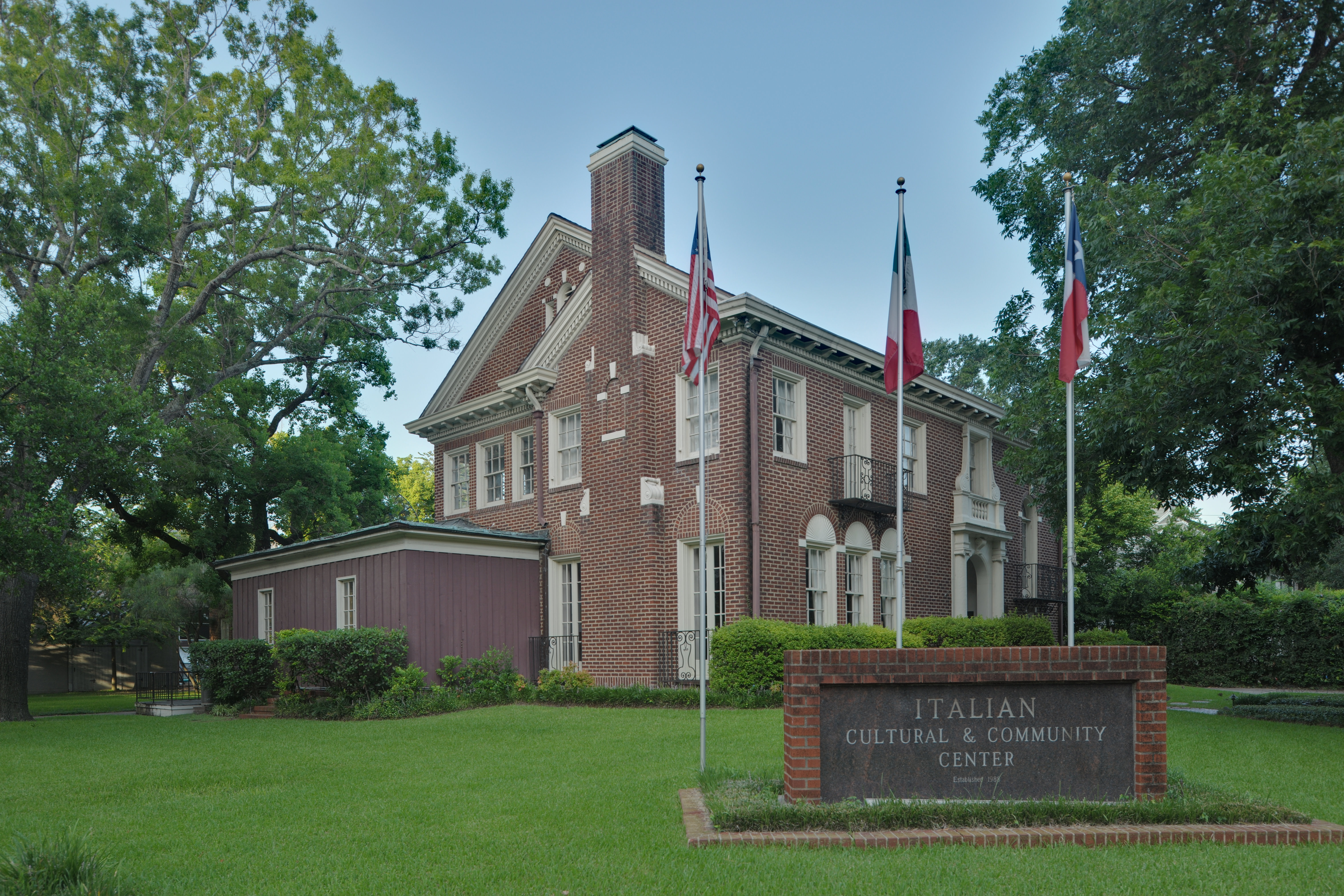
June 24, 1994 3909-3917 S. Main St.
29°44′11″N 95°22′50″W / 29.73639°N 95.38056°WHouston 136 Isbell House 
June 22, 1983 639 Heights Blvd.
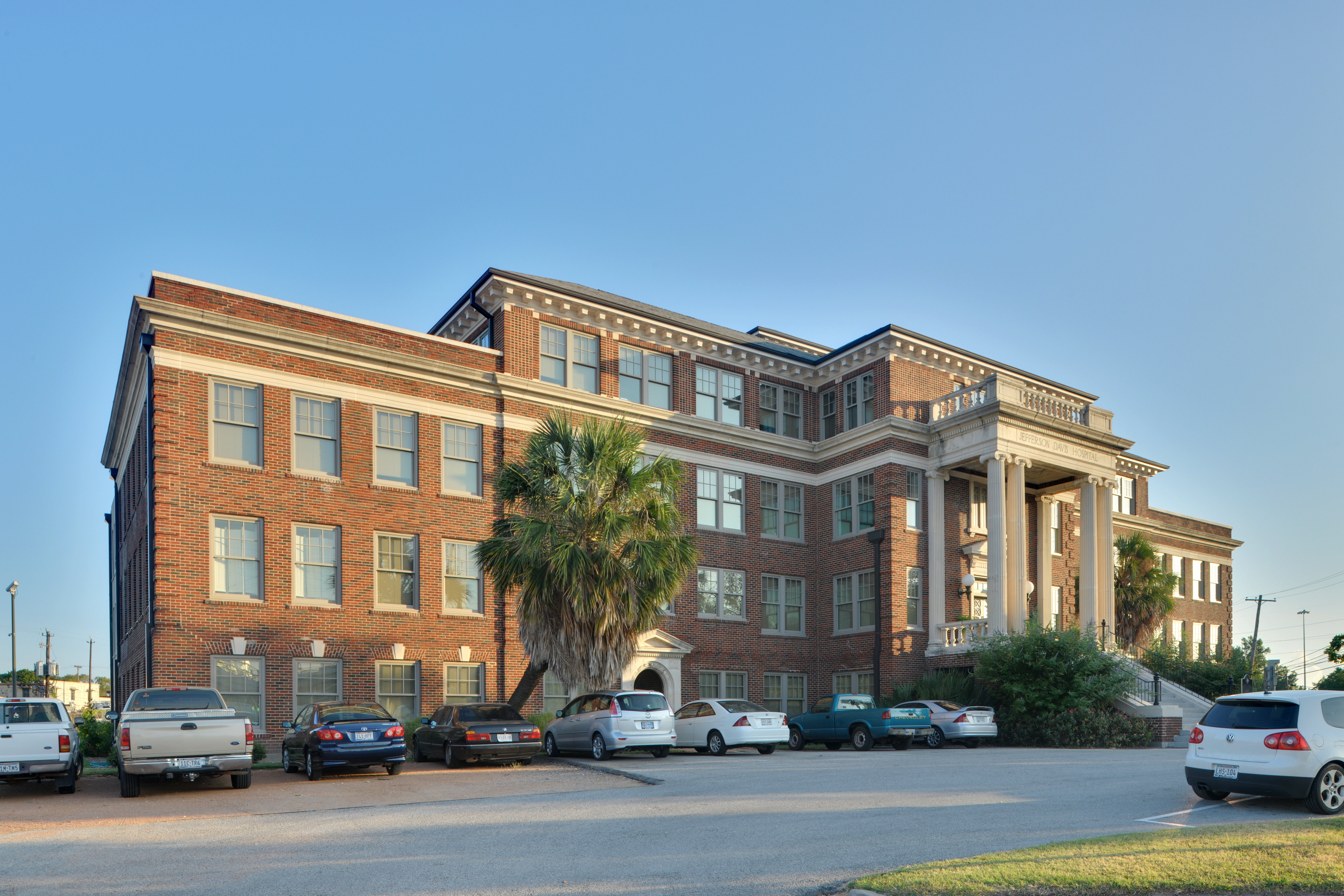
29°46′56″N 95°23′52″W / 29.78222°N 95.39778°WHouston 137 Jefferson Davis Hospital 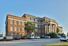
August 10, 2005 1101 Elder
29°46′10″N 95°22′7″W / 29.76944°N 95.36861°WHouston 138 James L. Jensen House July 17, 1990 721 Arlington
29°47′2″N 95°23′39″W / 29.78389°N 95.39417°WHouston 139 Charles Johnson House 
June 4, 1997 301 E. 35th St.
29°49′5″N 95°23′45″W / 29.81806°N 95.39583°WHouston 140 Morris and Mary Johnson House June 4, 1997 3818 Spencer St.
29°46′30″N 95°23′58″W / 29.775°N 95.39944°WHouston 141 Jones House June 22, 1983 1115-1117 Allston St.
29°47′27″N 95°24′0″W / 29.79083°N 95.4°WHouston 142 Jones-Hunt House June 14, 1979 24 Courtlandt Pl.
29°44′37″N 95°23′8″W / 29.74361°N 95.38556°WHouston 143 Keller House 
May 14, 1984 1448 Heights Blvd.
29°47′51″N 95°23′51″W / 29.7975°N 95.3975°WHouston 144 Kellum-Noble House 
April 3, 1975 212 Dallas St.
29°45′31″N 95°22′19″W / 29.75861°N 95.37194°WHouston 145 Kennedy Bakery 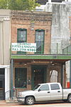
July 27, 1979 813 Congress St.
29°45′46″N 95°21′41″W / 29.76278°N 95.36139°WHouston 146 Marshall W. Kennedy House 
January 15, 1988 1122 Harvard
29°47′28″N 95°23′45″W / 29.79111°N 95.39583°WHouston 147 Kleinhaus House June 22, 1983 803 Yale St.
29°47′7″N 95°23′56″W / 29.78528°N 95.39889°WHouston 148 Knittel House 
June 22, 1983 1601 Ashland St.
29°47′59″N 95°24′10″W / 29.79972°N 95.40278°WHouston 149 Kress Building 
October 4, 2002 705 Main St.
29°45′31″N 95°21′46″W / 29.75861°N 95.36278°WHouston 150 Kronenberger House 
June 22, 1983 612 W. 26th St.
29°48′34″N 95°24′18″W / 29.80944°N 95.405°WHouston 151 Lewis Apartment Building 
May 24, 1996 2815-2817 Smith St.
29°44′43″N 95°22′44″W / 29.74528°N 95.37889°WHouston 152 Ella Lewis Store and Rental Houses 
June 4, 1997 3404-3406-3408 Cortlandt St.
29°49′2″N 95°23′44″W / 29.81722°N 95.39556°WHouston 153 Emil Lindenburg House 
January 15, 1988 1445 Harvard
29°47′52″N 95°23′48″W / 29.79778°N 95.39667°WHouston 154 Oscar Lindsay House 
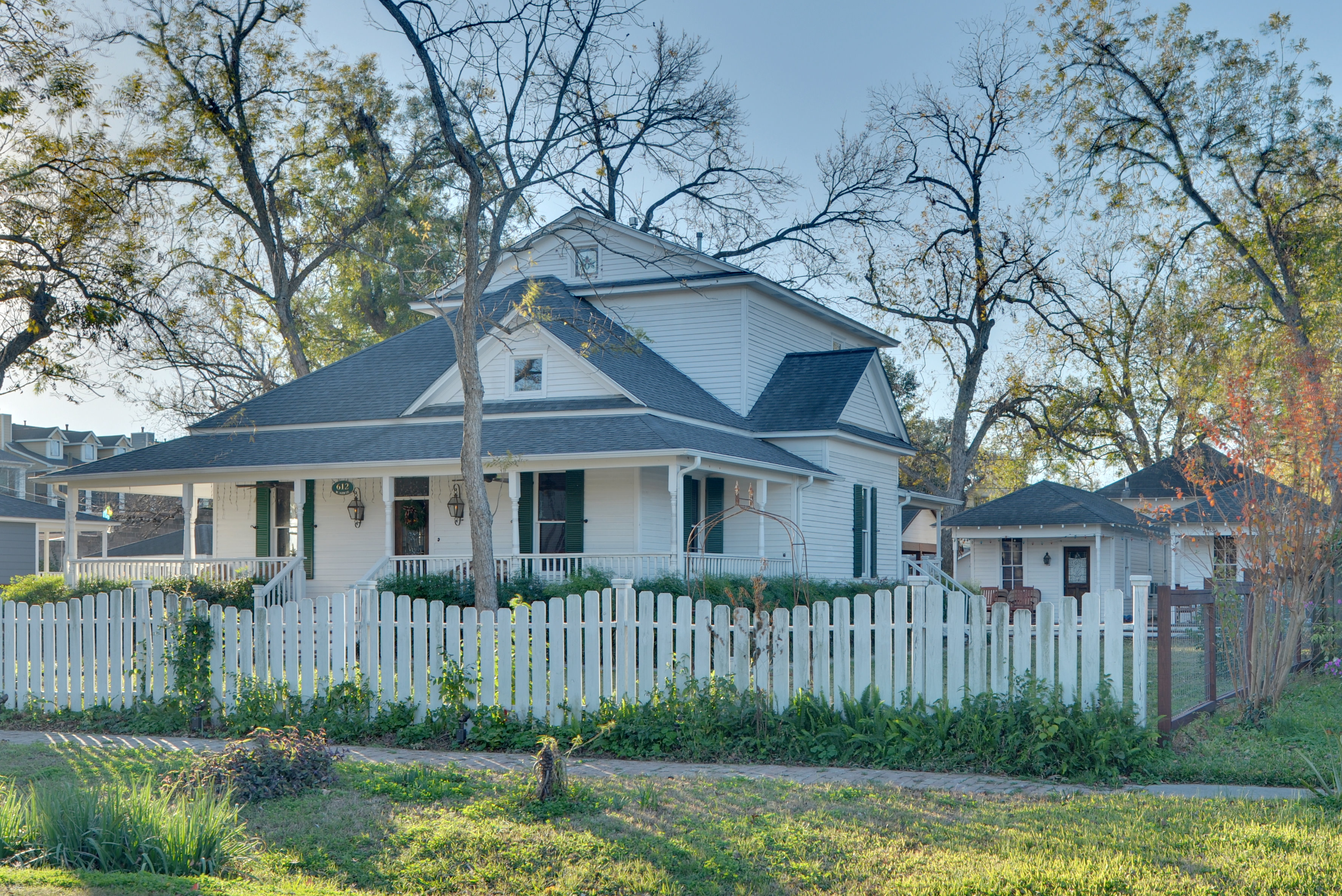
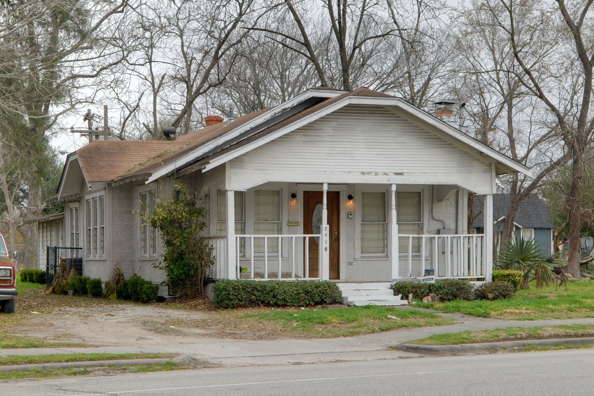
June 4, 1997 7415 N. Main St.
29°49′2″N 95°23′34″W / 29.81722°N 95.39278°WHouston 155 Link–Lee House 
September 11, 2000 3800 Montrose
29°44′16″N 95°23′29″W / 29.73778°N 95.39139°WHouston 156 Logue House 
April 30, 1998 1101 Milford
29°43′44″N 95°23′31″W / 29.72889°N 95.39194°WHouston 157 Fayette C. Lowry House July 19, 1990 2009 Harvard
29°48′15″N 95°23′48″W / 29.80417°N 95.39667°WHouston 158 Lund House 
June 22, 1983 301 E. 5th St.
29°46′46″N 95°23′42″W / 29.77944°N 95.395°WHouston 159 Leonard W. Macatee House May 6, 2005 1220 Southmore Blvd.
29°47′33″N 95°23′12″W / 29.7925°N 95.38667°WHouston 160 William Mackey House June 4, 1997 313 E. 37th St.
29°48′38″N 95°23′42″W / 29.81056°N 95.395°WHouston 161 Main Street/Market Square Historic District 
July 18, 1983 Roughly bounded by Buffalo Bayou, Fannin, Texas, and Milam streets
29°45′47″N 95°21′40″W / 29.76306°N 95.36111°WHouston 162 Mansfield House 
June 22, 1983 1802 Harvard St.
29°48′6″N 95°23′47″W / 29.80167°N 95.39639°WHouston 163 Mansfield Street Archeological Site May 22, 1978 Address Restricted Houston 164 Henry Hicks McCain House January 15, 1988 1026 Allston
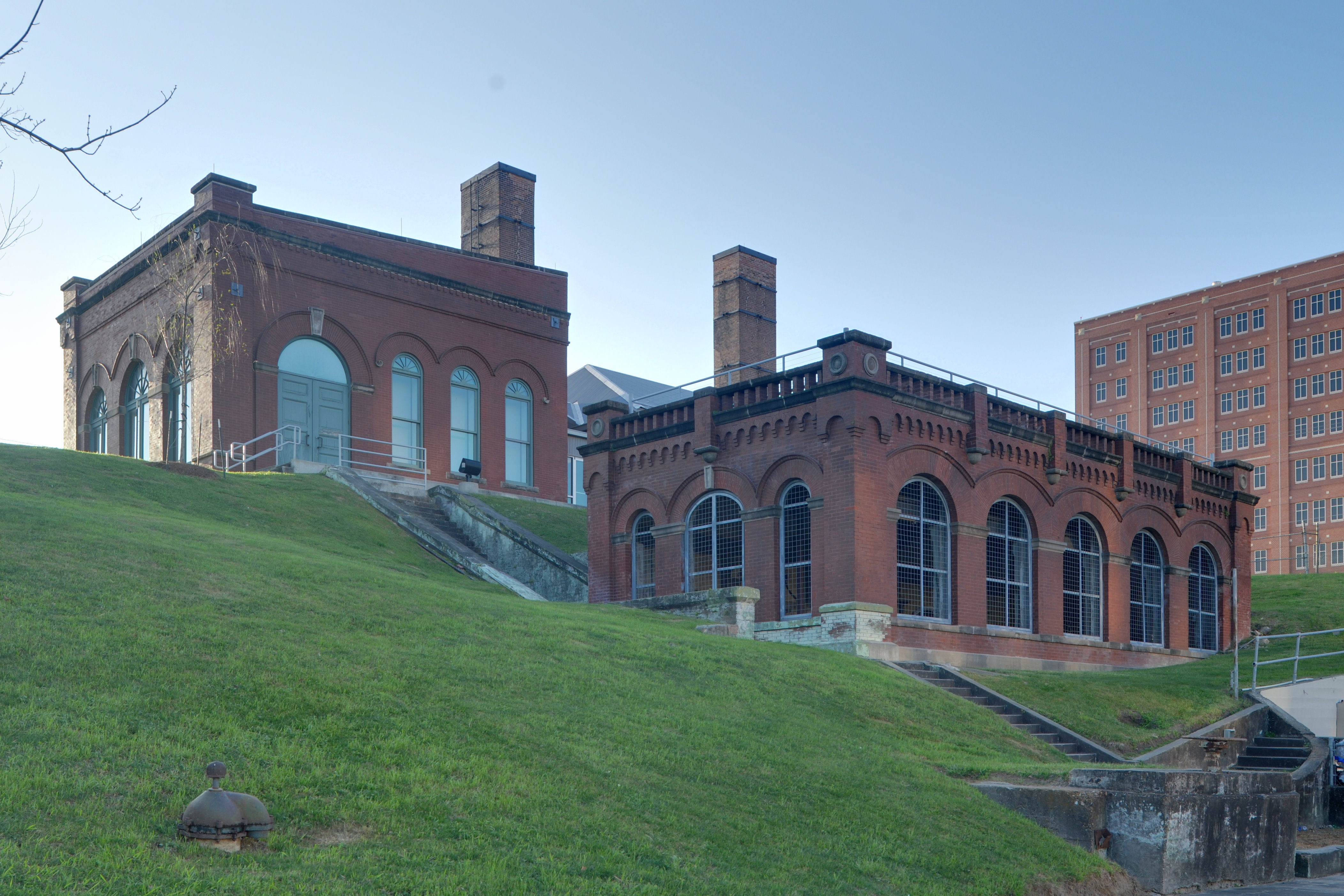
29°47′23″N 95°23′59″W / 29.78972°N 95.39972°WHouston 165 D. C. McCollum House 
July 17, 1990 433 W. 24th St.
29°48′29″N 95°24′16″W / 29.80806°N 95.40444°WHouston 166 McDonald House June 22, 1983 1801 Ashland St.
29°48′6″N 95°24′10″W / 29.80167°N 95.40278°WHouston 167 McKee Street Bridge 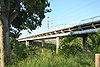
September 3, 2002 McKee St. and Buffalo Bayou
29°45′57″N 95°21′7″W / 29.76583°N 95.35194°WHouston 168 James V. Meek House 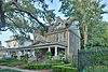
March 17, 1994 3704 Garrott Ave.
29°44′22″N 95°23′8″W / 29.73944°N 95.38556°WHouston 169 Meitzen House May 14, 1984 725 Harvard St.
29°46′30″N 95°23′46″W / 29.775°N 95.39611°WHouston 170 Merchants and Manufacturers Building 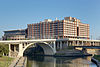
September 17, 1980 University of Houston–Downtown
1 Main St.
29°45′57″N 95°21′32″W / 29.76583°N 95.35889°WHouston 171 Miller House 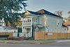
May 14, 1984 1245 Yale St.
29°47′37″N 95°23′57″W / 29.79361°N 95.39917°WHouston 172 Ezekial and Mary Jane Miller House 
October 6, 1983 304 Hawthorne St.
29°44′36″N 95°23′2″W / 29.74333°N 95.38389°WHouston 173 Milroy House June 22, 1983 1102 Heights Blvd.
29°47′26″N 95°23′51″W / 29.79056°N 95.3975°WHouston 174 John Milroy House November 12, 1980 1102 Heights Blvd.
29°47′27″N 95°23′49″W / 29.79083°N 95.39694°WHouston 175 Milroy-Muller House 
May 14, 1984 1602 Harvard St.
29°47′59″N 95°23′46″W / 29.79972°N 95.39611°WHouston 176 Simon and Mamie Minchen House 
December 7, 2000 1753 North Blvd.
29°43′45″N 95°24′15″W / 29.72917°N 95.40417°WHouston 177 Angelo and Lillian Minella House 
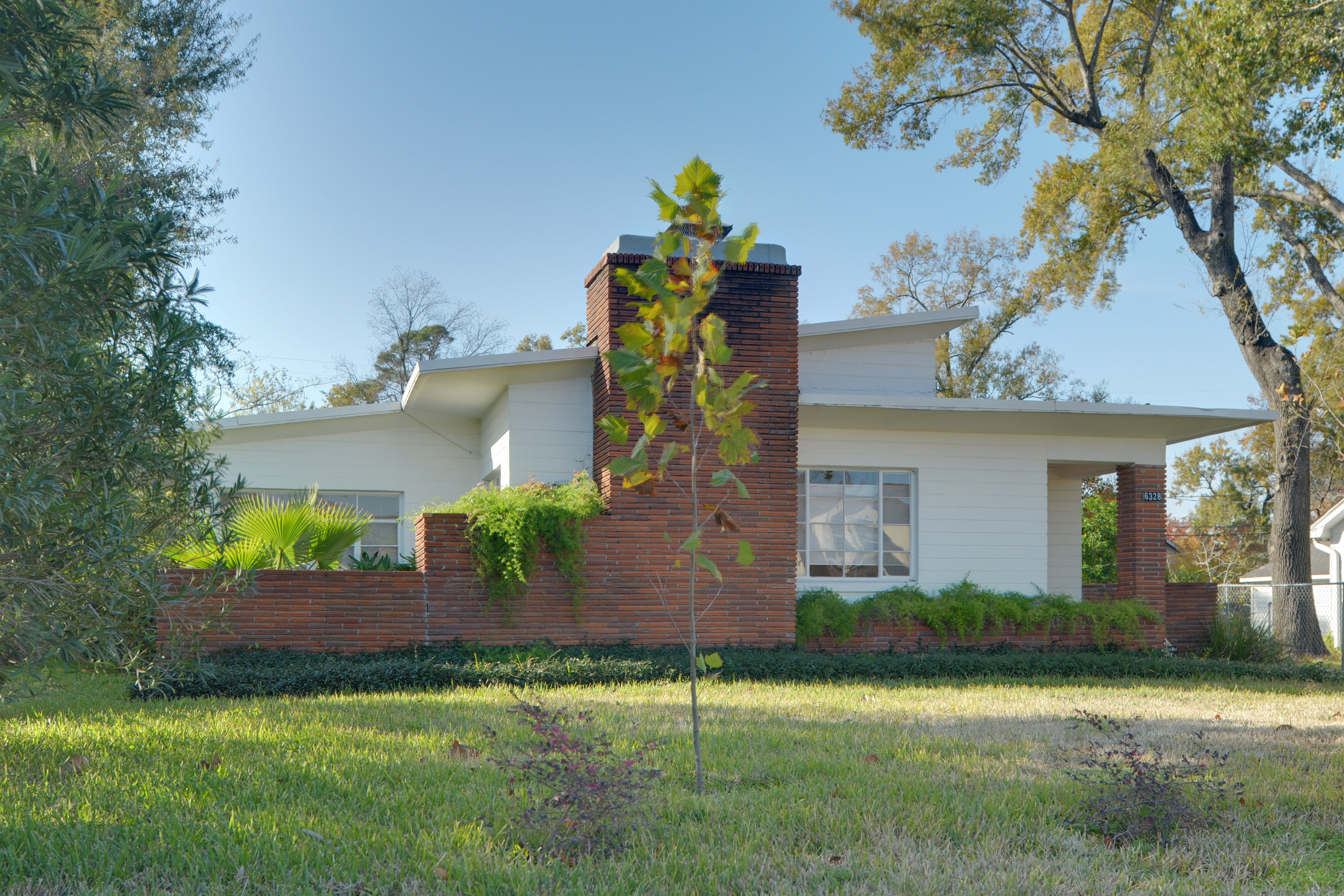
September 13, 2006 6328 Brookside Dr.
29°43′52″N 95°18′59″W / 29.73111°N 95.31639°WHouston 178 Morgan's Point Historic District September 30, 1994 89-835 Bayridge Rd. and 300-322 Vinsonia
29°40′13″N 94°59′39″W / 29.67028°N 94.99417°WMorgan's Point 179 Glenn W. Morris House July 17, 1990 1611 Harvard St.
29°48′8″N 95°23′48″W / 29.80222°N 95.39667°WHouston 180 Morton Brothers Grocery 
January 15, 1988 401 W. Ninth
29°47′13″N 95°24′4″W / 29.78694°N 95.40111°WHouston 181 Mulcahy House May 14, 1984 1046 Harvard St.
29°47′23″N 95°23′45″W / 29.78972°N 95.39583°WHouston 182 Sterling Myer House June 14, 1979 4 Courtlandt Pl.
29°44′37″N 95°22′55″W / 29.74361°N 95.38194°WHouston 183 Myers-Spalti Manufacturing Plant 
September 12, 2003 2115 Runnels St.
29°45′45″N 95°20′49″W / 29.7625°N 95.34694°WHouston 184 Forrest A. Nairn House November 12, 1991 1148 Heights Blvd.
29°47′31″N 95°23′50″W / 29.79194°N 95.39722°WHouston 185 William R. Nash House 
August 23, 1990 215 Westmoreland Ave.
29°44′27″N 95°23′4″W / 29.74083°N 95.38444°WHouston 186 National Biscuit Company Building 
February 20, 1998 15 N. Chenevert
29°45′36″N 95°21′8″W / 29.76°N 95.35222°WHouston 187 Near North Side Historic District November 29, 2010 Roughly bounded by Little White Oak Bayou on the N; Hogan on the S; I-45 on the W and the block between N Main and Keene
29°46′42″N 95°21′55″W / 29.77833°N 95.36528°WHouston 188 C. L. Neuhaus House June 14, 1979 6 Courtlandt Pl.
29°44′37″N 95°22′56″W / 29.74361°N 95.38222°WHouston 189 Hugo V. Neuhaus Jr. House March 30, 2005 2910 Lazy Ln.
29°45′28″N 95°25′0″W / 29.75778°N 95.416667°WHouston 190 Joseph Ogle House June 22, 1983 530 Harvard St.
29°46′47″N 95°23′45″W / 29.77972°N 95.39583°WHouston 191 Old Houston National Bank July 17, 1975 202 Main St.
29°45′46″N 95°21′37″W / 29.76278°N 95.36028°WHouston 192 Old Sixth Ward Historic District 
January 23, 1978 Bounded by Washington, Union, Houston, Capitol and Glenwood Cemetery
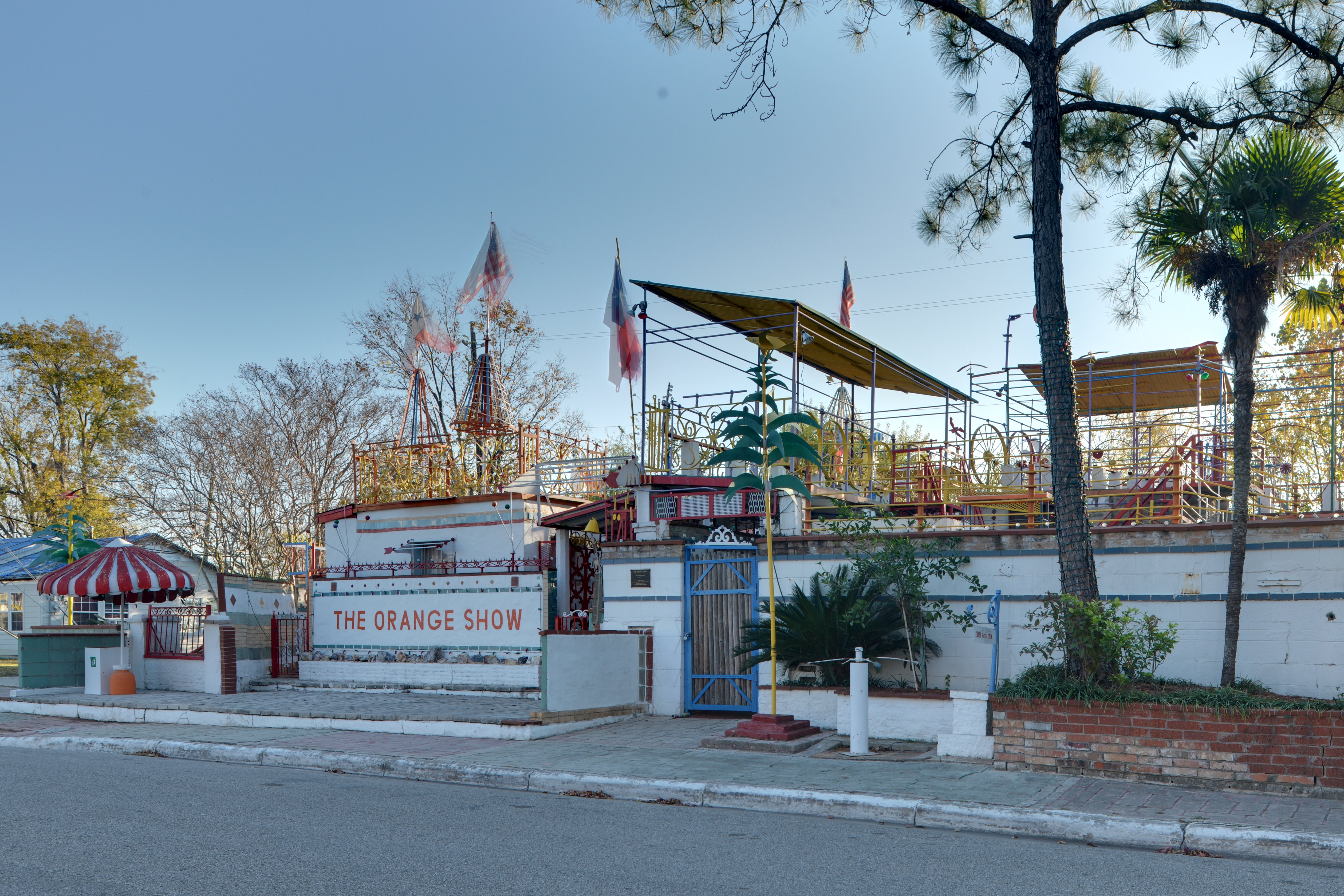
29°45′57″N 95°22′38″W / 29.76583°N 95.37722°WHouston 193 The Orange Show 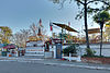
November 21, 2006 2401 Munger St.
29°43′10″N 95°19′28″W / 29.71944°N 95.32444°WHouston 194 Oriental Textile Mill 
June 22, 1983 2201 Lawrence St.
29°48′20″N 95°24′30″W / 29.80556°N 95.40833°WHouston 195 Otto House 
May 14, 1984 835 Rutland St.
29°47′9″N 95°24′3″W / 29.78583°N 95.40083°WHouston 196 Palace Hotel September 13, 2006 216 La Branch
29°45′44″N 95°21′24″W / 29.76222°N 95.35667°WHouston 197 Edward Albert Palmer Memorial Chapel and Autry House October 31, 1984 6221 and 6265 Main St.
29°42′57″N 95°23′47″W / 29.71583°N 95.39639°WHouston 198 John W. Parker House June 14, 1979 2 Courtlandt Pl.
29°44′37″N 95°22′54″W / 29.74361°N 95.38167°WHouston 199 Paul Building 
April 6, 1979 1018 Preston Ave.
29°45′38″N 95°21′38″W / 29.76056°N 95.36056°WHouston 200 D. D. Peden House July 16, 1991 2 Longfellow Ln.
29°43′20″N 95°23′34″W / 29.72222°N 95.39278°WHouston 201 Perry-Swilley House June 22, 1983 1101 Heights Blvd.
29°47′26″N 95°23′53″W / 29.79056°N 95.39806°WHouston 202 Pomeroy Homestead May 1, 2003 202 and 204 S. Main St.
29°42′43″N 95°12′35″W / 29.71194°N 95.20972°WPasadena 203 Thomas B. Reed House 
July 17, 1990 933 Allston St.
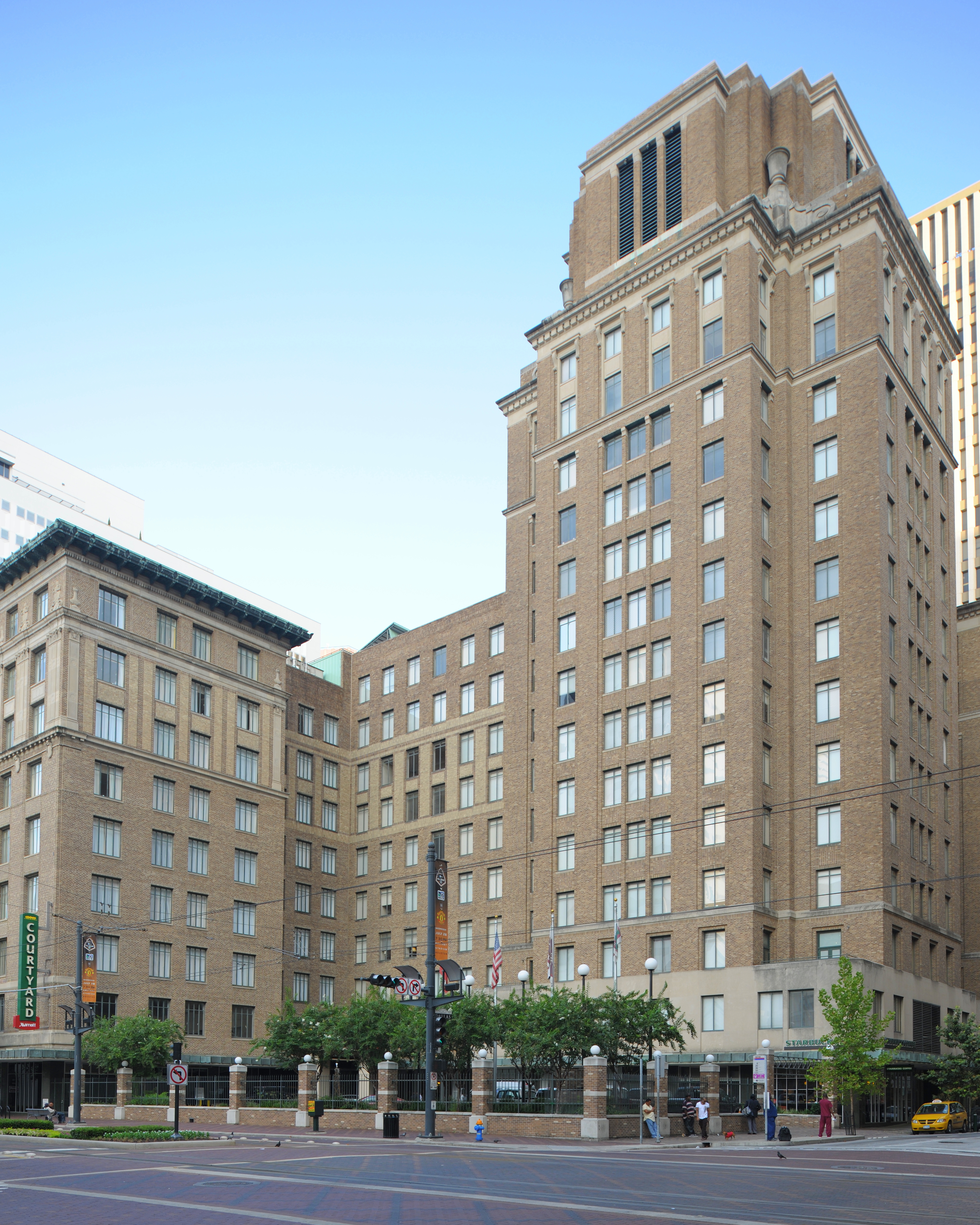
29°47′17″N 95°24′1″W / 29.78806°N 95.40028°WHouston 204 Rice Hotel 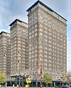
June 23, 1978 Main St. and Texas Ave.
29°45′37″N 95°21′46″W / 29.76028°N 95.36278°WHouston 205 Charles Roessler House January 15, 1988 736 Cortland
29°47′4″N 95°23′41″W / 29.78444°N 95.39472°WHouston 206 Ghent W. Rogers House July 17, 1990 1150 Cortlandt
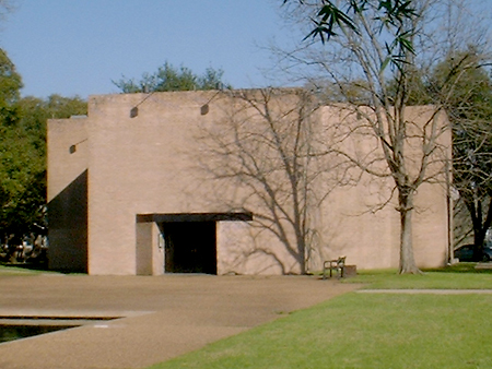
29°47′31″N 95°23′41″W / 29.79194°N 95.39472°WHouston 207 Rothko Chapel 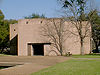
August 16, 2000 1409 Sul Ross Ave.
29°44′15″N 95°23′46″W / 29.7375°N 95.39611°WHouston 208 Sabine Street Bridge over Buffalo Bayou 
September 28, 2007 Sabine St. at Buffalo Bayou
29°45′45″N 95°22′31″W / 29.7625°N 95.37528°WHouston 209 Sam Houston Hotel (Alden Houston) 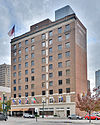
April 17, 2002 1117 Prairie St.
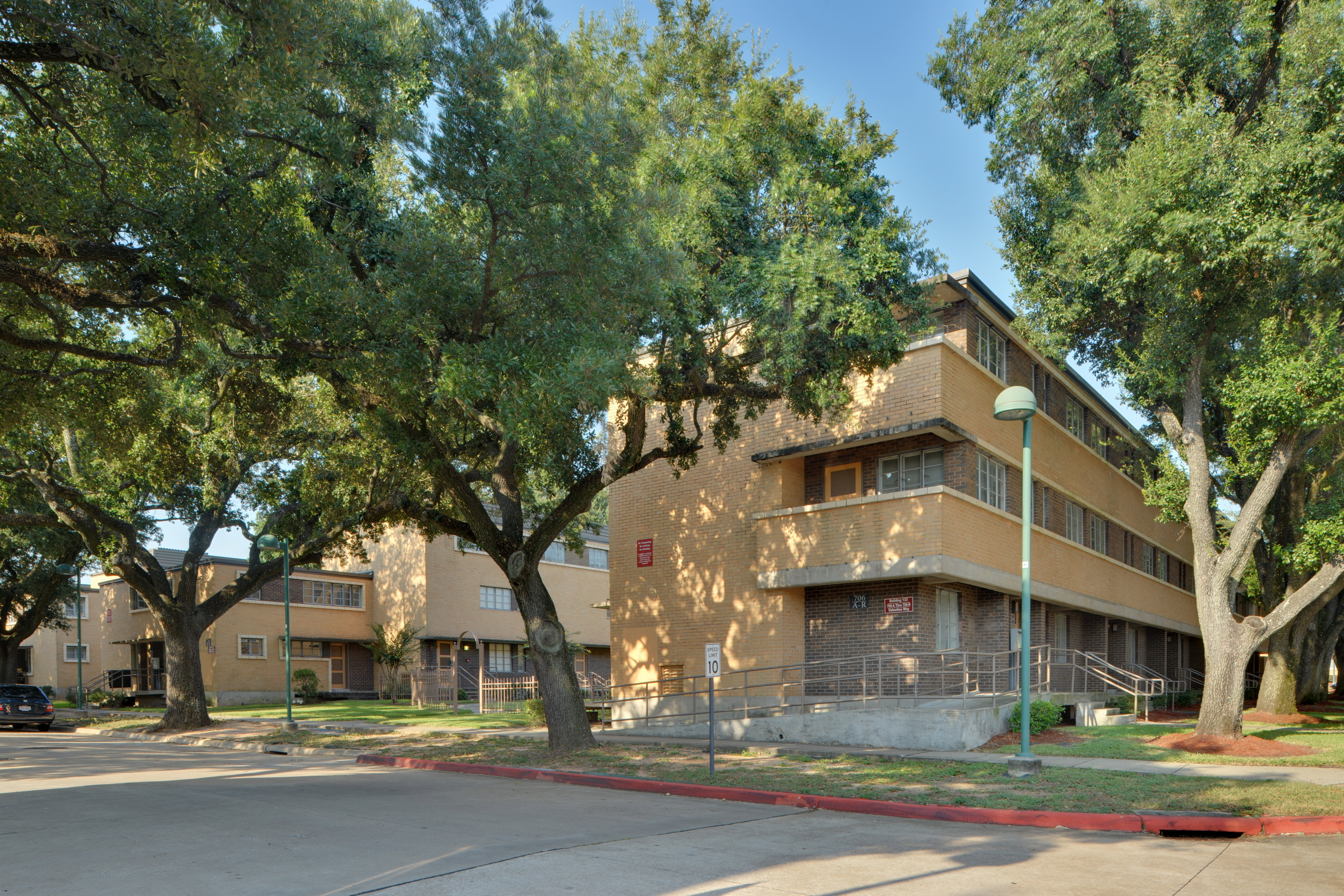
29°45′42″N 95°21′37″W / 29.76167°N 95.36028°WHouston 210 San Felipe Courts Historic District 
February 16, 1988 1 Allen Pkwy. Village
29°45′34″N 95°22′42″W / 29.75944°N 95.37833°WHouston 211 San Jacinto Battlefield 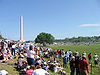
October 15, 1966 22 mi (35 km). E of Houston on TX 134
29°44′56″N 95°4′49″W / 29.74889°N 95.08028°WHouston 212 San Jacinto Street Bridge over Buffalo Bayou October 16, 2007 San Jacinto St. at Buffalo Bayou
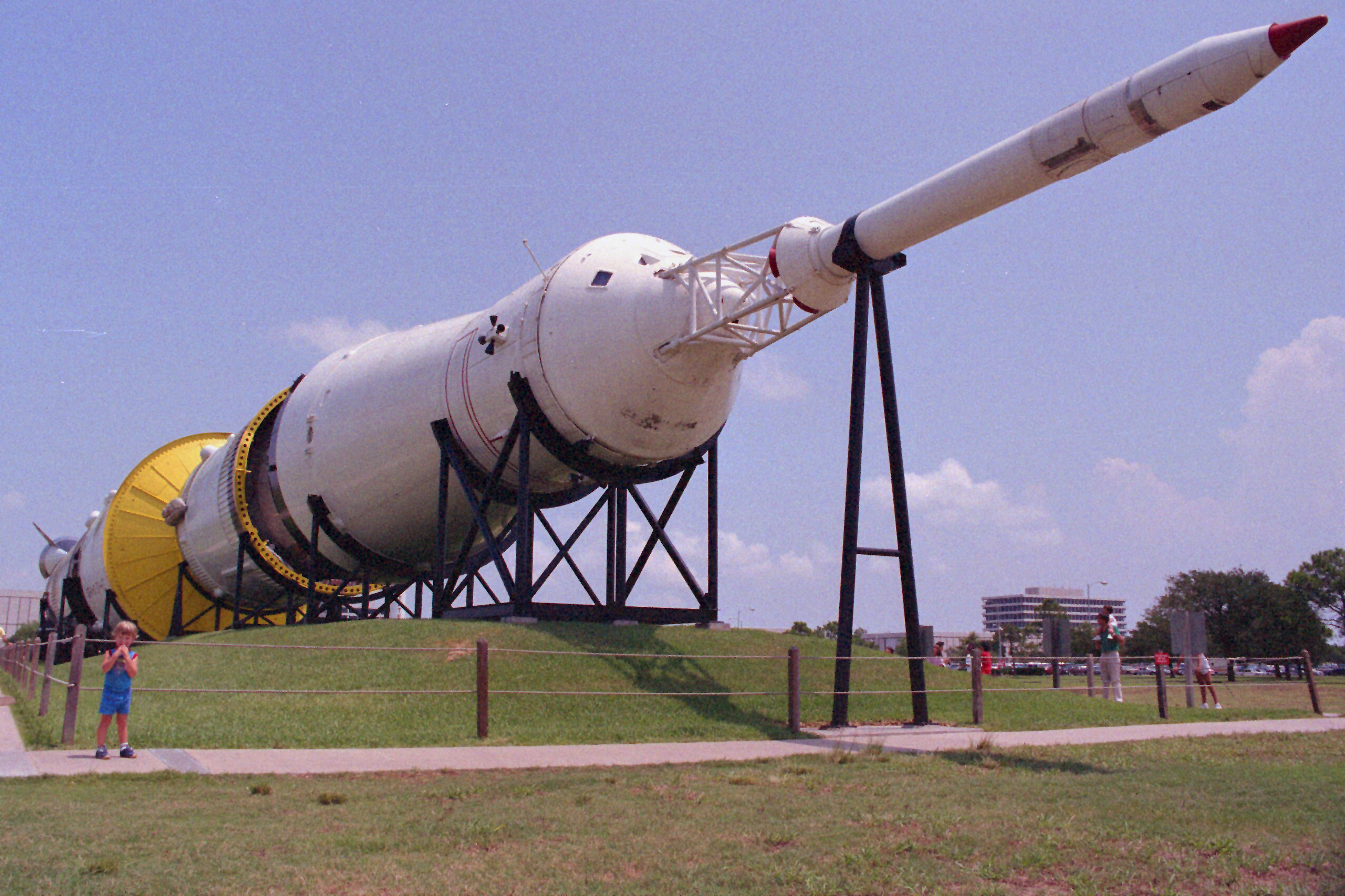
29°45′53″N 95°21′27″W / 29.76472°N 95.3575°WHouston 213 Saturn V Launch Vehicle 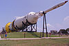
February 4, 2003 Johnson Space Center
29°33′26″N 95°5′20″W / 29.55722°N 95.08889°WHouston 214 Scanlan Building 
May 23, 1980 405 Main St.
29°45′40″N 95°21′40″W / 29.76111°N 95.36111°WHouston 215 Schauer Filling Station June 22, 1983 1400 Oxford St.
29°47′46″N 95°23′32″W / 29.79611°N 95.39222°WHouston 216 Schlesser-Burrows House May 14, 1984 1123 Harvard St.
29°47′26″N 95°23′48″W / 29.79056°N 95.39667°WHouston 217 Sessums-James House November 19, 1998 3802 Spencer
29°46′30″N 95°23′57″W / 29.775°N 95.39917°WHouston 218 Cleveland Harding Sewall House April 14, 1975 3452 Inwood St.
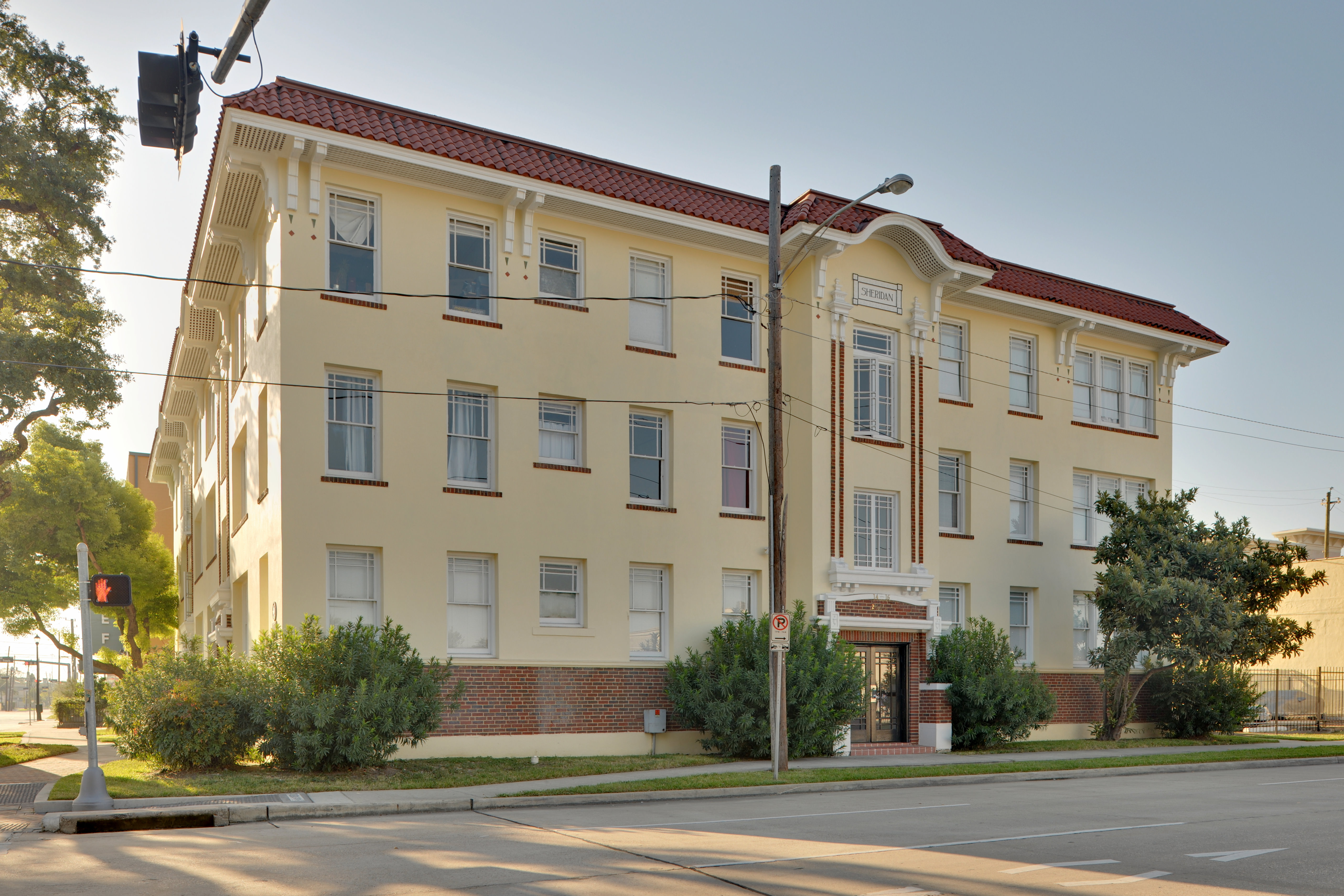
29°45′7″N 95°25′48″W / 29.75194°N 95.43°WHouston 219 Sheridan Apartments 
August 2, 1984 802-804 McGowen St.
29°44′45″N 95°22′32″W / 29.74583°N 95.37556°WHouston 220 John H. Shoaf House January 15, 1988 2030 Arlington
29°48′17″N 95°23′38″W / 29.80472°N 95.39389°WHouston 221 South Texas National Bank 
December 8, 1978 215 Main St.
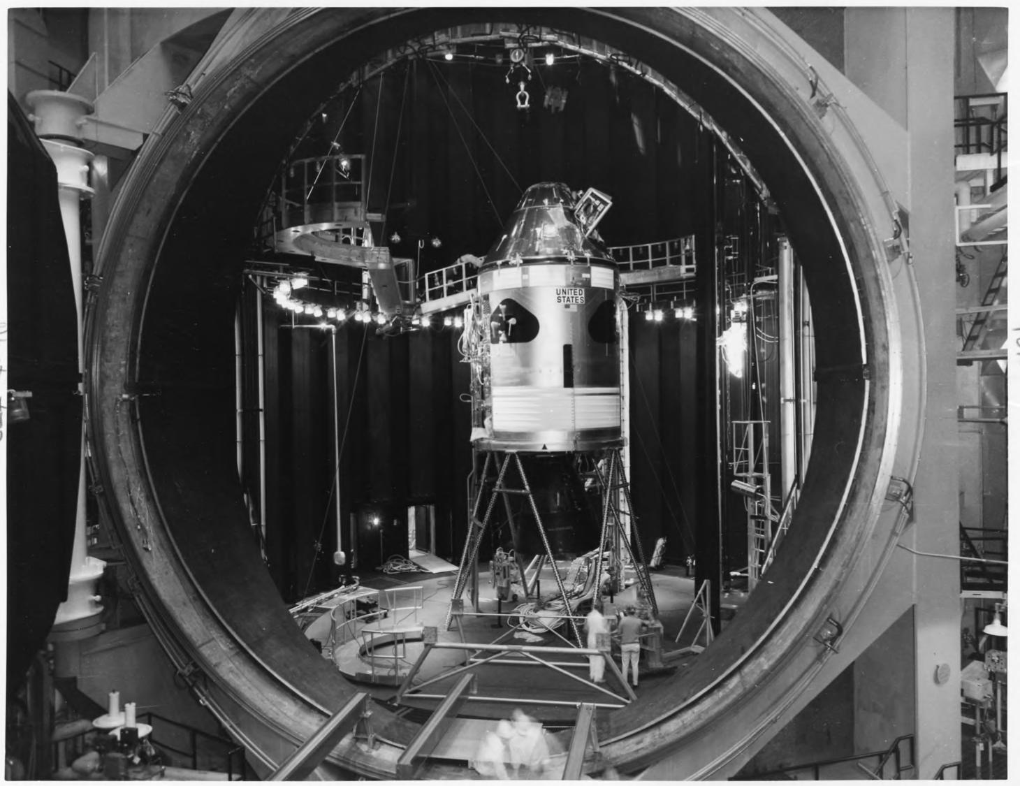
29°45′44″N 95°21′36″W / 29.76222°N 95.36°WHouston 222 Space Environment Simulation Laboratory 
October 3, 1985 Lyndon B. Johnson Space Center
29°33′38″N 95°5′17″W / 29.56056°N 95.08806°WHouston 223 Star Engraving Company Building 
January 6, 1995 3201 Allen Pkwy.
29°45′36″N 95°23′19″W / 29.76°N 95.38861°WHouston 224 State Highway 35 Bridge at the West Fork of the San Jacinto River 
October 10, 1996 US 59, 1.4 mi (2.3 km). N of jct. with FM 1960
30°1′39″N 95°15′28″W / 30.0275°N 95.25778°WHumble 225 State National Bank Building August 11, 1982 412 Main St.
29°45′40″N 95°21′42″W / 29.76111°N 95.36167°WHouston 226 Sterling S. Ross House October 29, 1982 515 Bayridge Rd.
29°40′7″N 94°59′42″W / 29.66861°N 94.995°WMorgan's Point 227 Sterling-Berry House July 14, 1983 4515 Yoakum Blvd.
29°43′56″N 95°23′31″W / 29.73222°N 95.39194°WHouston 228 Joseph R. and Mary M. Stevenson House 
March 21, 1996 804 Harold St.
29°44′28″N 95°23′20″W / 29.74111°N 95.38889°WHouston 229 Dr. James M. and Dove Stewart House 
February 16, 1996 5702 Fourth St.
29°47′21″N 95°49′21″W / 29.78917°N 95.8225°WKaty 230 Sweeney, Coombs & Fredericks Building 
June 20, 1974 301 Main St.
29°45′43″N 95°21′38″W / 29.76194°N 95.36056°WHouston 231 Sylvan Beach Pavilion September 9, 2010 554 N Bayshore Dr.
29°39′4″N 95°0′38″W / 29.65111°N 95.01056°WLa Porte 232 Judson L. Taylor House June 14, 1979 20 Courtlandt Pl.
29°44′37″N 95°23′6″W / 29.74361°N 95.385°WHouston 233 Telephone Road Bridge over Brays Bayou 
November 29, 2007 Telephone Rd. at Brays Bayou
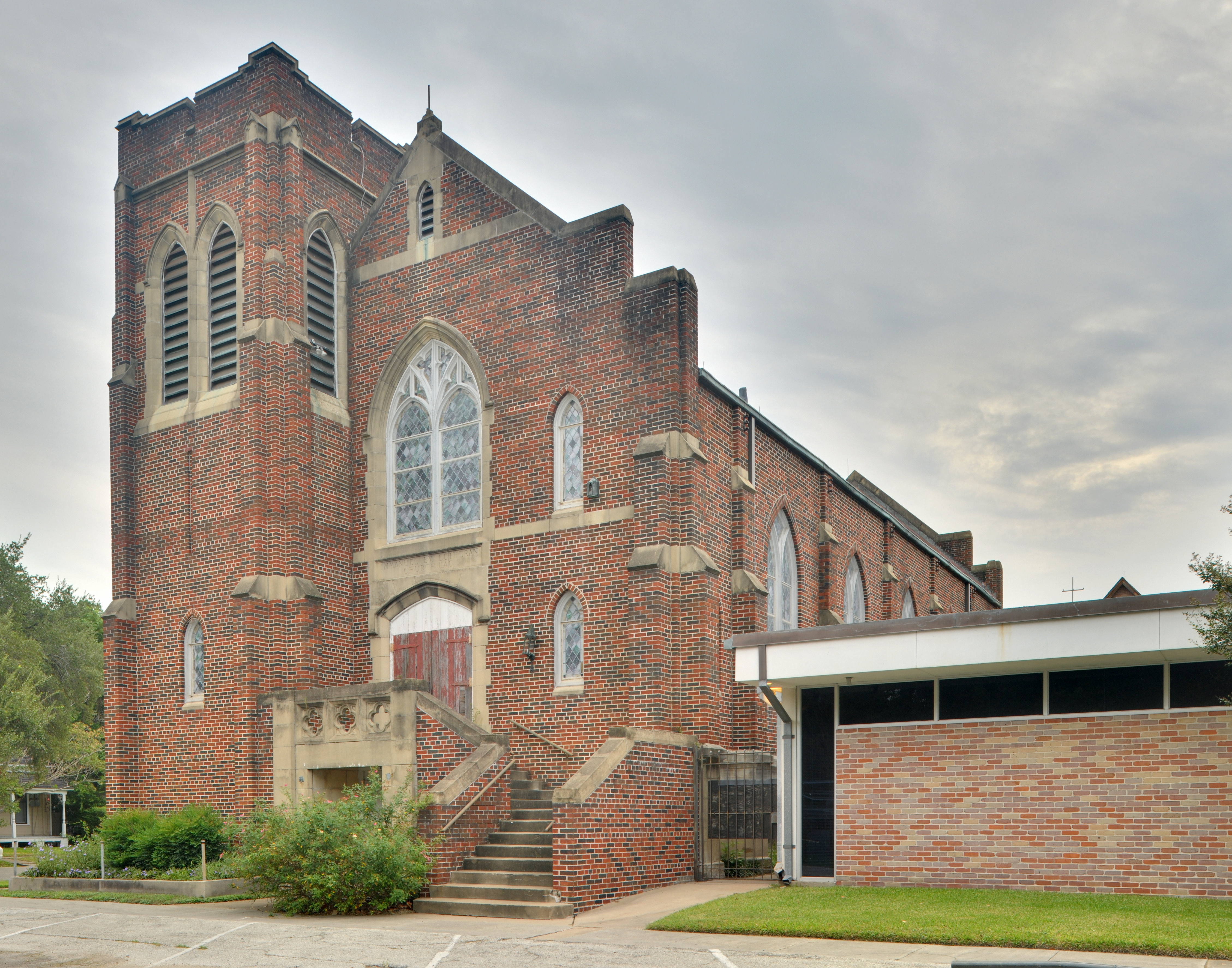
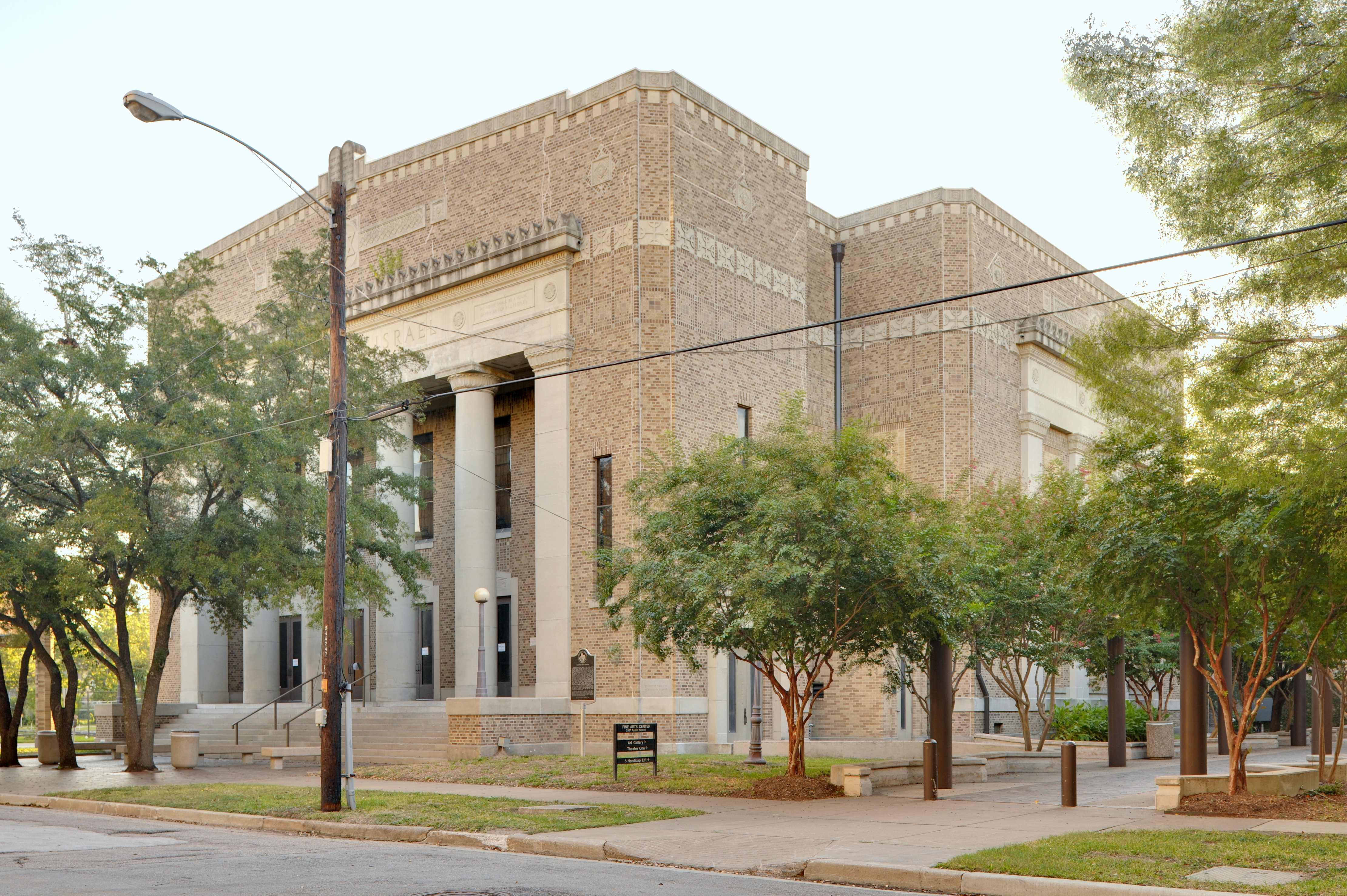
29°42′37″N 95°18′48″W / 29.71028°N 95.31333°WHouston 234 Temple Beth Israel 
March 1, 1984 3517 Austin St.
29°44′12″N 95°22′30″W / 29.73667°N 95.375°WHouston 235 Texas Company Building April 2, 2003 1111 Rusk
29°45′28″N 95°21′46″W / 29.75778°N 95.36278°WHouston 236 Texas State Hotel January 10, 2008 720 Fannin
29°45′28″N 95°21′46″W / 29.75778°N 95.36278°WHouston 237 Dr. Penn B. Thornton House 
June 22, 1983 1541 Tulane St.
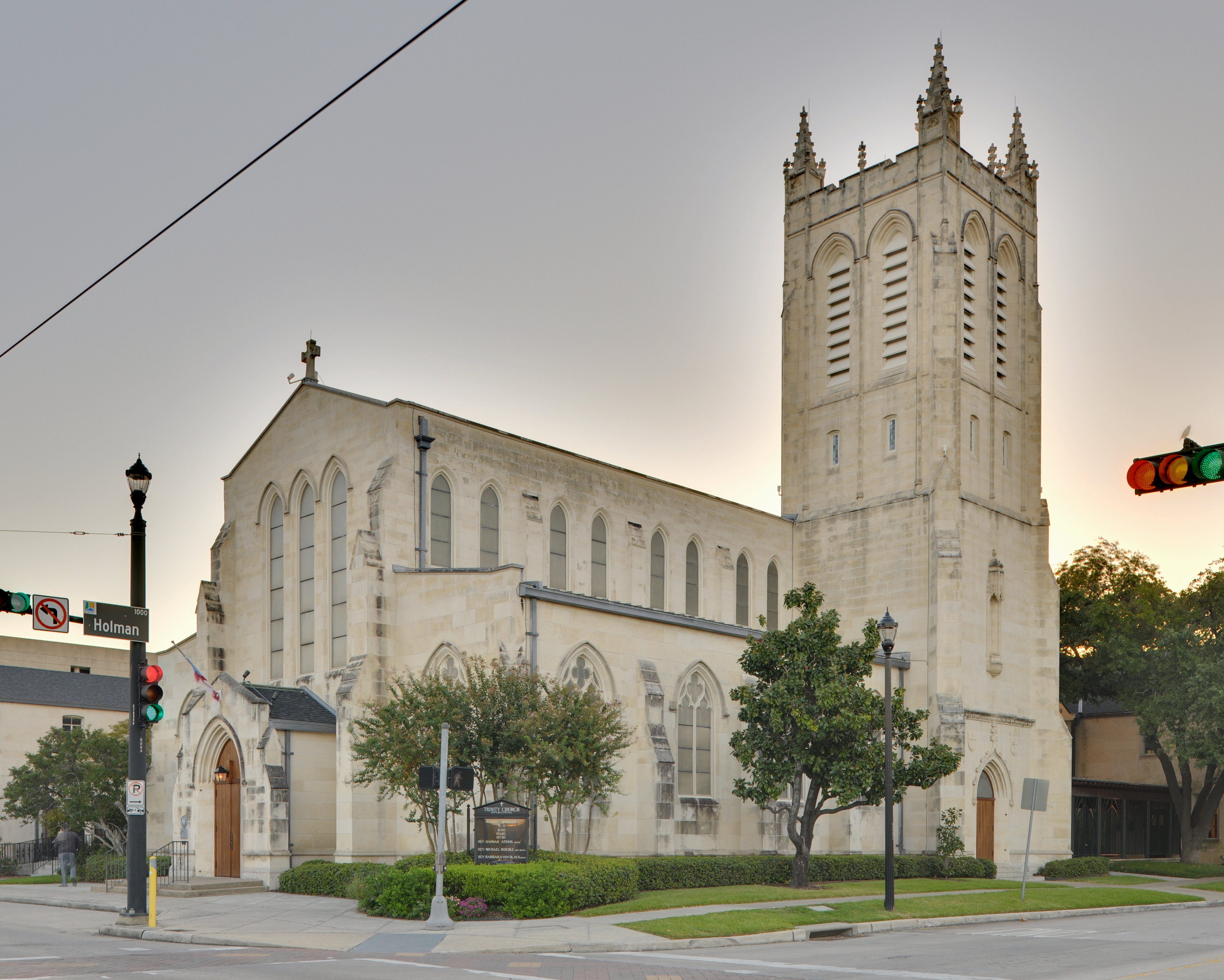
29°47′57″N 95°24′8″W / 29.79917°N 95.40222°WHouston 238 Trinity Church 
May 26, 1983 3404 S. Main St.
29°44′22″N 95°22′39″W / 29.73944°N 95.3775°WHouston 239 U.S. Customhouse 
August 28, 1974 San Jacinto at Rusk St.
29°45′26″N 95°21′40″W / 29.75722°N 95.36111°WHouston 240 U.S.S. TEXAS 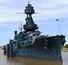
December 8, 1976 22 mi (35 km). E of Houston on TX 134 at San Jacinto Battleground
29°45′21″N 95°5′22″W / 29.75583°N 95.08944°WHouston 241 Union Station 
November 10, 1977 501 Crawford St.
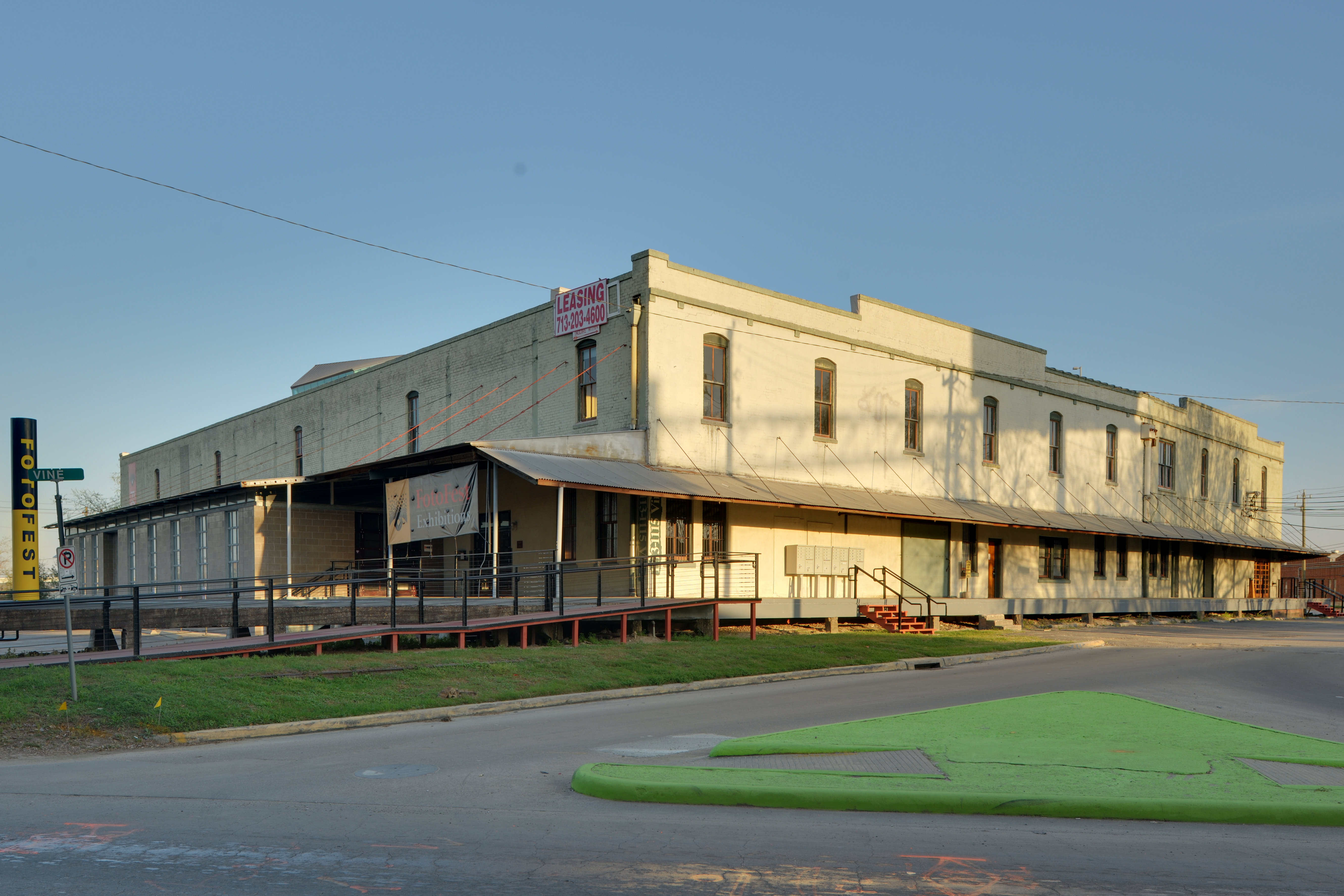
29°45′25″N 95°21′23″W / 29.75694°N 95.35639°WHouston 242 Union Transfer and Storage Building 
January 16, 2001 1113 Vine St.
29°46′12″N 95°21′25″W / 29.77°N 95.35694°WHouston 243 Upchurch House 
June 22, 1983 301 E. 14th St.
29°47′45″N 95°23′43″W / 29.79583°N 95.39528°WHouston 244 Ward House June 22, 1983 323 W. 17th St.
29°48′1″N 95°24′4″W / 29.80028°N 95.40111°WHouston 245 Washburn Tunnel April 16, 2008 3198 Washburn Tunnel
29°43′35″N 95°12′43″W / 29.72639°N 95.21194°WPasadena 246 Webber House May 14, 1984 N Shaver St at the Houston Ship Channel
29°47′26″N 95°23′53″W / 29.79056°N 95.39806°WHouston 247 Samuel H. Webber House June 22, 1983 407 Heights Blvd.
29°46′40″N 95°23′52″W / 29.77778°N 95.39778°WHouston 248 West Eleventh Place Historic District 
April 14, 1997 1-8 W. 11th Pl.
29°43′31″N 95°23′31″W / 29.72528°N 95.39194°WHouston 249 James and Jessie West Mansion August 19, 1994 3303 NASA Rd. 1
29°33′37″N 95°4′28″W / 29.56028°N 95.07444°WPasadena 250 Westmoreland Historic District August 16, 1994 Bounded by Hawthorne, Burlington and Marshall Aves., and Garott St.
29°44′26″N 95°23′0″W / 29.74056°N 95.383333°WHouston 251 Wilkins House 
May 14, 1984 1541 Ashland St.
29°47′57″N 95°24′12″W / 29.79917°N 95.40333°WHouston 252 Williams-Brueder House June 22, 1983 245 W. 18th St.
29°48′5″N 95°24′1″W / 29.80139°N 95.40028°WHouston 253 Willow Street Pump Station 
May 27, 2004 University of Houston–Downtown
811 N. San Jacinto St.
29°46′3″N 95°21′26″W / 29.7675°N 95.35722°WHouston 254 Wilson House May 14, 1984 1206 Cortlandt St.
29°47′34″N 95°23′42″W / 29.79278°N 95.395°WHouston 255 Wimberly House May 14, 1984 703 Harvard St.
29°46′28″N 95°23′46″W / 29.77444°N 95.39611°WHouston 256 Wisnoski House 
May 14, 1984 1651 Columbia St.
29°47′59″N 95°23′36″W / 29.79972°N 95.39333°WHouston 257 Woodard House 
May 14, 1984 740 Rutlant St.
29°47′4″N 95°24′2″W / 29.78444°N 95.40056°WHouston 258 Woodlawn Garden of Memories Cemetery October 22, 2004 1101 Antoine
29°47′18″N 95°28′41″W / 29.78833°N 95.47806°WHouston 259 Woodward House June 22, 1983 1605 Heights Blvd.
29°47′59″N 95°23′54″W / 29.79972°N 95.39833°WHouston 260 Andrew Jackson and Margaret Cullinan Wray House August 19, 1993 3 Remington Ln.
29°43′24″N 95°23′35″W / 29.72333°N 95.39306°WHouston 261 Peter and Sophie Wunderlich Farm February 27, 1997 18202 Theiss Mail Rd.
30°1′49″N 95°32′54″W / 30.03028°N 95.54833°WUnincorporated area (Klein area) 262 Wunsche Bros. Saloon and Hotel February 16, 1984 103 Midway St.
30°4′44″N 95°25′3″W / 30.07889°N 95.4175°WUnincorporated area/Spring CDP See also
References
- ^ The latitude and longitude information provided in this table was derived originally from the National Register Information System, which has been found to be fairly accurate for about 99% of listings. For about 1% of NRIS original coordinates, experience has shown that one or both coordinates are typos or otherwise extremely far off; some corrections may have been made. A more subtle problem causes many locations to be off by up to 150 yards, depending on location in the country: most NRIS coordinates were derived from tracing out latitude and longitudes off of USGS topographical quadrant maps created under the North American Datum of 1927, which differs from the current, highly accurate WGS84 GPS system used by Google maps. Chicago is about right, but NRIS longitudes in Washington are higher by about 4.5 seconds, and are lower by about 2.0 seconds in Maine. Latitudes differ by about 1.0 second in Florida. Some locations in this table may have been corrected to current GPS standards.
- ^ "National Register of Historic Places: Weekly List Actions". National Park Service, United States Department of the Interior. Retrieved on November 10, 2011.
U.S. National Register of Historic Places Topics Lists by states Alabama • Alaska • Arizona • Arkansas • California • Colorado • Connecticut • Delaware • Florida • Georgia • Hawaii • Idaho • Illinois • Indiana • Iowa • Kansas • Kentucky • Louisiana • Maine • Maryland • Massachusetts • Michigan • Minnesota • Mississippi • Missouri • Montana • Nebraska • Nevada • New Hampshire • New Jersey • New Mexico • New York • North Carolina • North Dakota • Ohio • Oklahoma • Oregon • Pennsylvania • Rhode Island • South Carolina • South Dakota • Tennessee • Texas • Utah • Vermont • Virginia • Washington • West Virginia • Wisconsin • WyomingLists by territories Lists by associated states Other External links
Categories:- Harris County, Texas
- National Register of Historic Places in Texas
- Buildings and structures in Harris County, Texas
-


Wikimedia Foundation. 2010.