- National Register of Historic Places listings in Williamson County, Texas
-
List of Registered Historic Places in Williamson County, Texas
This is intended to be a complete list of properties and districts listed on the National Register of Historic Places in Williamson County, Texas. The locations of National Register properties and districts (at least for all showing latitude and longitude coordinates below) may be seen in a Google map by clicking on "Map of all coordinates".[1]
-
- This National Park Service list is complete through NPS recent listings posted November 4, 2011.[2]
Landmark name Image Date listed Location City or Town Summary 1 Martin C. Amos House April 29, 1986 1408 Olive
30°37′53″N 97°40′1″W / 30.63139°N 97.66694°WGeorgetown 2 Arnold-Torbet House April 29, 1986 908 Pine
30°38′7″N 97°40′11″W / 30.63528°N 97.66972°WGeorgetown 3 Atkinson House April 29, 1986 911 Walnut
30°38′8″N 97°40′13″W / 30.63556°N 97.67028°WGeorgetown 4 Bartlett Commercial Historic District September 30, 1980 E. Clark St.
30°47′42″N 97°25′37″W / 30.795°N 97.42694°WBartlett 5 Belford Historic District April 29, 1986 Roughly bounded by University Ave., Main, E. Eighteenth, and Austin
30°37′48″N 97°40′39″W / 30.63°N 97.6775°WGeorgetown 6 Bowlen House January 14, 1986 1405 Forest
30°37′53″N 97°40′44″W / 30.63139°N 97.67889°WGeorgetown 7 Bryson Stage Coach Stop December 1, 1978 Northwest of Liberty Hill on TX 29
30°40′40″N 97°56′37″W / 30.67778°N 97.94361°WLiberty Hill 8 Burcham House April 29, 1986 1310 College
30°37′54″N 97°40′19″W / 30.63167°N 97.67194°WGeorgetown 9 Casey House January 14, 1986 705 E. Third
30°38′27″N 97°40′12″W / 30.64083°N 97.67°WGeorgetown 10 Caswell House April 29, 1986 207 E. Ninth
30°38′9″N 97°40′31″W / 30.63583°N 97.67528°WGeorgetown 11 Chesser-Morgan House January 14, 1986 1202 E. Fifteenth
30°37′49″N 97°39′56″W / 30.63028°N 97.66556°WGeorgetown 12 Jesse and Sara Cooper House February 16, 1996 1.8 mi (2.9 km). east of Georgetown Hwy. 29
30°38′32″N 97°38′48″W / 30.64222°N 97.64667°WGeorgetown 13 E. M. Daughtrey House April 29, 1986 1316 E. University
30°37′58″N 97°39′47″W / 30.63278°N 97.66306°WGeorgetown 14 John J. Dimmitt House February 16, 1996 W. University (TX 29) 0.5 mi. west of the junction with Austin Highway.
30°38′5″N 97°41′11″W / 30.63472°N 97.68639°WGeorgetown 15 S. A. Easley House April 29, 1986 1310 Olive
30°37′57″N 97°40′1″W / 30.6325°N 97.66694°WGeorgetown 16 First Methodist Church June 17, 1986 410 E. University
30°37′58″N 97°40′23″W / 30.63278°N 97.67306°WGeorgetown 17 D. D. Fowler House April 29, 1986 1531 Ash
30°37′45″N 97°40′21″W / 30.62917°N 97.6725°WGeorgetown 18 Georgetown Light and Water Works February 16, 1996 403 W. 9th
30°38′10″N 97°40′49″W / 30.63611°N 97.68028°WGeorgetown 19 Harper-Chesser House April 29, 1986 1309 College
30°37′54″N 97°40′17″W / 30.63167°N 97.67139°WGeorgetown 20 Moses Harrell House January 14, 1986 1001 Church
30°38′4″N 97°40′32″W / 30.63444°N 97.67556°WGeorgetown 21 E. M. Harris House January 14, 1986 404 E. Seventh
30°38′13″N 97°40′24″W / 30.63694°N 97.67333°WGeorgetown 22 A. W. Hawnen House April 29, 1986 1409 Olive
30°37′54″N 97°39′59″W / 30.63167°N 97.66639°WGeorgetown 23 M. S. Hewitt House February 16, 1996 1019 S. College
30°38′1″N 97°40′24″W / 30.63361°N 97.67333°WGeorgetown 24 House at 214 W. University April 29, 1986 214 W. University
30°37′58″N 97°40′41″W / 30.63278°N 97.67806°WGeorgetown 25 House at 801 West January 14, 1986 801 West
30°38′10″N 97°40′52″W / 30.63611°N 97.68111°WGeorgetown 26 House at 907 Pine January 14, 1986 907 Pine
30°38′8″N 97°40′10″W / 30.63556°N 97.66944°WGeorgetown 27 Hutto Commercial Historic District August 4, 2011 101-205 East St., 202 Farley St. & 204 US 79
30°32′38″N 97°31′50″W / 30.54389°N 97.53056°WHutto 28 Dr. Robert Hyer House January 14, 1986 904 Ash
30°38′7″N 97°40′23″W / 30.63528°N 97.67306°WGeorgetown 29 Imhoff House January 14, 1986 208 Austin
30°38′27″N 97°40′41″W / 30.64083°N 97.67806°WGeorgetown 30 Inn at Brushy Creek October 15, 1970 Taylor Exit off U.S. 79, off I-35
30°30′55″N 97°41′22″W / 30.51528°N 97.68944°WOld Round Rock 31 George Irvine House 
April 29, 1986 409 E. University
30°38′0″N 97°40′24″W / 30.633333°N 97.67333°WGeorgetown 32 J. J. Johnson Farm January 14, 1986 Rabbitt Hill Rd.
30°34′59″N 97°40′18″W / 30.58306°N 97.67167°WGeorgetown 33 Kenney's Fort Site (41WM465) April 20, 1987 Address Restricted Round Rock 34 Lane-Riley House April 29, 1986 1302 College
30°37′55″N 97°40′19″W / 30.63194°N 97.67194°WGeorgetown 35 Will and Mary Leake House April 29, 1986 313 E. Seventh
30°38′14″N 97°40′26″W / 30.63722°N 97.67389°WGeorgetown 36 John Leavell House April 29, 1986 803 College
30°38′11″N 97°40′16″W / 30.63639°N 97.67111°WGeorgetown 37 M. B. and Annie Lockett House April 29, 1986 811 E. University
30°38′0″N 97°40′8″W / 30.633333°N 97.66889°WGeorgetown 38 Frank and Mellie Love House April 29, 1986 1415 Ash
30°37′50″N 97°40′20″W / 30.63056°N 97.67222°WGeorgetown 39 W. K. and Kate Makemson House January 14, 1986 1002 Ash
30°38′4″N 97°40′23″W / 30.63444°N 97.67306°WGeorgetown 40 McFadin House April 9, 1980 North of Taylor
30°38′18″N 97°25′33″W / 30.63833°N 97.42583°WTaylor 41 McKnight-Ebb House January 14, 1986 502 W. Eighteenth
30°37′34″N 97°40′53″W / 30.62611°N 97.68139°WGeorgetown 42 McMurray House (Georgetown, Texas)McMurray House January 14, 1986 611 Church
30°38′13″N 97°40′30″W / 30.63694°N 97.675°WGeorgetown 43 Capt. Nelson Merrell House October 15, 1970 Northeast of Round Rock on U.S. 79
30°31′2″N 97°39′41″W / 30.51722°N 97.66139°WRound Rock 44 Miller-Ellyson House January 14, 1986 303 E. Ninth
30°38′9″N 97°40′28″W / 30.63583°N 97.67444°WGeorgetown 45 Old Georgetown High School January 14, 1986 507 E. University
30°38′1″N 97°40′20″W / 30.63361°N 97.67222°WGeorgetown 46 Paige-DeCrow-Weir House 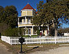
January 14, 1986 I-35 and State Route 2243
30°37′24″N 97°41′30″W / 30.62333°N 97.69167°WGeorgetown 47 Woodson and Margaret Patrick House January 14, 1986 211 E. Fifth
30°38′21″N 97°40′31″W / 30.63917°N 97.67528°WGeorgetown 48 Pegues House January 14, 1986 904 E. University
30°37′58″N 97°40′6″W / 30.63278°N 97.66833°WGeorgetown 49 Preslar-Hewitt Building May 1, 2003 321-323 N. Main
30°34′13″N 97°24′35″W / 30.57028°N 97.40972°WTaylor 50 R. H. and Martha Price House April 29, 1986 209 E. Tenth
30°38′5″N 97°40′31″W / 30.63472°N 97.67528°WGeorgetown 51 Railroad Produce Depot 
November 7, 1979 401 W. 6th St.
30°38′18″N 97°40′49″W / 30.63833°N 97.68028°WGeorgetown 52 J. H. Reedy House April 29, 1986 908 E. University
30°37′58″N 97°40′5″W / 30.63278°N 97.66806°WGeorgetown 53 Round Rock Commercial Historic District June 9, 1983 100 and 200 blocks of E. Main St.
30°30′30″N 97°40′39″W / 30.50833°N 97.6775°WRound Rock 54 Round Rock Post Office and William M. Owen House 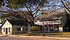
July 7, 1983 Chisholm Trail and Emanuel St.
30°30′55″N 97°41′24″W / 30.51528°N 97.69°WRound Rock 55 Rouser House January 14, 1986 602 Myrtle
30°38′16″N 97°40′30″W / 30.63778°N 97.675°WGeorgetown 56 Saint John's Methodist Church 
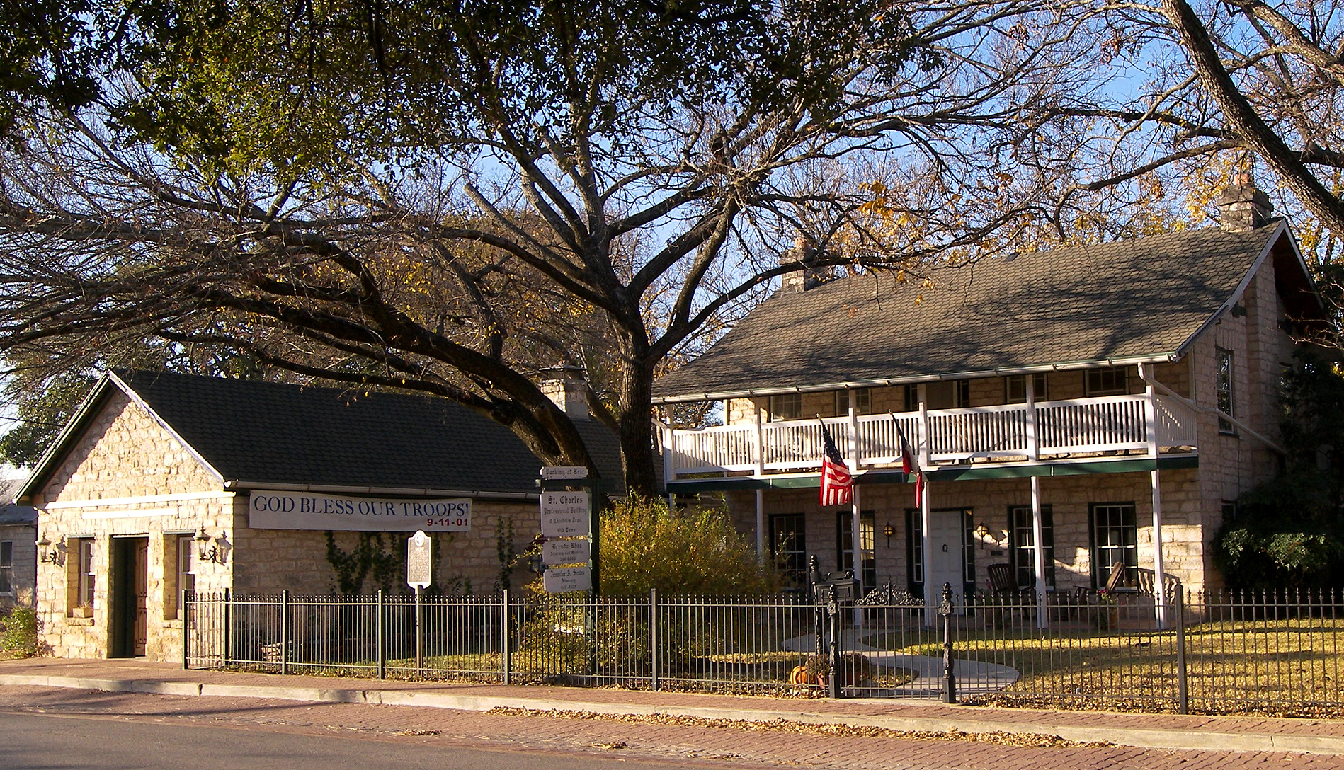
April 29, 1986 301 E University Ave
30°38′1″N 97°40′29″W / 30.63361°N 97.67472°WGeorgetown 57 Sansom-Schmalenbeck House January 14, 1986 813 Church
30°38′9″N 97°40′32″W / 30.63583°N 97.67556°WGeorgetown 58 Saxon Motor Car Store June 17, 1986 316 E. Sixth St.
30°38′17″N 97°40′27″W / 30.63806°N 97.67417°WGeorgetown 59 A. W. Sillure House April 29, 1986 1414 Ash
30°37′50″N 97°40′23″W / 30.63056°N 97.67306°WGeorgetown 60 Southwestern University Administration Building and Mood Hall 
April 23, 1975 University Ave., Southwestern University campus
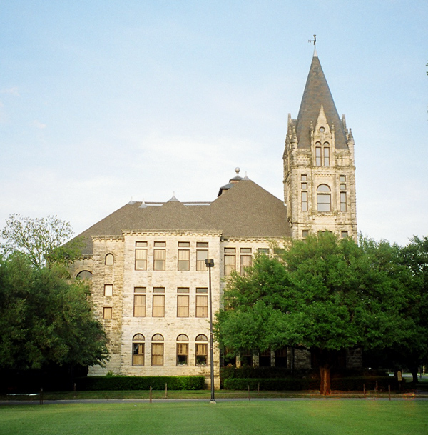
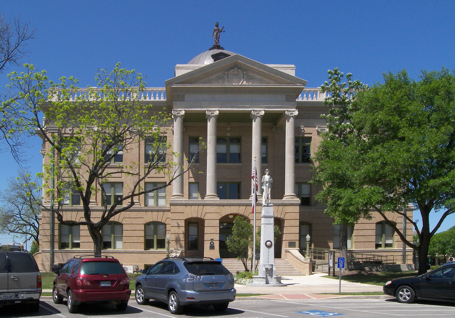
30°38′0″N 97°40′1″W / 30.633333°N 97.66694°WGeorgetown 61 Robert and Lula Stone House January 14, 1986 1102 Ash
30°38′1″N 97°40′23″W / 30.63361°N 97.67306°WGeorgetown 62 Taylor Downtown Historic District October 26, 2005 Roughly bounded by 5th, Washburn, 1st & Vance Sts.
30°34′16″N 97°24′36″W / 30.57111°N 97.41°WTaylor 63 Taylor National Bank May 23, 1980 200 Main St.
30°34′7″N 97°24′33″W / 30.56861°N 97.40917°WTaylor 64 Taylor-Cooper House 
January 14, 1986 105 E 5th
30°38′22″N 97°40′36″W / 30.63944°N 97.67667°WGeorgetown 65 Tinnen House August 25, 1970 1220 Austin St.
30°37′53″N 97°40′37″W / 30.63139°N 97.67694°WGeorgetown 66 University Avenue-Elm Street Historic District December 6, 1979 E. University and Elm Sts.
30°37′44″N 97°40′18″W / 30.62889°N 97.67167°WGeorgetown 67 W. C. and Kate Vaden House April 29, 1986 711 E. University
30°38′0″N 97°40′11″W / 30.633333°N 97.66972°WGeorgetown 68 Wesley Chapel A.M.E Church January 14, 1986 508 W. Fourth
30°38′24″N 97°40′53″W / 30.64°N 97.68139°WGeorgetown 69 D. K. and Inez Wilcox House April 29, 1986 1307 Olive
30°37′57″N 97°39′59″W / 30.6325°N 97.66639°WGeorgetown 70 Wilcox-Graves House April 29, 1986 1403 Olive
30°37′55″N 97°39′59″W / 30.63194°N 97.66639°WGeorgetown 71 Williamson County Courthouse Historical District 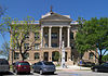
July 26, 1977 Rock and 9th Sts., Main and 7th Sts. (includes both sides)
30°38′12″N 97°40′39″W / 30.63667°N 97.6775°WGeorgetown 72 Zidell House May 12, 2009 2015 W. Lake Dr.
30°34′32.92″N 97°25′53.1″W / 30.5758111°N 97.431417°WTaylor See also
References
- ^ The latitude and longitude information provided in this table was derived originally from the National Register Information System, which has been found to be fairly accurate for about 99% of listings. For about 1% of NRIS original coordinates, experience has shown that one or both coordinates are typos or otherwise extremely far off; some corrections may have been made. A more subtle problem causes many locations to be off by up to 150 yards, depending on location in the country: most NRIS coordinates were derived from tracing out latitude and longitudes off of USGS topographical quadrant maps created under North American Datum of 1927, which differs from the current, highly accurate GPS system used by Google maps. Chicago is about right, but NRIS longitudes in Washington are higher by about 4.5 seconds, and are lower by about 2.0 seconds in Maine. Latitudes differ by about 1.0 second in Florida. Some locations in this table may have been corrected to current GPS standards.
- ^ "National Register of Historic Places: Weekly List Actions". National Park Service, United States Department of the Interior. Retrieved on November 4, 2011.
U.S. National Register of Historic Places Topics Lists by states Alabama • Alaska • Arizona • Arkansas • California • Colorado • Connecticut • Delaware • Florida • Georgia • Hawaii • Idaho • Illinois • Indiana • Iowa • Kansas • Kentucky • Louisiana • Maine • Maryland • Massachusetts • Michigan • Minnesota • Mississippi • Missouri • Montana • Nebraska • Nevada • New Hampshire • New Jersey • New Mexico • New York • North Carolina • North Dakota • Ohio • Oklahoma • Oregon • Pennsylvania • Rhode Island • South Carolina • South Dakota • Tennessee • Texas • Utah • Vermont • Virginia • Washington • West Virginia • Wisconsin • WyomingLists by territories Lists by associated states Other  Category:National Register of Historic Places •
  Portal:National Register of Historic PlacesCategories:
- Williamson County, Texas
- National Register of Historic Places in Texas
- Buildings and structures in Williamson County, Texas
-


Wikimedia Foundation. 2010.