- National Register of Historic Places listings in Harrison County, Texas
-
List of Registered Historic Places in Harrison County, Texas
This is intended to be a complete list of properties and districts listed on the National Register of Historic Places in Harrison County, Texas. The locations of National Register properties and districts (at least for all showing latitude and longitude coordinates below) may be seen in a Google map by clicking on "Map of all coordinates".[1]
-
- This National Park Service list is complete through NPS recent listings posted November 10, 2011.[2]
[3] Landmark name [4] Image Date listed Location City or town Summary 1 Arnot House July 27, 1979 306 W. Houston St
32°32′41″N 94°22′10″W / 32.544722°N 94.369444°WMarshall 2 Dial-Williamson House March 2, 1979 3 mi (4.8 km) W of Marshall on Old Longview Rd.
32°33′04″N 94°25′19″W / 32.551111°N 94.421944°WMarshall 3 Edgemont September 22, 1977 W of Marshall
32°31′58″N 94°25′10″W / 32.532778°N 94.419444°WMarshall 4 First Methodist Church July 16, 1980 300 E. Houston St.
32°32′42″N 94°21′55″W / 32.545°N 94.365278°WMarshall 5 Fry-Barry House November 21, 1978 314 W. Austin
32°32′44″N 94°22′11″W / 32.545556°N 94.369722°WMarshall 6 Ginocchio Historic District 
December 31, 1974 Bounded by Grand Ave., and N. Franklin, Willow, and Lake Sts.
32°33′05″N 94°21′57″W / 32.551389°N 94.365833°WMarshall 7 Hagerty House September 13, 1978 505 E. Rusk St.
32°32′49″N 94°21′43″W / 32.546944°N 94.361944°WMarshall 8 Harrison County Courthouse 
August 16, 1977 Public Square
32°32′41″N 94°22′01″W / 32.544722°N 94.366944°WMarshall 9 Hochwald House July 14, 1983 211 W. Grand Ave.
32°32′55″N 94°22′06″W / 32.548611°N 94.368333°WMarshall 10 Locust Grove June 20, 1979 Off TX 134
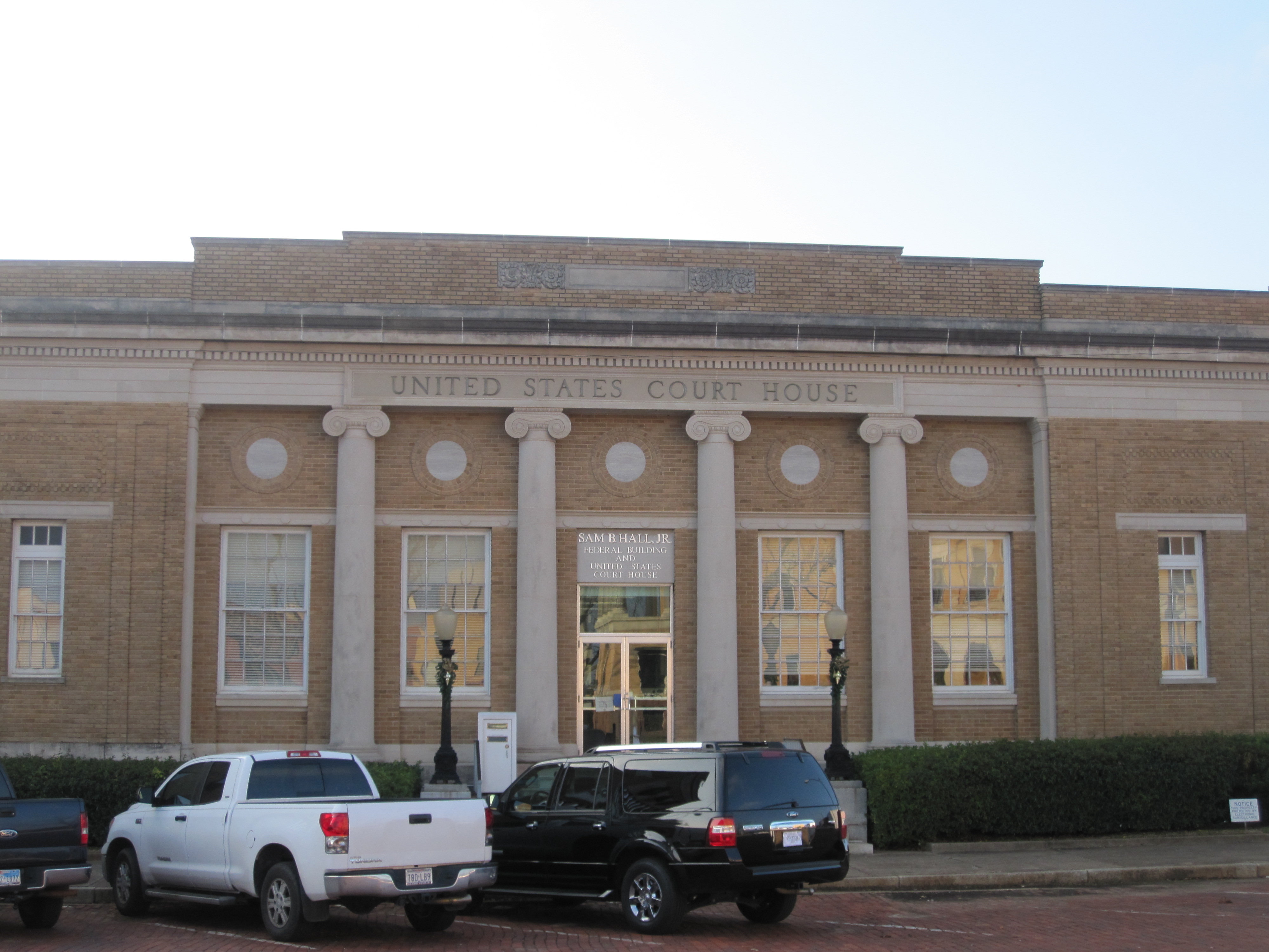
32°32′26″N 94°40′57″W / 32.540556°N 94.6825°WJonesville 11 Marshall Arsenal, CSA July 1, 1976 Address Restricted Marshall 12 Marshall US Post Office 
April 25, 2001 100 E. Houston St.
32°32′39″N 94°22′03″W / 32.544167°N 94.3675°WMarshall 13 Mimosa Hall 
November 2, 1978 S of Leigh off SR 134
32°35′19″N 94°08′37″W / 32.588611°N 94.143611°WLeigh 14 Old Pierce House April 13, 1973 303 N. Columbus St.
32°32′49″N 94°21′53″W / 32.546944°N 94.364722°WMarshall 15 Starr House December 11, 1979 407 W. Travis St.
32°32′31″N 94°22′13″W / 32.541944°N 94.370278°WMarshall 16 John R. Stinson House November 7, 1979 313 W. Austin St.
32°32′45″N 94°22′12″W / 32.545833°N 94.37°WMarshall 17 James Turner House November 7, 1979 406 S. Washington Ave.
32°32′31″N 94°22′01″W / 32.541944°N 94.366944°WMarshall 18 Weisman-Hirsch House July 7, 1983 313 S. Washington St.
32°32′33″N 94°22′03″W / 32.5425°N 94.3675°WMarshall See also
- Registered Historic Places in Texas, Counties H-J
References
- ^ The latitude and longitude information provided in this table was derived originally from the National Register Information System, which has been found to be fairly accurate for about 99% of listings. For about 1% of NRIS original coordinates, experience has shown that one or both coordinates are typos or otherwise extremely far off; some corrections may have been made. A more subtle problem causes many locations to be off by up to 150 yards, depending on location in the country: most NRIS coordinates were derived from tracing out latitude and longitudes off of USGS topographical quadrant maps created under the North American Datum of 1927, which differs from the current, highly accurate WGS84 GPS system used by Google maps. Chicago is about right, but NRIS longitudes in Washington are higher by about 4.5 seconds, and are lower by about 2.0 seconds in Maine. Latitudes differ by about 1.0 second in Florida. Some locations in this table may have been corrected to current GPS standards.
- ^ "National Register of Historic Places: Weekly List Actions". National Park Service, United States Department of the Interior. Retrieved on November 10, 2011.
- ^ Numbers represent an ordering by significant words. Various colorings, defined here, differentiate National Historic Landmark sites and National Register of Historic Places Districts from other NRHP buildings, structures, sites or objects.
- ^ "National Register Information System". National Register of Historic Places. National Park Service. . http://nrhp.focus.nps.gov/natreg/docs/All_Data.html.
U.S. National Register of Historic Places Topics Lists by states Alabama • Alaska • Arizona • Arkansas • California • Colorado • Connecticut • Delaware • Florida • Georgia • Hawaii • Idaho • Illinois • Indiana • Iowa • Kansas • Kentucky • Louisiana • Maine • Maryland • Massachusetts • Michigan • Minnesota • Mississippi • Missouri • Montana • Nebraska • Nevada • New Hampshire • New Jersey • New Mexico • New York • North Carolina • North Dakota • Ohio • Oklahoma • Oregon • Pennsylvania • Rhode Island • South Carolina • South Dakota • Tennessee • Texas • Utah • Vermont • Virginia • Washington • West Virginia • Wisconsin • WyomingLists by territories Lists by associated states Other Categories:- Harrison County, Texas
- National Register of Historic Places in Texas
- Buildings and structures in Harrison County, Texas
-


Wikimedia Foundation. 2010.