- National Register of Historic Places listings in Potter County, Texas
-
List of Registered Historic Places in Potter County, Texas
This is intended to be a complete list of properties and districts listed on the National Register of Historic Places in Potter County, Texas. The locations of National Register properties and districts (at least for all showing latitude and longitude coordinates below) may be seen in a Google map by clicking on "Map of all coordinates".[1]
-
- This National Park Service list is complete through NPS recent listings posted November 10, 2011.[2]
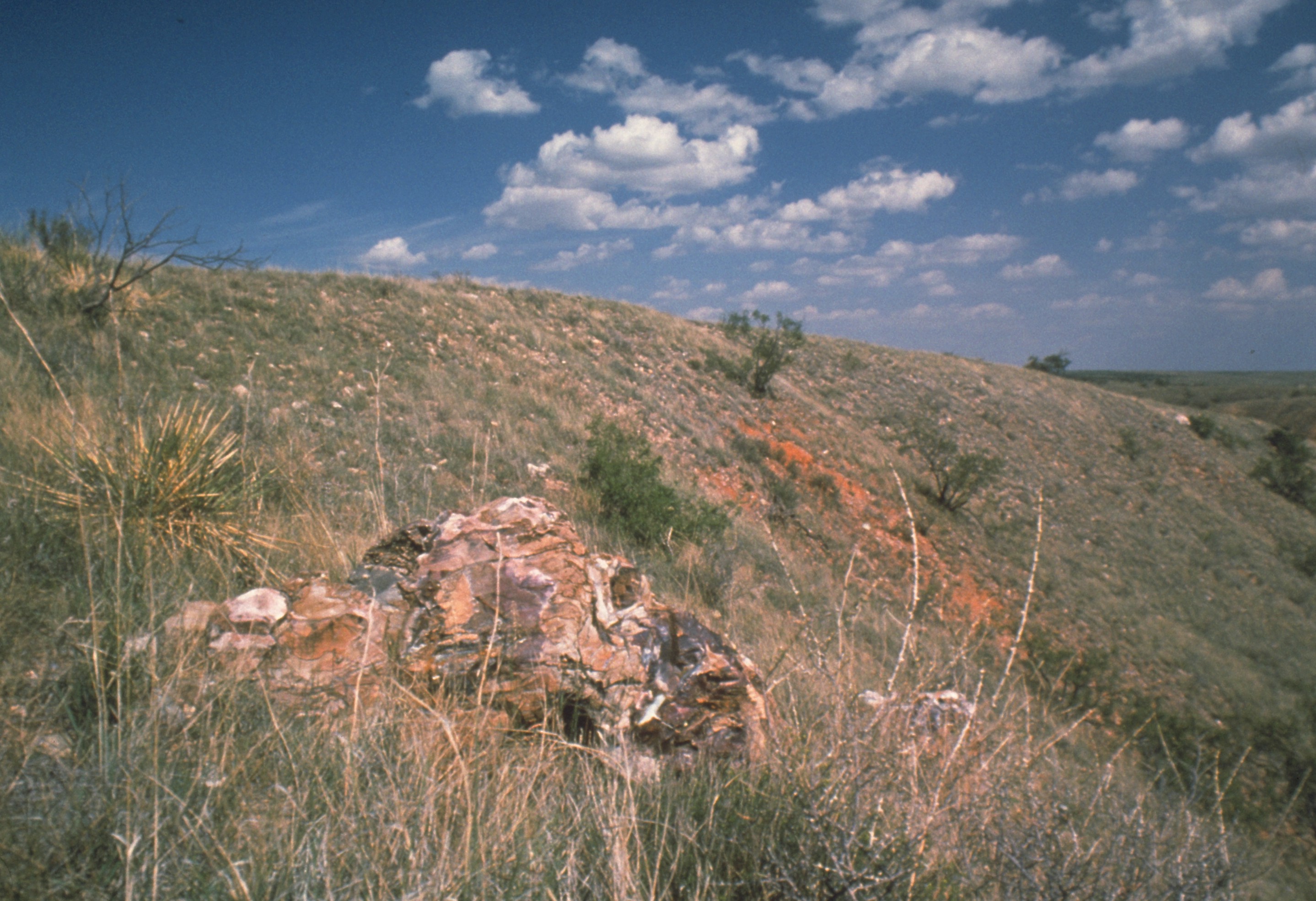
[3] Landmark name Image Date listed Location City or town Summary 1 Alibates Flint Quarries National Monument 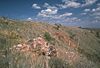
October 15, 1966 SW of Fritch on the Canadian River
35°34′55.53″N 101°40′19.48″W / 35.5820917°N 101.6720778°WFritch 2 Amarillo College Administration Building and Gymnasium January 28, 1992 2201 S. Washington St. and 2221 S. Washington St.
35°11′18″N 101°50′51″W / 35.188333°N 101.8475°WAmarillo 3 Amarillo US Post Office and Courthouse 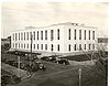
September 29, 2000 205 E. Fifth St.
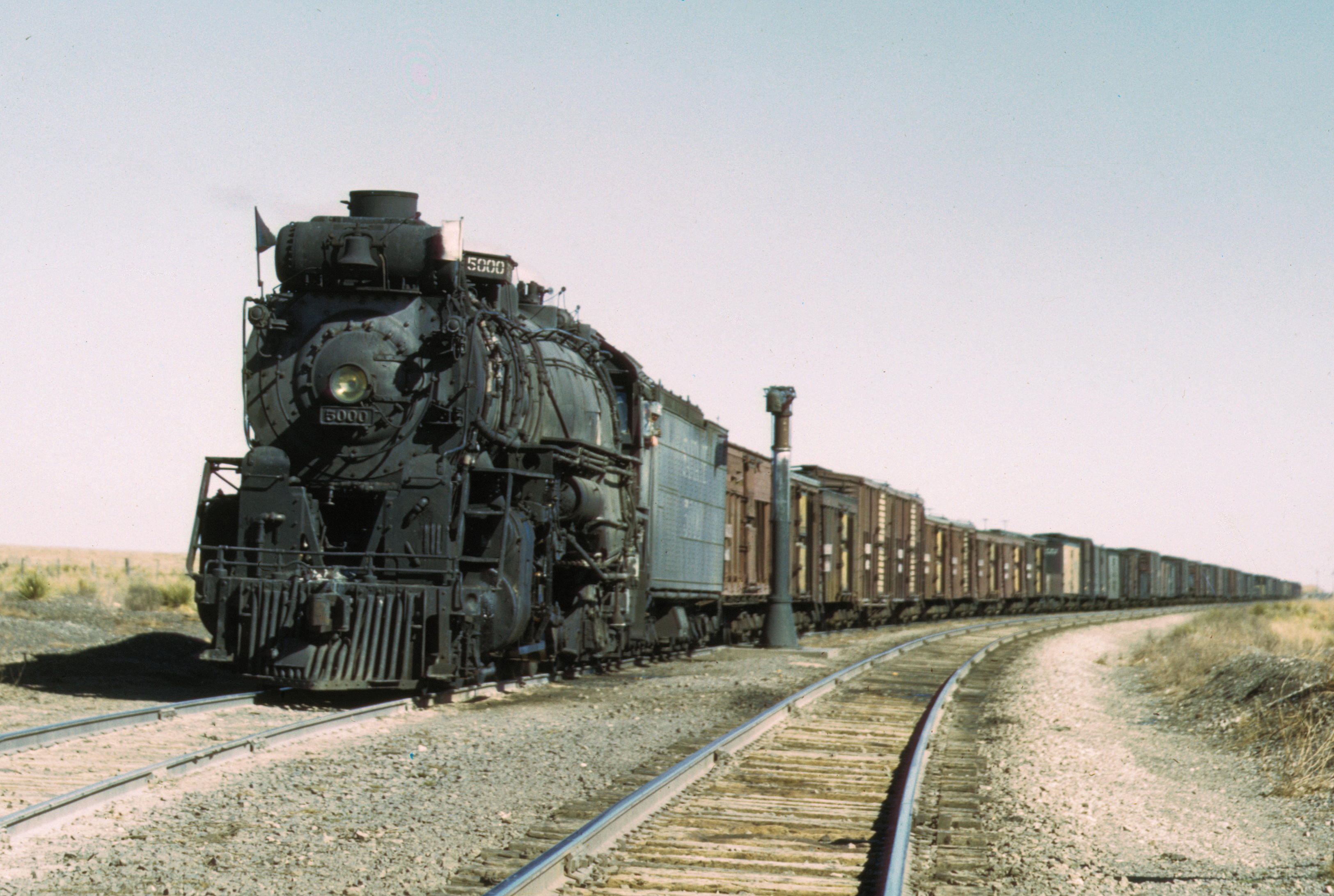
35°12′31″N 101°50′03″W / 35.208611°N 101.834167°WAmarillo 4 Atchison, Topeka and Santa Fe Railway Company Depot and Locomotive No. 5000 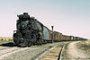
September 18, 1986 307 S. Grant
35°12′31″N 101°49′36″W / 35.20861°N 101.82667°W
Train moved to 2nd and Lincoln in 2005[4]
Amarillo 5 Bivins House 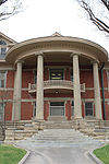
December 31, 1974 1000 Polk St.
35°12′11″N 101°50′17″W / 35.203056°N 101.838056°WAmarillo 6 Miles and Myda Bivins House October 2, 1992 2311 W. 16th Ave.
35°11′49″N 101°51′47″W / 35.196944°N 101.863056°WAmarillo 7 Central Presbyterian Church (Amarillo) 
November 13, 1991 1100 Harrison St.
35°12′10″N 101°50′26″W / 35.202778°N 101.840556°WAmarillo 8 Alice Ghormley Curtis House August 14, 1992 1626 S. Washington St.
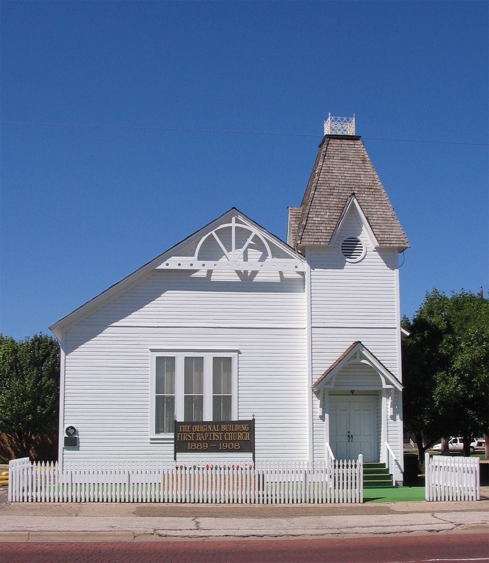
35°11′48″N 101°50′54″W / 35.196667°N 101.848333°WAmarillo 9 First Baptist Church (Amarillo) 
June 21, 1983 218 W. 13th St.
35°12′04″N 101°50′22″W / 35.201111°N 101.839444°WAmarillo 10 Jons-Gilvin House August 14, 1992 1500 S. Buchanan St.
35°11′51″N 101°50′01″W / 35.1975°N 101.833611°WAmarillo 11 Kouns-Jackson House August 14, 1992 1118 S. Harrison St.
35°12′07″N 101°50′26″W / 35.201944°N 101.840556°WAmarillo 12 Landergin-Harrington House December 16, 1977 1600 Polk St.
35°11′49″N 101°50′20″W / 35.196944°N 101.838889°WAmarillo 13 McBride Canyon Ruin July 5, 1985 Address Restricted Fritch 14 McBride Ranch House 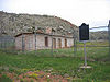
April 23, 1975 North of Amarillo in Lake Meredith National Recreation Area
35°32′29″N 101°43′44″W / 35.541389°N 101.728889°WAmarillo 15 McMillen Apartments April 2, 2010 1320 S. Fillmore
35°11′58″N 101°50′11″W / 35.199444°N 101.836389°WAmarillo 16 Northwest Texas Hospital School of Nursing November 7, 1996 2209 W. 6th Ave.
35°12′32″N 101°55′39″W / 35.208889°N 101.9275°WAmarillo 17 Plemons-Mrs. M. D. Oliver-Eakle Additions Historic District April 21, 1992 Roughly bounded by 16th Ave., Taylor St., 26th Ave., Van Buren St., I-40 and Madison St.
35°11′29″N 101°50′33″W / 35.191389°N 101.8425°WAmarillo 18 Polk Street Methodist Church January 28, 1992 1401 S. Polk St.
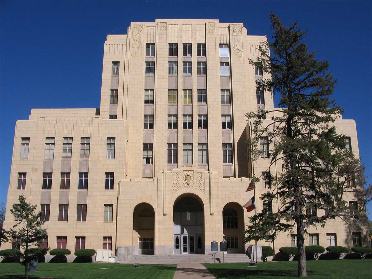
35°11′56″N 101°50′17″W / 35.198889°N 101.838056°WAmarillo 19 Potter County Courthouse and Library 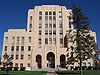
August 22, 1996 501 S. Taylor St.
35°12′29″N 101°50′06″W / 35.208056°N 101.835°WAmarillo 20 Ranchotel April 14, 1995 2501 W. Sixth Ave.
35°12′40″N 101°51′53″W / 35.211111°N 101.864722°WAmarillo 21 Henry B. and Ellen M. Sanborn House August 14, 1992 1311 S. Madison St.
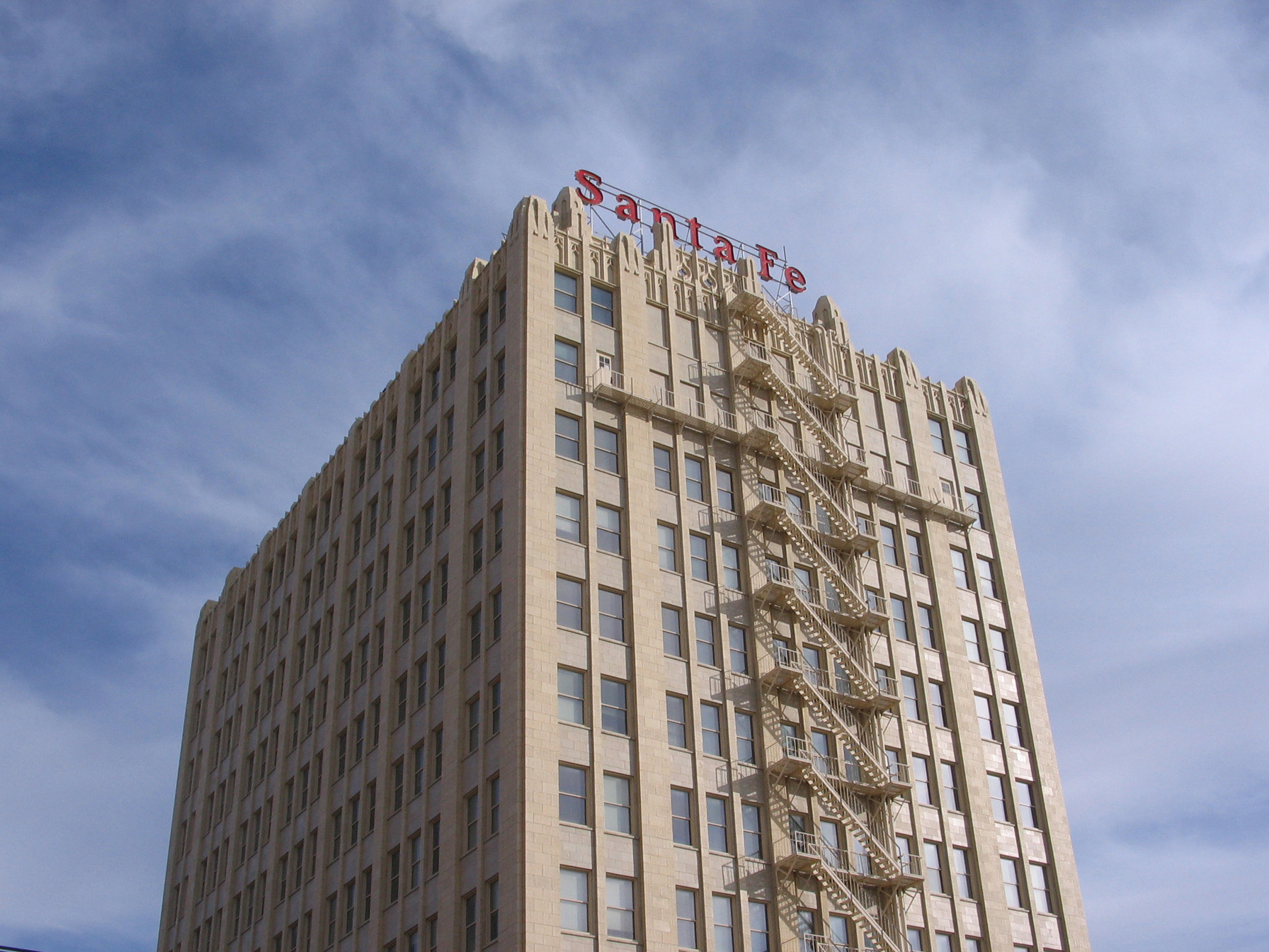
35°11′59″N 101°50′25″W / 35.199722°N 101.840278°WAmarillo 22 Santa Fe Building 
August 22, 1996 900 S. Polk St.
35°12′16″N 101°50′15″W / 35.204444°N 101.8375°WAmarillo 23 Shelton-Houghton House August 29, 1980 1700 Polk St.
35°11′42″N 101°50′22″W / 35.195°N 101.839444°WAmarillo 24 Triangle Motel December 7, 2010 7804, 7808, 7954, and 8024 E. Amarillo Blvd.
35°13′20″N 101°44′52″W / 35.222222°N 101.747778°WAmarillo Route 66 in Texas MPS 25 US Route 66-Sixth Street Historic District August 23, 1994 Sixth Ave. between Georgia and Forrest Aves.
35°12′40″N 101°52′24″W / 35.211111°N 101.873333°WAmarillo 26 Wolflin Historic District May 21, 1992 Roughly bounded by Wolflin Ave., Washington St., SW. 34th Ave., Parker St., SW. 30th Ave. and Lipscomb St.
35°11′07″N 101°51′07″W / 35.185278°N 101.851944°WAmarillo See also
References
- ^ The latitude and longitude information provided in this table was derived originally from the National Register Information System, which has been found to be fairly accurate for about 99% of listings. For about 1% of NRIS original coordinates, experience has shown that one or both coordinates are typos or otherwise extremely far off; some corrections may have been made. A more subtle problem causes many locations to be off by up to 150 yards, depending on location in the country: most NRIS coordinates were derived from tracing out latitude and longitudes off of USGS topographical quadrant maps created under North American Datum of 1927, which differs from the current, highly accurate GPS system used by Google maps. Chicago is about right, but NRIS longitudes in Washington are higher by about 4.5 seconds, and are lower by about 2.0 seconds in Maine. Latitudes differ by about 1.0 second in Florida. Some locations in this table may have been corrected to current GPS standards.
- ^ "National Register of Historic Places: Weekly List Actions". National Park Service, United States Department of the Interior. Retrieved on November 10, 2011.
- ^ Numbers represent an ordering by significant words. Various colorings, defined here, differentiate National Historic Landmark sites and National Register of Historic Places Districts from other NRHP buildings, structures, sites or objects.
- ^ Santa Fe Preserved Locomotives
U.S. National Register of Historic Places Topics Lists by states Alabama • Alaska • Arizona • Arkansas • California • Colorado • Connecticut • Delaware • Florida • Georgia • Hawaii • Idaho • Illinois • Indiana • Iowa • Kansas • Kentucky • Louisiana • Maine • Maryland • Massachusetts • Michigan • Minnesota • Mississippi • Missouri • Montana • Nebraska • Nevada • New Hampshire • New Jersey • New Mexico • New York • North Carolina • North Dakota • Ohio • Oklahoma • Oregon • Pennsylvania • Rhode Island • South Carolina • South Dakota • Tennessee • Texas • Utah • Vermont • Virginia • Washington • West Virginia • Wisconsin • WyomingLists by territories Lists by associated states Other  Category:National Register of Historic Places •
  Portal:National Register of Historic PlacesCategories:
- Potter County, Texas
- National Register of Historic Places in Texas
- Buildings and structures in Potter County, Texas
-


Wikimedia Foundation. 2010.