- Fritch, Texas
Infobox Settlement
official_name = Fritch, Texas
settlement_type =City
nickname =
motto =
imagesize =
image_caption =
image_
mapsize = 250px
map_caption = Location of Fritch, Texas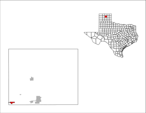
mapsize1 = 250px
map_caption1 =subdivision_type = Country
subdivision_name =United States
subdivision_type1 = State
subdivision_name1 =Texas
subdivision_type2 = Counties
subdivision_name2 = Hutchinson, Mooregovernment_footnotes =
government_type =
leader_title =
leader_name =
leader_title1 =
leader_name1 =
established_title =
established_date =unit_pref = Imperial
area_footnotes =
area_magnitude =
area_total_km2 = 3.1
area_land_km2 = 3.1
area_water_km2 = 0.0
area_total_sq_mi = 1.2
area_land_sq_mi = 1.2
area_water_sq_mi = 0.0population_as_of = 2000
population_footnotes =
population_total = 2235
population_density_km2 = 710.8
population_density_sq_mi = 1840.9timezone = Central (CST)
utc_offset = -6
timezone_DST = CDT
utc_offset_DST = -5
elevation_footnotes =
elevation_m = 974
elevation_ft = 3196
latd = 35 |latm = 38 |lats = 23 |latNS = N
longd = 101 |longm = 36 |longs = 3 |longEW = Wpostal_code_type =
ZIP code
postal_code = 79036
area_code = 806
blank_name = FIPS code
blank_info = 48-27696GR|2
blank1_name = GNIS feature ID
blank1_info = 1357770GR|3
website =
footnotes =Fritch is a city in Hutchinson and Moore counties in the
U.S. state ofTexas . The population within the city limits was 2,235 at the 2000 census. The total population including unincorporated residential areas surrounding the city, particularly alongLake Meredith is closer to 5,000. Fritch and the surrounding area is served by ZIP code 79036. The town is colloquially known as "Fritch, America."Geography
Fritch is located at coor dms|35|38|23|N|101|36|3|W|city (35.639639, -101.600921)GR|1 in the geographic center of the
Texas Panhandle region. It is 30 miles north-northeast of Amarillo and 15 miles west of Borger in an area of where the typically flatHigh Plains are broken up into canyons and draws by theCanadian River . The city itself sits on a flat piece of land surrounded by undulating terrain due to this phenomenon.According to the
United States Census Bureau , the city has a total area of 1.2square mile s (3.1km² ), all of it land.Lake Meredith lies just outside the city of Fritch and is a main source of water for surrounding communities, though the city actually uses well water drawn from theOgallala Aquifer for its' municipal water supply.Demographics
As of the
census GR|2 of 2000, there were 2,235 people, 886 households, and 679 families residing in the city. Thepopulation density was 1,840.9 people per square mile (713.2/km²). There were 961 housing units at an average density of 791.5/sq mi (306.6/km²). The racial makeup of the city was 95.53% White, 0.09% African American, 1.66% Native American, 0.13% Asian, 1.30% from other races, and 1.30% from two or more races. Hispanic or Latino of any race were 4.30% of the population.There were 886 households out of which 34.7% had children under the age of 18 living with them, 66.3% were married couples living together, 8.1% had a female householder with no husband present, and 23.3% were non-families. 21.6% of all households were made up of individuals and 11.7% had someone living alone who was 65 years of age or older. The average household size was 2.52 and the average family size was 2.93.
In the city the population was spread out with 26.4% under the age of 18, 7.5% from 18 to 24, 25.8% from 25 to 44, 24.0% from 45 to 64, and 16.4% who were 65 years of age or older. The median age was 39 years. For every 100 females there were 98.1 males. For every 100 females age 18 and over, there were 93.6 males.
The median income for a household in the city was $42,098, and the median income for a family was $46,600. Males had a median income of $41,134 versus $21,860 for females. The
per capita income for the city was $17,745. None of the population were below thepoverty line .The city of Fritch is primarily a
bedroom community with the majority of citizens commuting to nearbyBorger andAmarillo for work. Major employers in the area includePantex ,ConocoPhillips , andAgrium all located with a short distance of Fritch. Due to its nature as a commuting town, Fritch differs from most small towns in the region which rely more onagriculture as their economic base. Though there are several large ranches adjacent to the town. There is little to no farming due to the uneven topography and the town has noagriculture related services to speak of.Recreation
Fritch is located adjacent to the
Lake Meredith National Recreation Area offering residents and visitors ample opportunities for outdoor activities including boating, fishing, camping, hiking, and seasonal hunting.Alibates Flint Quarries National Monument , the onlyU.S. National Monument in Texas, is also located near the city.Notable natives
*
Ron White , comedianEducation
The City of Fritch is served by the
Sanford-Fritch Independent School District .
=References
External links
* [http://www.cityoffritch.com/ City of Fritch] - Official site.
* [http://www.nps.gov/lamr Lake Meredith National Recreation Area]

Wikimedia Foundation. 2010.