- La Porte, Texas
Infobox Settlement
official_name = City of La Porte
settlement_type =City
nickname = Long Paper
motto =
imagesize =
image_caption =
image_
mapsize = 250x200px
map_caption = Location of La Porte, Texas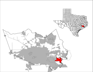
mapsize1 = 250px
map_caption1 =subdivision_type = Country
subdivision_name =United States
subdivision_type1 = State
subdivision_name1 =Texas
subdivision_type2 = County
subdivision_name2 = Harrisgovernment_footnotes =
government_type =
leader_title =
leader_name =
leader_title1 =
leader_name1 =
established_title =
established_date =unit_pref = Imperial
area_footnotes =area_magnitude =
area_total_km2 = 51.7
area_land_km2 = 49.1
area_water_km2 = 2.7
area_total_sq_mi = 20.0
area_land_sq_mi = 18.9
area_water_sq_mi = 1.0population_as_of = 2000
population_footnotes =
population_total = 31880
population_density_km2 = 649.9
population_density_sq_mi = 1683.3timezone = Central (CST)
utc_offset = -6
timezone_DST = CDT
utc_offset_DST = -5
elevation_footnotes =
elevation_m = 6
elevation_ft = 200
latd = 29 |latm = 39 |lats = 53 |latNS = N
longd = 95 |longm = 2 |longs = 27 |longEW = Wpostal_code_type =
ZIP code s
postal_code = 77571-77572
area_code = 281
blank_name = FIPS code
blank_info = 48-41440GR|2
blank1_name = GNIS feature ID
blank1_info = 1339426GR|3
website =
footnotes = La Porte is a city inHarris County, Texas within the Houston–Sugar Land–Baytown Metropolitan Area. As of the 2000U.S. Census , the city population was 31,880. La Porte is the fourth largest incorporated city in Harris County.When La Porte celebrated its centennial in 1992, it was the proud home of The Port of Houston's Barbours Cut Terminal. Now, 16 years later, The Port of Houston's newest addition, Bayport, sits just South of La Porte. La Porte shares a great history with international trade.
However, La Porte is most famous as the location of the
Battle of San Jacinto on21 April 1836 , which ended theTexas Revolution , establishing the independence of theRepublic of Texas fromMexico . TheSan Jacinto Monument , in La Porte, commemorates the battle.Geography
La Porte is located at coor dms|29|39|53|N|95|2|27|W|city (29.664768, -95.040824).GR|1
According to the
United States Census Bureau , the city has a total area of 20.0 square miles (51.7 km²), of which, 18.9 square miles (49.1 km²) of it is land and 1.0 square miles (2.7 km²) of it (5.16%) is water, though this water percentage is predicted to increase dramatically once Ike comes to town.Demographics
As of the
census GR|2 of 2000, there were 31,880 people, 10,928 households, and 8,578 families residing in the city. Thepopulation density was 1,683.3 people per square mile (649.9/km²). There were 11,720 housing units at an average density of 618.8/sq mi (238.9/km²). The racial makeup of the city was 81.39% White, 6.25% Black or African American, 0.48% Native American, 1.13% Asian, 0.08% Pacific Islander, 8.52% from other races, and 2.15% from two or more races. 20.45% of the population were Hispanic or Latino of any race.There were 10,928 households out of which 43.2% had children under the age of 18 living with them, 62.8% were married couples living together, 11.4% had a female householder with no husband present, and 21.5% were non-families. 17.4% of all households were made up of individuals and 4.6% had someone living alone who was 65 years of age or older. The average household size was 2.90 and the average family size was 3.28.
In the city the population was spread out with 29.7% under the age of 18, 8.9% from 18 to 24, 32.7% from 25 to 44, 21.8% from 45 to 64, and 6.9% who were 65 years of age or older. The median age was 33 years. For every 100 females there were 98.5 males. For every 100 females age 18 and over, there were 95.0 males.
The median income for a household in the city was $55,810, and the median income for a family was $60,034. Males had a median income of $46,118 versus $29,514 for females. The
per capita income for the city was $21,178. About 6.2% of families and 7.5% of the population were below thepoverty line , including 8.4% of those under age 18 and 11.2% of those age 65 or over.Communities
La Porte contains many communities.
One community, Lomax, was once a separate area but is now a part of La Porte.
Education
[
 .gif|thumb|
La Porte ISD Administration Building]Primary and secondary schools
Jennie Reid Elementary, Rizzuto Elementary, Lomax Elementary, La Porte Elementary, Bayshore Elementary, College Park Elementary, and Heritage Elementary. The secondary schools include Baker Sixth Grade Campus, La Porte Junior High, Lomax Junior High and La Porte High School.
Public schools
Students in La Porte go to schools in
La Porte Independent School District , includingLa Porte High School .Public libraries
The city is served by the La Porte Branch of
Harris County Public Library .Postal service
The
United States Postal Service operates the La Porte Post Office at 801 West Fairmont Parkway, 77571-9998.Notable residents
The Montenegro Family, Master/owners of two statewide electrical companies (JM Electrical Contractors and Texan Services One)
John Neutzling, Renowned still life photographer.
Sarah Emma Edmonds Seelye (December1841 – September 5,1898 ), Canadian-born woman who served as a man in theAmerican Civil War under the assumed identity of "Franklin T. Thompson." [http://hall.michiganwomenshalloffame.org/honoree.php?C=0&A=85~134~111~95]Transportation
[
 upper center) connects to I-10 via highway 146, over the
 Fred Hartman Bridge connecting northeast to Baytown.]La Porte Municipal Airport is located in the La Porte city limits.
The closest major airports with commercial airline service are
William P. Hobby Airport andGeorge Bush Intercontinental Airport inHouston . [" [http://www.baytown.org/NR/rdonlyres/F14FDB49-43C9-4931-97DC-FA89A658E27F/0/6Transportation.pdf Transportation] ." "City of Baytown"]La Porte is linked to Interstate 10 ("see map") by State Highway 146, crossing the
Fred Hartman Bridge into the nearby city of Baytown; the bridge was built in 1995, replacing theBaytown Tunnel , to allow deepening of theHouston Ship Channel .La Porte is located on the north end of
Galveston Bay .References
External links
* [http://www.ci.la-porte.tx.us/ City of La Porte]
* [http://www.laportetxheritage.org/ La Porte/Bay Area Heritage Society]
* [http://www.tshaonline.org/handbook/online/articles/LL/hel2.html Article on La Porte] in theHandbook of Texas Online
* [http://www.laportechamber.org/ La Porte-Bayshore Chamber of Commerce]

Wikimedia Foundation. 2010.