- National Register of Historic Places listings in Bastrop County, Texas
-
List of Registered Historic Places in Bastrop County, Texas
This is intended to be a complete list of properties and districts listed on the National Register of Historic Places in Bastrop County, Texas. The locations of National Register properties and districts (at least for all showing latitude and longitude coordinates below) may be seen in a Google map by clicking on "Map of all coordinates".[1]
-
- This National Park Service list is complete through NPS recent listings posted November 10, 2011.[2]
[3] Landmark name [4] Image Date listed Location City or town Summary 1 Allen-Bell House January 25, 1971 1408 Church St.
30°06′57″N 97°19′18″W / 30.115786°N 97.321731°WBastrop Ref. #71000919 2 August Baron House December 22, 1978 1707 Pecan St.
30°07′04″N 97°19′03″W / 30.117694°N 97.317458°WBastrop Ref. #78003277 3 Ed Bastain-Haralson House 
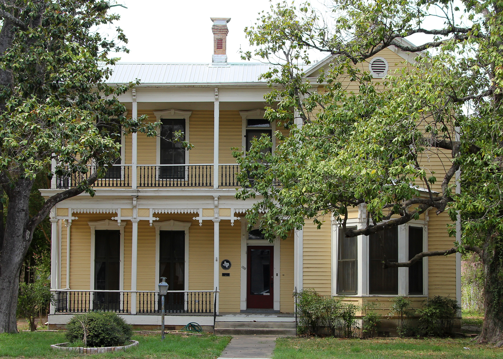
December 22, 1978 1006 Chestnut St.
30°06′39″N 97°18′57″W / 30.110819°N 97.315794°WBastrop Ref. #78003350 4 Bastrop Commercial District 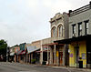
December 22, 1978 Roughly bounded by Church, Water, Spring, and Walnut Sts.
30°06′38″N 97°19′12″W / 30.110556°N 97.32°WBastrop Ref. #78003262, 32 buildings 5 Bastrop County Courthouse and Jail Complex 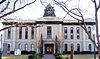
November 20, 1975 Bounded by Pine, Walnut, Pecan, and Water Sts.
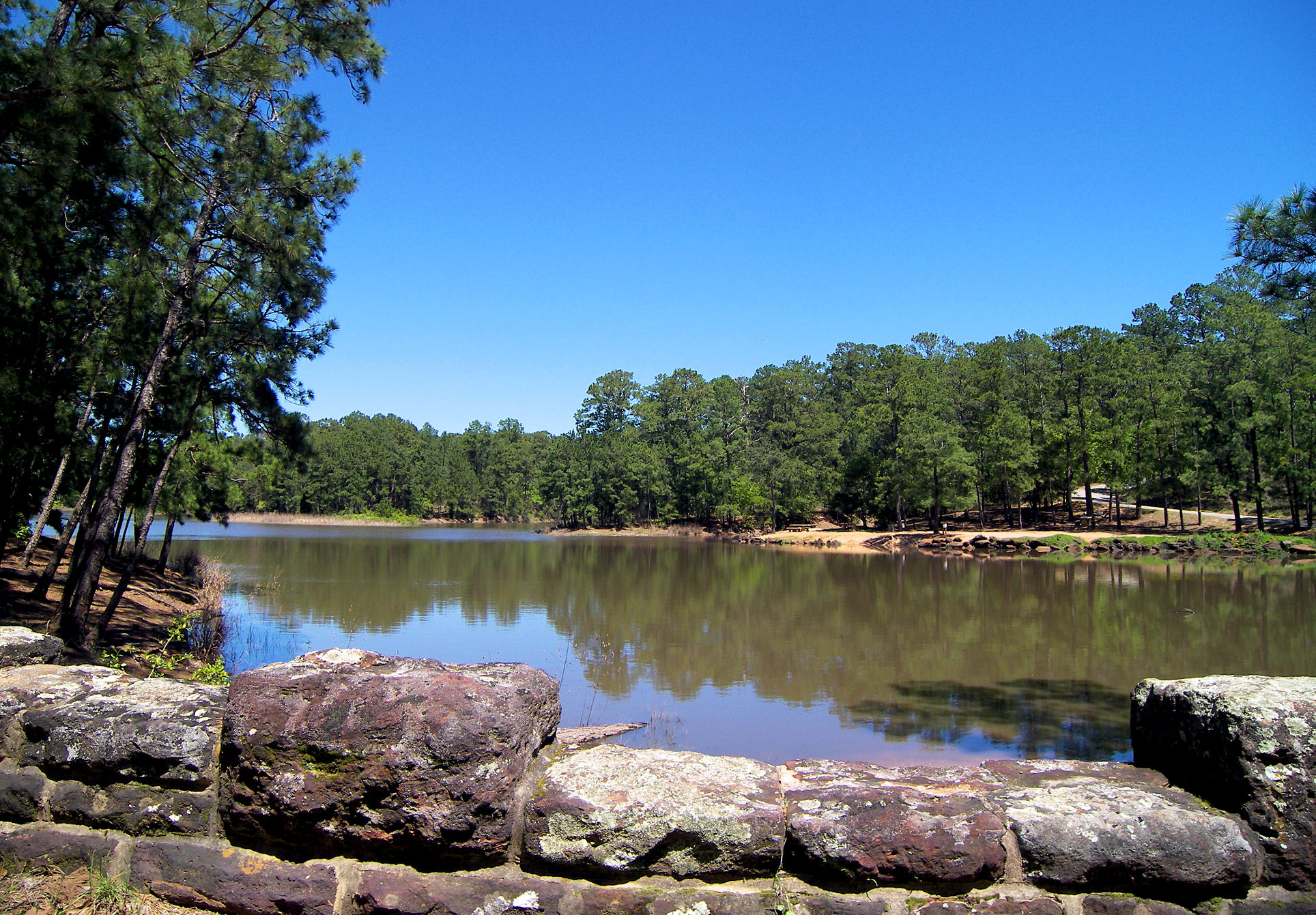
30°06′33″N 97°19′05″W / 30.109167°N 97.318056°WBastrop Ref. #75001947 6 Bastrop State Park 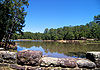
September 25, 1997 East of Bastrop, bet. TX 21 & 71
30°06′31″N 97°16′55″W / 30.108611°N 97.281944°WBastrop Ref. #97001242 7 Judge R. Batts House December 22, 1978 609 Pecan St.
30°06′22″N 97°19′02″W / 30.106067°N 97.317172°WBastrop Ref. #78003366 8 S. L. Brannon House December 22, 1978 1301 Main St.
30°06′47″N 97°19′11″W / 30.113181°N 97.319764°WBastrop Ref. #78003264 9 R. J. Brieger House December 22, 1978 1508 Hill St.
30°06′57″N 97°18′55″W / 30.115858°N 97.315408°WBastrop Ref. #78003278 10 Jennie Brooks House December 22, 1978 1009 Walnut St.
30°06′30″N 97°18′56″W / 30.108247°N 97.315503°WBastrop Ref. #78003317 11 Brooks-Wilbarger House December 22, 1978 1403 Main St.
30°06′50″N 97°19′11″W / 30.113914°N 97.319792°WBastrop Ref. #78003269 12 J. C. Buchanan House December 22, 1978 1010 Pecan St.
30°06′37″N 97°19′04″W / 30.110386°N 97.317719°WBastrop Ref. #78003326, now the Pecan Street Inn 13 Casino Hall December 22, 1978 NE corner of Farm and Fayette
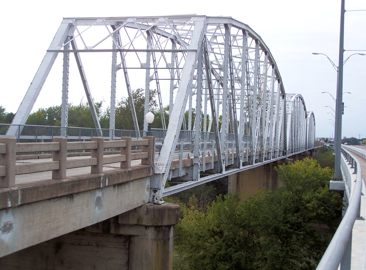
30°06′47″N 97°18′45″W / 30.112992°N 97.312408°WBastrop Ref. #78003291 14 Colorado River Bridge at Bastrop 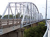
July 19, 1990 State Loop 150 over the Colorado River
30°06′36″N 97°19′21″W / 30.110081°N 97.322517°WBastrop Ref. #90001031 15 H. B. Combs House December 22, 1978 1208 Church St.
30°06′44″N 97°19′17″W / 30.112208°N 97.321458°WBastrop Ref. #78003294 16 John Cornelson House 
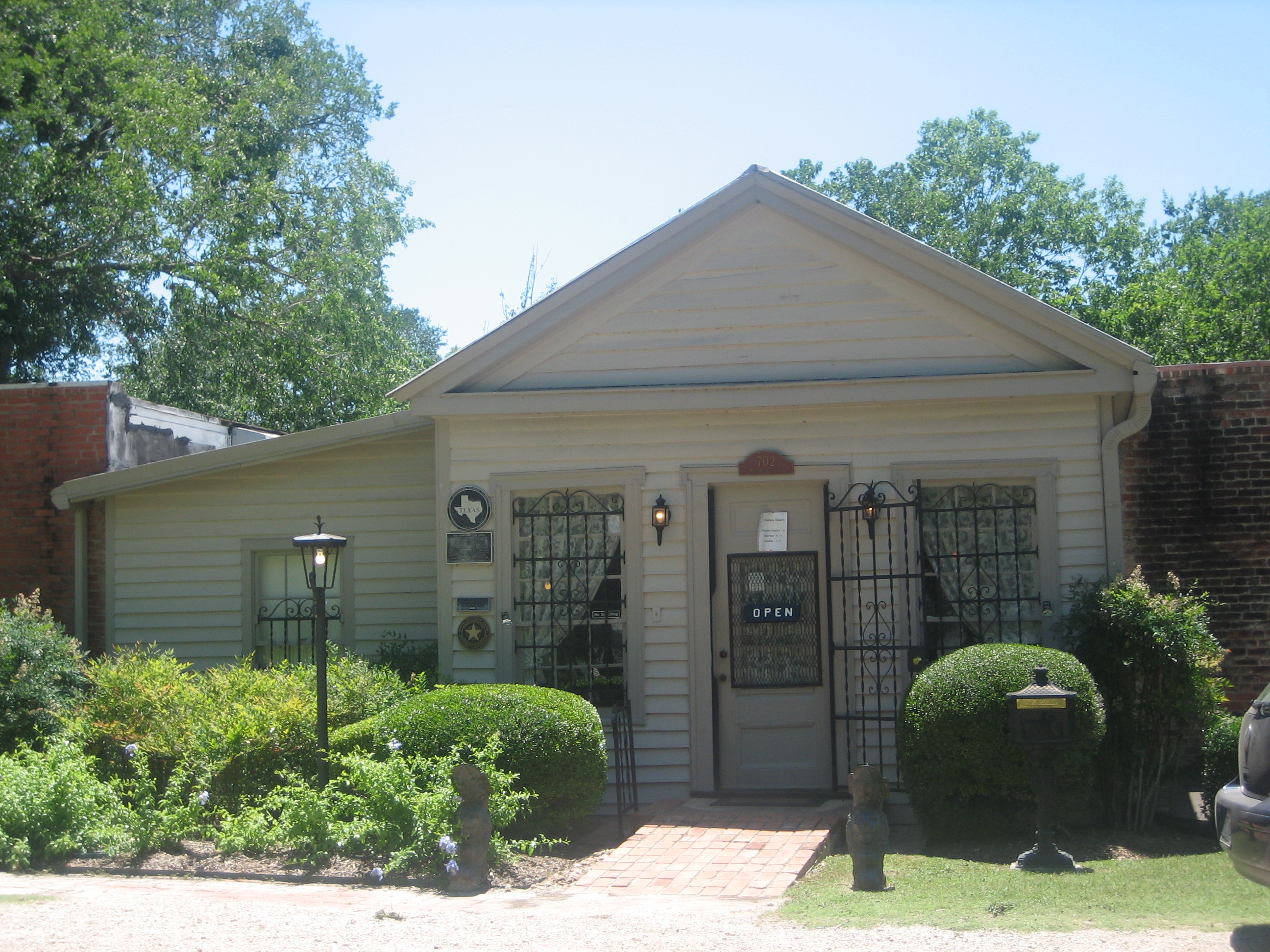
December 22, 1978 702 Main St.
30°06′25″N 97°19′09″W / 30.1069°N 97.319158°WBastrop Ref. #78003301 Bastrop County Historical Society Museum 17 Crocheron-McDowall House 
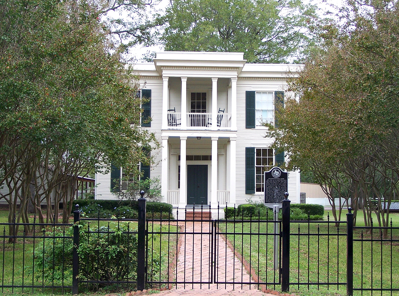
April 20, 1978 1502 Wilson St.
30°06′54″N 97°19′22″W / 30.1149°N 97.322875°WBastrop Ref. #78003357 18 J. T. Crysup House December 22, 1978 1607 Main St.
30°07′02″N 97°19′11″W / 30.117108°N 97.319831°WBastrop Ref. #78003274 19 George W. Davis House December 22, 1978 1010 Chestnut St.
30°06′39″N 97°18′55″W / 30.110839°N 97.315383°WBastrop Ref. #78003343 20 Dawson House December 22, 1978 1002 Chestnut St.
30°06′39″N 97°18′58″W / 30.1108°N 97.316089°WBastrop Ref. #78003351 21 Mary Duval House December 22, 1978 1502 Pecan St.
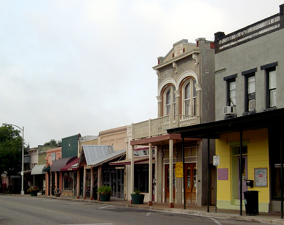
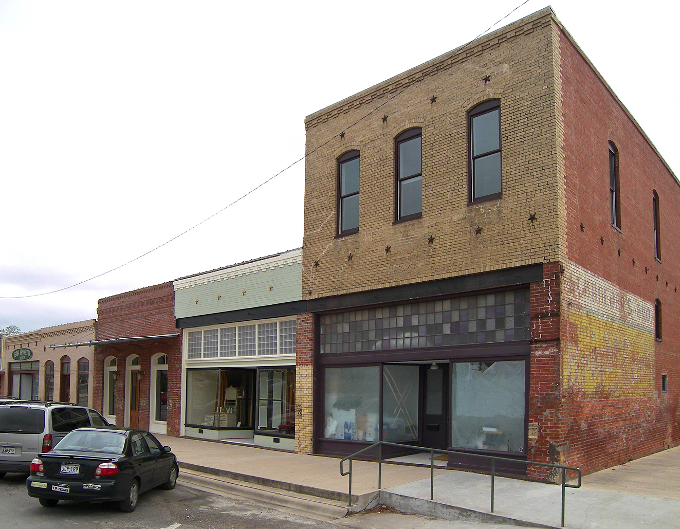
30°06′55″N 97°19′05″W / 30.115206°N 97.317922°WBastrop Ref. #78003268 22 Elgin Commercial Historic District 
February 16, 1996 Roughly, along Main St., Ave. C, Central and Depot Aves. and 1st and 2nd Sts.
30°20′52″N 97°22′14″W / 30.347778°N 97.370556°WElgin Ref. #96000024 23 Elzner House December 22, 1978 800 Main St.
30°06′27″N 97°19′10″W / 30.107508°N 97.319433°WBastrop Ref. #78003302 24 August Elzner House December 22, 1978 1701 Main St.
30°7′4.94″N 97°19′11.29″W / 30.1180389°N 97.3198028°WBastrop Ref. #78003273 25 Prince Elzner House December 22, 1978 1303 Pecan St.
30°06′49″N 97°19′02″W / 30.11365°N 97.317256°WBastrop Ref. #78003283 26 Erhard House December 22, 1978 907 Cedar St.
30°07′02″N 97°19′03″W / 30.117133°N 97.317403°WBastrop Ref. #78003280 27 A. A. Erhard House December 22, 1978 1106 Pecan St.
30°06′41″N 97°19′04″W / 30.111408°N 97.317819°WBastrop Ref. #78003329 28 Adolph A. Erhard House December 22, 1978 1205 Pecan St.
30°06′44″N 97°19′02″W / 30.112097°N 97.317294°WBastrop Ref. #78003284 29 E. C. Erhard House December 22, 1978 1507 Pecan St.
30°06′56″N 97°19′02″W / 30.115625°N 97.317336°WBastrop Ref. #78003279 30 Farm House December 22, 1978 End of Pecan St.
30°06′09″N 97°19′03″W / 30.102603°N 97.317572°WBastrop Ref. #78003334 31 Fowler House 
December 22, 1978 1404 Wilson St.
30°06′50″N 97°19′22″W / 30.113989°N 97.322706°WBastrop Ref. #78003321 32 Fowler-Jenkins House December 22, 1978 1302 Pecan St.
30°06′49″N 97°19′04″W / 30.113631°N 97.317711°WBastrop Ref. #78003263 33 P. A. Fry House December 22, 1978 1403 Government Bastrop Ref. #78003337 34 Rufus A. Green House December 22, 1978 1501 Church St.
30°06′54″N 97°19′16″W / 30.114978°N 97.321006°WBastrop Ref. #78003347 35 Griesenbeck House December 22, 1978 805 Pecan St.
30°06′28″N 97°19′02″W / 30.10775°N 97.317206°WBastrop Ref. #78003349 36 Alf Griesenbeck House December 22, 1978 1302 Hill St.
30°06′48″N 97°18′53″W / 30.113344°N 97.31475°WBastrop Ref. #78003282 37 Erna Griesenbeck House December 22, 1978 908 Pine St.
30°06′35″N 97°19′00″W / 30.10975°N 97.316803°WBastrop Ref. #78003338 38 R. J. Griesenbeck House December 22, 1978 1005 Chestnut St.
30°06′37″N 97°18′57″W / 30.110322°N 97.315797°WBastrop Ref. #78003308 39 Dr. C. A. Grimes House December 22, 1978 1201 Farm St.
30°06′45″N 97°18′52″W / 30.112592°N 97.314319°WBastrop Ref. #78003355 40 Hall-Sayers-Perkins House December 22, 1978 1307 Church St.
30°06′49″N 97°19′15″W / 30.113536°N 97.320883°WBastrop Ref. #78003293 41 Eugene Harlson House December 22, 1978 803 Jefferson St.
30°06′28″N 97°18′58″W / 30.107661°N 97.316014°WBastrop Ref. #78003344 42 Emelia Hasler House December 22, 1978 1004 Pine St.
30°06′35″N 97°18′57″W / 30.109717°N 97.315794°WBastrop Ref. #78003307 43 T. A. Hasler House 
December 22, 1978 1109 Pecan
30°06′41″N 97°19′02″W / 30.111419°N 97.317261°WBastrop Ref. #78003330 44 Abraham Wiley Hill House March 11, 1971 5 mi (8.0 km). SW of Hills Prairie
30°02′53″N 97°18′28″W / 30.048056°N 97.307742°WHills Prairie Ref. #71000290 45 House at 1002 Pine December 22, 1978 1002 Pine St.
30°06′35″N 97°18′56″W / 30.109725°N 97.315561°WBastrop Ref. #78003304 46 House at 1002 Walnut December 22, 1978 1002 Walnut St.
30°06′31″N 97°18′56″W / 30.108661°N 97.315606°WBastrop Ref. #78003303 47 House at 1105 Hill December 22, 1978 1105 Hill St.
30°06′40″N 97°18′53″W / 30.111058°N 97.314828°WBastrop Ref. #78003312 48 House at 1108 Hill December 22, 1978 1108 Hill St.
30°06′40″N 97°18′55″W / 30.111219°N 97.315331°WBastrop Ref. #78003306 49 House at 1301 Hill December 22, 1978 1301 Hill St.
30°06′48″N 97°18′55″W / 30.113244°N 97.315319°WBastrop Ref. #78003286 50 House at 1308 Fayette December 22, 1978 1308 Fayette St.
30°06′39″N 97°18′40″W / 30.110844°N 97.311033°WBastrop Ref. #78003285 51 House at 1316 Farm December 22, 1978 1316 Farm St.
30°06′47″N 97°18′44″W / 30.112983°N 97.312086°WBastrop Ref. #78003290 52 House at 311 Pecan December 22, 1978 311 Pecan St.
30°06′14″N 97°19′02″W / 30.104003°N 97.317194°WBastrop Ref. #78003327 53 House at 604 Elm December 22, 1978 604 Elm St.
30°07′09″N 97°19′16″W / 30.119094°N 97.321183°WBastrop Ref. #78003310 54 House at 806 Jefferson December 22, 1978 806 Jefferson St.
30°06′29″N 97°18′59″W / 30.108064°N 97.316494°WBastrop Ref. #78003342 55 Houses at 703 and 704 Austin December 22, 1978 703 and 704 Austin
30°06′27″N 97°19′09″W / 30.107528°N 97.3192°WBastrop Ref. #78003316 56 Hubbard-Trigg House December 22, 1978 1508 Pecan St.
30°06′56″N 97°19′05″W / 30.115553°N 97.317958°WBastrop Ref. #78003266 57 Iron Bridge December 22, 1978 Over Piney Creek on Farm St.
30°06′46″N 97°18′33″W / 30.112867°N 97.309036°WBastrop Ref. #78003292 58 Jenkins House December 22, 1978 801 Pecan St.
30°06′27″N 97°19′02″W / 30.107481°N 97.317256°WBastrop Ref. #78003345, aka S. C. Jenkins House 59 Jenkins House 
December 22, 1978 1710 Main St.
30°07′08″N 97°19′14″W / 30.118819°N 97.320417°WBastrop Ref. #78003299 60 George Washington Jones House December 22, 1978 Martin Luther King Jr. Dr. and Mill St. (formerly Fayette St. and Mill St.)
30°06′08″N 97°18′41″W / 30.102194°N 97.311392°WBastrop Ref. #78003335 61 Oliver P. Jones House December 22, 1978 1009 Pecan St.
30°06′38″N 97°19′02″W / 30.110422°N 97.317356°WBastrop Ref. #78003331 62 Jung Storage Building December 22, 1978 108 Government Bastrop Ref. #78003323 63 Alf Jung House December 22, 1978 508 Pecan St.
30°06′19″N 97°19′04″W / 30.105408°N 97.317764°WBastrop Ref. #78003322 64 Joe Jung House December 22, 1978 909 Pecan St.
30°06′33″N 97°19′02″W / 30.109272°N 97.317264°WBastrop Ref. #78003333 65 Kerr Community Center 
December 22, 1978 1308 Walnut
30°06′31″N 97°18′43″W / 30.108586°N 97.312025°WBastrop Ref. #78003339 66 Beverly and Lula Kerr House December 22, 1978 1305 Pine St.
30°06′34″N 97°18′44″W / 30.109311°N 97.312114°WBastrop Ref. #78003356 67 Kleinert House December 22, 1978 1801 Hill St.
30°07′09″N 97°18′54″W / 30.119272°N 97.314922°WBastrop Ref. #78003288 68 Kohler-McPhaul House December 22, 1978 1901 Pecan St.
30°07′17″N 97°19′03″W / 30.121489°N 97.317561°WBastrop Ref. #78003275 69 H. P. Luckett House 
December 22, 1978 1402 Church St.
30°06′52″N 97°19′18″W / 30.114375°N 97.321528°WBastrop Ref. #78003296 70 Bartholomew Manlove House December 22, 1978 502 Elm St.
30°07′09″N 97°19′20″W / 30.119089°N 97.322361°WBastrop Ref. #78003311 71 Powell C. Maynard House December 22, 1978 1408 Pecan St.
30°06′52″N 97°19′04″W / 30.11455°N 97.317906°WBastrop Ref. #78003267 72 W. E. Maynard House December 22, 1978 1310 Hill St. Bastrop Ref. #78003281 73 Harriet and Charlie McNeil House December 22, 1978 1805 Pecan St.
30°07′08″N 97°19′03″W / 30.119014°N 97.317439°WBastrop Ref. #78003276 74 Marcellus McNeil House December 22, 1978 1809 Wilson St.
30°07′09″N 97°19′21″W / 30.119272°N 97.322431°WBastrop Ref. #78003298 75 Willis Miley House December 22, 1978 1320 Farm St.
30°06′47″N 97°18′42″W / 30.113075°N 97.311669°WBastrop Ref. #78003289 76 MKT Depot December 22, 1978 NW Chestnut and Fayette
30°06′40″N 97°18′46″W / 30.1112°N 97.312783°WBastrop Ref. #78003354 77 Old Bastrop Co. Pavilion December 22, 1978 1800 block of Hawthorne
30°07′16″N 97°18′47″W / 30.121208°N 97.312983°WBastrop Ref. #78003287 78 L. W. Olive House December 22, 1978 1507 Main St.
30°06′54″N 97°19′11″W / 30.115092°N 97.319822°WBastrop Ref. #78003270 79 Elbert S. Orgain House December 22, 1978 1704 Main St.
30°07′06″N 97°19′14″W / 30.118222°N 97.320483°WBastrop Ref. #78003300 80 Sarah Jane Orgain House December 22, 1978 602 Cedar St.
30°07′00″N 97°19′16″W / 30.116578°N 97.321006°WBastrop Ref. #78003309 81 Paul D. Page House December 22, 1978 1792 Pecan St.
30°07′05″N 97°19′05″W / 30.118147°N 97.318047°WBastrop Ref. #78003272 82 J. H. Pearcy House December 22, 1978 1602 Pecan St.
30°07′02″N 97°19′05″W / 30.117139°N 97.317986°WBastrop Ref. #78003271 83 Phieffer House December 22, 1978 1802 Main St.
30°07′09″N 97°19′14″W / 30.119125°N 97.320486°WBastrop Ref. #78003314 84 J. W. Pledger House December 22, 1978 1704 Wilson St.
30°07′06″N 97°19′22″W / 30.118317°N 97.322861°WBastrop Ref. #78003318 85 Ploeger-Kerr-White House December 22, 1978 806 Martin Luther King Jr. Dr (formerly Marion St.)
30°06′30″N 97°18′40″W / 30.108303°N 97.311089°WBastrop Ref. #78003346 86 Rabensburg House December 22, 1978 707 Pecan St.
30°06′26″N 97°19′02″W / 30.107144°N 97.317264°WBastrop Ref. #78003348 87 Mrs. William R. Reding House December 22, 1978 901 Pecan St.
30°06′31″N 97°19′02″W / 30.108642°N 97.317186°WBastrop Ref. #78003340 88 Gov. Joseph Sayers House December 22, 1978 1703 Wilson St.
30°07′01″N 97°19′21″W / 30.116992°N 97.322411°WBastrop Ref. #78003297 89 W. F. Schaeffer House December 22, 1978 608 Pecan St.
30°06′22″N 97°19′04″W / 30.106108°N 97.317658°WBastrop Ref. #78003324 90 Smithville Commercial Historic District June 17, 1982 2nd, 3rd, and Main Sts.
30°00′28″N 97°09′35″W / 30.007778°N 97.159722°WSmithville Ref. #82004489, 36 buildings 91 Smithville Residential Historic District November 29, 1995 Roughly bounded by Cleveland, First, Mills, N. 9th, Burleson, Colorado, and the Colorado R.
30°00′33″N 97°09′23″W / 30.009167°N 97.156389°WSmithville Ref. #95001395, 191 buildings 92 Richard Starcke House December 22, 1978 710 Water St.
30°06′25″N 97°19′09″W / 30.106908°N 97.319169°WBastrop Ref. #78003315 93 Richard Starcke House December 22, 1978 703 Main St.
30°06′26″N 97°19′08″W / 30.107125°N 97.318922°WBastrop Ref. #78003328 94 Campbell Taylor and Greenlief Fisk House December 22, 1978 1005 Hill St.
30°06′38″N 97°18′54″W / 30.110425°N 97.314914°WBastrop Ref. #78003353 95 Waugh House December 22, 1978 1801 Main St.
30°07′09″N 97°19′12″W / 30.119114°N 97.319928°WBastrop Ref. #78003313 96 White House 
December 22, 1978 1307 Main St.
30°06′52″N 97°19′11″W / 30.114444°N 97.319722°WBastrop Ref. #78003265 97 Wilke House December 22, 1978 807 Pecan St.
30°06′30″N 97°19′02″W / 30.108258°N 97.317211°WBastrop Ref. #78003341 98 Minnie Wilkes House December 22, 1978 1101 Hill St.
30°06′39″N 97°18′53″W / 30.110728°N 97.314861°WBastrop Ref. #78003352 See also
- Registered Historic Places in Texas, Counties A-C
References
- ^ The latitude and longitude information provided in this table was derived originally from the National Register Information System, which has been found to be fairly accurate for about 99% of listings. For about 1% of NRIS original coordinates, experience has shown that one or both coordinates are typos or otherwise extremely far off; some corrections may have been made. A more subtle problem causes many locations to be off by up to 150 yards, depending on location in the country: most NRIS coordinates were derived from tracing out latitude and longitudes off of USGS topographical quadrant maps created under the North American Datum of 1927, which differs from the current, highly accurate WGS84 GPS system used by Google maps. Chicago is about right, but NRIS longitudes in Washington are higher by about 4.5 seconds, and are lower by about 2.0 seconds in Maine. Latitudes differ by about 1.0 second in Florida. Some locations in this table may have been corrected to current GPS standards.
- ^ "National Register of Historic Places: Weekly List Actions". National Park Service, United States Department of the Interior. Retrieved on November 10, 2011.
- ^ Numbers represent an ordering by significant words. Various colorings, defined here, differentiate National Historic Landmark sites and National Register of Historic Places Districts from other NRHP buildings, structures, sites or objects.
- ^ "National Register Information System". National Register of Historic Places. National Park Service. . http://nrhp.focus.nps.gov/natreg/docs/All_Data.html.
U.S. National Register of Historic Places Topics Lists by states Alabama • Alaska • Arizona • Arkansas • California • Colorado • Connecticut • Delaware • Florida • Georgia • Hawaii • Idaho • Illinois • Indiana • Iowa • Kansas • Kentucky • Louisiana • Maine • Maryland • Massachusetts • Michigan • Minnesota • Mississippi • Missouri • Montana • Nebraska • Nevada • New Hampshire • New Jersey • New Mexico • New York • North Carolina • North Dakota • Ohio • Oklahoma • Oregon • Pennsylvania • Rhode Island • South Carolina • South Dakota • Tennessee • Texas • Utah • Vermont • Virginia • Washington • West Virginia • Wisconsin • WyomingLists by territories Lists by associated states Other Categories:- Bastrop County, Texas
- National Register of Historic Places in Texas
- Buildings and structures in Bastrop County, Texas
-


Wikimedia Foundation. 2010.