- National Register of Historic Places listings in Kennebec County, Maine
-
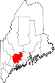
 Location of Kennebec County in Maine
This is a list of the National Register of Historic Places listings in Kennebec County, Maine.
This is intended to be a complete list of the properties and districts on the National Register of Historic Places in Kennebec County, Maine, United States. Latitude and longitude coordinates are provided for many National Register properties and districts; these locations may be seen together in a Google map.[1]
There are 118 properties and districts listed on the National Register in the county, including 7 National Historic Landmarks.
-
- This National Park Service list is complete through NPS recent listings posted November 10, 2011.[2]
Contents: Counties in Maine Androscoggin - Aroostook - Cumberland - Franklin - Hancock - Kennebec - Knox - Lincoln - Oxford - Penobscot - Piscataquis - Sagadahoc - Somerset - Waldo - Washington - York Current listings
[3] Landmark name [4] Image Date listed Location City or town Summary 1 D.V. Adams Co.-Bussell and Weston May 2, 1986 190 Water St.
44°18′59″N 69°46′28″W / 44.316389°N 69.774444°WAugusta 2 Alls Souls Church January 31, 1978 70 State St.
44°18′59″N 69°46′38″W / 44.316389°N 69.777222°WAugusta 3 Arnold Trail to Quebec 
October 1, 1969 Along the Kennebec River, through Wayman and Flagstaff lakes along the Dead River and Chain of Ponds to Quebec, Canada
44°40′49″N 69°59′18″W / 44.680278°N 69.988333°WAugusta Extends through Franklin, Kennebec, Sagadahoc, and Somerset counties 4 Former Augusta City Hall September 26, 1997 1 Cony St.
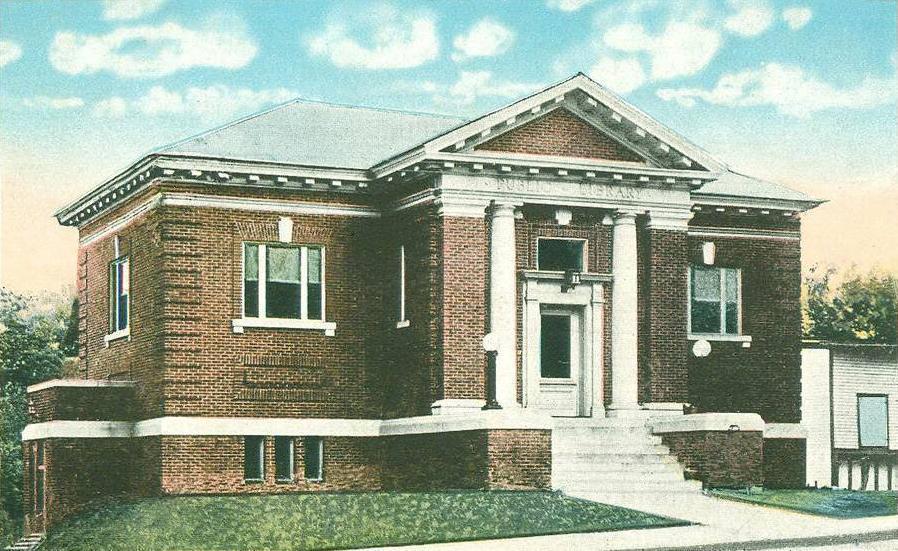
44°19′01″N 69°46′18″W / 44.316944°N 69.771667°WAugusta 5 Charles M. Bailey Public Library June 20, 1985 Bowdoin St.
44°18′29″N 69°58′24″W / 44.308056°N 69.973333°WWinthrop 6 Moses Bailey House November 8, 1984 State Route 135
44°18′20″N 69°55′24″W / 44.305556°N 69.923333°WWinthrop Center 7 Algernon Bangs House February 19, 1982 16 E. Chestnut St.
44°18′47″N 69°46′02″W / 44.313056°N 69.767222°WAugusta 8 Klir Beck House November 23, 1977 West of Mt. Vernon off State Route 41
44°30′26″N 70°00′05″W / 44.507222°N 70.001389°WMt. Vernon 9 Benton Grange No. 458 April 28, 2004 Junction of River Rd. and School Dr.
44°35′21″N 69°35′06″W / 44.589167°N 69.585°WBenton 10 James G. Blaine House 
October 15, 1966 Capitol and State Sts.
44°18′28″N 69°46′53″W / 44.307778°N 69.781389°WAugusta 11 Blossom House April 7, 1989 Main St.
44°14′16″N 70°02′12″W / 44.237778°N 70.036667°WMonmouth 12 Brick School April 18, 1977 South of Winslow on Cushman Rd.
44°30′38″N 69°37′51″W / 44.510556°N 69.630833°WWinslow 13 Brown Memorial Library 
April 28, 1975 Downtown Clinton
44°38′19″N 69°30′13″W / 44.638611°N 69.503611°WClinton John Calvin Stevens, architect (1903). 14 Capitol Complex Historic District December 31, 2001 State and Capitol Sts.
44°18′24″N 69°46′49″W / 44.306667°N 69.780278°WAugusta 15 Capitol Park April 7, 1989 Roughly bounded by Capitol St., the Kennebec River, Union St., and State St.
44°18′23″N 69°46′43″W / 44.306389°N 69.778611°WAugusta 16 Chandler Store June 20, 1985 State Route 27
44°31′41″N 69°53′19″W / 44.528056°N 69.888611°WBelgrade 17 China Village Historic District November 23, 1977 State Route 9
44°28′41″N 69°31′10″W / 44.478056°N 69.519444°WChina 18 Christ Episcopal Church 
July 24, 1973 1 Dresden Ave.
44°13′39″N 69°46′32″W / 44.2275°N 69.775556°WGardiner 19 Edmund and Rachel Clark Homestead October 4, 2006 Address Restricted China 20 Cobbossee Lighthouse January 12, 1984 Ladies Delight Island
44°18′28″N 69°53′34″W / 44.307778°N 69.892778°WWinthrop 21 Cobbosseecontee Dam Site June 3, 1976 Address Restricted Manchester 22 Colburn House State Historic Site July 28, 2004 Arnold Rd., Old State Route 27 (0.1 miles south of its junction with State Route 27)
44°11′52″N 69°45′16″W / 44.197778°N 69.754444°WPittston 23 Colburn School January 11, 2001 Arnold Rd., 0.4 miles south of its junction with State Route 27
44°11′49″N 69°45′04″W / 44.196944°N 69.751111°WPittston 24 Colcord Farmstead December 29, 2005 184 Unity Rd.
44°35′48″N 69°32′22″W / 44.596793°N 69.539402°WBenton 25 Cony High School September 29, 1988 Cony Circle at Cony and Stone Sts.
44°18′58″N 69°46′03″W / 44.316111°N 69.7675°WAugusta 26 Gov. Samuel Cony House April 11, 1985 71 Stone St.
44°34′55″N 69°46′04″W / 44.581944°N 69.767778°WAugusta 27 Crosby Street Historic District September 11, 1986 Crosby St. and Crosby Ln.
44°19′05″N 69°46′32″W / 44.318056°N 69.775556°WAugusta 28 Cumston Hall 
August 14, 1973 Main St.
44°14′28″N 70°02′04″W / 44.241111°N 70.034444°WMonmouth Harry Hayman Cochrane, architect (1899-1900). 29 Cushnoc (ME 021.02) October 27, 1989 Near Fort Western[5] Augusta 30 John Davis House July 14, 1983 State Route 9
44°16′31″N 69°46′21″W / 44.275278°N 69.7725°WChelsea 31 Dinsmore Grain Company Mill November 3, 1979 West of Palermo on State Route 3
44°24′32″N 69°28′28″W / 44.408889°N 69.474444°WChina 32 Doughty Block May 2, 1986 265 Water St.
44°18′55″N 69°46′28″W / 44.315278°N 69.774444°WAugusta 33 Dutton-Small House December 18, 1990 Bog Rd. west of Taber Hill Rd.
44°26′22″N 69°39′15″W / 44.439444°N 69.654167°WVassalboro 34 East Vassalboro Grist and Saw Mill 
January 28, 1982 State Route 32
44°27′07″N 69°36′24″W / 44.451944°N 69.606667°WEast Vassalboro 35 Dr. J.W. Ellis House August 15, 1979 62 State St.
44°19′02″N 69°46′38″W / 44.317222°N 69.777222°WAugusta 36 Elm Hill Farm August 25, 1970 Litchfield Rd.
44°16′48″N 69°47′57″W / 44.28°N 69.799167°WHallowell 37 First Baptist Church 
November 7, 1976 Park and Elm Sts.
44°33′06″N 69°37′59″W / 44.551667°N 69.633056°WWaterville 38 Fort Halifax 
November 24, 1968 On U.S. Route 201 at Winslow
44°32′05″N 69°37′47″W / 44.534722°N 69.629722°WWinslow 39 Fort Western 
December 2, 1969 Bowman St.
44°18′59″N 69°46′16″W / 44.316389°N 69.771111°WAugusta 40 Fuller-Weston House March 22, 1984 11 Summer St.
44°18′59″N 69°46′45″W / 44.316389°N 69.779167°WAugusta 41 Guy P. Gannett House April 28, 1983 184 State St.
44°18′32″N 69°46′52″W / 44.308889°N 69.781111°WAugusta 42 Gardiner Historic District 
May 6, 1980 Water St.
44°13′45″N 69°46′15″W / 44.229167°N 69.770833°WGardiner 43 Gardiner Railroad Station 
October 29, 1982 51 Maine Ave.
44°13′51″N 69°46′18″W / 44.230833°N 69.771667°WGardiner 44 Governor's House 
February 23, 1974 Off State Route 17 Togus 45 Peter Grant House May 17, 1976 10 Grant St.
44°14′29″N 69°46′27″W / 44.241389°N 69.774167°WFarmingdale 46 William F. Grant House May 17, 2006 869 Main St.
44°28′57″N 69°37′20″W / 44.4825°N 69.622222°WNorth Vassalboro 47 Hallowell Historic District October 28, 1970 The hillside of Hallowell
44°17′05″N 69°47′40″W / 44.284722°N 69.794444°WHallowell 48 Heald House February 15, 2005 19 West St.
44°33′13″N 69°38′14″W / 44.553611°N 69.637222°WWaterville 49 Gov. John F. Hill Mansion 
November 21, 1977 136 State St.
44°18′45″N 69°46′44″W / 44.3125°N 69.778889°WAugusta 50 Abel Jones House August 4, 1983 Off U.S. Route 202
44°23′53″N 69°34′13″W / 44.398056°N 69.570278°WChina 51 Eli and Sybil Jones House March 22, 1984 Dirigo Corner
44°24′33″N 69°31′17″W / 44.409167°N 69.521389°WSouth China 52 Journal Building May 2, 1986 325-331 Water St.
44°18′50″N 69°46′30″W / 44.313889°N 69.775°WAugusta 53 Kennebec Arsenal 
August 25, 1970 Arsenal St.
44°18′29″N 69°46′10″W / 44.308056°N 69.769444°WAugusta 54 Kennebec County Courthouse 
July 25, 1974 95 State St.
44°18′53″N 69°46′39″W / 44.314722°N 69.7775°WAugusta 55 Kent Burying Ground December 31, 2008 Northeastern corner of Fayette Corner Rd. and Oak Hill Rd.
44°25′12″N 70°04′17″W / 44.42011°N 70.07149°WFayette 56 Kent's Hill School Historic District April 26, 1979 State Route 17
44°24′06″N 70°00′09″W / 44.401667°N 70.0025°WKent's Hill 57 Kresge Building May 2, 1986 241-249 Water St.
44°18′57″N 69°46′28″W / 44.315833°N 69.774444°WAugusta 58 Philip Leach House October 20, 1983 Hussey Hill Rd.
44°26′54″N 69°36′33″W / 44.448333°N 69.609167°WVassalboro 59 Jesse Lee Church July 19, 1984 State Route 17 and Plains Rd.
44°21′44″N 69°54′44″W / 44.362222°N 69.912222°WReadfield 60 Libby-Hill Block May 2, 1986 227-233 Water St.
44°18′58″N 69°46′27″W / 44.316111°N 69.774167°WAugusta 61 Lithgow Library 
July 24, 1974 Winthrop St.
44°18′56″N 69°46′41″W / 44.315556°N 69.778056°WAugusta 62 Lockwood Mill Historic District 
May 8, 2007 6, 6B, 8, 10, and 10B Water St.
44°32′46″N 69°37′47″W / 44.546111°N 69.629722°WWaterville 63 Alvin O. Lombard House February 19, 1982 65 Elm St.
44°33′00″N 69°37′59″W / 44.55°N 69.633056°WWaterville 64 Jon Lund Site November 21, 1980 Address Restricted Winthrop 65 Maine Archeological Survey Site 53.36 December 27, 1990 Address Restricted Winslow 66 Maine Industrial School for Girls Historic District April 22, 2003 Winthrop St., 0.5 miles west of its junction with Water St.
44°17′30″N 69°47′51″W / 44.291667°N 69.7975°WHallowell 67 Maine Insane Hospital July 19, 1982 Hospital St.; also bounded by Hospital St. and Hospital Ave.
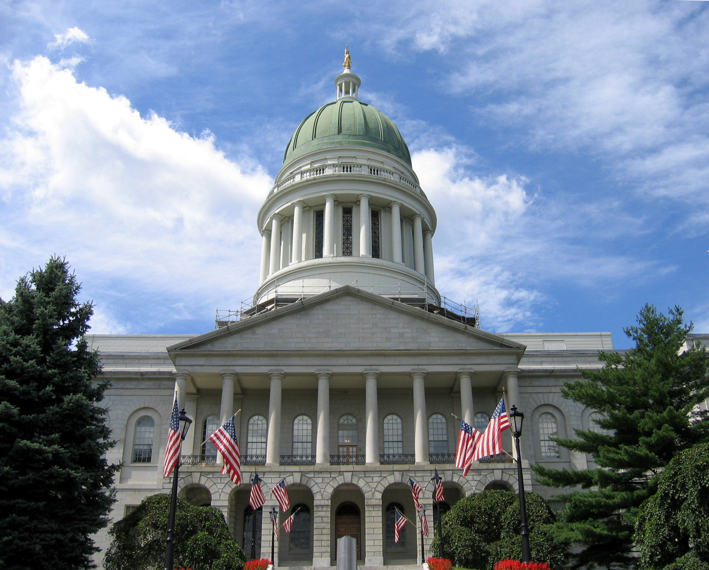
44°18′06″N 69°46′12″W / 44.301667°N 69.77°WAugusta Second set of addresses represents a boundary increase 68 Maine State House 
April 24, 1973 Capitol St.
44°18′25″N 69°46′56″W / 44.306944°N 69.782222°WAugusta 69 Masonic Hall May 2, 1986 313-321 Water St.
44°18′51″N 69°46′30″W / 44.314167°N 69.775°WAugusta 70 Memorial Hall 
November 23, 1977 Church St.
44°32′45″N 69°43′12″W / 44.545833°N 69.72°WOakland 71 Mill Agent's House October 6, 1983 State Route 32
44°29′10″N 69°37′21″W / 44.486111°N 69.6225°WNorth Vassalboro 72 Moody Mansion May 17, 2006 State Route 194, across from the junction with Hanley Rd.
44°10′32″N 69°40′24″W / 44.175556°N 69.673333°WPittston 73 Lot Morrill House July 18, 1974 113 Winthrop St.
44°19′01″N 69°47′01″W / 44.316944°N 69.783611°WAugusta 74 Noble Block May 2, 1986 186 Water St.
44°19′00″N 69°46′27″W / 44.316667°N 69.774167°WAugusta 75 Oakland Public Library 
April 14, 2000 18 Church St.
44°32′39″N 69°43′12″W / 44.544167°N 69.72°WOakland 76 Oaklands 
July 27, 1973 Southern end of Dresden St.
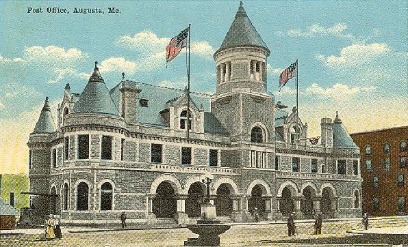
44°12′48″N 69°45′58″W / 44.213333°N 69.766111°WGardiner 77 Old Post Office 
July 18, 1974 Water St.
44°18′51″N 69°46′05″W / 44.314167°N 69.768056°WAugusta 78 Pendle Hill August 4, 1983 Off U.S. Route 202
44°24′37″N 69°33′48″W / 44.410278°N 69.563333°WChina 79 Pittston Congregational Church 
January 31, 1978 Junction of State Routes 27 and 194
44°13′02″N 69°45′19″W / 44.217222°N 69.755278°WPittston 80 Pond Meeting House August 4, 1983 On U.S. Route 202
44°26′47″N 69°31′24″W / 44.446389°N 69.523333°WChina 81 Powder House Lot April 11, 2002 High St., ¼ mile south of its junction with Winthrop St.
44°17′19″N 69°48′00″W / 44.288611°N 69.8°WHallowell 82 Powers House October 1, 1979 South of Sidney on State Route 104
44°23′16″N 69°44′11″W / 44.387778°N 69.736389°WSidney 83 Pressey House September 15, 1977 287 Summer St.
44°32′28″N 69°43′30″W / 44.541111°N 69.725°WOakland 84 Professional Building February 19, 1982 177 and 179 Main St.
44°33′07″N 69°37′52″W / 44.551944°N 69.631111°WWaterville 85 Dr. Samuel Quimby House December 18, 1990 North Rd. east of its junction with Church Rd.
44°25′49″N 69°56′19″W / 44.430278°N 69.938611°WMount Vernon 86 Readfield Union Meeting House July 8, 1982 Church Rd.
44°23′22″N 69°58′01″W / 44.389444°N 69.966944°WReadfield 87 Redington House July 21, 1978 64 Silver St.
44°32′49″N 69°38′05″W / 44.546944°N 69.634722°WWaterville 88 G.W. Reed Travellers Home February 11, 1982 Address Restricted Benton 89 Laura Richards House June 14, 1979 3 Dennis St.
44°13′38″N 69°46′21″W / 44.227222°N 69.7725°WGardiner 90 River Meetinghouse September 19, 1977 U.S. Route 201
44°28′03″N 69°40′30″W / 44.4675°N 69.675°WVassalboro 91 Riverview House April 12, 2001 U.S. Route 201 0.15 miles southeast of its junction with Old Federal Rd.
44°22′54″N 69°43′07″W / 44.381667°N 69.718611°WVassalboro 92 Edwin Arlington Robinson House November 11, 1971 67 Lincoln Ave.
44°13′20″N 69°46′25″W / 44.222222°N 69.773611°WGardiner 93 Row House 
July 1, 1970 106-114 2nd St.
44°17′14″N 69°47′29″W / 44.287222°N 69.791389°WHallowell 94 Jonas R. Shurtleff House December 30, 1974 Augusta Rd.
44°31′36″N 69°38′34″W / 44.526667°N 69.642778°WWinslow 95 South China Meeting House August 4, 1983 S. China Village
44°23′45″N 69°34′27″W / 44.395833°N 69.574167°WSouth China 96 South Parish Congregational Church and Parish House June 22, 1980 Church St.
44°19′02″N 69°46′33″W / 44.317222°N 69.775833°WAugusta 97 Spruce Point Camps February 7, 2007 84 Bearnstow Rd.
44°29′56″N 70°00′51″W / 44.498889°N 70.014167°WMount Vernon 98 St. Mark's Episcopal Church July 19, 1984 9 Summer St.
44°18′59″N 69°46′43″W / 44.316389°N 69.778611°WAugusta 99 St. Mary's Church June 12, 1987 39 Western Ave.
44°18′42″N 69°47′03″W / 44.311667°N 69.784167°WAugusta 100 Capt. Nataniel Stone House April 22, 2003 268 Maine Ave.
44°14′21″N 69°46′19″W / 44.239167°N 69.771944°WFarmingdale 101 Sturgis and Haskell Building May 2, 1986 180-182 Water St.
44°19′00″N 69°46′27″W / 44.316667°N 69.774167°WAugusta 102 Tappan-Viles House February 11, 1982 154 State St.
44°18′40″N 69°46′48″W / 44.311111°N 69.78°WAugusta 103 The Birches September 27, 1996 Off the eastern side of Foster Ln., 0.15 miles south of its junction with State Route 27
44°31′22″N 69°53′14″W / 44.522778°N 69.887222°WBelgrade Lakes 104 Two Cent Bridge 
September 20, 1973 Spans the Kennebec River at Temple St.
44°33′03″N 69°37′45″W / 44.550833°N 69.629167°WWaterville and Winslow 105 Joseph H. Underwood House December 28, 2005 1957 Main St.
44°24′33″N 70°02′02″W / 44.409167°N 70.033889°WFayette 106 Universalist-Unitarian Church 
February 17, 1978 Silver and Elm Sts.
44°32′48″N 69°38′09″W / 44.546667°N 69.635833°WWaterville 107 Vaughan Homestead October 6, 1970 Middle St. off Litchfield Rd.
44°16′36″N 69°47′43″W / 44.276667°N 69.795278°WHallowell 108 Vickery Building March 22, 1984 261 Water St.
44°18′46″N 69°46′28″W / 44.312778°N 69.774444°WAugusta 109 Vienna Town House October 29, 1982 State Route 41
44°32′21″N 69°59′57″W / 44.539167°N 69.999167°WVienna 110 Waterville High School September 30, 2010 21 Gilman St.
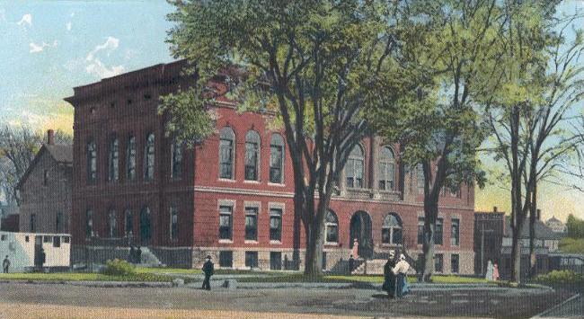
44°33′13″N 69°38′14″W / 44.553611°N 69.637222°WWaterville 111 Waterville Opera House and City Hall 
January 1, 1976 Castonguay Sq.
44°32′59″N 69°37′47″W / 44.549722°N 69.629722°WWaterville 112 Waterville Post Office 
April 18, 1977 Main and Elm St.
44°33′08″N 69°37′54″W / 44.552222°N 69.631667°WWaterville 113 Wayne Town House January 1, 1976 State Route 133
44°21′10″N 70°04′25″W / 44.352778°N 70.073611°WWayne 114 Whitehouse Block May 2, 1986 188 Water St.
44°19′00″N 69°46′27″W / 44.316667°N 69.774167°WAugusta 115 Williams Block May 2, 1986 183-187 Water St.
44°19′00″N 69°46′28″W / 44.316667°N 69.774444°WAugusta 116 John Williams House December 6, 1984 Church St.
44°30′07″N 69°59′19″W / 44.501944°N 69.988611°WMount Vernon 117 Wing Family Cemetery October 16, 1991 Eastern side of Pond Rd. north of its junction with State Route 133
44°22′14″N 70°04′01″W / 44.370556°N 70.066944°WWayne 118 Winthrop Street Historic District August 6, 2001 Roughly bounded by State, Bridge, North and South Chestnut, and Green Sts.; also 20 Spring St.
44°18′54″N 69°46′52″W / 44.315°N 69.781111°WAugusta Spring St. address represents a boundary increase of December 30, 2008 See also
References
- ^ The latitude and longitude information provided in this table was derived originally from the National Register Information System, which has been found to be fairly accurate for about 99% of listings. For about 1% of NRIS original coordinates, experience has shown that one or both coordinates are typos or otherwise extremely far off; some corrections may have been made. A more subtle problem causes many locations to be off by up to 150 yards, depending on location in the country: most NRIS coordinates were derived from tracing out latitude and longitudes off of USGS topographical quadrant maps created under the North American Datum of 1927, which differs from the current, highly accurate WGS84 GPS system used by Google maps. Chicago is about right, but NRIS longitudes in Washington are higher by about 4.5 seconds, and are lower by about 2.0 seconds in Maine. Latitudes differ by about 1.0 second in Florida. Some locations in this table may have been corrected to current GPS standards.
- ^ "National Register of Historic Places: Weekly List Actions". National Park Service, United States Department of the Interior. Retrieved on November 10, 2011.
- ^ Numbers represent an ordering by significant words. Various colorings, defined here, differentiate National Historic Landmark sites and National Register of Historic Places Districts from other NRHP buildings, structures, sites or objects.
- ^ "National Register Information System". National Register of Historic Places. National Park Service. . http://nrhp.focus.nps.gov/natreg/docs/All_Data.html.
- ^ "Cushnoc Archeological Site". National Historic Landmark summary listing. National Park Service. http://tps.cr.nps.gov/nhl/detail.cfm?ResourceId=2077&ResourceType=Site. Retrieved 2008-03-03.
U.S. National Register of Historic Places Topics Lists by states Alabama • Alaska • Arizona • Arkansas • California • Colorado • Connecticut • Delaware • Florida • Georgia • Hawaii • Idaho • Illinois • Indiana • Iowa • Kansas • Kentucky • Louisiana • Maine • Maryland • Massachusetts • Michigan • Minnesota • Mississippi • Missouri • Montana • Nebraska • Nevada • New Hampshire • New Jersey • New Mexico • New York • North Carolina • North Dakota • Ohio • Oklahoma • Oregon • Pennsylvania • Rhode Island • South Carolina • South Dakota • Tennessee • Texas • Utah • Vermont • Virginia • Washington • West Virginia • Wisconsin • WyomingLists by territories Lists by associated states Other Municipalities and communities of Kennebec County, Maine Cities Augusta | Gardiner | Hallowell | Waterville
Towns Albion | Belgrade | Benton | Chelsea | China | Clinton | Farmingdale | Fayette | Litchfield | Manchester | Monmouth | Mount Vernon | Oakland | Pittston | Randolph | Readfield | Rome | Sidney | Vassalboro | Vienna | Wayne | West Gardiner | Windsor | Winslow | Winthrop
Unorganized
territoryCDPs Clinton | Farmingdale | Oakland | Winthrop
Other
villagesCategories:- National Register of Historic Places in Maine by county
- Kennebec County, Maine
-


Wikimedia Foundation. 2010.